Ecoregions of the United States
Ecoregions of Countries Collection ![]()
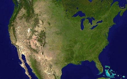
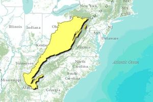
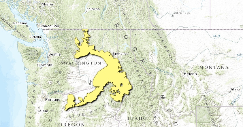
The United States has eighty-two ecoregions that occur entirely or partly within its borders as shown by the following figure. Fourteen of these ecoregions are found only in Alaska and three only in Hawaii.

Map of Ecoregions of the continental United States. Source: World Wildlife Fund.
|
|
|
In Alaska:
|
 |
|
In Hawaii: See also:
|
 |
Contents
- 1 New England-Acadian forests
- 2 Northeastern coastal forests
- 3 Atlantic coastal pine barrens
- 4 Middle Atlantic coastal forests
- 5 Southeastern mixed forests
- 6 Southeastern conifer forests
- 7 Florida sand pine scrub
- 8 Everglades
- 9 South Florida rocklands
- 10 Appalachian-Blue Ridge forests
- 11 Appalachian mixed mesophytic forests
- 12 Allegheny Highlands forests
- 13 Eastern forest-boreal transition
- 14 Eastern Great Lakes lowland forests
- 15 Southern Great Lakes forests
- 16 Central U.S. hardwood forests
- 17 Mississippi lowland forests
- 18 Ozark Mountain forests
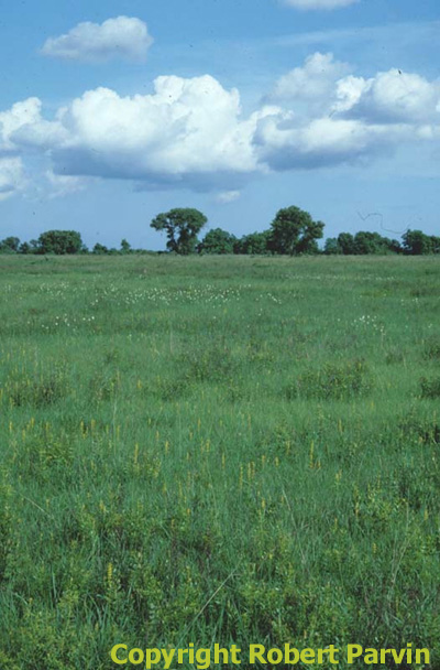
- 19 Piney Woods forests
- 20 Western Gulf coastal grasslands
- 21 Tamaulipan mezquital
- 22 East Central Texas forests
- 23 Texas blackland prairies
- 24 Edwards Plateau savanna
- 25 Central forest-grasslands transition
- 26 Upper Midwest forest-savanna transition
- 27 Western Great Lakes forests
- 28 Central tall grasslands
- 29 Flint Hills tall grasslands
- 30 Central and Southern mixed grasslands
- 31 Nebraska Sand Hills mixed grasslands
- 32 Western short grasslands
- 33 Chihuahuan Desert
- 34 Sierra Madre Oriental pine-oak forests
- 35 Arizona Mountains forests
- 36 Colorado Plateau shrublands
- 37 Colorado Rockies forests
- 38 Wyoming Basin shrub steppe
- 39 Northern short grasslands
- 40 Montana Valley and Foothill grasslands
- 41 South Central Rockies forests
- 42 North Central Rockies forests
- 43 Okanagan dry forests
- 44 Cascade Mountains leeward forests
- 45 British Columbia mainland coastal forests
- 46 Puget lowland forests
- 47 Central Pacific coastal forests
- 48 Willamette Valley forests
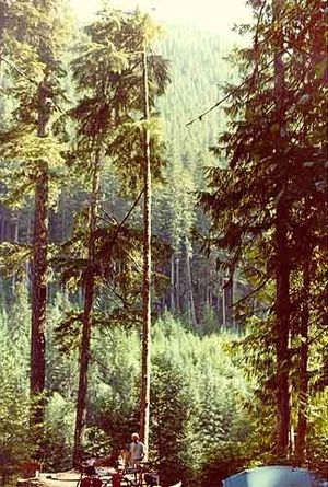
- 49 Cascade Mountains, USA Photograph by John Morrison Central and Southern Cascades forests
- 50 Eastern Cascades forests
- 51 Palouse grasslands
- 52 Blue Mountains forests
- 53 Snake-Columbia shrub steppe
- 54 Wasatch and Uinta montane forests
- 55 Great Basin shrub steppe
- 56 Great Basin National Park, Nevada, USA Photograph by John Morrison Great Basin montane forests
- 57 Mojave Desert
- 58 Sonoran desert
- 59 Sierra Nevada forests
- 60 Klamath-Siskiyou forests
- 61 Northern California coastal forests
- 62 California interior chaparral and woodlands
- 63 California Central Valley grasslands
- 64 California montane chaparral and woodlands
- 65 California coastal sage and chaparral
- 66 Arctic coastal tundra
- 67 Arctic foothills tundra
- 68 Brooks-British Range tundra
- 69 Interior Yukon-Alaska alpine tundra
- 70 Interior Alaska-Yukon lowland taiga
- 71 Ogilvie-MacKenzie alpine tundra
- 72 Beringia upland tundra
- 73 Beringia lowland tundra
- 74 Alaska Peninsula montane taiga
- 75 AleutianIslands tundra
- 76 Cook Inlet taiga
- 77 Alaska-St. Elias Range tundra
- 78 Pacific Coastal Mountain icefields and tundra
- 79 Northern Pacific coastal forests
- 80 Hawaii tropical moist forests
- 81 Hawaii tropical high shrublands
- 82 Hawaii tropical dry forests
- 83 Context
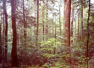
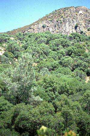
New England-Acadian forests
The New England-Acadian forests form a mosaic of forest types and nonforest habitats covering the Eastern Townships and Beauce regions of Quebec, approximately 50 percent of New Brunswick, most of Nova Scotia, northwestern Massachusetts and extreme northwestern Connecticut, and all but the southwestern corner of Maine, the Champlain Valley of Vermont and the coastal plain of New Hampshire. All of this area is hilly to mountainous with the highest elevations occurring in the White Mountains of New Hampshire.
Now increasingly forested, parts of the landscape in this ecoregion have changed dramatically over the past 350 years. Once covered by primeval forest, farmers cleared the land for agriculture at such a pace that by the middle of the 19th century farm crops or pastures covered nearly three-quarters of the arable land in southern and central New England. One hundred years later, forests again blanketed 75 percent of New England–the result of an era of farm abandonment brought on by the opening of richer farmland to the west, the building of railroads, the Civil War, and even the California Gold Rush.
The major conversion and degradation threats to this ecoregion are development and logging.
Northeastern coastal forests
Northeastern coastal forests of the Piedmont plateau and the Coastal Plain cover all or part of seven states, from northern Maryland to southern Maine.
The ecoregion is dominated by Appalachian oak forests, characterized by white oak (Quercus alba) and northern red oak (Q. rubra). Until the early part of this century American chestnut (Castanea dentata) was so ecologically and commercially important a species in this ecoregion that these forests were known as oak-chestnut forests.
A chestnut blight caused by Endothia parasitica and likely imported from Chinese chestnuts spread rapidly following its introduction in 1904, killing most chestnuts in New England in 20 years and at the southern end of the species’ range by 1940. Although chestnuts still sprout profusely from root systems after more than half a century, few trees survive long enough to reach the main canopy of a mature forest stand.
Development is the greatest threat and could significantly alter at least 25 percent of the remaining habitat within the next 20 years. Native plants are experiencing significant mortality due to shoreline erosion, the introduction of exotics, and overuse of natural resources. Collection of wild orchids and reptiles poses a threat to some species and the recreational use of fragile shoreline constitutes a major threat to the wildlife of this ecoregion.
Atlantic coastal pine barrens
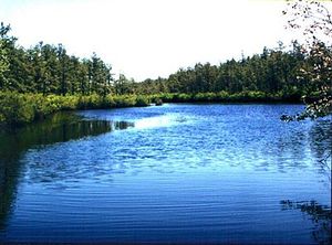
The Atlantic Coastal Pine Barrens cover the coastalplain of New Jersey, much of the southern half of Long Island, and Cape Cod, Massachusetts, an areal extent of nearly 9,000 square kilometers(km 2). The largest block of this disjunct ecoregionoccurs in the coastal plain of New Jersey. A smaller, inland example of a Pine Barrens ecosystemcan be found near Albany, New York. The Pine Barrens are underlain by sandy, nutrient-poor soils that typically support a stunted forest of pitch pine ( Pinus rigida) and blackjack oak ( Quercus marilandica) maintained by frequent fires. Hydrology, soils, disturbance regimes, and vegetation combine to separate this ecoregion from surrounding units. In particular, fire regimes and sandy, droughty soils distinguish this unit from surrounding ecoregions.
The major conversionand degradationthreats are development and fire suppression. These are considered to be moderate over the next decade. Exploitation of wildlife is not viewed as a major threat to biodiversityconservation, unlike in other ecoregions in the eastern United States.
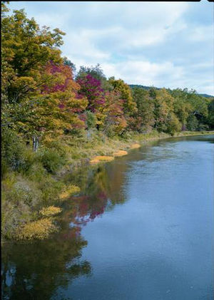
Middle Atlantic coastal forests
The Middle Atlantic coastal forests stretch from the eastern shore of Maryland and Delaware to just south of the Georgia-South Carolina border. The western border of this ecoregionis the juncture of the the Atlantic coastal plainand the edge of the Piedmont, whereupon it gives way to the Southeastern mixed forests. Although much of the ecoregion shares the same topography, the flat Atlantic coastal plain, it is one of the most heterogeneous units from a vegetation perspective. Some of the most majestic plant communities of the United States occur along riversof this ecoregion. The Atlantic white cedar ( Chamaecyparis thyoides) swampsonce occurred along the entire Eastern seaboard and were common in this ecoregion. Perhaps most famous are the river swampor bottomland forests, admired for its towering bald cypress and gum trees. The Middle Atlantic coastal forests contains the most diverse assemblage of freshwaterwetland communities in North America and perhaps of all temperate forest ecoregions. Nonalluvial wetlands, including freshwater marshes, shrub bogs, white cedar swamps, bayheads, and wet hammocks are particularly prominent. The coastline is bordered by barrier or sea islands that protect extensive estuaries, lagoons, and sounds. Many of these wetlands have already been convertedand others are highly threatened.
Conversionthreats include development along the coast and pine plantations on the outer coastal plain(but not the coast itself). The major degradation threats are fire suppression, dams, and ditching. There is no legal fire management regime in this ecoregion. Poachingof carnivorous plants and black bear is judged as moderate.
Southeastern mixed forests
The Southeastern mixed forests skirt the Appalachian/Blue Ridge Mountains, occupying the piedmont zone between upland forests and the Atlantic Coastal and Gulf Coastal plains. This ecoregionis by far the largest within the Temperate Broadleaf and Mixed Forests Major Habitat Type (MHT), crossing nine states and running northeast to southwest from Maryland to Louisiana. The Southeastern mixed forests are demarcated from the Southeastern conifer foreststo the south by vegetation and elevation (the fall line of the Atlantic piedmont). The latter ecoregion is more dominated by long-leaf pine ( Pinus palustris) and occurs on the coastal plain rather than on the piedmont. It is similarly separated from the Appalachian-Blue Ridge forestsand Appalachian mixed mesophytic forestsby elevation and vegetation. The Southeastern mixed forests, lying between all of these species-richecoregions, is enriched by the proximity to these other units. However, this ecoregion is perhaps the most heavily altered, having been heavily and repeatedly logged and now largely convertedto agriculture.
Because of the heavy rate of conversion, there is little left to conserve. Logging remains a threat, as does continued exploitation of remaining forests, and conversion to pine plantations. The lack of fire management in remaining areas is viewed as a serious degradationthreat.
Southeastern conifer forests
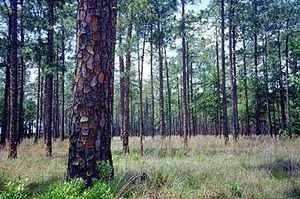
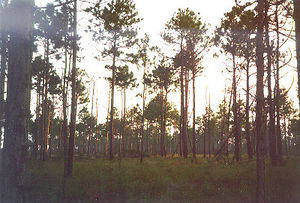
The Southeastern Conifer Forests span the coastalplain of the southeastern U.S., stretching across southeastern Louisiana, southern Mississippi, southern Alabama, central and southern Georgia, and the Florida panhandle and upper peninsula. This ecoregionis the largest conifer forestecoregion east of the Mississippi and the second largest coniferous ecoregion in the continental U.S. (second to North Central Rockies Forests). Most of the area of this ecoregion falls within the state of Florida.
The Southeastern conifer forests were dominated by relatively open tall stands of long-leaf pine ( Pinus palustris) with an understory of wiregrass ( Aristida stricta). The open nature of the mature long-leaf pine stands and the frequency of understory fires helped maintain perhaps the richesttemperate herbaceous flora on Earth. Unfortunately, virtually all of the mature long-leaf pine forests are gone, being restricted a few isolated sites.
This ecoregion is considered to be under high threat. The major types of conversion threats are: 1) fire suppression due to concerns about air quality; 2) highway development; and 3) urban sprawl and suburban development. Florida remains one of the fastest growing states in the United States. The major degradation threat is from introduced species.
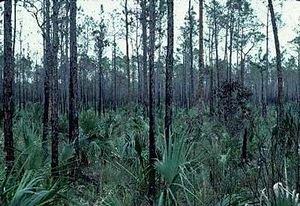
Florida sand pine scrub
Most ecoregionsdescribed in this conservation assessment are ecosystemsof regional extent covering at least 10,000 square- kilometers(km 2). An important exception, and one of the smallest ecoregions in the continental U.S., is the Florida sand pine scrub (hereafter scrub), which occurs as a small archipelago of sandy ridges and limestone areas restricted to central and southern Florida, and a narrow stretch along the Gulf coast of Florida. The extraordinary biodiversityfound within these units, a significant portion of which is restricted to these habitats, warrants their elevation to ecoregion status. The biodiversity of these islands is greatly threatened by development, but the state of Florida has made major efforts to purchase remaining scrub habitats.
Scrub is frequently cited as Florida's most distinct ecosystem; physiognomy and composition are quite distinct from surrounding habitatsand between 40-60 percent of scrub species are considered to be endemic.
The major conversionthreats in this ecoregion are citrus production and residential development. Fire suppression remains the most pervasive degradation threat. Unlike other Florida ecoregions, there are no serious exotic species (Alien species)problems.
Everglades
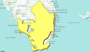
The Everglades, located at the southern tip of peninsular Florida, is the most famous wetland in the United States and one of the most distinct in the world. The Everglades is unique among the world's large wetlands because it derives its water from rainfall. Other large and famous wetlands, such as the Pantanalof South America, the Okavango of Botswana, and the Llanosin Venezuelaand Colombia, derive most of their water and nutrient inputs from riverflooding. The unique sheet flow, the slow flow of water over shallow, broad tracts of marsh, inspired Douglas to name the Everglades, River of Grass. As important as sheet flow is, the groundwaterconnections of the Everglades to Lake Okeechobee, the second largest freshwaterlake entirely within the U.S., are also essential for the maintenance of the wetland. The linkages between the Everglades, Lake Okeechobee, and the Kissimmee River, which provides 80 percent of the surface flow into Lake Okeechobee, illustrate the importance of connectivity among ecoregionsto maintain integrity. The boundaries of this ecoregion extend to include the Big Cypress Swampto the northwest, the southern edge of Lake Okeechobee to the north, and the Atlantic coastal ridge to the east.
Assuming restoration efforts will succeed, degradation threats will decline. Otherwise degradation threats will intensify and irretrievably affect this ecosystem. Poachingof deer, alligators, and panthers continues to be a threat.
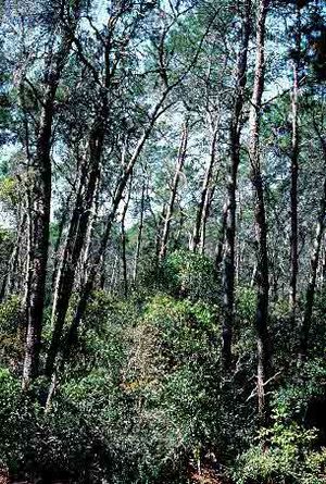
South Florida rocklands
Extreme southern Florida is characterized by thin, droughty soilssituated on outcroppings of limestone. Pinelands and tropical hardwood hammocks cover virtually all of these outcrops and are considered as rockland ecosystems. The best examples of the pine rocklands, an ecosystem that once covered about 1,500 square kilometers(km 2), are located at the southern tip of Florida above an extrusion of limestone known as the Miami Rock Ridge and along the lower Florida Keys. Pine rocklands are fire-maintained pine forests (dominated by slash pine, Pinus elliottii) with a mixture of tropical and temperate understory plants. The associated hardwood hammocks contains a rare intrusion of tropical hardwoods more typical of the Bahamas and Greater Antilles than the adjacent southeastern conifer forests. We chose to put this ecoregionin the Tropical Moist Forest Major Habitat Type (MHT) rather than in the Subtropical and Tropical Coniferous Forest MHT, in deference to the extraordinary richnessof its tropical hardwood flora.
Most of the privately owned lands containing rocklands have been convertedand little remains to be put under conservation management. Continued fire suppression and invasion of exotic species could drastically degrade these remaining blocks over the next two decades. Exotic plants pose a serious threat to the integrity of the rocklands.
Appalachian-Blue Ridge forests
The Appalachian-Blue Ridge forests ecoregionencompasses major portions of Fenneman's Blue Ridge and Ridge and Valley physiographic provinces of the central and southern Appalachians. The region stretches north from northeastern Alabama and Georgia, through eastern Tennessee, western North Carolina, Virginia, and Maryland, and into central Pennsylvania.
The large variety of landforms, climate, soils, and geology, coupled with a long evolutionaryhistory, has led to one of the most diverse assemblages of plants and animals found in the world's temperate deciduous forests.
The major types of conversionthreats for the ecoregion are timber and mineral extraction, conversion to developed lands, fire suppression, air pollution, acid precipitation, high densities of deer, and the introduction of exotic pests, and diseases.
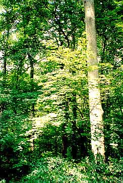
Appalachian mixed mesophytic forests
The extraordinary forests of southeastern North America represent relicts of ancient mesic forests that once covered much of the temperate regions of the Northern Hemisphere. Today, examples of these forests can only be found in the southeast region of North America and in eastern and central China. The Appalachian mixed mesophytic forests ecoregionencompasses the moist broadleaf forests that cover the plateaus and rolling hills west of the Appalachian Mountains. It extends southward into northwest Alabama and east central Tennessee. Moving north, the region includes eastern Kentucky, western North Carolina, most of West Virginia, southeastern Ohio, and southwestern Pennsylvania. Mixed mesophytic forests acted as a mesic refuge during drier glacialepochs for a wide range of taxa. The long evolutionaryhistory of the region and wide range of topographic and edaphic conditions have contributed to the development of the richbiota and abundance of endemic species, particularly in freshwater communities.
A primary threat is the increasing conversion and fragmentationof forests through logging and development. Hardwood forests are increasingly being exploited throughout the region as maturing forests become attractive to timber exploiters and production in West Coast forests declines. Other threats include 1) coal, copper and ore mining; 2) highway construction; 3) abundance of deer; 4) illegal poaching; and 5) harvesting of threatened plants.
Allegheny Highlands forests
The presettlement forests of the Allegheny Highlands consisted primarily of hemlock ( Tsuga canadensis) and beech ( Fagus grandifolia)—together the two species represent nearly 60 percent of all the trees observed in early land surveys of what is now Allegheny National Forest. Although hemlock and beech tolerate shade, the occurrence of both species can be traced to periodic catastrophes, particularly fire. These forests display large-scale patterning related to soil drainage, which segregates areas dominated by beech, hemlock, and white pine from areas dominated by hemlock and yellow birch. Smaller-scale patterning separates small areas of hemlock from yellow birch.
Between 1890 and 1920, loggers cleared most of the Allegheny Plateau. Save for a few pockets of old growth, the current forests, which contain most of the presettlement species in different relative abundances and distribution, originated at that time. Less than one percent of this ecoregionremains intact, but once logged areas are now reforested. Agriculture, particularly in the western and central lowlands, is the leading cause of habitat loss, while recreation and development contribute to habitat loss in the northern parts of the ecoregion. In the western portion of the ecoregion, a booming deer population is destroying herbaceous vegetation and preventing tree regeneration.
Eastern forest-boreal transition
This ecoregionincludes most of the southern Canadian Shield in Ontario and Quebec. The shield, in fact, principally defines the southern boundaries of this ecoregion. It lies north and west of the St. Lawrence Lowlandsexcept for a disjunct section comprised of the Adirondack Mountains in upper New York State. The characteristic mixed forests of this ecoregion are distinct from the predominantly deciduous forests to the south and the cooler boreal forests to the north.
The timber industry continues to be very active in the ecoregion, particularly in the Canadian portion. There is increased mining potential throughout and tourism is beginning to create significant impacts in parts of the ecoregion.

Eastern Great Lakes lowland forests
This ecoregionincludes lowland areas of New York and Vermont surrounding the Adirondacks, portions of Quebec along the St. Lawrence River, and much of southern Ontario between Lake Ontario and Lake Huron/Georgian Bay. Suburban development and pollution of the St. Lawrence have severely harmed natural areas here, and less than 5 percent of the ecoregion remains as intact habitat.
Development, particularly construction of summer homes and suburbanization, pose the greatest conversionthreat to the Eastern Great Lakes lowland forests. Degradation due to pollution, however, is a more serious concern. The St. Lawrence is one of the most polluted waterwaysin North America, with high levels of mirex, PCBs, DDT, and its derivatives.
Southern Great Lakes forests
This ecoregioncovers much of the industrial heartland of North America, including southern Michigan, much of Ohio and Indiana, extreme southwestern Ontario, including the lowlands of the south of Lake Ontario in Ontario and western New York State. The area is so heavily populatedand developed that essentially no large blocks of natural habitatremains. The Southern Great Lakes forests are dominated by deciduous forests which are distinct from the mixed forests in other parts of the St. Lawrence lowlandsto the north and contain lower species diversitythan ecoregionsto the east and south.
The remaining tiny fragmentsof natural habitatin the Southern Great Lakes forests face intense conversionpressure from development and agriculturalexpansion. Agricultural conversion for corn, soybeans, tobacco, grains, canola, and tender fruit has occurred. Urban sprawl threatens this region. Agricultural land and woodlots are being severed to accommodate country homes. Habitatnot being converted is being degraded by pollution and exotic species (Alien species). Wildlife exploitation continues and the elimination of most target species is imminent or complete.
Central U.S. hardwood forests
Like the ecoregionsto the east, broadleaf deciduous trees dominate the Central U.S. hardwood forests. This region receives less precipitation than the more coastal areas, however, so drought-resistant oak-hickory forests predominate here. While other forests in the United States and Canada have both oak and hickory, this region was once the only one where both species occurred in abundance over a large area. Much of the natural habitatin this ecoregion has now been destroyedby development and agriculture. Most of the areas covered by the Central U.S. hardwood forests is rolling, but some parts are nearly flat and the Ozark highlands reach approximately 1,000 meters(m). Parts of Kentucky and Tennessee are marked by dissected plateaus and basins.
Only about one percent of the Central U.S. hardwood forests remains as intact habitat. Urban sprawl and agriculturalconversion are the greatest conversionthreats to the region. Invasion of exoticgrasses, cave vandalism, and overuse for recreation, fire suppression in fire-maintained systems, and loss of large ungulates (bison) are degrading the remaining natural habitats. Deer poachingcontinues to be a problem in Kentucky and Tennessee, and collection of wild herbs is ongoing across the region.
Mississippi lowland forests
The Mississippi lowland forests ecoregionoccurs in the floodplain of the Mississippi River and runs north from Louisiana to the southern tip of Illinois. It is separated from surrounding ecoregions by topography, floodplain dynamics, and vegetation. While chiefly lying along the Mississippi floodplain, the ecoregion also lies along the lowest reaches of the Arkansas Rivernear the discharge point to the Mississippi. Surrounding ecoregions typically support more xeric conifer-dominated forests on upland landscapes. The Mississippi lowland forests were very similar in composition to the magnificent bottomland forests that occur along the riversfound in the Middle Atlantic coastal forests. However, virtually all of the remaining riparian forests of this ecoregion are gone, making it one of the most heavily convertedecoregions in the USA.
Because of the high degree of conversion, there is little left to conserve. Hydrologic alterationshave the greatest impact. Logging remains a threat, as does continued exploitation of remaining forests. Pollutant effects in the lower section of the ecoregionare serious.
Ozark Mountain forests
The Ozark Mountain forestsare comprised chiefly of the Ouachita and Boston Mountains, whose forests are among the best developed oak-hickory forests in the United States. The Ouachita Mountains cover an area approximately 380 kilometers(km) east to west by 100 km north to south in western Arkansas and southeastern Oklahoma.
Only about three percent of this ecoregionremains as intact habitat. While the upper elevation forests are still in relatively good condition, riparian habitat has been severely degraded. The forests along the Arkansas River, for example, have been almost completely destroyed. Conversionof hardwood to pine forests and the construction of second homes and resorts pose the greatest conversion threat to this ecoregion. Fire suppression is a major cause of degradation. Wildlife exploitation in the form of bear poachingand herb extraction is also a significant concern.
Piney Woods forests
The Piney Woods forests stretch across eastern Texas, northwestern Louisiana, and southwestern Arkansas. This ecoregionincludes parts of what is commonly known as the Big Thicket region of east Texas. The Piney Woods occupies the western extent of the Southeastern coastal plain and its vegetation reflects similarities with the communities (Ecosystem)found within the Southeastern mixed forestsand the Southeastern conifer forests. Despite its name, Küchler classified this ecoregion as oak-hickory-pine forest. Little of the long-leaf pine forests that once dominated this ecoregion remain. Pine plantations are widespread and the effects of fire suppression have caused considerable ecologicaldamage to this ecoregion.
Conversion threats are continued conversion to pine plantations and to a lesser extent urban areas. The main degradation threat is considered to be fire suppression.
Western Gulf coastal grasslands
The Western Gulf Coastal Grasslands ecoregionfollows the coastof the Gulf of Mexico encompassing the wetlands of Louisiana and Texas, in the United States, west of the Mississippi Delta then south into Mexicoto just past the Laguna Madre. Grasslands of the northern part of Tamaulipas State, in Mexico have developed on a portion of sandy plains that gently slope to the waters of the Laguna Madre, a sound off the Gulf Coast, which forms the most important hydrographic feature of the ecoregion.
The geophysical province of this the Western Gulf CoastalGrasslands ecoregionis a distinct ecosystemdue to its more temperate climate, proximity to the Gulf of Mexico and associated natural processes (e.g., tropical storms), and geological origin with subsequent succession since the Pleistocene era inundation.
Fragmentationof remaining habitatvia subdividing large tracts into more marketable "ranchettes" leads to other degrading factors such as overgrazing, exoticplant expansion, lack of fire as a natural or prescribedprocess, and modification of local hydrological features by means of land leveling. Urbanization around larger metropolitan areas such as Houston, Texas has been another direct cause of habitat loss. This will proceed with the continued proliferation of suburban development.
Tamaulipan mezquital
Conversion to agricultureposes the greatest threat to this ecoregion. Degradation of habitat due to pollution (Air pollution)and exploitation of wildlife are significant but less pressing threats. In the valley of Jaumave, the land is commonly converted to cultivable fields by burning native vegetation. Cacti and other succulents are badly damaged or die during these processes. Most of the fires burn out of control, which adds a major threat to the plant communities of the ecoregion. Construction of dams, road building, mining and expansion of urban areas also cause habitat destruction. In addition, illegal extraction and tradeof exotic plant specieshave endangered many species of cactus.
East Central Texas forests
The East Central Texas forests (hereafter ECTF) ecoregionis located entirely within the state of Texas and comprises one of the smallest ecoregions within the Temperate Broadleafand Mixed Forests biome. The potential natural vegetation of the ECTF is oak-hickory forest, the cross timbers association of oaks and little bluestem, and juniper-oak savannas. Common hardwoods of the oak-hickory association include scarlet, post, and blackjack oaks ( Quercus coccinea, Q.stellata, and Q. marilandica, respectively), and pignut and mockernut hickories ( Careya glabraand C. tomentosa). Forests of elm ( Ulmus americana), pecan ( Carya illinoensis), and walnut ( Juglans regia) occur along rivercourses. The ecoregion is distinguished from adjacent prairieunits and the coastal plaingrasslands (Biome)by higher tree density and from the Piney Woods forestsby the more open nature of the habitatand the greater dominance of hardwoods. Fire and drought were historically principle disturbance factors.
The major threats to the ecoregionare the conversionof forests to agriculture. In addition, the suppression of fire in the remaining blocks of habitatmay threaten their biological integrity in the future.
Texas blackland prairies
The Blackland Prairie ecoregionspans approximately 6.1 million hectares (ha) from the Red River on the north to near San Antonio in south Texas. It is part of a tallgrass prairiecontinuum that stretches from Manitoba to the Texas coast. The region consists of the main belt, covering 4.3 million ha, and two smaller islands of prairie, southeast of the main belt. These are the Fayette prairie, 1.7 million ha, and the San Antonio prairie, .7 million ha. A significant part of the main belt is bounded by oak woodland and savanna on the north, east, and northwest. The San Antonio and Fayette prairies are imbedded in and are separated from the main belt by the oak woodlands of the East Central Texas Forests.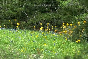
Primary threats to prairieremnants are urbanization, row crop agriculture, invasion by exoticplant species, fragmentation, and loss of landscape-scale processes, especially fire and grazing by large native herbivores.
Edwards Plateau savanna
The Edwards Plateau Savannas form an important part of the Texas Hill country, a moderately-sized ecoregionseparated from adjacent units by a distinct soiltype (mollisols) and a vegetation type distinguished by juniper-oak savannaand mesquite Acaciasavanna underlain by mid to short grasslands. In other aspects, the Edwards Plateau Savannas is an ecoregion that is intermediate among the dry grassland and savanna ecoregions in terms of rainfall, temperature, and length of growing season. It is estimated that up to 90 percent of this ecoregion has been convertedto pasture, urban areas, and agriculturalcrops. Previously, major disturbance regimes were dominated by fire, drought, and perhaps grazing by bison ( Bison bison).
Urban and suburban sprawl around Austin and San Antonio pose a high threat to remaining habitats. Invasion of exotic species (Alien species)and overgrazing will also increase habitat degradation unless mitigated by conservation measures. Cedar choppers in the hill country have removed much of the old growth juniper-oak woodland. Change in riparian disturbance regimes affects the dynamics of this system and threatens species dependent upon this habitat.
Central forest-grasslands transition
The Central Forest/Grassland Transition Zone (hereafter the CTZ) extends from northern Illinois, across much of Missouri, and into eastern Kansas, Oklahoma, and Texas. The CTZ is one of the larger savanna-type ecoregions, covering more than 380,000 km 2, and along with the Upper Midwest Forest/Savanna Transition Zone, separates the Eastern Deciduous Forests from the tallgrass and mixed grass prairies. The CTZ can be distinguished from the Central U.S. Hardwood Forests and other forested ecoregions to the east by its mixture of savanna, prairie, and woodlands. It can be delineated from the tallgrass prairie and Central and Southern Mixed Grasslands to the west by the higher tree and shrub densities. Annual precipitation ranges from 600-1040 millimeters (mm), with wetter areas supporting a more closed tree canopy.
Because almost all of this ecoregionhas already been converted to corn and soybean production, there is little chance for further extensive conversion to occur. The Osage Plains faces some threats of degradation.
Upper Midwest forest-savanna transition
One of the three ecotonalunits separating the vast Great Plains grasslands (Biome)from the forests of the eastern U.S. is the Upper Midwest Forest-Savanna Transition Zone (hereafter UMTZ). This is the smallest of the three transition units along the eastern and northern edge of the Great Plains. Much of the UMTZ is contained in central and southern Wisconsin and southwestern Minnesota.
The UMTZ is essentially an oak, maple, basswood woodland, forest, and savanna ecosystem. Today, the oak savanna component of the UMTZ is one of the world's most endangered ecosystems. Much of the original ecoregionhas been converted.
Four main threats to the survival of this ecosystemhave been identified: 1) loss of recovery opportunities as second home and residential development spread into more natural areas, 2) lack of general awareness of the globally threatened status of oak-savanna vegetation, 3) fire suppression and misunderstanding about the importance of burning in maintaining the integrity of the ecosystem, and 4) invasion by exoticplants such as honeysuckle ( Lonicera sp.) and reed canary grass ( Phalaris arundinacea).
Western Great Lakes forests
The Western Great Lakes forests stretch from northern Michigan and the Upper Peninsula through northern Wisconsin, much of northern Minnesota, and into the southern portion of northwestern Ontario and extreme southeastern Manitoba. Characteristic forests in this region are more closely identified with the warmer, more humidsoutheastern mixed forests, than with the colder, drier boreal regions to the north. Wetlands are widespread in this ecoregion, with conifers dominating most of the wetlands, although hardwoods still grow along streammargins and well-aerated wetlands in stream headwater areas.
The effects of the Great Lakes upon climate, commonly called the "lake effect," are of considerable importance to the biota. Lake effects play a lesser role in the western portions of this ecoregion than in northern Michigan because winds generally blow from the Great Plains to the southwest.
The most significant conversionthreat in this ecoregionis the conversion of pine to aspen forest. Logging is a significant cause of this conversion throughout the ecoregion. Agriculture, scattered throughout the ecoregion, and development, especially for second homes along the lakeshores, also pose conversion threats.
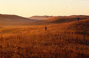
Central tall grasslands
The tallgrass prairie of the United States and Canada is divided into three ecoregions: the Central, Northern, and Flint Hills tall grasslands. The Central Tall grasslands cover southern Minnesota, most of Iowa, a small section of eastern South Dakota, and extend as a narrow finger through eastern Nebraska and northeastern Kansas. The Central Tall Grasslands are the most mesic of the grasslands of the central plains. It can be distinguished from other grassland associations by the dominance of tallgrass species–a feature once relatively uniform across its range–and by the highest levels of rainfall (100 cenitmieters (cm)/year). The Central Tall Grasslands also has the longest growing season of the ecoregions of the Great Plains. How abundant bison ( Bison bison) were is uncertain, but elk ( Cervus elaphus) were probably very important to this ecoregion.
Because this ecoregionis virtually converted, future threats to the remaining tiny fragments are low.
Flint Hills tall grasslands
This ecoregion covers the Flint Hills of Kansas and the Osage Plains of northeastern Oklahoma. The Flint Hills Tall Grasslands is the smallest grassland ecoregionin North America. It can be distinguished from other grassland associations by the dominance of tallgrass species–and from the Central Tall Grasslands to the north by its more depauperate biota and a thin soillayer spread over distinct beds of limestone. These flinty beds of limestone, from which the name of this ecoregion is derived, rendered large areas unsuitable for corn or wheat farming. Today, the Flint Hills tall grasslands is an anomaly–an essentially unplowed (although heavily grazed) remnant of the tallgrass prairie. Historically, fire, drought and grazing by bison ( Bison bison) and other ungulates were the principle sources of habitat disturbance in this ecoregion. A new tallgrass prairie national park has been established covering about 44 km 2. This ecoregion offers the best opportunity for restoration of tallgrass prairie in the USA.
Because this ecoregionis too difficult to farm, future threats of conversion to agricultureremain low relative to other grassland ecoregions. Grazing could become a more severe threat if not properly managed.
Central and Southern mixed grasslands
The Central and Southern Mixed Grasslands ecoregionhas a north-south orientation, spanning central Nebraska, central Kansas, western Oklahoma, and north-central Texas. It separates the Tall-Grass Prairie and the Central Forests/Grassland Transition Zone from the Western Short Grasslands. Essentially, this region is a broad ecotonethat covers slightly more than 282,000 square kilometers(km 2). It is distinguished from the Northern Mixed Grasslandsby warmer temperaturesand a much longer growing season, and from the adjacent tallgrass and short grasslands by the intermediate stature of the grassland layer. It is distinguished from the Central Forests/Grassland Transition Zone to the east by the relative scarcity of trees and shrubs. The major disturbance regimes are drought, the degree and frequency of grazing by domesticanimals and wild ungulates, and fire.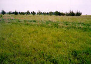
The major threat is conversionto agriculture. Water flow into streamsdue to diversions is another problem, as is fire suppression. Overgrazing by domesticstock, particularly in riparian areas, is a localized serious threat.
Nebraska Sand Hills mixed grasslands
Western short grasslands
The Western short grasslands is the second largest grassland ecoregionof North America, covering slightly more than 435,000 square kilometers(km 2). This unit ranges over portions of western Nebraska and southeastern Wyoming, across much of eastern Colorado, southwestern Kansas, west Texas, the Oklahoma panhandle and into eastern New Mexico. The Western short grasslands are bisected by the upper reaches of the Arkansas River.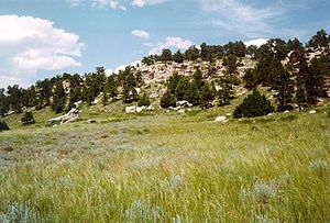
This grassland ecoregion is distinguished from other grassland units by low rainfall, relatively long growing seasons, and warm temperatures.
The main threat to this ecoregionis conversionto agriculture. Overgrazing is less of a threat in most parts of the ecoregion because of the abundance of grazing-tolerant plant species. The invasion of tree species is a problem in some areas.
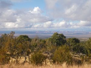
Chihuahuan Desert
This exoregion encompasses one of the most biologically diversearid regions on Earth. The Chihuahuan Desert stretches from the southeastern corner of Arizona across southern New Mexico and west Texas to the Edwards Plateau in the United States. It runs deep into central Mexico, including parts of the states of Chihuahua, northwest Coahuila, northeast Durango and several others. This desert is bounded by the Sierra Madre Occidental to the west and the Sierra Madre Oriental to the east, extending as far south as San Luis Potosi and to disjunct islands of the Chihuahuan vegetation in the states of Queretaro and Hidalgo. Some of the northern parts of the Chihuahuan Desert are drained by the Gila River.
The major conversion threats are urbanization, agriculturalexpansion, and resource extraction. Threats to this ecoregionare also related to water resources. Wetland and riparian areas suffer from water loss and water reduction from irrigation and livestock. Water pollution and over-pumping of groundwater for agriculture and use by growing urban areas are also major contributors.
Sierra Madre Oriental pine-oak forests
The Sierra Madre Oriental pine-oak forest contains a very diverse and unique community of endemic and specialized species of plants, animals, reptiles and amphibians. These high mountains run north to south, beginning in the United States and ending in Mexico. The variation accumulated in this distance, between its ends and elevation ranges, increases the diversity of habitatsand species present. For example, habitats in the north, near Big Bend, Texas are arid or desert-like with the influences of the Chihuahuan Desert; in the south, rainfallincreases greatly, creating tropical forest communities in the higher elevations. The orientation of this mountain chain with the trans-Mexican volcanic belt, connecting it to the Sierra Madre Occidental, has allowed these ecoregionsto share species, yet they are slightly different as they evolve to better fit their unique surroundings.
Currently, principal threats include logging, resin extraction, and agriculturalactivities. Selective logging for income of residents in the area is taking place throughout the region. Cattle farming, hunting and road building are additional threats.
Arizona Mountains forests
This ecoregion extends from the Kaibab Plateau in northern Arizona to south of the Mogollon Plateau into portions of southwestern Mexicoand eastern Arizona. This area consists mainly of steep foothills and mountains, but includes some deeply dissected high plateaus. Vegetation zones in this ecoregionresemble the Rocky Mountain Life Zones but at higher elevations. Although forests in this ecoregion are too far south to support distinct alpine communities, they do have a well-defined Transition Zone at 1980-2440 m where a cool, moist climate supports pine forestsabove the drier pinyon-juniper-oak woodlands of lower elevations.
There are several threats to the ecoregion, including land conversion(road building, timber harvesting); degradation(fire suppression, mining, ORV use, logging, fuel gathering); and potential wildlife losses (high threat to future Mexican wolf reintroduction from poaching).
Colorado Plateau shrublands
The Grand Canyon epitomizes the Colorado Plateau, an area that has been called the "land of color and canyons." The Plateau can be thought of as an elevated, northward-tilted saucer. It is characterized by its high elevation and arid to semi-arid climate. The Colorado Plateau has developed great relief through the erosiveaction of high-gradient, swift-flowing riversthat have downcut and incised the plateau. Approximately 90 percent of the plateau is drained by the Colorado River and its tributaries.
The Colorado Plateau is the only area in the United States and Canada where large mountaincutting riversrun through exposed sandstone. That unique juxtaposition created the Grand Canyon, an internationally important ecotourism zone, and other spectacular canyons in the region.
While conversionof natural habitatto other uses poses a problem for only a small portion of the Colorado Plateau, urban and suburban development, strip-mining, and other activities threaten some of the most sensitive habitats in the region. The greatest threat to wildlife on the Colorado Plateau is the destruction of native fish by dam-buildingand other forms of development.
Colorado Rockies forests

The Colorado Rockies Forest is a massive ecoregiondominated by the highest mountainsof the Rockies. It extends from Casper, Wyoming to Santa Fe, New Mexico, arrayed as both linear ranges (e.g., Laramie Mountains and Sangre de Cristo) and complex spatial expanses of peaks and massifs (e.g. San Juan Mountains).
The dominant vegetation type in the ecoregionis coniferous forest. Species composition and associations are similar to those of the South-Central Rockies, with a few exceptions.
Loss of valley bottoms (and increasingly, hillsides) to homebuilding has major impacts on ungulate movements in many parts of the ecoregion. Downhill ski resort expansion is another source of habitat destruction. Concentrated, heavy recreational use of mountainareas near resort towns and the urban Front Range is another threat. Logging of low-elevation forests remains a threat as well.
Wyoming Basin shrub steppe
The Wyoming Basin shrub steppe is an expansive ecoregionof high, open, arid country. The ecoregion is nearly surrounded by mountainecoregions. It is drained by three major riversystems: the Green River to the south, the Wind-Bighorn River to the north, and the North Platte to the east. A fourth watershed, the Great Divide Basin, has no surficial connection to any river system; it is also the driest area of the ecoregion.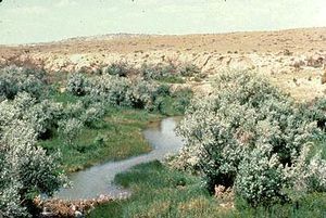
Overgrazing by domestic livestock, fire suppression, wholesale replacement of sagebrush with grasses, and spread of exotic grasses are the major anthropogenic threats to the ecoregion. Oil and gas exploration, along with mining (strip mining for coaland hard-rock mining for trona and other industrial minerals), have the potential to cause considerable disturbance, wildlife displacement, and environmental pollution. 6,000 to 11,000 new oil and gas wells could be sunk in southwestern Wyoming in the next 20 years. Unbridled industrial expansion could have severe long-term impacts on the ecoregion.
Northern short grasslands
The Northern short grasslands is the largest grassland ecoregion in North America, covering almost 640,000 km 2. This ecoregioncovers parts of southeastern Alberta and southwestern Saskatchewan, much of the area east of the Rocky Mountains, central and eastern Montana, western North and South Dakota, and northeastern Wyoming.
Four major features distinguish this unit from other grasslands: the harsh winter climate, with much of the precipitation falling as snow; short growing season; periodic, severe, droughts; and vegetation. Two environmental gradients determine species composition in mixed and shortgrass prairies: increasing temperatures from north to south and increasing rainfall from west to east.
The major threat is conversion of altered habitat (rangland) to wheat production. Major degradation threats are exotic species such as leafy spurge ( Euphorbiasp.) and yellow sweet clover. There is increased industrial activity (particularly oil and gas), road expansion (with associated access issues) and widespread application of pesticideand herbicide in agricultural production.
Montana Valley and Foothill grasslands
The Montana Valley and Foothill Grasslands ecoregionoccupies high valleys and foothill regions in the central Rocky Mountains of Montana and Alberta. The ecoregion occupies the Rocky Mountain Front, the uppermost flatland reaches of the Missouri River drainage, and extends into the Clark Fork-Bitterroot drainage of the Columbia River system.
Conversionof native habitatto homesites is a serious localized threat, although the boom appears to be levelling off. The loss of undeveloped riparian forest linkages across valley bottoms could have serious impacts on the long-term viability of sensitive species like the grizzly bear. Spread of exoticand noxious plant species could be a major long-term threat. Conversion of forest to grazing lands has a major impact on forest species. Long-term environmental pollution from hard rock mining is a major concern. The ecoregion contains the nation's largest Superfundtoxic waste site, stretching along the Clark Fork and Blackfoot Rivers from the Continental Divide west to Missoula, Montana.
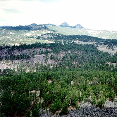
South Central Rockies forests
This ecoregion is centered primarily on the Yellowstone Plateau and the mountainranges radiating outward from the plateau. This unit lies mainly in western Wyoming, extending into eastern Idaho and central Montana; a portion of this ecoregion lies in northwestern Wyoming, and comprises the headwaters of the Green River. A second large unit comprises the mountains of central and eastern Idaho south of the Clearwater River. The ecoregionalso exists in two additional isolated units: the Bighorn Mountains of north-central Wyoming/ south-central Montana, and the Black Hills of western South Dakota/ northeastern Wyoming.
Indiscriminate logging, and especially associated roadbuilding, are major problems. Existing road networks in nonwilderness areas are quite dense and contribute to an overall loss of habitat security. Rapid developmentof low elevation areas is another threat, although concentrated mainly in other ecoregions. Mortality to grizzly bears and possibly to wolves through ungulate hunters in the fall is unacceptably high and could well be making the difference between a growing and a declining grizzly population in Greater Yellowstone.
North Central Rockies forests
The North Central Rockies forests is an extensive montane ecoregionstretching roughly 600 miles from north to south. It is virtually contiguous from southeastern British Columbia and the extreme southwestern corner of Alberta to west-central Montana and south-central Idaho. The ecoregion comprises some of North America's best-known wildlands: Alberta and British Columbia's Rocky Mountain parks (Mt. Revelstoke-Glacier, Yoho, and Waterton Lakes), Montana's Glacier Park/Bob Marshall Wilderness complex, and Idaho's Selway-Bitterroot Wilderness. This ecoregion is distinct from the drier 'interior' to the west, the cooler boreal forests to the north, and the drier foothills to the east.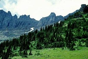
The major threats are loss of connectivity among habitatblocks due to resource extraction and development, and increased human activity within habitat blocks as more people occupy the region.
Okanagan dry forests
This ecoregionoccupies the southern interior of British Columbia and adjacent Washington state between the Rocky Mountains to the east and the coastal ranges to the west. Vegetative cover is quite diversein this region. It encompasses alpine, forests, and grasslands. This ecoregion contains the northern continental range extensions of many species of reptiles, amphibians, insects and plants.
Many of the valley bottoms, including bunchgrass and bunchgrass/sagebrush, are under intensive pressure from agricultureand urban development. Most of the remaining patches are slated for conversion. Upland forest habitatshave either been logged in the past or are all slated for logging in the future. Many of these areas lie on public lands and will remain under forest cover, although forest communities may be significantly altered or degraded.
Cascade Mountains leeward forests
This ecoregionstretches as a narrow band along a north-south axis along the leeward side of the Cascade Mountains that straddle the Canada- U.S.border in the province of British Columbia and Washington state.
Outside of protected areas, there are significant threats to forests on both the U.S. and Canadian sides of the border. There are additional threats from mineral exploration, and rural/recreational developments adjacent to some of the lakes in the ecoregion(e.g. Carpenter Lake).
British Columbia mainland coastal forests
This ecoregionoccupies all of the British Columbia mainland coastand a small part of Washington state. The ecoregion extends inland about 150 kilometers(km) to the crest of the Coast Mountains.
The greatest threat to habitatin this ecoregionis logging, which is occurring or soon scheduled to occur throughout most of the valleys. South of 50 degrees latitude, urbanization and recreational development, especially in valleys, is a locally significant threat.
Puget lowland forests
The Puget lowland forests occupy a north-south depression between the Olympic Peninsula and western slopes of the Cascade Mountains, extending from across the Canadianborder to the lower Columbia River along the Oregon border. In British Columbia, this ecoregionincludes the Fraser Valley lowlands, the coastal lowlands locally known as the "Sunshine Coast" and several of the Gulf Islands.
The ecoregion was given a critical ranking because of threats to remaining native habitats from urbanization; agriculture; fire suppression; invasive species; flood control and hydroelectric dams; and logging.
Central Pacific coastal forests
The Central Pacific Coastal Forests stre tch from southern Oregon to the northern tip of Vancouver Island. Major habitatsof this diverse region include sea stacks, sandy beaches, rocky coastalcliffs, coastal headlands, tidepools, mudflats, salt marshes, estuaries, streams, and riversof various sizes, grass balds, and many forest types.
The forests of the Central Pacific Coast are among the most productive in the world, characterized by large trees, substantial woody debris, luxuriant growths of mosses and lichenson trees, and abundant fernsand herbs on the forest floor. The major forest complex consists of Douglas-fir ( Pseudotsuga menziesii) and western hemlock ( Tsuga heterophylla), encompassing seral forests dominated by Douglas-fir and massive old-growth forests of fir, hemlock, western red cedar ( Thuja plicata), and other species.
So little intact habitat(approximately four percent) remains outside national and provincial parks that conversionof the Central Pacific Coastal Forests has ceased to be an important issue for conservationists. Some ecosystemtypes, such as the coastal temperate rain forests in Oregon, have been virtually destroyed. Degradationfrom pollution, grazing, burning, introduced species, road building, and excessive recreational impacts is causing significant mortality in some native plant communities.
Willamette Valley forests
Once a prairie supporting oak stands and groves of Douglas-fir and other trees, cultivation and development have destroyed nearly all of the natural habitatin the Willamette Valley.
Less than 1 percent of the valley's native grasslands and oak savannas remain as intact habitatdue to conversionto agriculture, urbanization, and fire suppression. Practically no prairie remains and the savannais converting to forest. Most of the riparian areas have been lost, though some remain intact because their propensity for flooding makes them unsuitable for agriculture or development.
So little natural habitatremains in the Willamette Valley that there are few conversionthreats to the ecoregion. Degradation of the remaining fragmentscontinues to be a problem, and there are still moderate levels of wildlife exploitation.
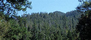
Cascade Mountains, USA Photograph by John Morrison Central and Southern Cascades forests
The Central and Southern Cascades span several physiographic provinces in Washington and Oregon, including the southern Cascades, the Western Cascades, and the High Cascades. This ecoregionextends from Snoqualmie Pass in Washington to just north of the Californiaborder.
The region is characterized by accordant ridge crests separated by steep, deeply dissected valleys, strongly influenced by historic and recent volcanicevents (Mount Saint Helens). The region is characterized by numerous perennial streamsand lakes maintained by abundant annual precipitation (1,270-3,048 millimeters).
Extensive logging (the primary threat to biodiversityin this region) and fire suppression have substantially altered natural disturbance regimes, shifting regional landscapes from those with a full range of seral stages to highly fragmentedlandscapes where late-seral stages are rapidly being replaced by monocultural tree plantations. Fire suppression, exotic species (Alien species)invasions, and road building have caused extensive damage to key watersheds, late-seral forests, and rangelands in this ecoregion.
Eastern Cascades forests
The Eastern Cascades Forests span the eastern slopes of the Cascade Mountains in Oregon and Washington, from the southern reaches of the Cascade Mountains Leeward Foreststo northern California. Vegetation is highly variable throughout this ecoregionand are influenced primarily by edaphic processes and disturbance regimes. Several ecotonesexist, particularly along the Cascade crest where western Cascade forest types overlap with eastern Cascade forests (e.g., the Wenatchee National Forest in Washington has conifer species present on both sides of the Cascades) and along the lower timberline where forest species mix with shrub and shrub-steppe communities.
The major types of threat in the ecoregioninclude the following: (1) logging; (2) livestock grazing in riparianareas and native shrub-steppe; (3) fire suppression; (4) spread of noxious weeds exacerbated by road building and fragmentation; and (5) hydroelectric dams and flood control. Congressionally imposed salvage logging levels remain the greatest threat to protecting biodiversityin the region.
Palouse grasslands
Grasslands and savannasonce covered large areas of the inter-mountain west, from southwest Canada into western Montana. Today, areas like the great Palouse prairieof eastern Washington, northeastern Oregon, and northwestern Idaho are virtually gone. The Palouse, formerly a vast expanse of native bluebunch wheatgrass ( Agropyron spicatoin), Idaho fescue ( Festuca idahoensi), and other grasses, has been plowed and convertedto wheat fields or is covered by cheatgrass ( Bromus tecturum) and other exoticplant species.
The Palouse does not face serious threats from agriculturebecause nearly all of the habitathas already been converted; itis now intensive agriculturalland with patches of shrub-steppe grassland. Once a rich ecosystemyear-round, the species that invaded the Palouse following the increase in grazing and the change in fire regime transformed these grasslands to seasonal rangelands. Degradation of the remaining fragmentscontinues to be a problem, and there are still moderate levels of wildlife exploitation.
Blue Mountains forests
The Blue Mountains ecoregionlies within northeastern Oregon and extreme southeastern Washington. This ecoregion consists of several basin and range areas, alluvial fans at the base of mountainranges, and floodplains along streamsdraining valleys. Mountainous areas include the Strawberry, Greenhorn, Elkhorn, Aldrich, and Maury Ranges, and the Ochoco, Blue, and Wallowa Mountains. Riparian and old growth forests represent important habitats in this region that receive disproportionate use by many fish and wildlife species.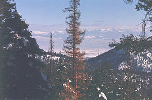
The rapid rate of logging in remaining old growth and roadless areas is the greatest threat to biodiversityin the ecoregion, followed by overgrazing. Other threats to biodiversityin the region include exotic species (Alien species)invasions and potential regional shifts in climatic patterns related to predicted global climate change. These threats are similar to threats identified in surrounding ecoregions within this major habitattype.
Snake-Columbia shrub steppe
The Snake-Colummbia shrub steppe is a vast, mostly arid ecoregion. Its easternmost limit is the Continental Divide in eastern Idaho. From there, the ecoregion follows the arc of the Snake RiverPlain as far as Hell's Canyon. The ecoregion then spreads throughout southeastern Oregon, extending along the Deschutes River basin to the Columbia River. It also includes, following hydrographic lines, parts of northern Nevada and the extreme northeast of California. To the north, the ecoregion dominates the western portion of the Columbia Basin in Washington.
Livestock grazing, invasion of exotic plants, irrigated agriculture, and recreation, especially through use of offroad vehicles, are the major threats to the ecologicalintegrity of this ecoregion. As there are no highly effective methods for checking or reversing the tideof exotic and noxious plant invasions, the spread of these species and consequent elimination of native plant communities is a serious threat. Combined with overgrazing and continued conversion to row crops, the ecoregion may be seriously altered and degraded in the near future.
Wasatch and Uinta montane forests
Although some popular native fauna have survived and even thrived in the ecoregion, m ost of the ecoregionhas been impacted by grazing, logging, mining, and recreational use and the outlook for its long-term viability is not optimistic. Large predators are fully extirpated, and ungulates like bighorn sheep ( Ovis canadensisc.) are apparently in decline. Increased motorized recreation in the mountains may compromise ungulate habitatsecurity beyond a critical threshold if allowed to expand. Domesticlivestock grazing continues unabated. The downhill ski industry poses some of the same threats here as it does in Colorado.
Great Basin shrub steppe
The Great Basin shrub steppe ecoregionis situated in the most northerly of the four American deserts. Unlike the other three, which have almost exclusive ties to warm-temperate and tropical/subtropical vegetation types, the Great Basin has affinities with cold-temperate vegetation. The Chihuahuanand Sonoran desertsmay in fact be more closely related to the Argentine "Monte" than they are to the Great Basin.
The Great Basin is composed of a series of uplifted mountainranges and their associated intervening valleys. There are approximately 100 internally drained basin within this ecoregion. The Basin is bounded to the east by the Colorado plateau and central Rocky Mountains, to the north by the Columbia plateau, and to the west by the Cascade-Sierra Range. The southern boundary is generally placed at the confluence of the Colorado River drainage and the Mojave desertof southern Californiaand southernmost Nevada.
Grazing poses the greatest conversion threat to the Great Basin; the U.S. Federal Government is pursuing policies disadvantageous to rangeland protection, by artificially stimulating the grazing of domesticated livestock, through below market lease rates for grazing. Current overgrazingcreates on-going opportunities for invasion by non-native species (Invasive species). The expansion of cities like Salt Lake City and Provo also may to lead to increased development and further conversion of habitat. Invasive speciesand fires are degrading the habitats of the Great Basin, while hunting threatens populationsof fur-bearing mammals.
Great Basin National Park, Nevada, USA Photograph by John Morrison Great Basin montane forests
The Great Basin montane forests rise steeply out of the semi-arid sage-covered plains of the Great Basin shrub steppe in Nevada and southeastern California. This ecoregionconsists of montane vegetation differentiated into distinct life zones that are roughly organized along elevational gradients. Within the basin, there is a distinct east-west pattern of declining species richnessthat correlates with distance from the western Rockies.
The biogeography of the forested mountaintops of the Great Basin has often been compared to that of an archipelago of oceanic islands. This "continental" island system has allowed biologists to explore many interesting ecologicaland evolutionaryquestions, such as the rate of differentiation among isolated taxa.
The major types of conversionthreats in this region are: (1) livestock grazing, (2) goldmining, and (3) microwave communication sites. Habitatloss in this region has been moderate with 25-50 percent of the remaining area still intact. However, fire suppression and livestock grazing have resulted in shifts in species composition particularly in lowland areas where invasive speciessuch as Russian thistle ( Salsola australis), cheatgrass ( Bromus tectorum), and exoticwheatgrass ( Agropyronspp.) have prospered.
Mojave Desert
The Mojave Desertis the smallest of the four American deserts. While the Mojave lies between the Great Basin Shrub Steppeand the Sonoran desert, its fauna is more closely allied with the lower Colorado division of the Sonoran desert. The Mojave is bounded to the north by the Great Basin Shrub Steppe, to the west by the Sierra Nevada and California montanescrub, and to the east by the Colorado Plateau. To the south, the Mojave blends into the Sonoran Desert, with a combination of species typical of the two deserts plus species most often found in the scrublands or conifer woodland of the Great Basin. Mojave speciesgenerally favor the colder plains, while Sonoran species are found on hillsides.
Conversion threats to the Mojave are concentrated in the southwest and east central portions of the ecoregion. Lower elevation valleys are largely in private hands and lack protection. The greatest present threat are proposals for large scale solar powerarrays; such arrays not only reduce the biological powering of sunlightfor desert flora and fauna, but destroy significant habitat areasby disturbing cryptobiotic soil crusts. Off-road vehicles and development threaten these valleys, and development also is harming creosotebush areas and the cryptobiotic crusts. Alien speciessuch as tamarisk are invading springs, and grazing is damaging mid-elevation pastures. Wildlife trade threatens chuckwallas, gila monsters, and desert tortoises.
Sonoran desert
The Sonoran Desert as currently defined covers approximately 200,000 square miles (520,000 sq. km), including100,000 square miles of land and 100,000 square miles of sea, and comprises much of the state of Sonora, Mexico, most of the southern half of Arizona, southeastern California, most of the Baja California peninsula, and the islands of the Gulf of California.
The Sonoran Desert prominently differs from the other three deserts of North Americain having mild winters. Most of the area rarely experiences frost, and the biota are partly tropical in origin.
Threats to the ecoregion include cattle grazing, agriculture, excessive ground water pumping, urbanization, and mineral extraction. The urban and suburban areas of Phoenix and Tucson in the U.S. continue to expand rapidly. This in turn is pushing agricultural operations further into the desert and along riparian areas such as the Gila River, with tremendous impacts on wildlife habitat. Riparian habitats are threatened by trampling, grazing and fouling by domestic livestock; water diversion and dam building; conversion for agriculture; and introduced species such as the Tamarisk tree (Tamarix chinensis) (Noss and Peters 1995). Furthermore, the introduction of invasive animal and plant species could displace native fauna and flora through direct competition.
Sierra Nevada forests
The Sierra Nevada forests are the forested areas of the Sierra Nevada Mountains, which run northwest to southwest and are approximately 650 kilometers(km) long and 80 km wide. The range is highest towards the south with several peaks over 4,000 meters(m). Several large river valleys dissect the western slope with steep canyons. The eastern escarpment is much steeper than the western slope, in general. The range supports a diverseset of natural communities with many endemic species and extraordinary habitats. It is important to note that a significant amount of the Sierra Nevada Mountains are totally unforested, since elevations above the treeline do not support even conifer growth.
The vast majority of native forests have already been largely convertedto tree plantations. Intensive forestrypractices have simplified forest structure and composition in most remaining forests, causing reduced ecologicresilience, genetic variability, and impaired function. Forest simplification and fire suppression together contribute to greatly increased probabilities of catastrophic fires and increased frequencies and severity of widespread mortality from epizootics such as bark beetles and fungal pathogens. Most remaining fragmentsof unlogged forests outside National Parks are threatened by logging, fire suppression, and grazing. Meadows throughout the range outside the national parks continue to be significantly damaged by sheep and cattle grazing and pack animals. Soilcompaction from logging and development activities is alteringnatural succession patterns.
Klamath-Siskiyou forests
Located in northwestern Californiaand southwestern Oregon, complex terrain, geology, climate, and biogeographic history have created one of the Earth’s most extraordinary expressions of temperate biodiversityin the Klamath and Siskiyou Mountains. Although well-known among biologists, few North Americans realize the uniqueness and importance of the speciesand communities in this ecoregion. Indeed, logging, mining, road building, and grazingcontinue to be intensive and pervasive threats to this area. To date no strict protected areas have been established in this richregion.
The Klamath-Siskiyou's native communities (Ecosystem)have been heavily impacted by commercial logging, fire suppression, mineral extraction, road building, and grazing of sheep and cattle. Many of the larger riversand tributaries have been severely degradedby dredging for gold, toxic runoff from mining operations, and sedimentation and associated changes from excessive and poorly managed logging. Introduced species, particularly in aquatic habitats, have alteredmany natural communities.
Northern California coastal forests
The Northern California coastal forests are largely defined by two features, the largely persistent moist environments provided by Pacific stormsin the winter and coastal fogs in the summer, and the distribution of the redwood ( Sequoia sempervirens). Redwoods range from central Californiato the Oregon border, and are typically found within 65 kilometers(km) (40 miles) of the coast. Redwood groves are patchily distributed among a variety of natural communities found within this coastal belt, including Douglas-fir–tanoak forests, oak woodlands, closed-cone pine forests, bogs, and coastalgrasslands.
The coastal forests of Northern Californiaare in many ways an extension of the temperate rainforests that hug the coasts in Washington and Oregon, except that, in California, redwoods and Douglas-fir–tanoak forests dominate many lowland areas. These ancient and spectacular conifers are among the biggest, tallest, and oldest trees in the world, often exceeding 60 meters(m) (more than 112.5 m in some individuals) in height, 4.6 m in diameter, and 2200 years old.
The last Redwood groves on private land, mostly in the Headwater Forest area near the van Duzan River, are under imminent threat of cutting by Pacific Lumber. Many remaining groves, both protected and unprotected, are threatened by significant alterationof surrounding watershedsfrom development and logging which can increase the frequency and severity of floods, fires, and sedimentation. Fire suppression can lead to hot fires that kill many individual trees and other species or allow other tree species to eventually out-compete young redwoods. Urbanization is also a major threat to this ecoregion, due to the spread of urban areas between Monterey and San Francisco and the area north of San Francisco.
California interior chaparral and woodlands
The California interior chaparral and woodlands ecoregionforms a nearly continuous ellipse of oak woodlandand chaparral around the CaliforniaCentral Valley, ranging from 300 to 3000 feet in elevation. The ecoregion continues across the coastranges to the Pacific Oceanfrom Point Reyes to Santa Barbara, with breaks around the redwood belt south of San Francisco Bay and the montane communities of the Santa Lucia Range that parallel the coast south of Monterey Bay.
Within the CaliforniaInterior Chaparral and Woodland ecoregion, one finds a mosaic of grasslands, chaparral shrublands, open oak savannas, oak woodlands, serpentine communities, closed-cone pine forests, pockets of montane coniferforests, wetlands, salt marsh, and riparian forests. Oak savannas and chaparral are the most widespread and characteristic communities.
Rural residential development and agricultural development are major threats to remaining low elevation oak woodlands. Overgrazingby domesticlivestock, including sheep and cattle, and wild deer and rodents is also a serious problem. Wetlands throughout the region continue to be threatened by development, draining, diversions, alterationof hydrologic conditions, and pollution. Introducedrats, cats, opossums, foxes, and other predators also cause mortality in wetland specialists such as salt marshharvest mice and clapper rails.
California Central Valley grasslands
The California Central Valley grasslands extend roughly 430 miles in central California, paralleling the Sierra Nevada Range to the east and the coastal ranges to the west (averaging 75 miles apart), and stopping abruptly at the Tehachapi Range in the south. Two riversflow from opposite ends and join around the middle of the valley to form the extensive Sacramento-San Joaquin Delta that flows into San Francisco Bay. Desert grasslandsoccur only in the southern end of the valley because of increasing aridity. The valley is ringed by oak woodlands and chaparral of the California Interior Chaparral and Woodland ecoregion.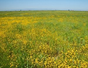
Virtually all Central Valley habitats have been altered. Introduced annual grasses now dominate grassland habitats. In most habitats native taxa comprise less than 1 percent of the standing grassland crop. Agriculturaldevelopment, urban expansion, alteration of hydrologic regimes and channelization, grazing by domestic livestock, fires, and introduced plants and animals have all contributed to the pervasive destruction of native habitats.
Remaining native habitatsare threatened by continuing habitat clearance for agriculture, alteration of hydrologic regimes, dams, channelization, fires, grazing by domestic livestock, and alien species. Over 526 species of introduced plant species are known from California, and many of these occur in the annual grasslands of the Central Valley. Many amphibianspecies show dramatic declines associated with habitat loss and introduced predators. Extensive riparian forests and woodlands have been destroyed by decades of tree-cutting, channelization, and flood-control projects. Salinization, toxic runoff, and erosion from ecologically-unsound agricultural practices increasingly degrade habitats.
California montane chaparral and woodlands
The ecoregionencompasses most of the Transverse Range that includes the San Bernardino Mountains; San Gabriel Mountains; portions of the Santa Ynez and San Rafael Mountains; Topatopa Mountains; San Jacinto Mountains; the Tehachapi, Greenhorn, Piute, and Kiavah Mountains that extend roughly northeast-southwest from the southern Sierra Nevada; and the Santa Lucia Range (part of the Coast Range) that parallels the coastsouthward from Monterey Bay to Morro Bay.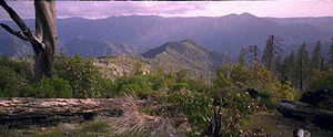
Fire suppression is a severe problem throughout the ecoregion, allowing fuel loads to build up and increase the probability of ecologicallydevastating hot fires. Few large predators remain due to centuries of hunting and predator control. The high densities of deer, rodents, and other herbivores that has resulted from predator extirpation contribute to intensive grazingand seed predation. High-impact recreational activities, such as off-road vehicles and hunting, cause significant damage of plant communities and mortality and disturbance of wildlife. Mixed conifer and closed-cone pine forestsare heavily impacted by air pollutionfrom urban centers. Ozonefrom smogcauses ponderosa pine and other species of conifer, shrubs, and lichento weaken and die.
California coastal sage and chaparral

The California Coastal Sage and Chaparral encompasses coastalterraces, plains, and foothills along the Pacific coast of northwestern Mexicoand southern California, United States. The Santa Rosa Mountains of the Peninsular Range are included, although the San Jacinto Mountains just to the northwest are considered under the adjacent ecoregion.
The coastal sage scrub is an endangered ecosystemthat contains a number of endangered species. The region is listed as an Endemic Bird Area with a very high number of endemic scrub species, such as the California gnatcatcher. Located on highly valued coastal real estate and threatened by human development, the ecoregion represents the struggle between preservation and human development.
Currently, only 15 percent of the region is intact. Native habitatscontinue to be clearedfor housing, golf courses, orchards, and other forms of development. Much of the remaining habitat, particularly near the coast, occurs only in very small patches and is highly isolated, fragmented, and surrounded by development, which is generally hostile environment for most native species.
Arctic coastal tundra
The Arctic Coastal tundra stretches along the northern coastsof Alaska, encompassing the eastern lowlands of Banks Island and Tuktoyaktuk coastal plains in the Yukon Territory, and the lower Anderson and Horton River plains in the Northwest Territories, covering 103,814 km 2. It is a low, gradually-rising plain characterized by poor drainage, wet graminoid herbaceous vegetation communities ( Carexspp., Eriophorumspp.), and many thaw lakes which cover up to 50 percent of the surface, distinguishing this ecoregionfrom the Low Arctic Tundraecoregion.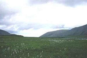
Over 90 percent of the Arctic Coastal Plain habitatremains intact. The main threat is the expansion of the Prudhoe Bayoil field development around the bay and into the Arctic National Wildlife Refuge coastal plain, as well as to the west into the Colville Delta and National Petroleum Reserve in Alaska. This expansion would significantly erode wilderness values and has the potential to disrupt wildlife habitatand use patterns.
Arctic foothills tundra
The Arctic Foothills Tundra forms a transition between the flat, low-lying Low Arctic Tundrato the north and the steep mountainousBrooks/British Range Tundrato the south. It is a series of rounded hills and plateaus which covers 123,512 square kilometers(km 2) and stretches from the Chukchi Sea east across northern Alaska to the Yukon border.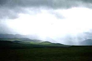
The main threats are potential habitat conversionfrom coaland mineral development in the western half of the ecoregionand continued degradationaround existing roads and mines. The current scope of these activities is small, but local impacts can be severe and permanent in the delicate tundra habitats. However, the vastness of the shallow coal deposits create a significant potential threat. High levels of subsistence hunting and resource use occur, but these are well managed and wildlife exploitation threats are resultingly low. The Trans-Alaska Pipelineand Dalton Highway provide easy access to this ecoregion. Once closed permanently to travel by the public, the Dalton Highway now can be traveled without restriction. The increased access to this previously remote area increases the possibility of over-exploitation of wildlife and habitat damagefrom off-road vehicles.
Brooks-British Range tundra
The Brooks/British Range Tundra ecoregionincludes the mountainous belt that extends from almost the Chukchi Sea across northern Alaska and into northern Yukon Territory and extreme northwestern Northwest Territory (NWT). This ecoregion consists of three large areas connected along a continuum: the Western Brooks Range, with relatively low, less rugged mountains and less permanent ice; the Eastern Brooks Range/British Range, with higher, more rugged terrain and more permanent ice; and the lower area near Anaktuvuk Pass that divides the two mountainous areas.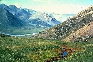
The Brooks/British Range ecoregion is almost entirely intact. Major threats include 1) t he possibility of mining activity; 2) a n increase in the hunting and recreation impacts on fragile tundra ecosystemsand wildlife populationsin the vicinity of the two roads, the Dalton and Dempster Highways; and 3) a continued steady increase in recreation activity in the National Parks. Fragile ecosystems with low resilience to human disturbancemake this a concern.
Interior Yukon-Alaska alpine tundra
This ecoregion encompasses much of south-central Yukon and a part of east-central Alaska. This ecoregioncontains mountainranges with many high peaks, and extensive, rolling to undulating hills and plateaus, moderately to deeply incised. These ranges are separated by wide valleys and lowlands, whose topography ranges from level to undulating.
Much of the ecoregionin the Yukon is taiga and boreal forest. Alpine areas are disjunct, although this is the natural condition. Roaded valleys are more problematic as these create barriers or interfere with seasonal movement of large mammals. Mining continues to expand and there is already a small amount of logging in the southwestern (Yukon) portion of the ecoregion with possible plans to increase logging of these northern forests.
Interior Alaska-Yukon lowland taiga
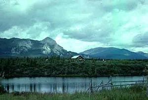
This large ecoregioncovers much of the interior Alaskan and Yukon forested area, extending from the Bering Sea on the west to the Richardson Mountainsin the Yukon Territory on the east and bounded by the Brooks Range on the north and the Alaska Range on the south.
The Interior Alaska/Yukon Lowland Taiga ecoregionhas retained intact ecosystems, with healthy populationsof all natural top predators. The Yukon Flats area in particular, in the northeastern corner of the ecoregion, is thought to be the most productive Arctic wildlife habitatin North America.
This ecoregionis almost entirely intact, with little habitat loss (Land-use and land-cover change)or fragmentation. Habitat loss has occurred mainly surrounding human communities, especially Fairbanks, and in the Tanama Valley State Forest, which has experienced some clearcutting. Major threats include timber harvest, oil and gas development, and exploitation of porcupine and caribou herds.
Ogilvie-MacKenzie alpine tundra
This extremely steep, mountainous ecoregionencompasses the Ogilvie and Wernecke mountains, the Backbone Ranges, the Canyon Ranges, the Selwyn mountains, and the eastern and southern Mackenzie Range (these last two are an extension of the Rockies).
The ecoregion is principally intact. Most of the threats relate to future access into this northern and fragile ecoregion. Further road development and mineral exploration may result in increased human access. This is already occurring in the western half of the ecoregion.
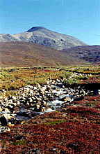
Beringia upland tundra
The Beringia Upland Tundra consists of three disjunct areas on the Bering Sea coastof Alaska, one comprised of the upland and mountainous areas of Seward Peninsula, one corresponding to the hills and mountains of the Ahklun and Kilbuck mountain ranges in southwest Alaska, and one of much smaller extent on the western half of St. Lawrence Island in the northern Bering Sea. These areas are similar in their varied terrain and elevation, and corresponding variety of vegetation, habitats, and communities.
The main threat to the ecoregionis the expanding development of mines and mining roads on the Seward Peninsula. Areas in the Ahklun and Kilbuck Mountains show potential for mineral extraction as well, so threats of similar habitat fragmentationand degradationare present there, too. There have been conservation concerns recently regarding the Kilbuck caribou herd that is at low levels. Additionally, a limited hunt has recently been allowed on walrus in the Walrus Islands.
Beringia lowland tundra
The Beringia lowland tundra ecoregionis formed by three major disjunct areas along the Bering Sea coastof Alaska from the base of the Alaska Peninsula to Kotzebue Sound, as well as one smaller area on the east side of St. Lawrence Island and St. Matthew Island. The ecoregion is characterized by low, flat, or gently rolling terrain, wet soils, and resulting predominance of wet and mesic graminoid herbaceous vegetation.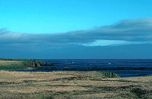
The abundance of surface water makes this ecoregionexcellent habitatfor waterfowl, and the tidal flats of the coastprovide an abundance of habitatfor shorebirds. Many species of birds depend on the habitats of this ecoregion for the majority, if not all, of their nesting habitat.
The Beringia Lowland Tundra is almost entirely intact. Human disturbanceconsists of small permanent and seasonal settlements, mostly along riversand coasts. Although there is some potential for unsustainablewaterfowl harvests from local communities, the harvests are at present well managed and represent less of a threat than habitat destruction (Land-use and land-cover change)in wintering areas for nesting waterfowl. Commercial fishing is a significant presence, and can affect not only the marine ecosystembut the many terrestrial species that rely on the abundant fish runs each year. Salmon fisheries in the area are generally well-managed to ensure sufficient spawning stock returns to the rivers. As with any commercial fishery, there is a concern with overharvesting, particularly of weak stocks in years of generally abundant returns.
Alaska Peninsula montane taiga
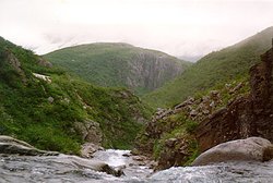
The Alaska Peninsula montane taiga is almost entirely intact, with habitat loss (Land-use and land-cover change)almost exclusively restricted to the localized effects of development surrounding the small communities and settlements along the coastline. The major threat to this ecoregion is the c ontinued habitat damage from existing ranching, feral cattle on some islands and predation effects on some islands from feral foxes. In addition, there is s ome potential for over harvest of game species, especially for brown bear populationsnear McNeil River.
AleutianIslands tundra
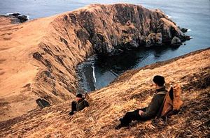
The Aleutian Islands are largely intact, with habitat alteration mostly resulting from widely scattered communities, military bases (some abandoned), cattle ranches (both ongoing and in disuse), fox farms (abandoned), and subsistence hunting. Almost all of the islands are included in the Alaska Maritime National Wildlife Refuge (AMNWR), and many areas are also included in the Aleutian Islands Wilderness. Major threats include 1) the c ontinuation of habitat degradation and conversion, due to cattle ranching, feral cattle and introduced reindeer; 2) predationon seabirds by feral fox and rats; and 3) c ontinuation of decline in seabird populations due to commercial fisheriesimpacts on Bering Sea marine ecosystem.
Cook Inlet taiga
This ecoregionsurrounds the upper reaches of Cook Inlet in south central Alaska, and is in turn surrounded by the mountainsof other ecoregions. Its relatively mild climate, level to rolling topography, and coastal position have made it the focus of most of the human activity in Alaska. These factors have also contributed to the wide variety of vegetation communities found in the ecoregion.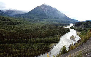
This ecoregionprobably has experienced the most extensive human disturbance and alterationin Alaska. Nevertheless, it remains approximately 90 percent intact, and still supports all of the top level terrestrial predators (such as the brown bear and wolverine) within, or close to, their natural ranges of variation.
Major threats include 1) c ontinued development along the Kenai River and overuse of the Kenai River, restricting wildlife movement, removing habitat, and disturbing hydrologic functioning; 2) unsustainabletimber harvest in the extensive forests throughout the ecoregion; 3) expansion of oil, gas, and coaldevelopment on the Kenai Peninsula and west side of Cook Inlet with potential for localized but severe impacts on surrounding habitatl 4) o ver-exploitation of fish and game stocks; and 5) k illing of bears for defense of life and property that come into conflict with growing human residential areas.
Alaska-St. Elias Range tundra
The Alaska/St. Elias Range Tundra is a long belt of high, rugged mountainsarcing north from the base of the Alaska Penninsula, east to encompass the Alaska Range, and south to include the Wrangell/St. Elias Range on the Canadian/Alaskan border near Yakutat Bay. The Canadian portion of this ecoregionencompasses the southwestern corner of the Yukon Territory and extreme northwestern British Columbia.
This ecoregionhas suffered very little habitat loss, degradation, or fragmentation. Minor losses are associated with development at the entrance to Denali National Park, at the north side of Denali Park at Kantishna, surrounding the abandoned Kennicott coppermine in the Wrangell Mountains, and at Nabesna in the Wrangells. Also, coalmining at Healy (northeast of Denali Park) has caused some habitat loss.
Pacific Coastal Mountain icefields and tundra
The Pacific Coastal Mountain icefields and tundra ecoregionconsists of a steep, very rugged range of mountains that stretches from the Kenai Penninsula along the Gulf of Alaska Coast and the Canadian/Alaskan border to the southern end of the Alaska panhandle. In Canada, this ecoregion encompasses the extreme southwestern corner of the Yukon Territory and parts of the coastalmountains in British Columbia south to Portland Inlet.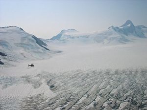
Most major threats relate to mining potential and the proposed roads and development associated with mineral exploitation. For example, two proposed roads would cut through the British Columbia coastrange: one at Taku Inlet and one at the Stikine River. The ecoregion contains a variety of extractable minerals, such as gold, silver, copper, and [zinc], as well as coal, petroleum, and uranium. The Kenai Penninsula has the highest chance of experiencing significant timber harvest or wildlife exploitation in the future. Planned timber harvests in response to mortality from a spruce bark beetle infestation could cause damage to streamsimportant for salmon spawning and to declining brown bear populationson the Kenai Penninsula.
Northern Pacific coastal forests
The North Pacific coastal forests occupy a narrow (about 160 kilometers(km) wide) coastal band extending from the southern portion of the Alexander Archipelago to the Prince William Sound region and eastern Kodiak Island. This ecoregioncontains more than one-fourth of the world's coastal temperate rainforest and is one of the largest and most pristine temperate rain forest and shorelineecosystemsin the world.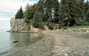
This ecoregion consists of thousands of small and several large mountainousislands (elevation to 1,500 meters(m)), long coastal valleys, and outburst flood fans. Some of the largest islands in North America are found here, including the eastern portion of Kodiak Island and Prince of Wales Island.
While there are still many pristine areas remaining in this ecoregion, old growth is on a trajectory similar to the extensive degradationthat has characterized the Pacific Northwest during the past 50 years. Populationviability concerns already exist for several species associated with old-growth and trends in these species over the next century are alarming (several species have low persistence probabilities). Other threats include expansion of roads and highways to accommodate the explosive growth in tourism, increases in cruise ships visiting popular tourism destinations such as Glacier Bay National Park, pollution from pulp mills and mining tailings, and potential long-term reductions in subsistence species (e.g. deer) due to logging in winter habitat areas.
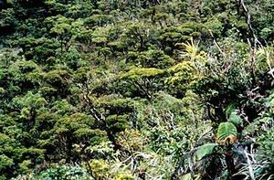
Hawaii tropical moist forests
Tropical moist forests of Hawai'i are comprised of mixed mesic forests (about 750-1,250 meters (m) elevation), rain forests (found above mixed mesic forests up to 1,700 m), wet shrublands, and bogs in swampy areas. Moist to wet forests are commonly found on the windward lowland and montane areas of the larger islands and on mountain tops of some of the smaller islands. Koa ( Acaciaspp.) and ‘Ohi’a lehua ( Metrosiderosspp.) are common dominant canopy tree species.
Lowland and foothill moist forests have been largely eliminated. Some relatively large blocks of montane forest still exist on the larger islands, but even here there is much degradation from feral ungulates, introduced weed species, development, and recreational activities. These activitites seriously threaten remaining Hawaiian bogs and wet forests.
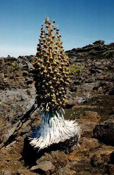
Hawaii tropical high shrublands
Hawaiian high shrublands range from open shrublands to alpine grasslands and deserts. The upper slopes of the high volcanoes, Mauna kea, Mauna loa, Hualalai, and Haleakala, support shrubland habitatswith species such as Chenopodium oahuense, Vaccinium reticulatum, Dubautia menziesii, and Santalum haleakalae. Subalpine grasslands, patchily distributed within and adjacent to the shrub zone, are dominated by tussock-forming species such as Deschampsia nubigena, Eragrostis atropioides, Panicum tenuifolium, and Trisetum glomeratum. On the highest peaks, cold and dry conditions create alpine deserts inhabited by silversword ( Agryroxiphium sandwicense), Dubautia spp., and other alpine-adapted plants, as well as alpine-adapted invertebrate species.
Although some large blocks of relatively intact high shrublands and alpine deserts still exist, overgrazing by domestic and feral livestock, wildfires, trampling from recreational activities, competition from introduced plants, removal of plants such as silverswords, and introduced ants that kill native invertebrate pollinatorsall pose significant threats to native species and communities. Alpine grasslands have been reduced in range, but still occupy more than 50 percent of their presumed original range.
Hawaii tropical dry forests
Tropical dry forests of Hawaii typically occurred on the leeward side of the main islands and once covered the summit regions of the smaller islands. Most native lowland forests of Hawaii are either seasonal or sclerophyllous to some degree, and more mesic transition forests occur where conditions are favorable. These transition forests include mixed mesic forests that often contain patches and elements of dry forest communities.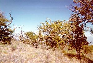
Tropical dry forests are globally threatened, and Hawaiian dry forests have been reduced by 90 percent. Clearing and burning of lowland dry forests began with arrival of Polynesians and the last remnants are being destroyed today through development, expansion of agricultureand pasture, and burning. Most larger fragments of relatively intact dry forests are in montane areas. I ntroduced plant species are widespread and dense growth and competition for resources prevents the establishment of native plant seedlings. Introduced rats, plants, and seed-boring insects, grazing by domesticlivestock and introduced deer, goats, and pigs, as well as recurring fires inhibit almost any regeneration of native species in most altered habitats.
Context
Ecoregions are areas that:
[1] share a large majority of their species and ecological dynamics;
[2] share similar environmental conditions; and,
[3] interact ecologically in ways that are critical for their long-term persistence.
Scientists at the World Wildlife Fund (WWF), have established a classification system that divides the world in 867 terrestrial ecoregions, 426 freshwater ecoregions and 229 marine ecoregions that reflect the distribution of a broad range of fauna and flora across the entire planet.
</div>Citation
Fund, W. (2013). Ecoregions of the United States. Retrieved from http://editors.eol.org/eoearth/wiki/Ecoregions_of_the_United_States