Deserts of North America
| Topics: |
Contents
Introduction
North America has four major deserts: the Great Basin, the Mojave, the Chihuahuan and the Sonoran. All but the Sonoran Desert have cold winters. Freezing temperatures are even more limiting to plant life than is aridity, so colder deserts are poorer in both species and life forms, especially succulents.
Map of North American Deserts
Forrest Shreve (1878-1950) was the preeminent botanist, ecologist and biogeographer of the North American desert regions for the first half of the Twentieth Century. Based at the Desert Laboratory in Tucson, Arizona, Shreve conducted extensive field research for decades in the western United States and northern Mexico. His intimate knowledge of the region’s natural history provided the information needed to delineate the North American Desert and the four major desert regions within it. The purpose of this article is to present a re-drawing of Shreve’s original 1942 map and to summarize his descriptions of the desert regions.
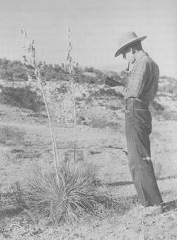 Forrest Shreve, about 1940 (from Bower, 1988).
The North American Desert has core regions with distinguishing vegetation features, but delineating its boundaries is a somewhat subjective act. Shreve drew his lines based on similar degrees of transition from desert to the semi-arid regions surrounding it with different vegetation characteristics. The lines separating the contiguous deserts (Great Basin, Mojave and Sonoran) were drawn based on geographical features to conform to conventional usage by natural scientists at the time. The Chihuahuan Desert is geographically distinct from the others in this map, though later researchers suggest that it joins up with the Sonoran Desert in Arizona.  Map of North American Deserts, re-drawn from Shreve (1942).
The Great Basin Desert
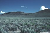 Great Basin Desert. (Source: Arizona-Sonora Desert Museum)
 The Great Basin Desert is both the highest-elevation and northernmost of the four deserts and has very cold winters. The seasonal distribution of precipitation varies with latitude, but temperatures limit the growing season to the summer. Vegetation is dominated by a few species of low, small-leafed shrubs; there are almost no trees or succulents and not many annuals.
The Great Basin covers significant parts of Utah, Oregon, Idaho, Wyoming, Colorado, Nevada and Arizona. The elevation of this area is generally 1200 m and above, where continuous freezing temperatures for a week or more are common. The highest levels of rainfall are found in the highlands and the northern region, reaching around 300 mm yearly, and are almost double the average for the other seven-eighths of the desert. Precipitation is relatively uniform throughout the year compared to other North American deserts, thus the effects of a long dry season are not felt as strongly. Climate data presented here are from Shreve and have not been updated, though they have been converted to metric values. Elevations have been converted, as well.
The lack of a prolonged dry season added with comparatively moderate temperatures combine to create moisture conditions that are more conducive to biological use than the low amount of precipitation would indicate. The topography of the Great Basin floor is dominated by playa basins separated by fault-block mountain ranges or the accumulation of outwash material. Centered in each basin is an alkaline flat or a dry lake, surrounded by concentric belts of changing soil conditions, mostly decreasing alkalinity and increasing grain size, moving away from these centers.
Communities of semi-shrub vegetation are monotonous, sometimes 30 to 100 km long, with clearly defined borders at soil belt transitions. The most widespread communities are dominated by Artemisia tridentata (big sagebrush) and Atriplex confertifolia (four-wing saltbush). The second most common community is found in lower soil belts and more alkaline soil. Artemisia is found throughout the Great Basin and beyond its borders; expressing a wide range of density, height, rate of growth, and size in individual plants. Plants are usually absent in dried lakebeds due to high salinity. Atriplex confertifolia (shadscale saltbush) seems to succeed in more alkaline soils where Artemisia cannot. Other important semi- shrubs of the area include: Artemisia nova, Chrysothamnus puberulus, Grayia spinosa, Eurotia lanata, Atriplex nuttallii, Coleogyne ramosissima, and Artemisia spinescens. The apparent monotony of this desert vegetation is due to the fact that the abundant plants of the region are of the same life-form, all shrubs.
The Mojave Desert
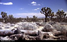 Mohave Desert. (Source: Arizona-Sonora Desert Museum)
 The smallest subdivision of North American deserts, the Mojave (also spelled Mohave) Desert is characterized largely by its winter rainy season. Hard freezes are common but not as severe as in the Great Basin Desert. The perennial vegetation is composed mostly of low shrubs; annuals carpet the ground in wet years. There are many species of these two life forms, but few succulents and trees grow there. This desert lies mostly in southeastern California and extending into Nevada and Arizona. It is east of the southern end of the Sierra Nevada range and north and east of the San Bernardino Mountains; it also extends east to the Colorado River and north to the 1370 m contour line in California and Nevada (corresponding to the northern limit of Larrea tridentata (creosote bush), based on 1893 data). Death Valley, which contains the lowest point in North America at 146 m below sea level, lies in the northern Mojave. This is a mountainous region, having a higher total percentage of area occupied by mountains than the Great Basin. The mountains to the south and west provide the rain shadow that causes the aridity of the region. There is very little drainage to the sea, and it occurs through minor tributaries of the Colorado River. All other drainage occurs in large lake beds or small dry lakes. Similar to the Great Basin, there are “many bare lake beds surrounded by zones of vegetation of decreasing ability to withstand highly charged soil." These lake beds provide a consistent source of dune-building material that is blown far across the outwash slopes and deposited on adjacent and distant hills.
Most of the Mojave Desert, according to the sparse available data in the early 1940s, receives less than 120 mm of rain per year and suffers from seasonal periods with little to no rainfall; which makes the Mojave more arid than the Great Basin Desert. The extreme aridity and heavy sediment load in the streams of the Mojave leads to the development of many intersecting rills, rather than well defined streamways that would provide a riparian habitat containing more favorable moisture conditions.
The richest and most diversified flora and vegetation is found along the southwestern edge of the desert, which is also the part of the desert closest to population centers in southern California. This is due to relatively higher elevation (between 910-1220 m), 120 mm or more in precipitation from storms breaking over the surrounding mountain ranges, and areas of granitic loam soil of low salt content. The upper region of this desert is dominated by Yucca brevifolia (Joshua tree); which overtops a heavy, discontinuous stand of one-meter high shrubs made up of a large number of species that are found only in this region of the Mojave. As the distance increases from the mountains and plant spacing increases, Larrea begins to dominate as the Yucca disappears. In a transition zone within the desert between Yucca and Larrea, spring rains bring forth a high percentage of the perennial flora of the Mojave. Elsewhere in the eastern and central regions of the Mojave, almost 70% of the desert is covered with open stands of Larrea and Franseria dumosa (burrobush). This monotonous blanket of vegetation dominates these areas without regard to aspect, slope, or soil. Areas of shifting sand provide the only breaks in this almost contiguous stand. Some perennial plants that can form minor patches of vegetation within the Mojave are confined to specific soils: Hilaria rigida (sandy soils), Atriplex canescens (alkaline soils), Opuntia echinocarpa (stony soils), Hymenoclea salsola (sandy or deep loam), Atriplex hymenelytra (stony soils), Krameria pervifolia (coarse soils), and Ephedra nevadensis (deep loam soils). The center part of the Mojave, at elevations between 1130 and 1220 m, features 600 mm high Coleogyne (blackbrush) instead of the dominant Larrea. Of all the desert flora of southern California, 45% are common in the Mojave and adjacent transition zones. Almost one-fourth of the species in the Mojave are confined to its borders and adjacent areas.
The southern tip of Nevada, the low elevations of California near Needles, and northwest Arizona near Kingman form a transition zone featuring vegetation characteristic of the Mojave, Great Basin, and Sonoran deserts. Topography, landscapes and vegetation typical of the Mojave Desert extend south to northern boundary of Riverside County, California and east to the Colorado River. The Colorado Desert is a narrow belt of transition from the treeless, monotonous Mojave Desert to the arboreal, diverse Sonoran Desert.
The Chihuahuan Desert
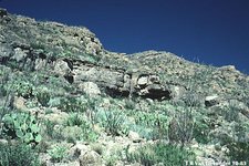 Chihuahuan Desert. (Source: Arizona-Sonora Desert Museum)
 North American deserts are fairly continuous from the state of Washington, USA to the state of Puebla, Mexico except for the break provided by the continental divide; which separates the Chihuahuan Desert from the rest. The separation is considered the Desert-Grassland Transition region of the high plains of Arizona and New Mexico (around 1220 m). This area is considered a transition region because most of the common desert species are absent.
The Chihuahuan Desert lies at a fairly high elevation and is not protected by any barrier from arctic air masses, so hard winter freezes are common. Its vegetation consists of many species of low shrubs, leaf succulents, and small cacti and trees are rare. Rainfall is predominantly in the summer, but in the northern end there is occasionally enough winter rain to support massive blooms of spring annuals. This desert includes parts of New Mexico and western Texas adjacent to the Rio Grande, the lower valley of the Pecos River, eastern half of Chihuahua, the western half of Coahuila, and parts of Durango, Zacatecas, Nuevo Leon and San Luis Potosi. Some of the Rio Grande Basin is below 910 m, but over half the desert is above 1220 m and some of the highest parts are at 1830 m. Desert vegetation can frequently be found as high as 2130 to 2590 m. Vast plains and undrained basins mix with mountain ranges and intricate groups of limestone hills. Limestone is far more abundant in here than any other desert, and gypsum is very common.
The rainy season is June to September, during which time over 65% of the total precipitation falls. From October to the end of the year, this area receives light rainfall. From January to May, this desert experiences a season of drought. Rainfall varies from 70 mm in large undrained basins in Coahuila to 300-400 mm in the western and southern edges of the desert. Summer temperatures are 5 to 10 °C lower than in the Sonoran, except for the lower elevations near the Rio Grande. These conditions combine to produce only one growing season for vegetation.
Shrubs and semi-shrubs dominate this desert, while trees are confined to streamways or rocky slopes. Various species of Opuntia (prickly pears) are abundant in local areas. Two leaf succulents, Agave and Hechtia, are widely occurring and abundant. Fouquieria (ocotillo) is present throughout the desert. Three species are common in both the Sonoran and Chihuahuan deserts: Larrea, Fouquieria, and Prosopis (mesquite). Leguminosae is better represented in the floristic composition of the Sonoran and Compositae are better represented in the Chihuahuan, however both families are present in both deserts. The most widely distributed and drought-resistant plants are dominant in the intermountain plains.
An important line of biological demarcation is east to west mountain ranges, including Sierra de Parras and Sierra Jimulco in southern Coahuila. This area represents a true transition zone, with equally different areas of vegetation existing north and south of the mountains. Sand dunes that surround large lake beds are found exclusively in the northern part of the state of Chihuahua. There are grasslands interspersed in undrained basins; however, when the grass covers 50% or more of the surface that is an indication of a transition to grassland. Grassland llanos, which occupy the deep fine soil of some undrained basins, are considered part of the Chihuahuan desert due to the absence of the species common in true grasslands. Limestone covers the northern areas, while obligate gypsophiles are found from Texas to San Luis Potosi. Topography plays an important role throughout this region, and can be associated with changes in vegetation.
The Sonoran Desert
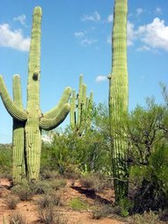
The Sonoran Desert is lush in comparison to most other deserts. The visually dominant elements of the landscape are two life forms that distinguish the Sonoran Desert from the other North American deserts: legume trees and large columnar cacti. This desert comprises the lowlands around the upper part of the Gulf of California, the southwestern quarter of Arizona, the lowlands of Baja California and the western half of the state of Sonora, Mexico. The highest point in this desert is less than 910 m, with the majority of the desert lying below 610 m. The rivers of the region traverse the desert or add to the underflow of the floodplains allowing for normal dendritic drainage and creating an arboreal desert. Towards the Pacific Coast and near the head of the Gulf of California, dunes and sandy plains occupy large tracts of land. Gently sloping bajadas and level plains are common, comprising approximately 75% of the surface of the desert.
At low elevations, precipitation is rare and extremely seasonal. For example, in the early 1940s, central Baja California received no precipitation for four years. Annual precipitation falls biannually in the inner, continental part of the desert, which means that the dry spells are often shorter than those in the Mojave and Great Basin but more severe due to the higher temperatures in the Sonoran.
In higher elevations, more precipitation and greater relief allow for a rapid vegetation change resulting in one of the most diversified plant communities found in North American deserts. In the low plains bordering the rivers that traverse the desert, Larrea tridentata and Franseria dumosa dominate with a number of other sub-dominates. Hilaria rigida, Opuntia echinocarpa, Acacia paucispina, Opuntia wrightii, Atriplex canescens, Fouquieria splendens, Opuntia ramossima, and some small amounts of Prosopis chilensis are among the sub-dominates of this area. Changes in soil composition lead to changes in vegetation or composition. In the central plains, Larrea becomes localized and Franseria is at its southern most limits. Along streamways, small trees are present within a heavier stand of the common shrubs. These trees and sub-dominates are the distinguishing feature that separates the arid parts of the Sonoran Desert from the lower areas of the Mojave. Vegetation can be more varied, equally distributed, and layered according to height than in the Mojave. Baja California’s rugged interior does not allow for the uniformity seen in the monotonous stands of vegetation in the Mojave.
The Gulf of California can provide an effective barrier to plant migration, even giving insular conditions to the lower third of the peninsula. North of Guardian Angel and Tiburon Islands vegetation is similar, but south of these islands the peninsula has distinct flora and vegetation from corresponding areas on the mainland. The flora of Baja California is distinguished by a wide variety of localized, endemic vegetation, though some species have now been found on the mainland.
Further Reading
- Biomes and Communities of the Sonoran Desert, Arizona-Sonoran Desert Museum.
- Bowers, Janice Emily, 1988. A Sense of Place: The Life and Work of Forrest Shreve. Tucson, University of Arizona Press, 195 p.
- Desert Biome, UCMP.
- Phillips, S.J. and P.W. Comus (eds.) 2000. A Natural History of the Sonoran Desert. Arizona-Sonora Desert Museum Press, Tucson, and University of California Press, Berkeley.
- Shreve, Forrest, 1942. The Desert Vegetation of North America. Botanical Review 8:195-246.
| Disclaimer: This article is taken wholly from, or contains information that was originally published by, the Arizona-Sonora Desert Museum. Topic editors and authors for the Encyclopedia of Earth may have edited its content or added new information. The use of information from the Arizona-Sonora Desert Museum should not be construed as support for or endorsement by that organization for any new information added by EoE personnel, or for any editing of the original content. |
