Middle Atlantic coastal forests
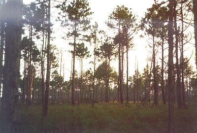
Croatan National Forest, North Carolina, USA. (Photograph by John Morrison)
Biological Distinctiveness
The mosaic of plant communities observed is a result of dramatic gradients in soil structure and chemistry and hydrology. Habitats are dynamic, with fire being a major source of disturbance in drier areas and, hurricanes and floods in the bottomlands, coastal plains, and maritime habitats. The interaction of moisture and fire frequency influence species richness in the herb layer with frequent (1-3 yr) summer fires favor a herb dominated savanna and less frequent (5-10 yr) leading to a dense shrubby understory.
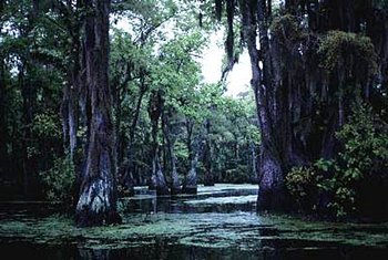 Mill Pond, North Carolina, USA. (Photograph by David Olson)
 River swamp forests or bottomland forests were once prominent in this ecoregion and are one the most visually appealling habitats in North America. This forest type is dominated by bald cypress (Taxodium distichum) and swamp tupelo (Nyssa sylvatica var. biflora). Eastern or Atlantic white cedar (Chamaecyparis thyoides) occurs along blackwater rivers, most commonly on organic substrates underlain by sand. Christensen describes in detail the variety of river forest and nonalluvial wetland communities found throughout the ecoregion. Some of the more interesting types include the pocosins and Carolina Bays. Pocosins, an ancient Algonquin term for swamp-on-a-hill are characterized as extensive flat damp, sandy or peaty areas far from streams with a scattered growth of pond pine (Pinus serotina) and a dense growth of mostly evergreen shrubs (often gallberry, Ilex glabra), that taken together, resemble a heath scrub community. Pond pine is especially prevalent in coastal North Carolina on poorly drained organic [[soil]s] and where wildfire is common. Carolina Bays are ovate shaped shallow depressions and occur abundantly across a broad band of the coastal plain from southern North Carolina to the South Carolina-Georgia border. They represent a type of bog or bog-lake complex unique to the southeastern coastal plain, and are thought to have been formed by a meteor or comet impact. Maritime communities are also an important feature of this ecoregion.
The ecoregion as a whole ranks in among the top ten ecoregions of the U.S. and Canada in reptiles, birds, and tree species. Within this ecoregion, the bottomland or floodplain forests are some of the most biologically important habitats in North America. They occur on rich alluvial [[soil]s], maintain moderate climates and microhabitats that provide seasonal refugia for many species, maintain an abundance of arthropods and mast from canopy species to sustain overwintering migratory birds, and offer abundant rotting logs, bole, and branch cavities for detritivores and hole-nesting species, respectively. Many of the remaining pockets of forested habitat are crucial as seasonal habitat for songbirds and migratory waterfowl. Bottomland forests also provide a distinct contrast to the pine-dominated uplands, serve as a resource sink for upland aquatic communities, support aquatic food webs when flooded and terrestrial food chains during the dry season. Finally, the linear distribution of floodplain forests facilitates local and regional movements of species and river flow maintains effective water dispersal of seeds and larvae. Other habitats, such as bogs, provide habitat for rich assemblages of herbaceous species, including many endemics. Carnivorous plants, such as Venus fly-traps (Dionea spp.), pitcher plants (Saracena spp.), and sundews (Drosera spp.), are restricted to very small areas. The ecoregion was a Pleistocene refugia although this section is out on the continental shelf.
Conservation Status
Habitat Loss and Degradation
Approximately 12 percent of the ecoregion contains habitat that meets the definition of intact used in this assessment. The highest levels of conversion are in the western part of this ecoregion, the upper coastal plain, where upland vegetation on loamy [[soil]s] has been nearly completely converted. Long-leaf pine communities have largely disappeared, and are now absent in Virginia. Much of the cypress forests of the Middle Atlantic coastal forests has been lost to logging. Stands where cypress has been high-graded often revert to bay forests. Where logging and fire have occurred, cypress is extremely slow to recover. The Great Dismal swamp in Virginia was one of the strongholds of Atlantic White Cedar swamps and is now virtually gone.
One of the greatest threats is to the diverse wetlands communities and in particular bottomland forests. These were once extensive: in the mid-1970s, 47 percent (188,000 square-kilometers (km2)) of remaining wetlands in the lower 48 states of the U.S. were in the southeast. Sixty-five percent of the pallustrine forested wetlands (pocosins, swamps, bottomland hardwoods, and bogs) in the United States occur in the Southeast. Pocosins originally covered 9,080 km2 of the 41 Coastal Plain counties of North Carolina. By 1979 6,080 km2 of natural or slightly altered pocosins remained. Of this amount only 2,810 km2 were still considered in a natural state as of 1980. The number of Carolina Bays in uncertain, although at least 6,000 once occurred in North and South Carolina. Few natural bays remain, the majority having already been modified by agricultural or urban development. The South Carolina Trust Program provides details on the numbers and proportions of altered and natural bays. The least affected communities in this ecoregion are the coastal marshes and deep peatlands.
The main reasons behind conversion are agriculture, fire suppression, urbanization, coastal development (including resorts), ditching and draining of wetlands, and damming of rivers which affect hydrology.
Remaining Blocks of Intact Habitat
There are numerous blocks of habitat scattered about the ecoregion, but all are relatively small in size. Those that include at least a fraction of intact habitat are:
- Savannah River bottomlands - southern South Carolina/Georgia border
- C.E. basin - southern South Carolina
- Francis Marion National Forest - eastern South Carolina
- Winyah Bay - eastern South Carolina
- Lake Waccamaw and River - southeastern North Carolina, northeastern South Carolina
- Brunswick County Pinelands - southeastern North Carolina
- Bladen Lakes - southern North Carolina
- Holly Shelter Gamelands - southeastern North Carolina
- Camp Lejeune - southeastern North Carolina
- Croatan National Forest - eastern North Carolina
- Outer Banks - coastal North Carolina
- Pamlimarle Peninsula - eastern North Carolina
- Roanoke River - eastern North Carolina
- North and Northwest River - northeastern Carolina
- Great Dismal Swamp - Virginia/North Carolina border
- Assatague and Chincoteague - Maryland/Virginia Atlantic coast
- Virginia coast reserve - Virginia
- Cape Romain - South Carolina coast
- Fort Bragg - southeastern North Carolina
- Sandhills Gameland - southeastern North Carolina
- Sandhill National Wildlife Refuge (NWR) - northern South Carolina
- Fort Jackson - central South Carolina
- Fort Stewart - eastern Georgia
Degree of Fragmentation
Fragmentation is an important threat in this ecoregion because it exacerbates the main problem of fire suppression. An area where much work remains to be done is in planning and creating corridors along the coast. In the uplands, a corridor between Fort Bragg and the Sandhills gamelands represents the only possibility at present for linking upland areas. Other opportunities for establishing corridors include links among the Croatan National Forest, Camp Lejeune, and the Holly Shelter Gamelands. Another possibility is among the Brunswick County Pinelands, and Lake Waccamaw.
Degree of Protection
This ecoregion contains the longest undammed river sections in the country. However,there is very poor protection of blackwater bottomlands. Forested wetlands, such as bottomlands forests, are undergoing rapid reduction in area and alteration of composition. Many are being converted to farmland, used for industrial parks, or modified by urban and suburban expansion. Other forested wetlands are being managed for timber production which typically reduced their value as wildlife habitat for sensitive species. North Carolina and South Carolina were estimated at having 12,950 km2 and 12,790 km2, respectively of bottomland hardwood forest in 1952. Projections for the year 2000 show a loss of 20 percent in North Carolina and 28 percent in South Carolina bottomland hardwood forests.
Other communities which are not represented in the protected areas of this ecoregion are areas underlain by loamy [[soil]s] and upland blocks of habitat.
The most important protected areas for biodiversity conservation are:
- Francis Marion National Forest - southeastern South Carolina
- Brunswick County Pinelands
- Holly Shelter Gamelands
- Croatan National Forest - eastern North Carolina
- Outer Banks - eastern North Carolina
- Pamlimarle Peninsula - eastern North Carolina
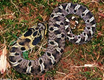 Eastern Hognose Snake (Heterodon platirhinos), eastern Maryland, United States. (Photograph by John White & CalPhotos)
 - Roanoke River - southwestern Virginia
- Sandhills Gameland - northeastern South Carolina
- [[National Wildlife Refuge - northeastern South Carolina
- Fort Stewart - eastern Georgia
The North Carolina Heritage Program, in conjunction with the state, has purchased more than a dozen bays totaling less than 20 km2. The South Carolina Trust Program has acquired or are negotiating the purchase of more than 30 Carolina Bays.
Thirty-seven species of southeastern songbirds are known to require extensive forest areas for maintaining viable populations]. The continued fragmentation of these forests has put greater stress on these species. A georeferenced database using Geographic Information Systems (GIS) will be available by 1998. This data source will help identify the integrity of remaining blocks of forested wetland habitat.
The wetlands of the Middle Atlantic coastal forests are keystone habitats for a variety of reptile, amphibian, and shrub species that require the moist conditions available to complete stages of their life cycle (herps) or maintain viable populations (shrubs). The loss of a significant portion of wetlands in this ecoregion will have a dramatic impact on many species that are either native or reach high densities within this ecoregion. Bays and pocosins are also important reservoirs of carbon (CO2) and their continued conversion will compound the rise in atmospheric CO2.
Types and Severity of Threats
Conversion threats include development along the coast and pine plantations on the outer coastal plain (but not the coast itself). The major degradation threats are fire suppression, dams, and ditching. There is no legal fire management regime in this ecoregion. Poaching of carnivorous plants and black bear is judged as moderate.
Suite of Priority Activities to Enhance Biodiversity Conservation
- Increase protection in Winyah Bay, Lake Waceamah, and Waceamah River; Brunswick County Pinelands; and Bladen Lakes
- Improve management for biodiversity conservation, particularly fire management, in Francis Marion National Forest, Great Dismal Swamp, Fort Bragg, Sandhills Gameland, Sandhills National Wildlife Refuge, and Fort Stewart
- Establish corridors among units listed above
- Protect blackwater river systems in northeast Cape Fear area, northeast Black River, and the Little Perdu
- Strengthen right to burn laws
- Identify and inventory sites with loamy [[soil]s] and last bits of long-leaf pine for inclusion into protected areas
- Develop strong state land use management systems which include the protection of biodiversity as a fundamental goal. One example of such a program is the Chesapeake Bay Critical Area Program of the State of Maryland.
- Enact and implement effective forest management programs at the state level. These programs should include both minimum regulatory standards as well as a mix of economic incentives for good forest practices. This is particularly important because a high proportion of forest resources in this region are located on private lands.
- Improve implementation of state programs for the protection of both tidal and non-tidal wetlands.
- Undertake significant restoration efforts in selected areas. For example, substantial work needs to be undertaken to remove physical barriers obstructing movement of aquatic species from the many rivers flowing into the coastal waters.
- Pay special attention to retaining the natural characteristics of the barrier island systems which remain in the region. Acquisition programs such as carried out by The Nature Conservancy in the Virginia Barrier Islands are vital but should be supplemented by development which is more sensitive where it is allowed.
Policy issues:
- The effects of transportation corridors have been devastating in certain areas and threaten much of the region. High priority should be placed on development of a long range strategy for increased reliance on mass transit alternatives to the automobile.
- Throughout many of the rural parts of the ecoregion there is a growing animal livestock industry such as with chickens in the Del-Mar-Va Peninsula and hogs in North Carolina. Conversion of open space to these uses and the associated potential water pollution impacts are serious and need to be controlled more effectively. Of special concern is the very high density of animals in some areas.
- Widespread use of drainage systems to allow for [[agricultural] activities] have substantial altered much of the low lying habitat of the region. Action should be undertaken to remove the government subsidies for these systems and where high value habitat is at stake, restoration actions should be undertaken.
Conservation Partners
- Adkins Arboretum
- Chesapeake Bay Foundation
- EPA Chesapeake Bay Liaison Office
- Maryland Ornithological Society
- The Nature Conservancy
- The Nature Conservancy of Maryland
- The Nature Conservancy of Virginia
- The Nature Conservancy - Southeast Regional Office
- North Carolina Coastal Federation
Relationship to Other Classification Schemes
The Middle Atlantic coastal forests cover the same area as Küchler unit 101 (Oak-Hickory Pine Forest) until the ecoregion abuts the Piedmont (fall line). Omernik unit 63 (Middle Atlantic Coastal plain) is virtually the same except that we chose to separate southern New Jersey into the Atlantic coastal pine barrens. Bailey delineates this unit as parts of sections 232A and 232C (Middle Atlantic Coastal Plains and Atlantic Coastal Flatlands, respectively).
Additional Information on this Ecoregion
- For a shorter summary of this entry, see the WWF WildWorld profile of this ecoregion.
- To see the species that live in this ecoregion, including images and threat levels, see the WWF Wildfinder description of this ecoregion.
- World Wildlife Fund Homepage
| Disclaimer: This article is taken wholly from, or contains information that was originally published by, the World Wildlife Fund. Topic editors and authors for the Encyclopedia of Earth may have edited its content or added new information. The use of information from the World Wildlife Fund should not be construed as support for or endorsement by that organization for any new information added by EoE personnel, or for any editing of the original content. |