Weddell Sea
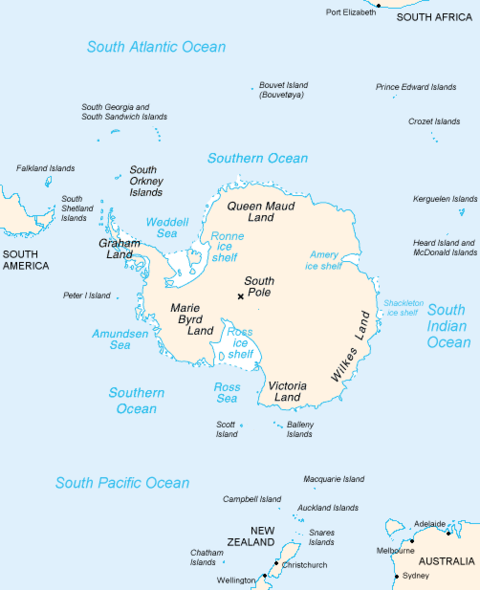
The Weddell Sea is a marginal sea of the Southern Ocean that is situated along the coast of Antarctica south of the Atlantic Ocean.
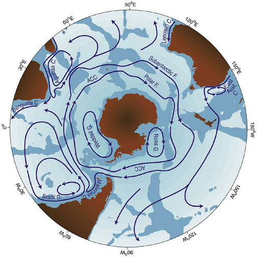
To the west are found the Antarctic Peninsula and the Amundsen Sea. Important circulation features of the Weddell Sea are the cyclonic Weddell Gyre and a prevailing surface easterly flow known as the Antarctic Circumpolar Current.
The Weddell Sea has a relatively low primary productivity, but sports a diversity of cetaceans, penguins as well as various fish species at the different depth layers.
Like much of Antarctica, the Weddell Sea was experiencing a warming effect from the hole in the ozone layer; after the Montreal Protocol diminished use of aerosols and halocarbons worldwide, a resulting cooling affect in this region has resulted, as evidenced by the recent mass enlargement of the East Antarctic Ice Sheet. Also in recent evidence is significant sea ice enlargement as reported by Meredith et al. (Meredith et al, 2011)
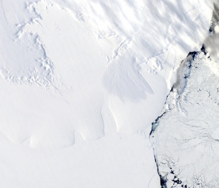
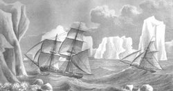
A large portion of the Weddell Sea is covered with sea ice through much of the year, especially in the south. This made the sea very difficult to explore until recent times. The first ships to sail into the sea, the Jane and the Beaufoy, were led by James Weddell in 1823 during an unusually warm Antarctic summer. The Sea is named after James Weddell.
Contents
Details of Circulation
Antarctic Bottom Water is a type of water in the seas surrounding Antarctica with temperatures ranging from 0 to -0.8 degrees C, salinities from 34.6 to 34.7, and a density near 27.88. Atlantic Bottom Water is formed chiefly in the Weddell Sea and Ross Sea. This is the densest water in the free ocean, with the only denser waters being found in regional sill basins such as the Norwegian Sea or the Mediterranean Sea.
It is overlain by Antarctic Circumpolar Water at a depth of 1000 to 2000 m M (Tchernia) and overlies Weddell Sea Bottom Water in some locations.
At the surface the wind-driven Antarctic Circumpolar Current flowing eastward is the dominant feature. This surface current is overlain by the Weddell Gyre, a cyclonic surface element that makes the circulation more complex. The Antarctic Circumpolar Current flows around Antarctica and provides a partial return of water to the South Pacific, the South Indian Ocean and the South Atlantic Ocean.
Marine Ecosystem
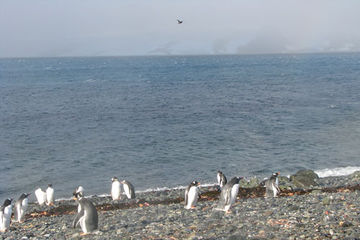 Gentoo penguin colony on an island in the western Weddell Sea. @ C.Michael Hogan
One of the largest shelf areas around the Antarctic continent is found in the southern part of the Weddell Sea.
The Antarctic LME is considered a Class III, low productivity (<150 grams of carbon per square meter per year) ecosystem based on SeaWiFS annual primary productivity estimates. The low productivity is linked with extreme weather conditions, and also with the limited light (Sunlight) penetration due to the winter ice cover.
In the Weddell Sea, the seasonal production cycle is strongly determined by ice formation in the fall and ice melting in the spring and summer. Upwellings and cold water currents flowing around Antarctica release nutrients that cause plankton blooms.
Marine species in this LME have unique ecological and biological characteristics. The base of the marine food chain is supported by about 100 species of phytoplankton. Some 200 Antarctic finfish species are found south of the Antarctic Convergence, 25% of which are unique to the area. The species of zooplankton, fish, squid, benthic organisms, seals, whales, and birds found at this latitude have sophisticated mechanisms for survival under very cold conditions. Low metabolic rates help them maintain a higher rate of protein synthesis.
The food chain is very short and based almost entirely on krill (Euphausia superba), a small shrimp-like crustacean and a key species crucial to the sustainability and production of all other fisheries (Fisheries and aquaculture). Baleen whales, seals, penguins, squid, fish and seabirds all feed on krill. The region is an international science laboratory where scientists study weather and climate, oceanography, geology and glaciology
Terrestrial Margin Ecosystem
See main article: Maudlandia Antarctic desert
The greatest part of the terrestrial margin of the Weddell Sea consists of the arid Maudlandia Antarctic desert. This cold desert, found at the south and east sides of the Waddell is devoid of vascular plants.
In this ecoregion the larger expanses of ice-free land are found inland, rather than near the coast. It is within the McMurdo Dry Valleys that the most outstanding examples of life adapted to the extreme climate occur. In this landscape that was once assumed to be completely barren, microbiologists in the 1970s discovered communities of microscopic algae, fungi, and bacteria living protected inside rocks. These organisms live in minute gaps between grains of sandstone, close to the surface of the semi-translucent rock where they can receive some sunlight and moisture, and also receive nourishment from the minerals in the stone. These organisms are known as cryptoendolithic microorganisms. Other such algal species as Hemichloris antarctica, are specially adapted to repeated freezing and re-thawing. Recently discovered by divers, the bottom of some lakes support a microbial mat made up of many species of blue-green algae, similar to those thought to be the earliest life-forms and the original sources of oxygen on the planet.
The unlikely top predator within the Dry Valleys is a bacteria-eating nematode that can survive multiple years of being freeze-dried—entering a state called anhydrobiosis. Certain lichen species, for example, Buellia frigida, might grow as little as 1 centimeter in 1000 years. The area's harsh conditions and the organisms that have adapted to them are often considered to be an approximation of life that may exist on Mars.
Discovery
James Waddell is credited with the first recorded discovery of the Waddell Sea. After reaching the South Orkney Islands in January, 1823, he took note of other more distant peaks to the south. His ships, the Jane and the Beaufoy reached them but, as was often the case, icebergs had been mistaken for land. Weddell decided to continue south to search for new lands and seal resources. On January 27th, they reached 64° (degrees) 58' (minutes south), about 300 miles (480 Km) south of the islands. Weddell realized they were south of the South Shetlands and "Trinity Land" (Trinity Peninsula, the northernmost part of the Antarctic Peninsula sighted by William Smith and Edward Bransfield).
Here Weddell decided to search for land between the South Orkney Islands and the South Sandwich Islands which lay 600 miles (960 Km) further east. On February 4, Weddell was within 100 miles (160 Km) of the South Sandwich Islands and concluded that there was no new land in that area and turned south again. For the next twelve days the ships battled adverse and bitterly cold winds until the weather suddenly calmed and became mild. Another sighting of land turned out to be an iceberg crusted with rocks. By February 17th, they reached 71° 34' South, a new record, surpassing James Cook's record set in 1774. Three days later, the Jane and the Beaufoy were at 74° 15' S, 34° 16' W and, but for icebergs, open sea ahead.
Here Weddell opted for caution and turned north. The weather had been unusually calm and mild, but it was getting late in the season and the ships could easily find themselves trapped by ice, a fatal outcome. Weddell even wondered if the would be land to find further south and not merely sea and ice all the way to the south pole. He was wrong in this. After sailing 1000 miles (1600 Km) south, another 170 miles (270 Km) east and south would have brought Weddell to the Antarctic continent (Coat's Land and the Filchner Ice Shelf). Whether the ice was clear enough for Weddell have reached those areas, is not known. Whether he, his crew, and ships, would have returned is also unknown.
References
- Antarctic climate and environment history in the pre-instrumental period. (2021) Editors: Luca Bargelloni, John Turner et al. Victoire Press. Cambridge, UK. Published by the Scientific Committee on Antarctic ResearchScott Polar Research Institute, Lensfield Road,Cambridge, UK. ISBN 978-0-948277-22-1
- Eileen E. Hofmann a1, John M. Klinck a1, Ricardo A. Locarnini a1, Bettina Fach a1 and Eugene Murphy. 1998. Krill transport in the Scotia Sea and environs. Antarctic Science 10:406-415
- Meredith, Michael P. , Nicholls, Keith W. , Renfrew, Ian A., Boehme, Lars, Biuw, Martin, Fedak, Mike (2011) Seasonal evolution of the upper-ocean adjacent to the South Orkney Islands, Southern Ocean: results from a “lazy biological mooring”. British Antarctic Survey. Natural Environment Research Council
- Peter Saundry. 2011. Seas of the world. Topic ed. C.Michael Hogan. Ed. in chief Cutler J.Cleveland. Encyclopedia of Earth. Washington DC
- Rhodes W. Fairbridge, editor. 1966. The Encyclopedia of Oceanography. Van Nostrand Reinhold Co.,
- A. S. Grotov, D. A. Nechaev, G. G. Panteleev, and M. I. Yaremchuk. Large–scale circulation in the Bellingshausen and Amundsen seas as a variational inverse of climatological data. JGR, 103:13,011–13,022, 1998
- Tchernia, P., 1980: Descriptive regional oceanography: an elementary description of the four main divisions of the world ocean, of their limits, forms, topography, wind systems, climatology, surface circulation, and hydrological characteristics and structure. By C.D. Densmore, Pergamon Press, 253pp.
