Biogeography (main)
Biogeography
Biogeography is the study of the distribution of biological organisms. The scale of analysis ranges from very small micro-topography regimes to continental dimensions. Fundamental concepts in this field of study are the nature of barrier formation and response of species to their patterns of travel and migration; in particular, the presence of rivers, mountain ranges, deserts and other natural boundaries are examples of large scale barriers. Besides such major landform barriers there are soil, topographic and meteorological factors that influence the distribution of each species. In the case of smaller scale regimes that are applicable for some bacteria or limited range plant species, there are often very restricted niches; for example, certain bacteria extremophiles may be limited to such localized features as small geyser pools, and some rare plants may have a single extant colony defined specialized soils such as serpentine and narrow climatic zone. Inherent in the concept of biogeography are the processes of speciation, extinction, dispersal and migration.
</div>-
 Featured Article
  Douglas-fir (Biogeography)The Douglas-fir (scientific name: Pseudotsuga) is a genus of tree that includes ar least five species found in North America and Asia: Scientific... More »
-
 Featured Article
  Ocean acidification troublesThe seas in which corals and other calcifying species dwell are turning acidic, their pH slowly dropping as Earth's oceans acidify in response to increased carbon dioxide... More »
-
 Featured Article
  Big Bend National Park, United StatesBig Bend National Park is one of the two National Parks located in the state of Texas, in the USA. Big Bend National Park is located in the Big Bend region along the border of... More »
-
 Featured Article
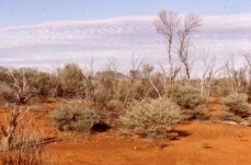
  Great Victoria DesertWWF Terrestrial Ecoregions Collection A vast, sparsely populated region covered by dunefields and gibber plains, the Great Victoria Desert... More »
-
 Featured Article
  Daugava River (Biogeography)The Daugava River drains portions of the countries of Latvia, Belarus and Russia, prior to discharging to the Gulf of Riga. Also known as the West Dvina River, this watercourse is... More »
-
 Featured Article
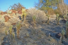
  Mojave Desert (Biogeography)WWF Terrestrial Ecoregions Collection The Mojave Desert is the smallest of the four North American deserts. While the Mojave lies between the... More »
-
 Featured Article
  Cactus (Biogeography)Cactus is a family of plants that are specially adapted to survive arid conditions, most often having leaves reduced to spines, and succulent characteristics. The scientific... More »
-
 Featured Article
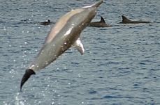
  Spinner dolphin (Biogeography)The Spinner dolphin (Stenella longirostris), a marine mammal in the family of oceanic dolphins, gets itsname from the spinning behavior it shows when it leaps out of... More »
-
 Featured Article
  Ecoregions of ChileChile has eight ecoregions that occur entirely or partly within its borders on the mainland and three ecorgions offshore: Sechura desert Atacama... More »
 Adriatic Sea (Biogeography) Last Updated on 2015-09-29 15:00:08 The Adriatic Sea is a branch of the Mediterranean Sea lying between 2 (50,590 miles2). The Adriatic has a maximum depth of 1233 metres (m) and an average depth of 252 m; although north of a line from Zadar, Croatia to Pescara, Italy, it is less than 100 m deep. The northern end of the sea is the Gulf of Venice and its southern limit is the Strait of Ontranto. By European standards, the Adriatic is both warm (surface water temperature ranges from 8-13oC in winter to 22-25oC in summer) and low in turbidity; correspondingly, this sea is a popular tourist destination. Map of the Adriatic Sea basin. Source: Norman Einstein/Wikimeia Commons True-color Moderate Resolution Imaging Spectroradiometer (MODIS) image from May 18, 2002. Source: NASA The Adriatic coastline is heavily indented and includes many islands. As a result the coastline is... More »
  Namibian savanna woodlands Last Updated on 2015-09-07 13:29:18 WWF Terrestrial Ecoregions Collection The Namibian savanna woodlands ecoregion covers the Great Escarpment that delimits the interior of southern Africa from both the Kaokoveld Desert and Namib Desert. This broken and deeply dissected escarpment is an area of high endemism for plants, invertebrates, amphibians, reptiles, mammals and birds. The northern area of the ecoregion, the Kaoko escarpment, is an endemism "hotspot" (area of extremely high species richness and endemism). The Namibian savanna woodlands comprise a land area of approximately 87,100 square miles. This northern area is poorly protected and is under threat from poaching, off-road driving, and to a lesser extent from farming, and resultant habitat fragmentation; much of this destabilisation in the Angolan portion of the ecoregion stems from the Cuban mercenaries aided... More »
  Colorado Plateau shrublands Last Updated on 2015-09-05 12:10:49 WWF Terrestrial Ecoregions Collection The Colorado Plateau shrublands is epitomized by the Grand Canyon, an area that has been called the "land of color and canyons." The Plateau can be thought of as an elevated, northward-tilted saucer. It is characterized by its high elevation and arid to semi-arid climate. The Colorado Plateau has developed extensive topographic relief through the erosive action of high-gradient, swift-flowing rivers that have downcut and incised the plateau. Approximately 90 percent of the plateau is drained by the Colorado River and its tributaries, notably the lower catchmentCatchment is the entire area of a hydrological drainage basin. of the Green River, the San Juan River and Animas River. This ecoregion is classified within the Deserts and Xeric Shrublands biome, and is codified as WWF Ecoregion... More »
  Kalahari xeric savanna Last Updated on 2015-07-10 18:01:28 WWF Terrestrial Ecoregions Collection The Kalahari xeric savanna is an ecoregion in southern Africa characterized by a harsh climate, where temperatures may vary by 44°C from night to day, and rainfall is infrequent. Rain appears only during the austral summer on the reddish-brown Kalahari sands , pelting the savanna with violent, localized storms. Although this area is semi-arid, there is an impressive diversity of migratory birds and large mammals, both herbivorous and carnivorous; in fact, 550 different vertebrates have been observed in the Kalahari xeric savanna. This ecoregion is classified within the Deserts and Xeric Shrublands biome. A considerable fraction (approximately 18 percent) of the Kalahari xeric savanna is protected. Where lands are not protected, overgrazing has often severely degraded habitat. Fences are a significant... More »
 .jpg) Highveld grasslands (Biogeography) Last Updated on 2015-07-07 21:46:02 WWF Terrestrial Ecoregions Collection Highveld grasslands ecoregion covers a large portion of west-central South Africa. Grasslands all over the world have experienced dramatic habitat destruction as a result of anthropogenic changes. The Highveld grasslands are no exception, with agriculture severely fragmenting this once-expansive region. This ecoregion now provides the last remaining stronghold of a number of grassland species that have suffered major reductions in abundance in the grassland biome, and which are consequently threatened with extinction (e.g. the Blue Crane (Anthropoides paradisea). There is a relatively biodiverse vertebrate fauna, with 608 taxa recorded. This ecoregion is part of the Montane Grasslands and Shrublands biome, within the Afrotropics Realm. The ecoregion draws its name from the high interior plateau known as... More »
Highveld grasslands (Biogeography) Last Updated on 2015-07-07 21:46:02 WWF Terrestrial Ecoregions Collection Highveld grasslands ecoregion covers a large portion of west-central South Africa. Grasslands all over the world have experienced dramatic habitat destruction as a result of anthropogenic changes. The Highveld grasslands are no exception, with agriculture severely fragmenting this once-expansive region. This ecoregion now provides the last remaining stronghold of a number of grassland species that have suffered major reductions in abundance in the grassland biome, and which are consequently threatened with extinction (e.g. the Blue Crane (Anthropoides paradisea). There is a relatively biodiverse vertebrate fauna, with 608 taxa recorded. This ecoregion is part of the Montane Grasslands and Shrublands biome, within the Afrotropics Realm. The ecoregion draws its name from the high interior plateau known as... More »