Middle Arctic tundra
|
|
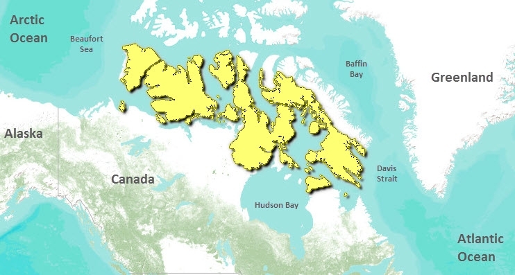
The Middle Arctic tundra ecoregion is quite large in geographic extent, stretching from the Banks Island lowlands in the west to the eastern tip of Baffin Island in the east. Principally in the Northwest Territories, it includes a small portion of extreme northern Quebec.
This ecoregion is described as having a predominantly mid-arctic ecoclimate. It incorporates the coldest and driest landscapes in Canada. Summer mean temperatures range from 0.5°C in the north central part of the ecoregion to 4.5°C in the south-central area. Winter mean temperatures vary between -30°C in the northern and western part of the ecoregion and -20°C in the northern Ungava peninsula. Mean annual precipitation is very low, ranging from 100-200 millimeters (mm), with occasional higher values in the southeastern portion of the ecoregion. These measures are the lowest in Canada, and this ecoregion is often referred to as a "polar desert." Snow covers the ground for at least ten months of the year.
The western portion of the ecoregion is underlain by flat-lying Paleozoic and Mesozoic sedimentary bedrock, and consists of lowland plains covered with glacial moraine, marine deposits, and bedrock outcrops. East of Prince of Wales and Somerset Islands, the terrain is composed mainly of Precambrian granitoid bedrock, and tends to consist of plateaux and rock hills. The Arctic Islands circumscribe a variety of oceanic conditions. In the northern half of the ecozone, the waters are ice-fast, even through the summer. Towards the south, open waters are more common in the summer, but pack ice usually persists offshore. The permafrost is continuous and may extend to depths of several hundred meters (m).
Contents
Biological Distinctiveness
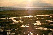
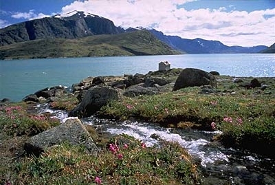
Because of high winds, harsh cold climate, and shallow, poor soils, vegetation is sparse and dwarfed. Although the area supports some shrub life (arctic willow (Salix arctica), for example) plant life is characterized by a continuous or discontinuous cover of herb (saxifrage (Saxifraga spp.), Dryas spp.) and lichen-dominated vegetation. The size of any shrubs decreases quickly as one moves to the north. In the east, the Meta Incognita Peninsula, Wager Bay Plateau, and Northern Ungava Peninsula are described as having a low arctic ecoclimate where shrub tundra vegetation dominates, while tall dwarf birch (Betula spp.), willow (Salix spp.) and alder (Alnus spp.) occur on warm sites. Vegetative cover tends to be greater on wetter sites confined to coastal lowlands, sheltered valleys and moist, nutrient-rich corridors along rivers or streams.
In the far north of the Middle Arctic tundra, shrubs have given way to sedges and lichens. At the farthest north of the ecoregion even Carex bigelowii is becoming scarce in favor of Carex stans, the latter species here characteristically dominating not only the fens, but also the grasslands.
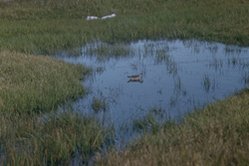
Characteristic mammalian wildlife include barren-ground caribou (Rangifer tarandus ssp. arcticus), muskox (Ovibos moschatus), wolf (Canis lupus), arctic fox (Alopex lagopus), polar bear (Ursus maritimus), arctic hare (Lepus arcticus), brown lemming (Lemmus sibiricus), and collared lemming (Dicrostonyx groenlandicus). Peary caribou (Rangifer tarandus ssp. pearyi) are found on high Arctic Islands. The ecoregion provides a major breeding ground for many migratory bird species, including snow goose (Chen caerulescens), brant (Branta bernicla), Canada goose (Branta canadensis), eider (Somateria spp.), and oldsquaw duck (Clangula hyemalis). Other birds include red-throated loon (Gavia stellata), gyrfalcon (Falco rusticolus), willow and rock ptarmigan (Lagopus lagopus and L. mutus), red phalarope (Phalaropus fulicaria), parasitic and long-tailed jaeger (Stercorarius parasiticus and S. longicaudus), snowy owl (Nyctea scandiaca), and snow bunting (Plectrophenax nivalis). Marine species, which are found in much higher concentration at the eastern and western coastal margins of the ecoregion, include Beluga whale (Delphinapterus leucas), walrus (Odobenus rosmarus), seal (Phocidae), and Narwhal (Monodon monoceros).
Significant ecological features of this ecoregion include: 80 percent of the world’s muskox population, including the highest density (Minto Inlet and Thompson valley), global range of Arctic island caribou (similar to Peary caribou but taxonomic designation unresolved), global range (with High Arctic Tundra) of high Arctic wolf (Canis lupus arctos), calving grounds for six caribou herds on Northwest Territories mainland and others on the islands, and Polar beardenning hotspots.
Conservation Status
Habitat Loss and Degradation
Approximately 95 percent of the natural habitat of this ecoregion is estimated to be intact. There is terrain disturbance in the vicinity of communities, abandoned military sites, and mining exploration. Some habitats, such as raised beach ridges and areas of glacial outwash, are more threatened as these gravel deposits are sought after for road, air strip and other construction needs.
Remaining Blocks of Intact Habitat
The majority of the ecoregion is intact.
Degree of Fragmentation
This ecoregion is naturally fragmented due to the large number of islands that make up its composition. For much of the year, however, sea ice links the islands permitting dispersal of large mammals. Caribou seasonal ranges can be interrupted by high-frequency human activity (i.e. behavioral versus habitat fragmentation–this likely would be significant for assessing cumulative effects).
Degree of Protection
- Aulavik National Park - Northwest Territories- 12,200 square kilometers (km2)
- Banks Island No. 1 Migratory Bird Sanctuary (MBS) - western Northwest Territories - 20,518 km2
- Dewey Soper MBS - Northwest Territories - 8,159 km2
- East Bay MBS - Northwest Territories - 1,166 km2
- Bowman Bay Wildlife Sanctuary - Northwest Territories - 1,079 km2
- Cape Dorset MBS - Northwest Territories - 259 km2
- Banks Island No. 2 MBS - western Northwest Territories - 142 km2 (part of Aulavik NP)
- Katannilik Territorial Park - Northwest Territories - 14.64 km2
- Cape Parry MBS - Northwest Territories - 3 km2
Types and Severity of Threats
 Igloolik, Island, Northwest Territories, Canada. (Photograph by Biz Agnew/WWF)
 Threats are relatively minor. One threat is atmospheric fallout, resulting in heavy metal and pesticide pollution. There is a risk of oil spills in [[coastal] areas]. Ecotourism will need to be carefully managed in order that nesting bird colonies, caribou calving grounds and other sensitive wildlife species are not disturbed. With increased access, over-hunting of caribou is a possibility and commercial harvesting of both caribou and muskoxen needs to be carefully monitored and controlled.
Suite of Priority Activities to Enhance Biodiversity Conservation
- Complete designation of Wager Bay National Park - Northwest Territories
- Upgrade protection standards for both Migratory Bird Sanctuaries and Territorial Parks to permanently exclude mineral exploration and mine development.
- Protect Cap Wolstenholme and Mts. de Povungnituk candidate protected areas - Quebec
- Protect caribou calving grounds from human encroachment and habitat loss. Important calving grounds include:
- Arctic Island/Peary Type: Banks Island, NW Victoria Island, Prince of Wales Somerset, South and East Victoria Islands, Boothia Peninsula
- Barren-ground herds: Pelly Bay, Keith Bay, Wager Bay
- Lorriland, North and South Melville
- Baffin, and Southhampton
- Protect Minto Inlet - a muskox refugium. Protection is needed from overharvesting and wetland loss. Also, an arctic island wolf denning site - protect from human disturbance.
- Protect polar bear denning ‘hotspots’ from human disturbance (includes Gateshead Is., north Pelly Bay, Wager Bay).
Conservation Partners
- Canadian Arctic Resources Committee
- Canadian Nature Federation
- Ecology North
- Kativik Aboriginal Government
- Nunavut Wildlife Management Board
- Société Makivik
- World Wildlife Fund Canada, Quebec Region
Additional Information on this Ecoregion
- A. Gunn, S. Oosenbrug, C. O’Brien, N. Zinger, K. Kavanagh, M. Sims, G. Mann. 2001. Middle Arctic Tundra. World Wildlife Fund
- The Vegetation Types of Northeast Greenland. Museum Tusculanum Press
| Disclaimer: This article contains certain information that was originally published by the World Wildlife Fund. Topic editors and authors for the Encyclopedia of Earth have edited its content and added new information. The use of information from the World Wildlife Fund should not be construed as support for or endorsement by that organization for any new information added by EoE personnel, or for any editing of the original content. |


