Leeward Islands dry forests
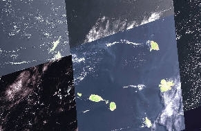
Satellite view of the Leeward Islands Photograph by USGS
The Leeward Islands dry forests ecoregion is comprised of a number of forest patches on some islands in the Caribbean’s Leeward Island group. This neotropical ecoregion measures less than fifty square miles in extent. Due to the diminutivegeographic areal size and to the proximity of densely human populated coastal regions, these dry forests are particularly prone to degradation and disturbance.
Millennia of deforestation and intensive agricultural use have resulted in the alteration of much of the original forest cover and contributed to a subsequent loss of species richness. A relatively high degree of island-endemism is a characteristic that these dry forests share with many other forests in the Leeward Islands group. Ecological conservation measures vary significantly from one island to another, while most units suffer similarly from population-related development, agricultural encroachment, hunting, and limited enforcement of wildlife and environmental legislation.
Location and general depiction
[../../../files/209201_209300/209251/lesser-antillean-dry-forests-map.png  ]
]
This ecoregion covers portions of the Caribbean’s Leeward Islands. It is commonly found as a mid-gradient forest type between the xeric coastal zones and the higher topographic relief interior-island moist forests. This ecoregion is characterized by moderate relief and rainfall, and covers all of St. Eustatius, the central portion of Barbuda, interior portions of Montserrat, and small coastal areas on Anguilla and Antigua.
The Leeward Islands are found north of the Windward Islands extending to immediately east of the Virgin Islands between latitudes 15° 45' N to 18° 35' N and longitudes 61° 45' W to 63° 20' W. All of the Leeward Islands lie within the tradewinds belt resulting in a subtropical climate. Islands with sufficient topographic relief receive plentiful rainfall, but those with a more subdued topography tend to be dry to semi-arid. The principal hurricane track passes through these islands.
The Leeward Islands exhibit two geologically distinct belts. The island of Guadeloupe marks the southern end of the two belts and embodies characteristics of both. The eastern half of Guadeloupe is called Grande Terre and is composed entirely of limestone overlying older andesitic and dacitic volcanics. Basse Terre, the western half of Guadelope, is dominated by Soufriere, a 1467-metre (m) high active volcano. The inner belt or arc of islands is volcanic in origin and tends to have higher, more rugged topography. These include Monserrat, Nevis, St. Christopher, St. Eustatius, and Saba. Andesitic flows, pyroclastic units, and volcanoclastics of recent to Eocene age dominate this belt. These volcanics are interbedded with Pliocene and Pleistocene limestones on some islands, notably on St. Eustatius, St. Christopher, and Monserrat. Formiferal or oolitic limestone underlies the remaining islands in the outer belt or arc of islands including Guadeloupe's offshore islands of Marie Galante and Desirade; Antigua; Barbuda; St. Barthelemy; St. Martin; and Anguilla.
The Caribbean Basin is an important biological region due to its rich vegetation and the large number of endemic plants. The West Indies have about 200 endemic genera; the largest Wallenia has 30 species while six other genera have 10 or more. The principal plant genera (Bontia, Spathelia, Lagetta, and Catesbaea) are rather broadly distributed over the archipelago. Corresponding with lower elevations and less rainfall, the original forest formations of this ecoregion include littoral woodland, thorn woodland, deciduous woodland, and semi-evergreen woodland. Commonly found are plant species such as White Cedar (Tabebuia heterophylla), Red Rodwood (Myrcia citrifolia),Aristida suringari andImrayana spp. Certain mesic valleys hold remnants of the original woodland mixed with fruit trees, and large numbers of genus Acacia and family Orchidaceae species can be found in localised microhabitats.
Biodiversity
From the earliest colonial period, to as recently as the 1960’s, export agriculture dominated the land-use patterns of many of these Leeward Islands, resulting in major changes to terrestrial habitats and the islands’ biodiversity. Nearly three centuries of deforestation and land clearing for intensive agricultural use have resulted in the removal or degradation of much of the original vegetation and contributed to habitat destruction and subsequent loss of species richness.
Reptiles
Anolis Lizards (Anolis spp.), Turnip-tailed Geckos (Thecadactylus spp.), Dwarf Geckos (Sphaerodactylus spp.), House geckos (Hemidactylus spp.) and in Barbuda, the Redfoot Tortoise (Geochelone carbonaria) are common reptiles inhabiting this ecoregion. The Boven National Park, recently established in the northern hills of Barbuda, is the common location for the West Indian Iguana (Iguana delicatissima).
Mammals
Most extant mammals in the Leeward islands are introduced. More common are alien species such as the Red-rumped Agouti (Dasyprocta leporina), Fallow Deer (Dama dama) to provide game, the Small Indian Mongoose (Herpestes auropunctatus) and the inadvertent importation of the black or roof rat and the Brown or Norway Rat (Rattus rattus, R. norvegicus). There are no remaining endemic rodents in the Lesser Antilles.
The Leeward Islands are similar to other Caribbean islands in having a relatively high degree of island-endemism. The amount of diversity and number of island endemics in the Lesser Antilles is related to island size, diversity of habitat, and distance from the mainland or another island. Thus, larger islands from Guadeloupe and south into the Windward islands have relatively high biodiversity and a higher degree of endemic flora and fauna.
Ecological status
The overall ecoregion status is considered Critical/Endangered. Much of this ecoregion has been dramatically reduced in extent for most of the Leeward Islands. As a counter-example, Barbuda, comprised chiefly of this dry forest habitat, has much of its original dry forest community intact, representing a valuable scientific resource.
Clearing of land was greatest early in the 19th century. After that, erosion and the depression of sugar as a commodity caused poor and degraded areas to be abandoned and reverted to pasture. Ultimately, various types of secondary woodland formed successional communities. The history of land-use can be inferred through the presence in the woodlands of trees such as Longwood (Haematoxylum campechianum) originating from Central America in the 18th century. After the abolition of slavery, indigenous peoples scattered into the hills surrounding the plantations and settled there leading to further degradation of other forests.
The recurrent planting of sugar cane over several centuries, and the extensive area under cane production are considered to have destroyed, for all practical purposes, the evidence of natural vegetation. The Introduction (Leeward Islands dry forests) and rapid naturalization of many plant species, which now dominate areas previously used for agriculture, have created pioneer ecosystems that are maintained by current land practices. Conversely, there has been a trend towards the abandonment of upper hill slopes for agriculture in favor of more suitable sites, and some areas are reverting to secondary forest.
Similar to the moist forest ecoregion of the Lesser Antilles, conservation measures in the dry forests vary significantly from one island to another. In Montserrat, there is no substantive legislation for establishing and managing natural areas for either the conservation of fauna and flora, or the declaration of terrestrial or marine parks. Nor is there any governmental organization with responsibilities for wildlife conservation, although the draft Forestry and Wildlife Ordinance makes provision for a Forestry and Wildlife Division to be responsible for management and wildlife. In Antigua and Barbuda, the National Parks Act gives general powers to the relevant Minister to declare any area of land or water to be a national park. This is subject to affirmative resolution of the legislature, and provides for the creation of a statutory corporation called the National Parks Authority. The institutional framework for the management of protected areas needs review, primarily because national laws have been created without sufficient provision for staffing and budgetary requirements.
Threat profile
The philosophy that natural products of the land are divine bounty to be used directly or shared with whomever is in need is prevalent thought in the West Indies. Such well-meaning belief tends to blur concepts of property rights and land ownership, resulting in few prosecutions and rare convictions for illicit felling of trees or environmental vandalism. Long-term culling for charcoal and uncommon forest products causes progressive damage.
The drier forests, by virtue of being of lower relief and closer to population-related development, are more susceptible to agricultural encroachment, hunting, and also suffer from limited enforcement of wildlife and environmental legislation. Predatory importations, in particular domestic cats and mongooses, have been destructive of other animals and have extirpated several small mammals, mainly herbivores, birds, and reptiles. Historically, hunting was widely practiced without adequate attention to biology of the game species hunted or controls regarding the numbers of birds taken. This has resulted in dramatic declines of formerly common species, particularly pigeons, doves and waterfowl.
Justification of ecoregion delineation
The dry forests ecoregion of the Leeward Islands were designated according to CCA survey reports. In order to maintain our broad scale coverage we lumped the dry woodland terrestrial life zones from all of the Leeward Island, which contained this habitat type. Littoral vegetation was also included, when bordering dry woodland formations.
Further Reading
- P. Butler. 1991. Making a move on Montserrat. Philadelphia: Rare Centre.
- Caribbean Conservation Association (CCA). 1991. Antigua and Barbuda: Environmental Profile. Barbados: St. Michael ISBN: 9991573798
- Caribbean Conservation Association. 1980. Survey of conservation priorities in the Lesser Antilles: Virgin Gorda, Preliminary Data Atlas. Eastern Caribbean Natural Area Management Program, Caribbean Conservation Association, the University of Michigan and the United Nations.
- Caribbean Conservation Association. 1980. Survey of conservation priorities in the Lesser Antilles: Anegada, Preliminary Data Atlas. Eastern Caribbean Natural Area Management Program, Caribbean Conservation Association, the University of Michigan and the United Nations.
- Caribbean Conservation Association. 1980. Survey of conservation priorities in the Lesser Antilles: Saint Barthélemy, Preliminary Data Atlas. Eastern Caribbean Natural Area Management Program, Caribbean Conservation Association, the University of Michigan and the United Nations.
- Caribbean Conservation Association. 1980. Survey of conservation priorities in the Lesser Antilles: Saint Martin, Preliminary Data Atlas. Eastern Caribbean Natural Area Management Program, Caribbean Conservation Association, the University of Michigan and the United Nations.
- Caribbean Conservation Association. 1980. Survey of conservation priorities in the Lesser Antilles: Saba, Preliminary Data Atlas. Eastern Caribbean Natural Area Management Program, Caribbean Conservation Association, the University of Michigan and the United Nations.
- Caribbean Conservation Association. 1980. Survey of conservation priorities in the Lesser Antilles: Anguilla, Preliminary Data Atlas. Eastern Caribbean Natural Area Management Program, Caribbean Conservation Association, the University of Michigan and the United Nations.
- Caribbean Conservation Association. 1980. Survey of conservation priorities in the Lesser Antilles: St. Eustasius, Preliminary Data Atlas. Eastern Caribbean Natural Area Management Program, Caribbean Conservation Association, the University of Michigan and the United Nations.
- Caribbean Conservation Association. 1980. Survey of conservation priorities in the Lesser Antilles: Montserrat, Preliminary Data Atlas. Eastern Caribbean Natural Area Management Program, Caribbean Conservation Association, the University of Michigan and the United Nations.
- Caribbean Conservation Association. 1980. Survey of conservation priorities in the Lesser Antilles: Tortola, Preliminary Data Atlas. Eastern Caribbean Natural Area Management Program, Caribbean Conservation Association, the University of Michigan and the United Nations.
- Caribbean Conservation Association. 1980. Survey of conservation priorities in the Lesser Antilles: St. Kitts, Preliminary Data Atlas. Eastern Caribbean Natural Area Management Program, Caribbean Conservation Association, the University of Michigan and the United Nations.
- Caribbean Conservation Association. 1980. Survey of conservation priorities in the Lesser Antilles: Barbuda, Preliminary Data Atlas. Eastern Caribbean Natural Area Management Program, Caribbean Conservation Association, the University of Michigan and the United Nations.
- Caribbean Conservation Association. 1980. Survey of conservation priorities in the Lesser Antilles: Nevis, Preliminary Data Atlas. Eastern Caribbean Natural Area Management Program, Caribbean Conservation Association, the University of Michigan and the United Nations.
- Caribbean Conservation Association. 1980. Survey of conservation priorities in the Lesser Antilles: Guadeloupe, Preliminary Data Atlas. Eastern Caribbean Natural Area Management Program, Caribbean Conservation Association, the University of Michigan and the United Nations.
- Caribbean Conservation Association. 1980. Survey of conservation priorities in the Lesser Antilles: Antigua, Preliminary Data Atlas. Eastern Caribbean Natural Area Management Program, Caribbean Conservation Association, the University of Michigan and the United Nations.
- Donovan, S. K., and T. A. Jackson. 1994. Caribbean geology: an introduction. Kingston: University of the West Indies Publishers Association.
- Fink, L. K., Jr., and R. W. Fairbridge. 1975. Leeward Islands. Pages 339-340 in R.W. Fairbridge, editor, The Encyclopedia of World Regional Geology, Part 1: Western Hemisphere. Stroudburg, Dowden, Hutchinson and Ross. ISBN: 047025145X
- Johnson, T. H. 1988. Biodiversity and conservation in the Caribbean: profiles of selected islands. Cambridge UK: International Council for Bird Preservation. ISBN: 0946888140
- Lacereda, L.D. 1994. Conservation and sustainable utilization of mangrove forests in Latin America and Africa regions. Part 1, Latin America. Mangrove Ecosystems Technical Reports. Vol. 2. International Society for Mangrove Ecosystems. International Tropical Timber Organization.
- Malhotra, A., and R. S. Thorpe. 1999. Reptiles and amphibians of the Eastern Caribbean. London: Macmillan Education LTD. ISBN: 0333691415
- Pregill, G., D. Steedman, S. Olson, and F. Grady. 1988. Late holocene fossil vertebrates from Buvma quarry, Antigua, Lesser Antilles. Smithsonian contributions to zoology, no. 463. Washington, D. C.: Smithsonian Institution Press
- Rand McNally. 1988. World atlas of nations. New York: Rand McNally. ISBN: 0528833154
- Stoffers, A. L. 1993. Dry coastal ecosystems of the West Indies. In E. van der Maarel, editor, Ecosystems of the world 2B: dry coastal ecosystems Africa, America, Asia and Oceania. B.V., Amsterdam: Elsevier Science Publishers. ISBN: 044487349X
- Woods, C. A. 1985. Endemic rodents of the West Indies: the end of a splendid isolation. Proceedings from a workshop of the IUCN/SSC Rodent Specialist Group, #4. p. 11-19.
| Disclaimer: This article contains some information that was originally published by the World Wildlife Fund. Topic editors and authors for the Encyclopedia of Earth may have edited its content or added new information. The use of information from the World Wildlife Fund should not be construed as support for or endorsement by that organization for any new information added by EoE personnel, or for any editing of the original content. |