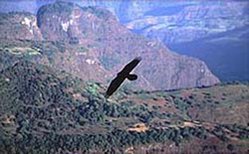
Ethiopian montane grasslands and woodlands
Introduction During the last Ice Age, this entire ecoregion (Ethiopian montane grasslands and woodlands) would have been similar to the Eurasian tundras, while still higher elevations were capped with glaciers. As the climate warmed, these highlands were recolonized, resulting in a biota with a combination of Palearctic and Afrotropical influences. Ranging up to 3,000 meters (m), the montane vegetation includes Hagenia, Podocarpus and Juniperus, but intact vegetation is increasingly fragmented. The region is densely populated because it contains the best arable land in Ethiopia. A variety of Ethiopian endemics can be found, including the critically endangered Walia ibex (Capra walie) and endangered mountain nyala (Tragelaphus buxtoni). Plant endemism in this region peaks in the forest/ woodland/ grassland complex.
Location and General Description
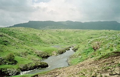
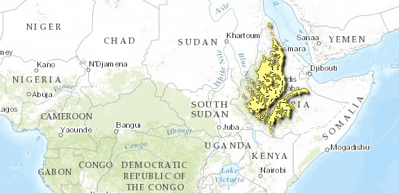
This is a biologically rich and severely threatened ecoregion that covers the majority of two [[Ethiopia]n] mountain massifs (Eastern and Western), separated by a part of the African Great Rift Valley. This ecoregion ranges from 1,800 m to 3,000 m in elevation, with montane forest at lower altitudes and Afroalpine habitat higher up. The climate of these highlands is greatly affected by their topography, and also by the movement of the Intertropical Convergence Zone (ITCZ). As the ITCZ moves north between May and October, warm moist air is drawn from the Indian Ocean so that rain falls on the southern slope of the Ethiopian Highlands. During the remainder of the year, the ITCZ lies south of the highlands, and the winds are from the Red Sea to the north and east. These winds typically contain less moisture, which mainly falls on the northern side of the highland massif. Overall, the highest annual rainfall (up to 2,500 millimeters (mm)) is on the southwestern scarp faces of the highlands, which support montane or transitional forests, while over most of the ecoregion the rainfall is around 1,600 mm annually.
The Ethiopian highlands first began to rise 75 million years ago, pushed upwards by volcanic forces (Plate tectonics). The main dome was split into two halves, the northern and southern highlands, by the development of the Great Rift Valley.
Plants and animals from different directions then colonized these separate massifs. During the Ice Ages, the jebels and escarpments along the Red Sea provided a gateway for Palearctic species. The southern highlands were linked to the Horn of Africa by rift wall connections. Both the northern and southern highlands are adjacent to tropical Africa but the dry Kenyan deserts in the south and the Nile River floodplains in the west were significant obstacles for potential plant and animal immigrants. Therefore, despite the differences in climate, the surrounding dry lowlands have been the most consistent source of recruitment over the past one million years. The ecoregion’s biota shows both Palearctic and Afrotropical influences. Biologically poor when compared to other Afromontane [[habitat]s], the lack of diversity in the Ethiopian highlands reflects their recent post-volcanic, post-glacial history. A high rate of endemism is found here though, fostered by geographical isolation and the unique climate.
Geologically the area consists of a Precambrian basement capped in most places by thick Tertiary basaltic lava flows (the Trap Series). The ancient Precambrian rocks form the substrate of the montane forests in southwestern Ethiopia and Eritrea. Mesozoic rocks form the surface outcrops of the southeastern highlands of Ethiopia, while Tertiary basalts form the surface rocks of the remainder of the Ethiopian and Eritrean massifs. The latter attain a thickness of 3,000 to 3,500 m in the Simien Mountains. Forest soils in Ethiopia are mainly ferrosols derived from these volcanic substrates.
The human population density is very high, ranging from 100 to 400 people per square kilometer (km2). Most of the population engages in subsistence farming, and the demand on natural products and land for farming is huge. This has been the case for many hundreds of years, and is the predominant reason for the widespread loss of natural vegetation in the ecoregion. The Bale Mountains National Park is the only place in this ecoregion where examples of intact vegetation types can be found, including the large and still relatively unexplored Harenna forest. However, even these areas are increasingly threatened by human activities.
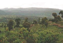
Phytogeographically, the ecoregion is mapped as Afromontane vegetation and considered to be part of the Afromontane archipelago-like regional center of endemism. The natural vegetation, called dega or weyna dega in Amharic, was probably a mixture of closed forest in areas with higher rainfall (mainly to the southwest of the two main massifs and on some higher [[mountain]s]), grassland, bushland, and thicket in other lower rainfall areas. Forest structure and composition varies with locality and elevation. There is a cloud forest belt at 2,000 to 2,500 m in the south, while in drier locations (particularly on steep hillsides) the forest consists of Podocarpus falcatus and Juniperus procera, often with Hagenia abyssinica. In the north, between 2,300 and 2,700 m in the Simien Mountains, there is an evergreen broadleaved montane forest dominated by Syzygium guineense, Juniperus procera, and Olea africana.
On the moist slopes of the Harenna forest, a shrubby zone of Hagenia and Schefflera grows along with giant lobelias, Lobelia gibberroa, similar to the vegetation found on the upper reaches of most East African [[mountain]s]. Below 2,400 m, clouds and localized rain support small pockets of dense, moist forest. The Harenna forest receives more than 1,000 mm per year because the southwest-facing orientation combines with the steep escarpment, resulting in orographic rainfall. Dominant trees include Aningeria and Olea, often draped with lianes and epiphytes. Woodland and shrubland dominated by Acacia species was probably the natural vegetation over the majority of the lower plateau. The forest/woodland/grassland complex contains a high number of endemic plants.
Biodiversity Features
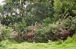
The ecoregion has a number of endemics in all taxonomic groups, and covers the majority of two endemic bird areas (EBAs). The south Ethiopian Highlands EBA is centered on the forests, grasslands and thickets to the southwest of the Bale Mountains and around the town of Yabello. The Central Ethiopian Highlands EBA is found to the north of Addis Ababa and extends into the highland areas of Eritrea. Ruppell's chat (Myrmecocichla melaena) and Ankober serin (Serinus ankoberensis) are two notable near-endemics. Among the birds, only the lineated pytilia (Pytilia lineata) is endemic to this ecoregion. A number of [[Ethiopia]n] endemics occur only in this ecoregion and the Ethiopian Montane Moorland ecoregion, so that they are considered near-endemic in each. These high altitude ecoregions are especially known for their diversity of small mammals with over 10 near-endemic species, but also harbor notable near-endemic large mammals, such as the Walia ibex (Capra walie), the mountain nyala (Tragelaphus buxtoni), and the gelada baboon (Theropithecus gelada). Most of these species are shared with the Ethiopian Montane Moorland ecoregion.
At least 10 amphibians are endemic or near-endemic to the ecoregion, together with five species of near-endemic reptiles. Most of the species are shared either with the lower altitude Ethiopian Montane Woodland ecoregion, or with the higher altitude Ethiopian Montane Moorland ecoregion.
Much of this endemism came about as a result of the last Ice Age, when the higher areas of the Ethiopian plateau were glaciated. The glacial maximum was approximately 18,000 to 14,000 years ago, and is believed to have finished by 11,000 years ago. Glaciation radically affected the distribution of vegetation communities, and species today restricted to mountain islands at high elevations would have once presumably been found lower down and had a wider distribution. The retreat of the ice has led to isolation and high levels of speciation and endemism, particularly among plants.
Most plants and animals found in this region show some behavioral or morphological adaptation to the chilly montane environment. For example, the near-endemic gelada baboon has a thick fur coat and often huddles to conserve heat. Within the Simien National Park, their preferred habitat is the high Geech plateau above 3,000 meters (m) (Ethiopian Montane Moorland Ecoregion) but they have been observed in lowland fields, eating crop leftovers. Fossil evidence demonstrates that the gelada’s ancestors were widespread throughout the Pleistocene, with one species as large as a gorilla. These species may have been eradicated by early hominids and the gelada is now confined to the [[Ethiopia]n] highlands, dependent on an energy-poor diet of grass. In contrast, the near-endemic mountain nyala shows no specific adaptations to a montane environment, only minimally changing its behavior to regulate its temperature.
The mountain nyala is not a montane specialist, but has been restricted to Afromontane areas through habitat loss. Found only in the southern part of the highlands, the lower reaches of its altitudinal range are more suitable to the mountain nyala than the higher, less vegetated ones, but the lower habitat has mostly been converted to cultivation and pastoralism. The mountain nyala population in Bale Mountains National Park was thriving until 1991 when it was severely reduced by local people, in protests and upheaval associated with the change in government. Another antelope commonly found at lower elevations is Menelik’s bushbuck (Tragelaphus scriptus meneliki), a subspecies of bushbuck endemic to Ethiopia.
A number of the endemic species are endangered. Threatened bird species include two near-endemics, the Ankober serin (Serinus ankoberensis, EN) and the white-winged flufftail (Sarothrura ayresi, EN). Several distinctive mammalian endemics face global extinction. The Walia ibex (CR) numbers fewer than 400 individuals, and it is threatened through habitat loss and hybridization with free-ranging domestic goats.
Other mammals found in this ecoregion include olive baboon (Papio anubis), black and white colobus monkey (Colobus guereza), golden jackal (Canis aureus), leopard (Panthera pardus), lion (Panthera leo), spotted hyaena (Crocuta crocuta), caracal (Caracal caracal), serval (Felis serval), bush duiker (Sylvicapra grimmia) and bush pig (Potamochoerus porcus). Two different subspecies of the Cercopithecus superspecies are found in this ecoregion: the Djam-djam or Bale monkey (Cercopithecus aethiops djamdjamensis, DD), which is restricted to the southern highlands and the black-faced vervet (Cercopithecus aethiops aethiops).
All these species, including the black and white colobus monkey, are suffering from a decrease in suitable habitat. Colobus [[population]s] are increasingly fragmented, with groups living in small remnant forest patches, often a single church graveyard.
Cultivated fields and grazed woodlands attract a diverse butterfly fauna, with far more species found here than in Ethiopian Montane Moorland ecoregion. Papilio and Charaxes are well represented and Pieridae and Lycaenidae are also present. The distribution of the butterfly fauna illustrates the conversion of forest to farmland, with species adapted to cultivated areas.
The low trench of the Great Rift Valley has remained a formidable barrier, with several species distributed only on one side. The Walia ibex and Gelada baboon are found only in the northern highlands whereas the mountain nyala lives only in the southern highlands. Many of the small rodent species are similarly restricted. The Ethiopian wolf Canis simensis, endemic to the higher Ethiopian Montane Moorland ecoregion, is an exception to this rule, since it occurs in both the northern and southern highlands.
Current Status
By the early twentieth century, only 5 percent of the Ethiopian Highlands were forested, although it is believed that at one time forest covered most of them. Podocarpus and Juniperus species once covered 176,000 square [[kilometer]s] (km2) in the central, eastern and northern [[region]s]. Less than 1% of these forests remain because Podocarpus and Juniperus provide the most commonly used timber in Ethiopia. The natural vegetation has been altered and destroyed by intensive human use over millenia, and today only fragments are left. Remaining grassland and thorn scrub patches are generally confined to rocky and steep areas. Besides these inaccessible areas, the only remaining forested areas are church graveyards. Even these forests are not totally protected. A survey of Syzygium forest in graveyards in the Simien region found that trees were harvested for local use and cattle grazed within the graveyards, affecting the regeneration of the forest. Parts of the ecoregion are officially protected within the Bale Mountains National Park, but about 2,500 people currently live in the Park along with 10,500 livestock. Controlled hunting areas and wildlife reserves offer very little, if any, protection for native flora and fauna. The forests, woodlands, and grasslands remaining to the southwest of the Nechisar National Park are not protected. The proposed Termaber-Wufwasha-Ankober conservation area in the western highlands would protect much of the ecoregion's biodiversity, as would the proposed areas for protecting the forests further to the southwest. Smaller-scale actions are undertaken throughout the ecoregion by local nongovernmental organizations (NGOs) and projects.
Types and Severity of Threats
Conversion to cropland is nearly complete in this ecoregion, where sedentary cereal production has continued for thousands of years and agricultural production is extremely intensive. As a result, the remaining [[habitat]s] are highly fragmented. With the population increasing by 3.1% each year, people are heavily dependent on natural resources, particularly grazing pasture and wood for construction or firewood. In the Bale region on the southern border of the Harenna forest large timber trees are being cleared. The Harenna forest is increasingly being utilized to supply construction material, fuel and charcoal for the expanding urban population in this region. Traditionally, forests were used for gathering honey, coffee and other forest products as well as cattle grazing.
Justification of Ecoregion Delineation
White nests this ecoregion within a larger ‘undifferentiated montane vegetation’ unit. The ecoregion roughly follows the 1,800 m contour for the lower elevation and 3,000 m contour for the upper elevation. Although the South and Central Highlands are recognized as two areas of bird endemism, they contain floral and faunal similarities.
Additional Information on this Ecoregion
- For a shorter summary of this entry, see the WWFWildWorld profile of this ecoregion.
- To see the species that live in this ecoregion, including images and threat levels, see the WWF Wildfinder description of this ecoregion.
- World Wildlife Fund Homepage
Further Reading
- Friis, I. 1992. Forests and Forest Trees of Northeast Tropical Africa. HMSO, Kew Bulletin Additional Series XV. ISBN: 0112500056
- Gemachu, D. (undated). Environment and Development in Ethiopia. Department of Geography, Addis Ababa University, Addis Ababa, Ethiopia. Unpublished report.
- Hamilton, A.C. 1982. Environmental history of East Africa: a study of the Quaternary. London: Academic Press.
- Kingdon, J. 1989. Island Africa: The evolution of Africa’s rare animals and plants. Princeton University Press. Princeton, NJ, USA. 287 pp.
- Nievergelt, B., Good, T. & Güttinger, R. 1998. A survey of the Flora and Fauna of the Simen Mountains National Park, Ethiopia. Special Issue of Walia, Journal of the Ethiopian Wildlife and Natural History Society. Addis Abeba, Ethiopia.
- Stattersfield, A.J., Crosby, M.J., Long, A.J. & Wege, D.C. 1998. Endemic Bird Areas of the World. Priorities for Biodiversity Conservation. BirdLife Conservation Series No. 7. BirdLife International, Cambridge, UK. 846 pp. ISBN: 1560985747
- Tilahun, S., Edwards, S. & Egziabher, T.B.G. (eds.) 1996. Important Bird Areas of Ethiopia. Published by Ethiopian Wildlife and Natural History Society. Semayata Press. Addis Ababa, Ethiopia.
- White, F. 1983. The vegetation of Africa, a descriptive memoir to accompany the UNESCO/AETFAT/UNSO Vegetation Map of Africa (3 Plates, Northwestern Africa, Northeastern Africa, and Southern Africa, 1:5,000,000). UNESCO, Paris. ISBN: 9231019554
- WWF. 1998. A conservation assessment of terrestrial ecoregions of Africa: Draft proceedings of a workshop, Cape Town, South Africa, August 1998. World Wildlife Fund, Washington, DC, USA.
- Yalden, D.W., Largen, M.J., Kock, D., Hillman, J.C. 1996. Catalogue of the mammals of Ethiopia and Eritrea. 7. Revised checklist, zoogeography and conservation. Tropical Zoology 9: 3-164.
| Disclaimer: This article is taken wholly from, or contains information that was originally published by, the World Wildlife Fund. Topic editors and authors for the Encyclopedia of Earth may have edited its content or added new information. The use of information from the World Wildlife Fund should not be construed as support for or endorsement by that organization for any new information added by EoE personnel, or for any editing of the original content. |
