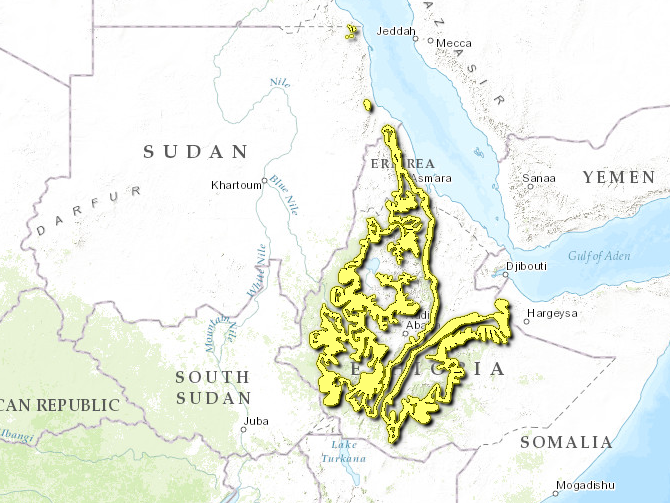
Ethiopian Montane Woodland ecoregion
Contents
- 1 Ethiopian montane forests
- 1.1 WWF Terrestrial Ecoregions Collection
- 1.2 Introduction The Ethiopian Montane Woodland ecoregion (Ethiopian montane forests) is biodiverse, poorly known and highly threatened. The rugged topography of this ecoregion rings the highlands of Ethiopia and Eritrea, extending to outlying massifs in Sudan. Formed by volcanic forces 75 million years ago, these highlands were covered with Eurasian tundra-like vegetation during the last Ice Ages. Today, remnant patches of natural vegetation consist mostly of podocarp and juniper forests, with some acacias found at lower elevations. While soils are rather infertile, this area is densely populated and most land has been converted to agriculture. Notable endemics found here include the yellow-throated serin and Prince Ruspoli's turaco. Many of the endemic species are threatened due to the loss of their habitat.
- 1.3 Location and General Description
- 1.4 Biodiversity Features
- 1.5 Current Status
- 1.6 Types and Severity of Threats
- 1.7 Justification of Ecoregion Delineation
- 1.8 Additional Information on this Ecoregion
- 1.9 Further Reading
Ethiopian montane forests
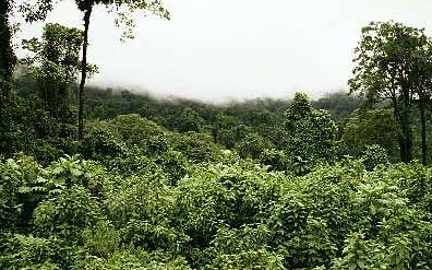
Awash National Park, Ethiopia. (Source: Photograph by WWF/ Canon/Martin Nicoll)
Introduction The Ethiopian Montane Woodland ecoregion (Ethiopian montane forests) is biodiverse, poorly known and highly threatened. The rugged topography of this ecoregion rings the highlands of Ethiopia and Eritrea, extending to outlying massifs in Sudan. Formed by volcanic forces 75 million years ago, these highlands were covered with Eurasian tundra-like vegetation during the last Ice Ages. Today, remnant patches of natural vegetation consist mostly of podocarp and juniper forests, with some acacias found at lower elevations. While soils are rather infertile, this area is densely populated and most land has been converted to agriculture. Notable endemics found here include the yellow-throated serin and Prince Ruspoli's turaco. Many of the endemic species are threatened due to the loss of their habitat.
Location and General Description
This ecoregion is highly biodiverse, relatively poorly known and highly threatened. It is mainly found on the margins of the highlands of Ethiopia and Eritrea. Isolated montane outliers include Jebel Elba and Jebel Hadai Aweb, parts of which are politically in Egypt although they are administered by Sudan; Jebel Ower near Port Sudan; and the Goda and Mabla massifs in Djibouti. The altitudinal limits of the ecoregion vary from one locality to another depending upon annual precipitation, but are generally between 1,100 and 1,800 meters (m). From May to October, winds blow from the southwest and bring rainfall to the Ethiopian portion of the ecoregion. During the rest of the year, onshore winds from the Red Sea bring moisture to the Eritrean side of the mountains. Rainfall varies from 600 millimeters (mm) in the driest sites to more than 1,500 mm in wetter areas. Humidity is sometimes higher than would be expected from these figures, due to cloud precipitation and local interactions between topography and weather. Unlike the moist equatorial mountains, the effects of cold descend further down on these dry highlands. Temperatures vary according to the season and elevation, but mean maxima lie between 18°C and 24°C. Mean minima are between 12°C and 15°C.
Ancient Precambrian basement rocks form the substrate of the montane forests in southwestern Ethiopia and Eritrea. The topography is generally rugged, and soils are rather infertile. The main Ethiopian and Eritrean dome began to rise 75 million years ago, eventually dividing into two halves, the northern and southern highlands. A turbulent volcanic period ended four to five million years ago, followed by climatic fluctuations in the Pliocene and Pleistocene. Glaciers formed on the peaks of the Ethiopian highlands while surrounding areas, including this ecoregion, were covered with vegetation similar to Eurasian tundra. Separated by the Great Rift Valley, the northern and southern highlands were colonized by new species from different directions. The jebels and escarpments along the Red Sea linked Eritrea and northern Ethiopia with the Palearctic region while southern Ethiopia had a rift-wall connection to the Horn of Africa. Both the western and eastern highlands were invaded by tropical species that could penetrate the Nile floodplains in the west or the Kenyan deserts in the south. Despite the climatic differences, the surrounding lowlands provided the most consistent source of new species, so that these highlands show both Afrotropical and Palearctic influences.
Phytogeographically, the ecoregion is part of the Afromontane archipelago-like regional center of endemism. The area supports East African evergreen and semi-evergreen forests through to bushlands. At lower elevations, woodland, known as kolla, is dominated by Terminalia, Commiphora, Boswellia, and Acacia species. However, at moister or higher locations the vegetation is called weyna dega and is increasingly dominated by the conifers Podocarpus falcatus and Juniperus procera. The low, dry portion of the Harenna forest south of the Bale Mountains N.P. reflects the type of forest that once covered a large part of Ethiopia and possibly Yemen. Coffea arabica is the dominant understory shrub and wild coffee is still harvested extensively. The tall, open canopy consists of Warburgia ugandensis, Croton macrostachyus, and Syzygium guineense, with emergent Podocarpus falcatus. At higher elevations, moist pockets of dense forest grow, with abundant lianes and epiphytes. Trees here are typical of eastern Africa, with Aningeria and Olea being dominant.
Biodiversity Features
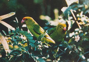 Black-winged lovebird (Agapornis taranta), Ethiopia. (Source: Photograph by WWF/ Taye Demissew)
 Forest types present in this ecoregion range from wet to dry, giving the area high biodiversity values. The patterns of endemism and their association with the forests of the area are complex and have been presented elsewhere. There is an area of bird endemism on the southeast corner of the southern Ethiopian highlands and another one in the higher plateau of the northern Ethiopian highlands and Eritrea. Other plant and animal endemics are found along the drier northeastern margins of the Ethiopian highlands, which link to the mountains of northern Eritrea and Somalia as well as the Day Forest in the Goda Massif in Djibouti. This small outlier in Djibouti is an important forest island in a sea of semi-desert, with at least four known endemic plant species. The relatively unexplored Harenna forest in southern Ethiopia is however probably the most biodiverse area in the ecoregion.
Because humans have intensively occupied the highlands of the Horn of Africa for thousands of years, it is difficult to gauge the extent to which the ecoregion was formerly forested, and the extent to which it has always consisted of a natural grassland, thicket, and forest mosaic. Remnant ancient trees in enclosed cemeteries provide evidence that forest was previously much more widespread. These forests may be used for cattle pasture or to obtain wood. A large portion of the ecoregion is now covered by farmland or secondary vegetation derived from agricultural or wood-harvesting activities. For example, 88 percent of the Day Forest in Djibouti has been lost in the last two centuries, and more than 20 percent of the loss has occurred in the last 50 years.
Threatened species include four strict endemics, including Djibouti francolin (Francolinus ochropectus, CR), Harwood's francolin (Francolinus harwoodi, VU), Prince Ruspoli's turaco (Tauraco ruspoli, VU), and yellow-throated seedeater (Serinus flavigula, VU), all of which are primarily threatened by habitat loss. Prince Ruspoli’s turaco is further restricted where its range overlaps with the near-endemic white-cheeked turaco (Tauraco leucotis). Where both species are present, Prince Ruspoli’s turaco is only found in juniper forest, but where it occurs alone, it inhabits both broad-leaved and juniper forest. Both birds are part of a recent radiation of small, red-winged turacos. However, the white-cheeked turaco is extremely adaptable and the regional representative of a type that is found across all of Africa. Prince Ruspoli’s turaco has not become significantly distinct and is declining as the white-cheeked turaco advances. The ecoregion also contains part of the South Ethiopian highlands endemic bird area, centered on the forests, grasslands, and thickets to the southwest of the Bale Mountains and including the Yabello Sanctuary at around 1,700 meters where the endemic Sidamo lark (Heteromirafra sidamoensis, EN), white-tailed swallow (Hirundo megaensis, VU) and Ethiopian bush-crow (Zavattariornis stresemanni, VU) occur. Other birds considered as near-endemic to this ecoregion include dark-headed oriole (Oriolus monacha), Abyssinian catbird (Parophasma galinieri), Abyssinian slaty flycatcher (Dioptrornis chocolatinus), and yellow-fronted parrot (Poicephalus flavifrons).
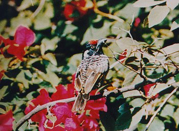 Banded barbet (Lybius undatus), Ethiopia. (Source: Photograph by WWF/ Taye Demissew)
 Mammals with ranges restricted to Ethiopia that occur in this ecoregion include the shrew (Crocidura harenna CR), the narrow-footed woodland mouse (Grammomys minnae), and Menelik’s bushbuck (Tragelaphus scriptus meneliki), a subspecies of bushbuck with long, dark fur. Males are black while females are chestnut colored with white spots. Some other mammals found in this ecoregion are: olive baboons (Papio anubis), black and white colobus monkeys (Colobus guereza), black-faced vervet monkey (Cercopithecus aethiops aethiops), bush duikers (Sylvicapra grimmia), warthogs (Phacochoerus aethiopicus), bush pigs (Potamochoerus porcus) and hippopotamus (Hippopotamus amphibius). Predators include caracals (Caracal caracal), golden jackals (Canis aureus), black backed jackals (Canis mesomelas), leopards (Panthera pardus, EN), lions (Panthera leo, VU), spotted hyaenas (Crocuta crocuta) and servels (Felis serval). Antelope species found here include Swayne’s hartebeest (Alcelaphus buselaphus swaynei, EN), Guenther’s dikdik (Madoqua guentheri) and greater kudu (Tragelaphus strepsiceros). Many of these larger mammals are only found in protected areas, most notably Nechisar National Park. In the early 1900s, elephant (Loxodonta africana), black rhinocerus (Diceros bicornis), buffalo (Syncerus caffer), and oryx (Oryx gazella) were found in the Nechisar area but all have been eliminated.
Although accurately ascribing species of amphibian and reptile to this complex ecoregion has proven problematic, there are believed to be a number of strict and near-endemic species of both taxonomic groups in these forests. Of the five endemic amphibians two are tree frogs (Afrixalus clarkei and Afrixalus enseticola), two are ranid frogs (Phrynobatrachus bottegi and Phrynobatrachus sciangallarum), and one is a caecilian (Sylvacaecilia grandisonae) . Two endemic chameleons are found, including two species of chameleons, Chamaeleo balebicornutus and Chamaeleo harennae.
Current Status
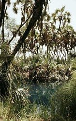 Awash National Park, Ethiopia. (Source: Photograph by WWF/ Canon/Martin Nicoll) The ecoregion is poorly protected, although some small areas are included in Ethiopian protected areas that primarily encompass other ecoregions. Ethiopian Montane Woodland is contained in the Babile Elephant Sanctuary, Awash N.P., Omo N.P., and Nechisar N.P. Many of these protected areas, such as controlled hunting areas and wildlife reserves, offer little to no protection for native flora and fauna. The very few patches of natural forest remaining are mostly found in the southwest where rainfall is highest. Smaller areas of drier forest are also found to the north on the scarp slopes facing the Red Sea and Gulf of Aden. Non-forest [[habitat]s] are also found, but are principally located within areas of very high population density; and, little remains in a natural state, except in rocky ravines and other inaccessible areas.
Types and Severity of Threats
All natural [[habitat]s] in the ecoregion are highly threatened because they have been reduced to small patches, are severely fragmented, and poorly protected. Agriculture is the main threat, coupled with exploitation of trees for fuelwood and timber. Tilahun et al report that a sawmill has been constructed in Mena, on the southern border of the Harenna forest and the large timber trees are being logged out. The expanding urban population in this region, which utilizes these forests for construction material, fuel, and charcoal, threatens the Harenna forest. Traditionally, the Harenna forest was used for gathering honey, coffee, and other forest products as well as cattle grazing.
In many places within this ecoregion, poor agricultural methods and overgrazing have resulted in intense soil erosion. A protected area system in Djibouti, Ethiopia, and Eritrea that better covers the [[habitat]s] of the ecoregion is urgently needed. When political stability returns, we will be to assess the remaining [[habitat]s] and species compositions of the small areas of this ecoregion in Somalia. Cultivation, grazing, and removal of firewood are all serious concerns within protected areas as well. Nechisar N.P. is threatened by intensive natural resource use, fueled by the fast growth in the nearby town of Arba Minch. Previously one of the best protected areas in the country, the park is now exploited for livestock grazing and wood for construction and fuel.
Justification of Ecoregion Delineation
This ecoregion is based on the ‘East African evergreen and semi-evergreen bushland and thicket’ and ‘cultivation and secondary grassland replacing upland and montane forest’ vegetation units. The cultivation and secondary grassland areas are included in an effort to cover potential vegetation. The ecoregion lies between 1,100 meters (m) and 1,800 m in elevation. Although the Day Forest in the Goda Massif in Djibouti is not mapped in this assessment, its affinities to the Ethiopian Highlands are recognized.
Additional Information on this Ecoregion
- For a shorter summary of this entry, see the WWF WildWorld profile of this ecoregion.
- To see the species that live in this ecoregion, including images and threat levels, see the WWF Wildfinder description of this ecoregion.
- World Wildlife Fund Homepage
Further Reading
- Comité National pour l'Environnement (CNE). 1991. Rapport National Environnement. Secrétariat Technique du Comité National pour l'Environnement ONTA/SPSE, Djibouti.
- Friis, I. 1992. Forests and Forest Trees of Northeast Tropical Africa. HMSO, Kew Bulletin Additional Series XV.
- Kingdon, J. 1989. Island Africa. Princeton University Press, New Jersey. ISBN: 0691085609
- Lovett, J. C. and I. Friis. 1996. Patterns of endemism in the woody flora of north-east and east Africa. Pages 582-601 in L. J. G. van der Maesen, X. M. van der Burgt, J. M. van Medenbach de Rooy, editors. The Biodiversity of African Plants. The Netherlands: Kluwer Academic Publishers. ISBN: 0792340957
- Magin, C. editor. 1999. Monographie Nationale de la Diversité Biologique de Djibouti. Direction de l’Environnement, Ministère de l’Habitat, de l’Urbanisme, l’Environnement et de l’Aménagement du Territoire, Djibouti et l’UICN, Nairobi, Kenya.
- Magin, G. 2001. Djibouti chapter in: Fishpool, L.D.C. and Evans, M.I. (eds). Important Bird Areas in Africa and associated islands: priority sites for conservation. Newbury and Cambridge, U.K: Pisces Publications and BirdLife International (BirdLife Conservation Series No. 11). ISBN: 187435720X
- Nievergelt, B., T. Good, and R. Güttinger. 1998. A Survey of the Flora and Fauna of the Simen Mountains National Park, Ethiopia. Special Issue of Walia, Journal of the Ethiopian Wildlife and Natural History Society, Addis Abeba, Ethiopia.
- Stattersfield, A. J., M. J. Crosby, A. J. Long, and D. C. Wedge. 1998. Endemic Bird Areas of the World. Priorities for biodiversity conservation. BirdLife Conservation Series No. 7. BirdLife International, Cambridge, United Kingdom. ISBN: 1560985747
- Tilahun, S., S. Edwards, and T. B. G. Egziabher. editors. 1996. Important Bird Areas of Ethiopia. Published by Ethiopian Wildlife and Natural History Society. Semayata Press. Addis Abeba, Ethiopia.
- White, F. 1983. The vegetation of Africa, a descriptive memoir to accompany the UNESCO/AETFAT/UNSO Vegetation Map of Africa (3 Plates, Northwestern Africa, Northeastern Africa, and Southern Africa, 1:5,000,000). UNESCO, Paris. ISBN: 9231019554
- Yalden, D. W., M. J. Largen, D. Kock, and J. C. Hillman. 1996. Catalogue of the mammals of Ethiopia and Eritrea. 7. Revised checklist, zoogeography and conservation. Tropical Zoology 9:73-164.
| Disclaimer: This article is taken wholly from, or contains information that was originally published by, the World Wildlife Fund. Topic editors and authors for the Encyclopedia of Earth may have edited its content or added new information. The use of information from the World Wildlife Fund should not be construed as support for or endorsement by that organization for any new information added by EoE personnel, or for any editing of the original content. |
