Ecoregions of Algeria
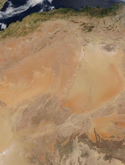
Source: NASA
Ecoregions of Countries Collection ![]()
There are eight ecoregions in Algeria:
- Mediterranean woodlands and forests
- Mediterranean conifer and mixed forests
- Mediterranean dry woodlands and steppe
- Saharan halophytics
- North Saharan steppe and woodlands
- Sahara desert
- West Saharan montane xeric woodlands
- South Saharan steppe and woodlands
Contents
Mediterranean woodlands and forests
The Mediterranean woodlands and forests ecoregion stretches from the coastal plains to the hills of northern Morocco, Algeria and Tunisia, and eventually surrounds the Atlas Mountains. To the north is the Alboran Sea, the westernmost element of the Mediterranean Sea. The variety of substrates and climates leads to a diverse mix of vegetation including holm oak forests, cork oak forests, wild olive and carob woodlands, as well as extensive Berber thuya forest. This old, endemic North African conifer species is representative of the great diversity and endemism of both flora and fauna in this ecoregion. Reptile diversity is high and the region harbors charismatic large mammals, including the rare and endangered Barbary leopard. Unfortunately, this region contains high human populations and widespread deforestation (Land-use and land-cover change).
Mediterranean conifer and mixed forests
Scattered through North Africa (and southernmost mountains of Cádiz and Málaga in Spain), Mediterranean conifer and mixed forests occur on high elevations of major mountain massifs. Relict stands of these fir and pine forests are endemic, and survive in isolated locations in areas of limited areal extent. The flowering plants on these ranges have high rates of endemism, with over 450 strictly endemic plant species, as a result of the long isolation of Holarctic taxa at these high elevations. The faunal diversity is the greatest in the Palearctic realm, with a mixture of Palearctic, Afrotropical and more restricted North African taxa. Mammals found in this region include the only African [[endemic] species] of deer, Cervus elaphus barbarus, the Barbary leopard (Panthera pardus panthera), the Barbary macaque (Macaca sylvanus), and before its extinction in the 1930s, the Atlas lion (Panthera leo leo). One strict endemic bird species, the Algerian nuthatch (Sitta ledanti), is also found. These forests have been utilized since ancient Roman times, but deforestation has increased dramatically in the past century. Human impact is significant, compounded by the socio-economic instability of the Maghreb countries.
Mediterranean dry woodlands and steppe
The Mediterranean dry woodlands and steppe ecoregion forms a buffer between the Mediterranean forest ecoregions and the Sahara Desert farther south. The ecoregion may have been partially forested in prehistory, but today scrub vegetation predominates. A number of narrowly [[endemic] species] of plants are found here, although there are few endemic vertebrates. The ecoregion is currently highly threatened by the change from nomadic pastoralism to settled agriculture and grazing. The overgrazing widely practised here is considered to be leading to increased desertification in the area.
Saharan halophytics
Scattered across the Sahara, "Sebkhas" or "Chotts" are saline depressions in the desert that remain predominantly dry. Although flooding is rare, some of these areas flood annually. They are important habitats for small rodents and are important for grazing camels during dry seasons. The habitats of this ecoregion are not particularly threatened, as human populations are very small and most of the areas are too saline to be used for farming. Large mammals, however, have been hunted out from these areas. Woody resources, where available, are used by desert people. The only permanently populated part of the ecoregion is the Siwa Oasis in Egypt, which has permanent freshwater sources from large springs.
This ecoregion is restricted to some suitable semi-desert and desert locations in the northern portion of Africa, in Morocco, Algeria, Tunisia, Libya, Egypt, Western Sahara and Mauritania. The most extensive of the areas are Chott Melghir, Oued Rir Vally, Hodna, Sebkhat Tidikelet, Sebkha of Timimoun, Tefedest, Chott El Djerid and the Qattara Depression and Siwa Depression in Egypt.
North Saharan steppe and woodlands
This ecoregion forms the north and western border of the greater Sahara Desert region. Rainfall occurs during the cooler winter, nourishing a variety of plants that flower before the hot, dry summer. Compared to the South Saharan Steppe and Woodland, this ecoregion harbors a significant number of plant and small animal endemics. In the past the ecoregion also supported large numbers of desert-adapted African mammals, but many have been extirpated from the area due to decades (in some cases centuries) of over-hunting. Some of the remaining desert adapted species, such as the Dama gazelle and Houbara and Nubian bustards are still facing extreme hunting pressure, and in some areas they too have been extirpated.
This ecoregion extends across northern Africa and covers parts of Western Sahara, Mauritania, Morocco, Algeria, Tunisia, Libya, and Egypt. It is generally found inland of the coast, but stretches to the shore in areas where there is low rainfall. In Morocco, Algeria and Tunisia, this ecoregion forms a transition between the Mediterranean domain towards the north and the true desert in the south. The Saharan Halophytics ecoregion is also found scattered through this ecoregion in areas of suitable saline conditions.
Sahara desert
The Sahara Desert is the largest hot desert in the world and occupies approximately ten percent of the African continent. The ecoregion includes the hyper-arid central portion of the Sahara where rainfall is minimal and sporadic. Although species richness and endemism are low, some highly adapted species do survive with notable adaptations. Only a few thousand years ago the Sahara was significantly wetter, and a significant large mammal fauna resided in this area. Climatic desiccation over the past 5000 years, and intense human hunting over the past 100 years, has obliterated most of these fauna. Now, in vast portions of the Sahara, merely rock, sand and sparse vegetation are found. The remnant large mammal fauna is highly threatened by ongoing over-hunting. An alternative name of the Sahara is the Great Desert.
From the Atlantic Ocean in the west, the greater Sahara stretches across Africa to the Red Sea and down to the highlands of Ethiopia, encompassing an area 9,100,000 square kilometres (km2). This ecoregion covers the central Sahara Desert, between 18° and 30° N, and has an area of 4,619,260 km2. The northern and southern margins of the Sahara, which receive greater rainfall and have greater vegetation cover, are described separately.
The flora of the central Sahara Desert is quite depauperate, and is estimated to include only 500 species. This is extremely low considering the huge extent of the area. It mainly consists of xerophytes and ephemeral plants (called also locally Acheb), with halophytes in moister areas. The flora has one near endemic family, a number of isolated monotypic genera of both wide and narrow distribution, and perhaps as many as 162 [[endemic] species]. The monotypic genera suggest a Tertiary origin with probable extinction of linking forms. Vegetation is very contracted along the wadis and the dayas with Acacia sp, Tamarix sp., and Calotropis procera. Where there is sufficient groundwater, hammadas are covered by Anrthirrnum ramosissimuma and Ononis angustissima.
The Sahara is a vast area of largely undisturbed habitat, principally sand and rock, but with small areas of permanent vegetation. The most degradation is found where water (oases, etc) is present. Here, habitats may be heavily altered by human activities. Previously existing tree cover has often been removed for fuel and fodder by nomadic pastoralists and traders.
West Saharan montane xeric woodlands
The mountains of the West Saharan montane xeric woodlands ecoregion are found within disjunctive portions of the Sahara Desert and are predominantly of volcanic origin.
 Hoggar Mountains, Algeria (Photograph by Jeanne Tabachnick) Hoggar Mountains, Algeria (Photograph by Jeanne Tabachnick)
 They rise from the surrounding flat desert topography, creating islands of moister habitat that support a notable relict flora and fauna.
The most important area is the Tassili-n-Ajjer Plateau, an outlier of the Ahaggar Mountains in Algeria which supports relict species, some near-[[endemic] species] and some globally threatened (Endangered species) antelopes.
The human population of the ecoregion is very sparse, with less than five persons per square kilometre (km2). Because most people are nomadic, the vegetation remains fairly intact.
Tassili-n-Ajjer, found largely in southeastern Algeria, comprises a majority of the ecoregion. Three smaller outliers also occur, including the Air ou Azbine in northern Niger (with Monts Bagouezane reaching over 2000 metres), Dhar Adrar in Mauritania (reaching almost 700 m), and Adrar des Iforas in Mali and Algeria (reaching 900 m).
The largest intact blocks of habitat found in Algeria lie within the huge protected areas of Ahaggar National Park and Parc National de Tassili N’Ajjer. In these areas the flora and fauna are actively protected. Tourism has become a means of income for the area, so local people have come to realize the economic importance of the animals and plants. Park managers are attempting to end poaching and woodcutting. The other portions of the ecoregion are less well protected, but their relative lack of human inhabitants may reduce threats.
South Saharan steppe and woodlands
This ecoregion covers a narrow band on the southern edge of the [[Sahara Desert],] stretching from central Mauritania to the Red Sea. Annual grazing after rainfall is a key feature, in former times attracting large herds of arid-adapted migratory ungulates such as gazelles, addax, and scimitar-horned oryx. Much of the ecoregion is now overgrazed by herds of domestic livestock, and habitat degradation (Land-use and land-cover change) is widespread. Motorized hunters have decimated the wild ungulate herds, and the ecoregion's few protected areas have suffered from civil and international wars. Continued and increased external support is required to protect the ecoregion and provide alternate livelihoods and supplemental incomes for local people.
The South Saharan Steppe and Woodlands ecoregion extends in a narrow band from central Mauritania, through Mali, southwestern Algeria, Niger, Chad, and across Sudan to the Red Sea, covering the southern fringes of the Sahara Desert.
The habitats of this ecoregion are heavily influenced by drought, the effects of which are exacerbated by the large numbers of domestic livestock. In wetter years, there can be an abundance of forage, and in the past considerable numbers of large migratory ungulates used these temporary grasslands. Tree cover in the south and along wadis has declined. Many trees have been cut for charcoal, firewood, and building materials. The recruitment of young trees into mature age-classes is almost non-existent in many areas due to overgrazing.
See also: Regional biodiversity hotspot (Mediterranean Basin)
See also: Tassili N'Ajjer National Park, Algeria
Context
Ecoregions are areas that:
[1] share a large majority of their species and ecological dynamics;
[2] share similar environmental conditions; and,
[3] interact ecologically in ways that are critical for their long-term persistence.
Scientists at the World Wildlife Fund (WWF), have established a classification system that divides the world in 867 terrestrial ecoregions, 426 freshwater ecoregions and 229 marine ecoregions that reflect the distribution of a broad range of fauna and flora across the entire planet.