Wetlands and remote sensing: the way ahead
Contents
Introduction
This article will discuss the link between wetland study and the emerging field of geospatial technology for sustainable and wise use of wetland systems. This is nothing new. It is, however, an attempt to:put together past works;present initiatives;explore future possibilities;identify gaps in management, and in conservation, activity;develop links with ongoing initiatives at global, regional (Wetlands and remote sensing: the way ahead) and national spatial levels; and * take the challenge of linking multiple components in a holistic way.
To start—unfolding the pages of knowledge

Wetlands are productive and dynamic systems of flora, fauna and biological diversity supporting millions of people by related ecosystem services. Regarded as "kidneys of the ecosystem” and important features of the landscape matrix, they are treasure houses of ecological diversity, and provide an essential environment for plant and animal species, in addition to governing significant ecological and hydrological functions. The Ramsar Convention on Wetlands was an intergovernmental treaty adopted on 2 February 1971, for conservation and management of global wetlands. A comprehensive definition framed by the Convention and adopted by the research community says: “areas of marsh, fen, peatland or water, whether natural or artificial, permanent or temporary, with water that is static or flowing, fresh, brackish or salt, including areas of marine water the depth of which at low tide does not exceed six metres". The U.S Department of Agriculture (USDA) with the Environmental Protection Agency (EPA) and U.S Fish and Wildlife Service (FWS), together defined wetlands (in the Emergency Wetlands Resources Act of1986) as: “an ecosystem that depends on constant or recurrent, shallow inundation or saturation at or near the surface of the substrate". The Ramsar initiative was a target effort in prioritizing wetland sites for conservation, and now includes 154 contracting parties to the convention, with 1674 wetland sites, totaling 150.2 million hectares. Diverse wetlands systems with high ecological value and pertinent social dependence, that include flooded riparian forests, backwater swamps, coastal mangroves, high-elevation bogs, inundated savannas, cover million square kilometers and are distributed in temperate, tropical and boreal regions worldwide.
Wetland inventories have been executed in major geopolitical regions of the world—namely, Africa, Asia, Oceania, Neotropics, North America, and Western and Eastern Europe—based on ground survey, existing topographic maps and introductory efforts using spatial tools. However, we spot information gaps on the specific issues. Overall, awareness of the global wetland inventory resources is incomplete and inadequate to support management needs. Total wetland distribution globally is a thorny estimate, and to date all wetlands have not been identified and inventoried. Ramsar estimates about 500 to 4,000 Mha, counting 70% of the world's population in coastal areas. At the global scale, the information base for wetland management is outdated, inaccurate and contains many management gaps. These issues on wetland inventory, assessment and monitoring have been addressed in international and national fora, yet the present extent and quality of wetland information is insufficient to support effective management of a dwindling resource.
Ecosystem services—different sectors
- Wetlands cover about 1% of the Earth's surface and play a significant role in balancing biogeochemical fluxes between the land surface, the atmosphere and hydrologic systems. They play a particularly important function in processing methane, carbon dioxide, nitrogen, and sulfur as well as in carbon sequestration.
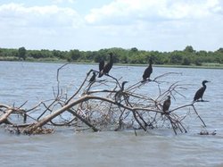
- The environmental role of these fragile biological systems varies from acting as buffer zones for water, sediment, pollutants and nutrients, providing niches for species including birds, reptiles, fish, and mammals, governing fresh water supply and managing nutrient cycles.
- Wetlands play a vital role in governing high rates of primary productivity and biogeochemical activity along with other environmental processes, namely, aquifer recharging, flood mitigation, hydrological buffering, and climate regulation.
- Economically, wetlands support livelihoods providing numerous services and products to humankind.
- Scientific evidence suggests that wetland ecosystems (inland/coastal) are essential for human survival, and play a crucial role in managing natural calamities (hurricanes, floods, cyclones), along with providing community needs.
Wetland inventory—from ground survey to spatial era
While traditional use of wetlands maintained the resource, modern use eliminates or degrades their existence. Changing human systems have, directly or indirectly, driven changes in wetland distribution, pattern, ecology and biodiversity. Multiple pressures (natural, anthropogenic and socio-economic) to convert wetlands for agriculture and aquaculture requirements (for food and livelihood), especially in developing countries, have aggravated wetland loss. Taylor et al. support that resource inventories provide indication of location, biological productivity, potential multiple uses, and biodiversity profiles of wetland ecosystems. Finlayson designed a wetland monitoring program including methodology and data reporting steps also addressing the issue of scale. The accelerating rate of climate change, global warming, and fluctuations in rainfall pattern, have been a cause of concern for these biologically productive and hydrologically stabilizing wetlands demanding a comprehensive strategy and work plan for global wetland activities. International organizations along with regional and local support were actively participating to strengthen the knowledge base on wetland systems. Wetlands International, in global, regional and national conservation initiatives, has developed some guidelines for sustainable use. Environmental attribute assessments of wetland ecosystems was considered the essential component for inventory and change dynamics. Galatowitsch supported that knowledge on water regime, groundwater flow system, organic carbon soil, land use pattern, agriculture expansion, ecological, hydrological, economical, and socioeconomic benefits provides a holistic picture of these complex systems. Sahagian and John Melack explain the understanding of the role of wetlands in biogeochemical and hydrologic cycles is significant to map global wetland distribution.
The Global Wetland Inventory and Mapping (GWIM) program initiated by the International Water Management Institute takes into account the existing inventory data, digital elevation models, multiscalar data, and environmental attributes in a geospatial domain. Global inventory planned using satellite data, processing geospatial software and integrating ancillary data and ground details, would recognize factors that influence the sustainability of wetland ecosystems. Potential and systematic use of spatial data will assess global inventory of natural and anthropogenic wetlands, and the study of wetland dynamics (seasonal and spatial), thereby leading to the formation of global data sets that can be used by wetland managers and scientific researchers. The functional methodology developed would provide a platform to inventory, map and classify wetlands taking into account the associated functional parameters. The data sets incorporated in GIS-Map server interface would provide an interactive online geospatial analysis for multiple users.
Though the journey to define, inventory, assess and monitor the systems started long back, actors initially concentrated on large-scale projects. Ramsar Convention’s ‘wetland monitoring programme’ design involved a series of steps: problem identification, objective definition; hypothesis derivation, variable identification and feasibility and cost analysis. The main target of these efforts was permanent wetland area, while seasonally inundated areas were not taken into consideration in a significant way. Further, Ramsar defined eight priorities towards global wetland studies and sustainable use; with the multi-fold global conservation approach emphasizing wetland dynamics, change analysis, widespread inventory to generate a database for location, characteristics, spatial distribution, ecology and economic analysis and prioritization.
Traditional methods for mapping involve intensive and time-consuming fieldwork. Several efforts to document the knowledge base on wetland resources and the profile of their ecosystems services was initiated; Finlayson et al. summed up the global overview of the wetlands emphasizing status, resources and future priorities in seven regions; Wong emphasized wetland management strategies in Asian countries, including Philippines, Thailand, Hong Kong and China. Hughes and Hughes focused on the fauna, flora, human impact and utilization of African wetlands. Wigham et al. described wetlands across three major rivers— the Amazon, Orinoco and Magdalena. Along with a detailed inventory on type, flora and fauna of the wetlands, the causes of disturbance (mining; forest exploitation, sewage disposal) were also listed. The directory of Azov-Black Sea coastal wetlands documented by Gennadiy Marushevsky, by Wetlands International, lists all details with map illustrations of six countries covering an area of 422,000 km2. It provides details on location, type, hydrology, ecology and disturbance factors. The approach is mainly based on wetland inventory sheets, available ancillary datasets and ground surveys. The compilations were based on ground explorations, existing literature and topographic maps.
In most cases, wetland inventory is based on ground-survey, but studies also utilize aerial photography and topographic maps and, more recently, satellite imagery. Wetland inventory details at the global level were summarized by Finlayson and Valk, covering the United States, Canada, Australia and some European countries. National wetland inventories have sets of databases whereas in Asian and African countries the database reflects certain gaps, and until 1995 there was no database of wetland ecosystems, although some information on mangroves was available. Zalidis et al. worked on photo interpretation and cartographic conventions in Mediterranean wetlands to support mapping of wetlands using a process of transferring information to the base map, including border definition of the mapped area, presentation of non-wetland habitats and the use of graphical techniques.
A spatial approach provides a means for repetitive monitoring and also aids in identifying the indicators of change in natural systems. Studies on ‘Wetlands in Space’ started back in the 1970’s; perhaps the case studies reported were sufficient. First was the epoch of aerial photography. Bendjoudi et al. explored the riparian wetlands in France using thermographic aerial survey and electromagnetic prospecting. The potential for remote sensing to create wetland maps using color infrared aerial photography at different scales was practiced along with field studies, review of soil maps, and integration of existing information.
Geospatial technology (multi-spectral, hyper-spectral, optical and microwave sensors) and tools (digital image processing [DIP] and Geographic Information Systems [GIS]), opened new vistas for wetland inventory at multiple scales. Application of remotely-sensed data for wetland mapping, classification and characterization gained momentum in the past two decades. Associated attributes, namely definition, scale, boundaries, evaluations, and methodology were analyzed and modeled using Geo-Arc interface. Support tools of geospatial analysis, namely Global Positioning Systems (GPS), meta-database and developing query tools and internet GIS, added further dimension to the overall approach of wetland inventory and management. The raster/vector data sets having information on area, boundary, location, geomorphology, soil characteristics, water regime, water quality, and vegetation pattern were prepared using both spatial and non-spatial domains and were linked with the meta-database.
Many regional and local-level studies were executed to inventory and map wetland types. Kelly documented changes in the landscape pattern and landscape-scale wetland fragmentation of coastal North Carolina wetlands using Landsat Thematic Mapper data. The results highlight the lack of agreement between management and landscape-scale wetland structure, function and change. The Salim Ali Centre for Ornithology and Natural History, India, enlisted 199 wetlands for conservation prioritization describing the anthropogenic pressure in terms of heavy pollution, risking the niche of threatened bird species, based on remote sensing analysis and geospatial modeling. Further development of optical and microwave sensing systems and algorithm modeling brought measurable advancements in the understanding of wetlands.
The Millennium Ecosystem Assessment confirmed earlier statements that the extent of wetland mapping and inventory was inadequate and that the most recent estimates of wetland extent were under-estimates with significant gaps regionally and for various types of wetland ecosystems (as defined under the Ramsar Wetlands Convention). The conservation, management and prioritization initiatives in wetland study need to be designed on a basic framework to concentrate on the Ramsar baseline by assessing current inventory status, identifying gaps in wetland data and the status of wetland functions, and establishing an unswerving methodology for wetland research study.
Further Reading
- Bendjoudi et al, 2002
- Finlayson, 1996a
- Finlayson, 1996b
- Finlayson, C. M. and Moser, M. (Eds.), 1992. Wetlands. Facts on File. Oxford. ISBN: 0816025568
- Finlayson, C.M., and van der Valk, A. G., 1995. Wetland classification and inventory: a summary. In: C.M. Finlayson and A. G. van der Valk (Eds.). Classification and Inventory of the World’s Wetlands. (Advances in Vegetation Science 16), pp. 185–92. Kluwer Academic Press, Dordrecht, Netherlands. ISBN: 079233714X
- Finlayson, C. M. and Spiers, A. G. (Eds.), 1999. Global Review of Wetland Resources and Priorities for Inventory. Supervising Scientist Report No. 144. Canberra. ISBN: 0642243476
- Finlayson and Davidson, 2001
- Finlayson et al., 2001
- Galatowitsch, 1993
- Gibbs,1993
- Gooselink, 2000
- Hughes and Hughes, 1992
- International Water Management Institute. IWMI Global Wetland Initiative.
- Johnston and Barson, 1993
- Kelly, 2004
- Melack, 2004
- Phinn et al., 1999
- Ramsar Convention Secretariat. Key Documents of the Ramsar Convention on Wetlands.
- Sahagian and Melack, 1996
- Taylor et al., 1995
- Vijayan et al., 2005
- Wigham et al. (Eds.), 1993
- Wong, 2004
- Zalidis et al., 1996