Southern New Guinea lowland rain forests
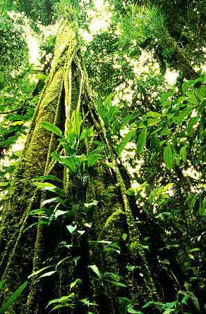
Kikori Basin, Papua New Guinea. (Photograph by Don Henry via Flickr)
The Southern New Guinea lowland rain forests are some of the largest tropical wilderness areas in Australasia, with huge swaths of wet evergreen forest and important mosaics of other forest types. It is one of the richest areas for vascular plants in Indo-Malaysia.
Location and General Description
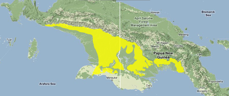
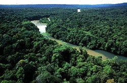 Kikori Basin, Papua New Guinea. (Photograph by Don Henry) The Southern New Guinea lowland rain forests ecoregion stretches across the lowland forests south of the Central Cordillera of Indonesian Irian Jaya and Papua New Guinea (PNG). The climate of the ecoregion is [[tropical] wet], which is characteristic of this part of Melanesia, located in the western Pacific Ocean north of Australia. The wettest portions of New Guinea are found in the Central Cordillera and from 100 to 1,000 meters (m) on the southern slopes of the Cordillera in this ecoregion. Although the remainder of the ecoregion is lower than most parts of New Guinea, the area's low relief and large rivers draining the nearby Central Ranges result in this ecoregion's inundation during the wet season. The wetland system associated with the Fly River is the largest watershed in PNG. Although New Guinea is a very active tectonic area with a complex geologic history, the geology of the West Papuan shelf, where this ecoregion is located, shows little folding, an indication of stability. The surface geology of the ecoregion consists of alluvium on active and relict alluvial plains and fans.
 Source; WWF
The vegetation is primarily tropical lowland broadleaf forest, of both alluvial and hill type, in addition to a (17 percent) portion of savanna. Small (less than 10 percent each) percentages of semi-evergreen rain forest, tropical montane evergreen forest, limestone forest, peat swamp forest, and freshwater swamp forest are also present in the ecoregion.
The lowland rain forests of this ecoregion are ecologically critical to the great Fly River watershed that is born in this high rainfall zone. The lowland hill forests are dominated by Hopea celtidifolia and Vatica russak, whereas the lower montane elements include Podocarpus and Lithocarpus. The Upper Fly lowlands, except for extensive settlements around the Ok Tedi mine in the west, represent a large expanse of sparsely populated, old-growth wet rain forest that is characteristic of the extraordinarily rich biota of the Upper Fly platform. This ecoregion also includes an enormous extent of botanically unknown tower limestone as well as Araucaria forest, Castanopsis, Quercus, traditional medicinal and food plants, nutmeg, and traditional spirit trees.
Lake Kutubu, PNG's largest lake, is also found in this ecoregion. This lake supports a diverse aquatic plant flora, and eleven of its fourteen fish species are endemic to it.
Biodiversity Features
Table 1. Endemic and Near-Endemic Mammal Species. Family Species Macropodidae Dendrolagus spadix Macropodidae Dorcopsis luctuosa Macropodidae Dorcopsis muelleri Pteropodidae Aproteles bulmerae Pteropodidae Nyctimene draconilla Emballonuridae Emballonura furax Rhinolophidae Hipposideros wollastoni Rhinolophidae Hipposideros muscinus Vespertilionidae Kerivoula muscina Molossidae Otomops papuensis Muridae Melomys lorentzi Muridae Melomys gracilis Muridae Pogonomelomys bruijni An asterisk signifies that the species' range is limited to this ecoregion. Overall richness (Southern New Guinea lowland rain forests) and endemism for this ecoregion are low to moderate when compared with those of other ecoregions in Indo-Malaysia, although plant richness is high. The mammalian fauna consists of a wide variety of tropical Australasian marsupials, including a tree kangaroo. The ecoregion contains sixty-nine mammal species, thirteen of which are endemic or near endemic (Table 1). Bulmer's fruit bat (Aproteles bulmerae) and the large pogonomelomys (Pogonomelomys bruijni) are critically endangered, whereas the lesser tube-nosed bat (Nyctimene draconilla), New Guinea sheathtail-bat (Emballonura furax), Fly River horseshoe-bat (Hipposideros muscinus), and Papuan mastiff bat (Otomops papuensis) are considered vulnerable. {| border="1" cellpadding="3" align="right" ! colspan="3" align="center" | Table 2. Endemic and Near-Endemic Bird Species. Family Common Name Species Megapodiidae Red-billed brush-turkey Talegalla cuvieri Loriidae Striated lorikeet Charmosyna multistriata Alcedinidae Little paradise-kingfisher Tanysiptera hydrocharis Meliphagidae Spot-breasted meliphaga Meliphaga mimikae Paradisaeidae Greater bird-of-paradise Paradisaea apoda An asterisk signifies that the species' range is limited to this ecoregion. The avifauna of the ecoregion (Southern New Guinea lowland rain forests) has a clear Australasian flavor, including representatives of several Australasian families such as Ptilonorhynchidae, Eopsaltridae, Meliphagidae, and Paradisaeidae. There are 344 bird species in the ecoregion, including 5 endemic and near-endemic species (Table 2). The ecoregion intersects two separate Endemic Bird Areas (EBAs), the South Papuan lowlands and the Trans Fly. ==Current Status== The Papuan Plateau and the Purari River Basin are major wilderness areas in this ecoregion. Most of the habitat remains in contiguous blocks, and the three protected areas, which cover 9,330 square-kilometers (km2), or 8 percent of the ecoregion area, are well distributed between Indonesia and PNG (Table 3). All the protected areas are large (more than 1,000 km2). An additional large protected area (Kumbe-Merauke, 1,268 km2) also extends into this ecoregion. {| border="1" cellpadding="3" align="center" ! colspan="3" align="center" | Table 3. WCMC Protected Areas That Overlap with the Ecoregion. Protected Area Area (km2) IUCN Category Gunung Lorentz [AA0105], 127, 129, 131] 5,360 I Mt. Bosavi [AA0105] 2,280 ? Kikori River [AA0121], [AA1401] 1,690 ? Total 9,330 Ecoregion numbers of protected areas that overlap with additional ecoregions are listed in brackets. (Southern New Guinea lowland rain forests) ==Types and Severity of Threats== 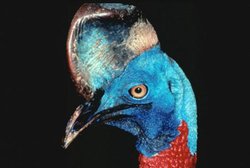 Northern cassowary (Casuarius unappendiculatus). (Photograph by Don Henry) Northern cassowary (Casuarius unappendiculatus). (Photograph by Don Henry) |
|---|