Maranhão Babaçu forests
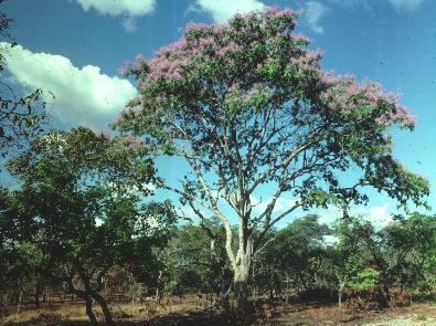
The Maranhão Babaçu Forest is located in eastern Brazil at the very eastern and southern flank of the Amazon Basin. This region comprises a transition zone between the moist evergreen forests of the Amazon Basin and the drier woodlands and scrub savannas of Brazil’s central plateau. Floristic elements of both regions intermingle, and the region is characterized by a vegetation mosaic . The dominant type is cerrado vegetation of woodland, scrub, and patches of dry savanna. The western portion hosts tall species-rich moist evergreen and deciduous forest. A small area of seasonally wet savanna dominated by sedges and grasses exists on the lower reaches of the major rivers. Much of the ecoregion’s original habitat has been altered by agriculture development; there are no large protected areas in this region.
Contents
Location and General Description
The northern tip of this ecoregion lies at the head of the San Marcos Bay in the State of Maranhão. The border then follows the Pindaré River west and south into the area of small hills. Following these foothills southeast, the region then turns north to the coastal forest. The terrain is flat to gently rolling, mostly occupying a broad flat plain of sedimentary deposits dissected by many rivers that drain into the Atlantic Ocean. The larger rivers are the Mearim, Itapecuru, and Parnaíba. Elevations inland reach 150 meters (m) and drop toward the coast. Annual rainfall ranges from 1,000 to 1,500 millimeters (mm). Most of this falls in six months; then the region goes through 5 to 6 months of drought (less than 100 mm of rainfall). Annual temperature ranges from 25° to 28° C. The bottomland soils are rich from alluvial deposits and the uplands are eutrophic podzols.
The most striking feature of the region are the extensive high-density stands of the economically important oil palm babaçu (Attalea speciosa, formerly Orbignya phalerata). While the palm occurs naturally in this region, and is a widespread species throughout the southern fringe of Amazonia, the stands today that cover a 1,000 km2 in Maranhão are mostly anthopogenic – that is, induced by human activity. The dominance of this palm in this landscape is most likely due to its ability to respond favorably under conditions of burning and deforestation, two common and repeated activities in this region . The most abundant trees of the primary forest are babaçu, Eugenia sp., the yellow mombin fruit Spondias mombin, a hardwood timber Gustavia augusta, a legume Swartzia polyphylla, Hyeronima alchorneoides, and a tree used for incense, Protium heptaphyllum. Secondary forests primarily host babaçu mixed with some Spondias mombin, another palm, Astrocaryum vulgare, and the pioneer tree Cecropia concolor . Stands dominated by the buriti palm Mauritia flexuosa occur in the flooded savanna region.
Biodiversity Features
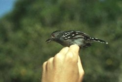
This was originally a region of rare endemic birds, fishes, and insects, although with a fairly low biodiversity as compared to neighboring regions in Amazonia. There are 112 mammal species recorded here. including pacas (Agouti paca) and agoutis (Dasyprocta punctata), porcupines (Coendou prehensilis), spiny rats (Proechimys longicaudatus and Mesomys hispidus), hog-nosed skunks (Conepatus semistriatus), and peccaries (Tayassu pecari and T. tajacu, both locally extinct). The avian fauna comprises 268 species.
Current Status
Most of this region is anthropogenic secondary forest and degraded pasture. No large protected areas exist here. The principal land uses are shifting cultivation, plantation agriculture, and cattle-ranching on pastures planted with exotic grasses or on unimproved range. Severe deforestation during the past 70 years has eliminated most of the original moist forest, and only remnant patches remain. Extensive and regular burning of the natural savanna and pastures also has threatened natural flora and fauna. While plantations of babaçu cover vast areas, the palm has also invaded all natural vegetation zones, even the gallery forests along the rivers in the savanna zone. Stands of babaçu completely dominate cattle pastures, which have been subject to prolonged deforestation.
Types and Severity of Threats
The babaçu palm continues to proliferate on deforested sites which are in great supply as human activities such as agriculture and ranching require cleared land. The remnants of natural savanna and forest vegetation are threatened by strong demand for land for large-scale intensive production operations, such as cattle-ranching and sugar cane plantation. Introduced grasses for pasture such as Hyparrhenia rufa compete with native savanna species.
Justification of Ecoregion Delineation
The forests form the eastern most extension of the Amazonian floristic province. The northern delineation occurs along mangroves, the Atlantic coast, and the distinctive sand dune [[habitat]s] of the restingas which form a clear and distinct boundary. The western delineation follows the Rio Pindaré from the cerrado shrublands to the São Marcos bay. The southern delineation follows the habitat transition from cerrado shrubland to moist forest, each with distinctive species assemblages. The linework for the eastern delineation follows the IBGE classification of "seasonal forest – steppe" and "savanna – steppe – seasonal forest". We justify this ecoregion due to its unique habitat types and species endemism.
Additional Information on this Ecoregion
- For a shorter summary of this entry, see the WWF WildWorld profile of this ecoregion.
- To see the species that live in this ecoregion, including images and threat levels, see the WWF Wildfinder description of this ecoregion.
- World Wildlife Fund Homepage
Further Reading
- Anderson, A. B. 1983. People and the Palm Forest: Biology and utilization of babassu palms in Maranhão, Brazil. Forest Service, U.S. Department of Agriculture, Washington, DC.
- Anderson, A. B., P. H. May, and M. J. Balick. 1991. The subsidy from nature: Palm forests peasantry, and development on an Amazon frontier. New York:Columbia University Press. ISBN: 0231072228
- Daly, D. C., and J. D. Mitchell. 2000. Lowland vegetation of tropical South America. Pages 391-453 in D. L. Lentz, editor, Imperfect Balance: Landscape transformations in the Precolumbian Americas. New York: Columbia University Press.
- Fundação Instituto Brasilero de Geografia Estatástica-IBGE. 1993. Mapa de vegetação do Brasil. Map 1:5,000,000. Rio de Janeiro, Brazil.
- Silva, J.M. C. 1998. Um método para o estabelecimento de áreas prioritárias para a conservação na Amazônia Legal. Report prepared for WWF-Brazil. 17 pp.
| Disclaimer: This article is taken wholly from, or contains information that was originally published by, the World Wildlife Fund. Topic editors and authors for the Encyclopedia of Earth may have edited its content or added new information. The use of information from the World Wildlife Fund should not be construed as support for or endorsement by that organization for any new information added by EoE personnel, or for any editing of the original content. |


