Japurá-Solimoes-Negro moist forests
This tropical rainforest in the northern Amazon Basin is dissected by rivers. Biodiversity is high and includes a number of primates such as black spider monkeys (Ateles paniscus), red-handed tamarins (Saguinus midas), and common squirrel monkeys (Saimiri sciureus). This ecoregion contains the largest national park in Brazil, Jaú National Park. Although much of this habitat has remained intact, areas along the rivers have high levels of mining, logging, agriculture, hunting, and fishing.
Contents
Location and General Description
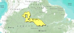
This region of dense tropical rain forest is situated on the lowland plateau in the central northern portion of the Amazon Basin in Brazil with tiny sections just touching Colombia and Venezuela. This interfluvial region extends west from the Amazon City of Manaus at the confluence of the Rio Negro and Rio Solimões (Amazon), following these rivers until the latter forks with the Japurá at the City of Tefé. The southern limit of the region then follows the Japurá west to the Colombian border, turning northward and skirting below the lowest foothills of the Guayana Shield. In eastern Colombia, the region encompasses the Lower Vaupés River Basin and the land south of the Guainía River, then again follows the Rio Negro along the Colombia-Venezuela border south into Brazil. The terrain is mostly terra firme, or non-flooded ground, on broad plains dissected by the erosive action of many streams cutting through to the larger rivers. Thus, the relief is one of small valleys of steep slopes and with some small hills at a higher level. The region’s elevation is well below 80 meters (m), and it is as low as 23 m at Manaus.
The Japurá-Solimões-Negro moist forest ecoregion lies entirely on lowland plateau which emerged recently in the late Tertiary (2-5 million years ago) as soft sediments. The areas to the north and east lie on the older uplands on the ancient crystalline Guayana Shield (about 1 billion years old). The climate is hot and humid. The mean monthly temperature ranges from 26° to 27°C, and average annual precipitation is 2,500 millimeters (mm), falling seasonally. Perforating this ecoregion are large areas of campinarana, a patchwork of broad-leaved meadows with dwarf shrubs, and isolated shrublands, both growing on bleached white-sand soils and subject to shallow and intermittent flooding. These are treated separately in the Campinarana ecoregion.
Two types of river define and dissect this region: blackwater (carrying few suspended solids, dark brown color) and whitewater (carrying a significant load of suspended solids, an ocher color). The Japurá and Solimões are whitewater rivers; the Rio Negro and most of the tributaries to all three are blackwater rivers. All of the major rivers and many of the tributaries overflow their banks annually from high precipitation here and in the Andes. Near the cities of Manaus and Tefé, the river level can rise 14 meters during the flood season; on the smaller tributaries the river level changes less. Flooding can last as long as ten months near Manaus, but only a month or two along the upper reaches of the tributaries. Várzea forests occur on the broad floodplains of whitewater rivers where the river sediments settle out on the landscape. This phenomenon and the forests it creates are treated in the description of the Purus Várzea ecoregion. Igapó forests occur along the flooded blackwater rivers, and the soils tend to be poor in nutrients and tree species lower in diversity. Forests that never flood are called terra firme and cover the vast majority of the area in this region. On terra firme, the soils are generally poor in nutrients.
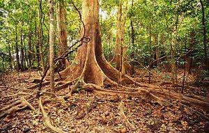
The environmental heterogeneity of this region lends itself to high ecological diversity and, in turn, high biodiversity . This is a region of medium endemism but with many rare or endangered plants and animals. On terra firme, the rain forests have either a medium-high (25 to 30 m) open canopy] or a medium-high dense canopy with very tall emergent trees up to 40 m. Leading tree families are Leguminosae, Sapotaceae, Rubiaceae, Chrysobalanaceae, Lauraceae, and Annonaceae. While there are hundreds of tree species in this region, some that occur in these and igapó forests along the Tarumã-Mirim River near Manaus are Vismia amazonica, Unonopsis guatterioides, Pentaclethra macroloba, Macrolobium suaveolens, Eschweilera parvifolia, Caraipa grandiflora, Aspidosperma nitidum, and Mabea nitida. On the Jaú River, farther west, are found Elvasia calophylla, Swartzia laevicarpa, Pouteria elegans, Aldina latifolia, Swartzia polyphylla, Ouratea hexasperma, Mollia speciosa, Leopoldiana pulchra (palm), Inga puntata, and Heterostemon mimosoides. Many palms exist both in the understory and canopy in all forest types. The predominant palms on the non-flooded areas are miriti and carana in the genus Mauritia. Other large trees, some with commercial value, on the terra firme are the Brazil nut (Bertholletia excelsa), sucupira (Bowdichia virgilioides), and rubber (Hevea spruceana). Some important timber species on the high edge of the várzea include Ceiba pentandra, Manilkara amazonica, and Virola surinamensis.
Biodiversity Features
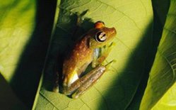
This is a region of high biodiversity in both the flora and fauna. As many as 181 mammals exist in these forests, along with 506 bird species. Reptiles and amphibians are abundant. Some of the venomous snakes that occur here are fer-de-lance (Bothrops asper), palm pit-vipers (Bothriechis spp.), coral snakes (Micrurus spp.), bushmasters (Lachesis muta), as well as boa constrictors (Boa constrictor). Iguanas (Iguana iguana) are ubiquitous and tegus lizards (Tupinambis) common.
Large and tiny ornamental fishes, turtles, dolphins (Inia geoffrensis), and manatees (Trichechus inunguis) live in the rivers.
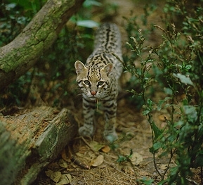
Some of the larger mammals include tapirs (Tapirus terrestris), the largest rodents in the world, capybaras (Hydrochaeris hydrochaeris), jaguars (Panthera onca), collared peccaries (Tayassu tajacu), and primates such as black spider monkeys (Ateles paniscus), red-handed tamarins (Saguinus midas), common squirrel monkeys (Saimiri sciureus), and several capuchin monkeys (Cebus spp.). Many small rodents, anteaters, opossums, and more than 100 species of bats are found.
The birds that stand out include the macaws (Ara spp.), herons (Egreta spp., Ardea spp., Bulbulcus spp.), tinamous (Crypturellus spp.), and parrots (Amazona spp., Piona spp.).
Current Status

The Japurá-Solimões moist forest is mostly intact, especially in the interior. Along the rivers that delimit the region, both intensive activities, such as mining and agriculture, and extensive activities, such as logging, agriculture, hunting, and fishing, have resulted in deforested or degraded habitat and resultant population reductions in plants and animals. No roads exist in this region except very near to Manaus, but there is heavy boat traffic. The southern half of the Puinawai National Reserve below the Guainía River in Colombia protects a diversity of habitats. Also, this region hosts a very large corridor of protected areas extending from the Mamirauá Sustainable Development Reserve in the Purus Várzea ecoregion (not included here) through the Amanã Sustainable Development Reserve (half igapó forest and half adjacent terra firme), and Jaú National Park, Brazil’s largest national park. Because people live in the reserves, the conservation goal is to manage the natural resources sustainably while protecting the rich flora and fauna.
Types and Severity of Threats
Logging, mining, cattle ranching, uncontrolled fires, and urban development all pose threats to the environment in this region. In the far east, at the border region between Brazil and Colombia, gold mining is degrading some river [[habitat]s] and destroying swaths of riverbank. Near Manaus, there is intense pressure on the environment from urban development with deforestation, pollution, and water contamination among the top threats to wildlife and the environment. The valuable timber growing on the riverbanks is diminishing from unregulated logging.
Justification of Ecoregion Delineation
As the name suggests, this ecoregion is bound on three sides by large rivers, the Japurá, Solimões, and Negro, which act as formidable barrier to the distributions of many species. The northernmost delineation, in Colombia – follows the Rio Guainía, a tributary of the Negro. The line extending south from there, along the western edge follows Navarro et al, who classifies the Colombian portion of this ecoregion as a distinct flora: "Short and tall forest-savanna mosaic with dense understory". Embedded in this ecoregion are campinarana outliers, which are distinct in flora and fauna and thus separated. Delineations for this ecoregion were based on da Silva, who identifies distinct species associations confined by these rivers which justify this ecoregion – namely species endemism. Border regions with Venezuela were referenced with Huber and Alarcon.
Additional Information on this Ecoregion
- For a shorter summary of this entry, see the WWF WildWorld profile of this ecoregion.
- To see the species that live in this ecoregion, including images and threat levels, see the WWF Wildfinder description of this ecoregion.
- World Wildlife Fund Homepage
Further Reading
- Ducke, A., and G. A. Black. 1953. Phytogeographical notes on the Brazilian Amazon. Anais da Academia Brasileira de Ciências 25: 1-46.
- Huber, O., and C. Alarcon. 1988. Mapa de vegetación de Venezuela. 1:2,000,000. Ministerio del Ambiente y de los Recursos Naturales Renovables, Caracas, Venezuela.
- Navarro, A.E.S., G.H. Peña, F.C. Lemus, J.R. Baquero, R.F. Soto. 1984. Bosques de Colombia. IGAC-INDERENA-CONIF, Bogota, Colombia.
- Ferreira, L. V. 2000. Effects of flooding duration on species richness, floristic composition and forest structure in river margin habitat in Amazonian blackwater floodplain forests: implications for future design of protected areas. Biodiversity and Conservation 9: 1-14.
- Silva, J.M.C. 1998. Um método para o estabelecimento de áreas prioritárias para a conservação na Amazônia Legal. Report prepared for WWF-Brazil. 17 pp.
| Disclaimer: This article is taken wholly from, or contains information that was originally published by, the World Wildlife Fund. Topic editors and authors for the Encyclopedia of Earth may have edited its content or added new information. The use of information from the World Wildlife Fund should not be construed as support for or endorsement by that organization for any new information added by EoE personnel, or for any editing of the original content. |


