Climate (Environmental Information)
Contents
- 1 Climate
- 1.1 Climate and Weather
- 1.2 Climate Classification Systems
- 1.3 Measuring Climate and the Climate Record
- 1.4 Solar Radiation and Climate
- 1.5 Factors Affecting Climate
- 1.6 Atmosphere and Climate
- 1.7 Climate and the Oceans
- 1.8 Climate and Land Cover
- 1.9 Natural Climate Drivers
- 1.10 Microclimates
- 1.11 Climate Modeling
- 1.12 Further Reading
Climate
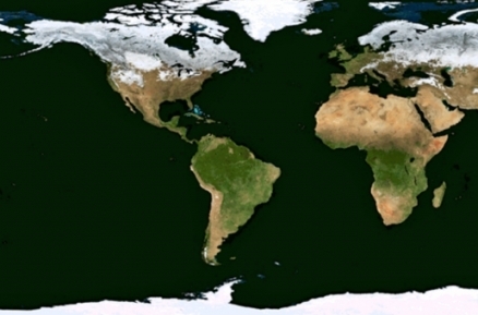
Climate is the typical pattern of conditions of the earth’s atmosphere over a given region, as defined by factors such as temperature, air pressure. humidity, precipitation, sunlight (Solar radiation), cloudiness, and winds. The World Meteorological Organization defines climate as "the statistical description in terms of the mean and variability of relevant quantities over a period of time," where an appropriate period is typically at leastthirty years.Climate can be assessed at different, overlapping geographic regions. For example, Earth is thought to have a climate that is distinct from that of other planets, while different regions of Earth are also thought to have distinct climate types. Climate is often described as the "average" conditions; however, since daily and seasonal variability (including extremes) are critical determinants, using the term "average" can be problematic.
Climate can also be defined as the exchange of mass and energy between the surface of the Earth and its atmosphere over time. Each location on Earth has a specific climate which is dictated by physical attributes (latitude, longitude, altitude, relationships to oceans and other water bodies), and influenced by surrounding biological conditions, including land cover andecological conditions. Climatology is the scientific study of climate.
Climate and Weather
It is the conditions over long time periods that distinguishes climate from weather, which describes those same conditions at a particular moment in time or over time frames of hours or days. While ranges and averages over time is the most significant difference between climate and weather, climate is also generally assessed over larger geographic areas, while weather is generally considered as the instaneous conditions at a particular place or limited area.
Climate Classification Systems
Several systems are commonly used to classify climate conditions on Earth. These include
- Köppen climate classification
- Bergeron climate classification
- Spatial Synoptic Classification
- Thornthwaite
Measuring Climate and the Climate Record
- Measuring Climate
- Paleoclimate
- Ice ages and climate cycles
Solar Radiation and Climate
Climate is rooted the interaction of radiation from the sun with the earth system and how that radiation warms the planet. Factors affecting how much radiation reaches the earth include the condition of the sun and the orbit of the earth relative to the sun. The level of radiation reaching the earth is subject to some short term disturbances (such as solar storms), the annual cycle of the earth as it orbits the sun (resulting in the seasons), and longer term shifts in the earth’s motion over periods of tens of thousands of years (see Milankovitch cycles). While the influence of changes solar radiation (Sunlight) on the earth is a subject of study for scientists addressing climate change, it is regarding by most scientists as being not a significant factor in the rapid changes in the earth’s climate over the past century. Rather, scientific attention on changes in earth’s climate are focused on primarily factors within the earth system, particularly those factors which are being impacted by human behavior (anthropogenic climate change).
Factors Affecting Climate
Important factors within the Earth-Sun system which affect climate include:
- Atmosphericconditions, includingsuch factors as cloud cover andThe concentration of various gases andparticles
- Solar fluctuations (inlcudingshort term effectssuch assolar flares;cyclical variations that occur over decades, centuries, or millennia;and very long term (billion year) changes in intensity
- Relationship of Earth to the sun, including orbital oscillations and variations in axial tilt
- The oceans, through such factors as techtonically determined distribution of land and water, long-distanceocean currents, heat storage, and absorption of greenhouse gases
- Albedo, or reflectivity of dfferent colored surfaces
- Land cover through factors like mountains,valleys ande plains,the extent and type of ice, snow and water, type and extent and types of vegetation cover
- Human activities influence some of these, includingagricultural choices such as emphasis on grazing animals and rice cultivation, both of which lead to high methane levels, one of the most potent greenhouse gases; andurbanization and agriculture, which can affect albedo over large areas.
Atmosphere and Climate
Without Earth's atmosphere, most incoming solar radiation would be reflected back into space or absorbed and quickly reradiated, and the earth would be significantly colder that it is today; consequently life as we know it could not be sustained. The warming of the planet by the trapping of solar radiation by the atmosphere is known as the greenhouse effect. A small fraction of gases in the atmosphere absorb heat reradiated that that cause the greenhouse effect are known as greenhouse gases. Long term changes in the concentration of various greenhouse gases change the level of warming caused by the greenhouse effect and change the Earth’s climate. These issues are at the core of climate change and global warming:
- Albedo
- Cloud cover
- Ice and Snow cover
Climate and the Oceans
The oceans and seas of the world have a profound effect on climate, not only due to the massive amount of thermal exchange between the atmosphere and water, but also due to the kinetic energy and gas exchanges that occur on a massive scale. The inherent spatial heterogeneity of the world's oceans create dynamic drivers to the atmospheric system, of a continually changing nature. Small changes in ocean currents or gyres can have a strong impact on atmospheric circulation.
Thermohaline circulation (THC) refers to ocean currents driven by fluxes of heat and salinity gradients throughout the seas of the world.The phenomenon of thermohaline circulation includes formation of cold deepwater masses, deep-sea movement of this cold water, subsequent ocean interior mixing of heat and salt, and return flow of surface warm currents.
Thermohaline circulation can be affected by variations in climate, but any alteration in thermohaline circulation can conversely have an affect on global climate. The feedback mechanisms between ocean and climate are incompletely understood, but generally the oceans are a damping effect on the faster frequency atmospheric meteorological oscillations.
Climate and Land Cover
Land cover has profound influence over climate through a variety of mechanisms. Changes in vegetative cover, for example, can alter the Earth's albedo and hence modify surface temperatures; moreover, reduction in vegetative cover leads to increase in carbon dioxide concentrations in the atmosphere and hence contribute to temperature elevation. Correspondingly when vegetative cover is replaced with urbanization, an urban heat island effect can arise, where surface temperatures not only rise, but remain elevated due to heat storage in large amounts of pavement and masonry material.
Reduction in vegetative cover has further impacts on climate through the hydrologic cycle. Large scale reduced vegetative cover, such as deforestation, can increase surface runoff (Surface runoff), not only aggravating flooding peaks, but also reducing the near surface water holding capacity. These effects are thought to be widespread in drought increases in Africa over the last four decades. In Morocco, for example, the water runoff is concentrated more in the spring months, aggravating spring flooding, but also depriving humans and animals from summer surface water supplies, and likely contributing to a reduction in evapotranspiration and precipitation. The issues of the region of Africa are complex, and very likely factors of urbanization and overgrazing are instrumental in the trend of drought and desertification ot this region.
Natural Climate Drivers
There are several natural large scale climate driving phenomena generated in the Earth crust or oceans, which can affect climate over large regions of the globe for periods of at least several years:
- El Niño and La Niña - Southern Oscillation
- Volcanic emission
- Degassing of subsea methane clathrates
Microclimates
Microclimate refers to the set of meteorological parameters that characterize a limated locale. Examples of areas for which a microclimate might be defined are:
- A small watershed or portion of a larger basin (examples: Napa River watershed, California, Danube Delta Biosphere Reserve, Romania)
- A localized component of a mountain range or smaller mountain range (examples: Piatra Craiului National Park, Romania, Table Mountains, California (Climate))
- A town or village (examples: Windhoek, Namibia, Stonehaven, Scotland)
In some cases microclimate is construed as extremely localized phenomena; for example, in the design of sound barriers for urban freeways, the scale of interest may be chiefly over tens of meters, and microclimate and topographic data may be collected within an extremely limited area in order to analyze the proper mitigation design.
The parameters typically associated with microclimate include conventional variables such as air temperature, relative humidity, solar insulation flux, wind speed, wind direction; however, there may even greater attention on parameters that are associated with localized effects such as: air thermal gradient, soil temperature, soil thermal gradient, soil moisture content, wind turbulence (vertical and horizontal), near surface wind shear. The study of microclimates is often geared toward understanding the impacts upon habitat and biodiversity, but also upon agricultural production and upon human comfort. Microclimates are extremely important in understanding the phenomena of air pollutant dispersal, noise pollution, thermal pollution and other environmental science factors.
Climate Modeling
Mathematical models have been employed since the middle of the twentieth century to describe and predict climate, based on a range of variables (see here for a complete history of climate modeling). The scale of climate modeling ranges includes localized effects on microclimates (microscale modeling); regional effects for larger geographic regimes (mesoscale modeling); and, in the latter part of the twentieth century environmental scientists began the serious undertaking of global modeling of climate effects. Microscale modeling can be driven by simple terrestrial based instrumentation such as anemometers, ground mounted thermal sensors and humidity guages, whereas regional and global modeling places more demand upon aircraft, balloon and satellite platforms with remote sensing applications.
Further Reading
- H.J.Critchfield. 1974. General Climatology: Third Edition, Prentice-Hall, New Jersey, USA, 446 pp.
- P.Kabat. 2004. Vegetation, water, humans and the climate: a new perspective on an interactive system. Springer. 566 pp.
- Siegfried Demuth. 2006. Climate variability and change--hydrological impacts. IAHS International. 707 pp.

