Western Himalayan alpine shrub and meadows

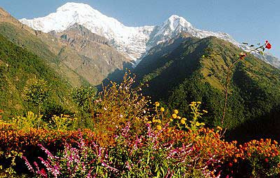
Annapurna Conservation Area, Chomrong, Nepal. (Photograph by Dirk-Jan de Haan, World4view)
The Western Himalayan Alpine Shrub and Meadows ecoregion has large areas of habitat suitable for conserving viable populations of the high-altitude Himalayan predator, the snow leopard (Uncia uncia), and the large montane ungulates such as blue sheep (Pseudois nayur), Himalayan tahr (Hemitragus jemlahicus), Himalayan musk deer (Moschus chrysogaster), and serow (Capricornis sumatraensis), which form its prey. Wild yak (Bos grunniens) used to inhabit the innermost ranges of the western Himalayan alpine meadows adjacent to the Tibetan Plateau. These large beasts are now considered locally extinct throughout most of their former distribution and have not been recorded in Indian territory recently. Most of the ecoregion's mammals are small species, such as the Himalayan palm civet, pale weasel, Himalayan weasel, pikas, and voles, that scurry about the undergrowth and among the boulders.
In spring and summer the meadows, known locally as the bughiyals, become a resplendent tapestry of contrasting blue, purple, yellow, pink, and red flowers of delphiniums, gentians, poppies, roseroots, louseworts, anemones, and asters. The shrub layer closer to the treeline is bright with the flowers of Rhododendron shrubs.
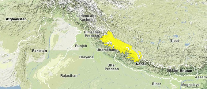
Location and General Description
This alpine area was formed during the early Pleistocene, after a long geological process that thrust up the Inner Himalayas. The beginning of the process dates back to the Cretaceous, when the drifting Deccan Plateau collided with the northern Eurasian continent, causing the latter to buckle upward. The Himalayan Mountain Range now comprises three parallel east-west-directed zones: the Outer, Middle, and the imposing Inner Himalaya, which contains the tallest peaks in the world.
There is a general trend of decreasing moisture (Precipitation and fog) levels from east to west along the length of the Himalayan Mountain Range. The southwestern monsoon that provides most of the moisture originates from the Bay of Bengal and expends most of its precipitation in the eastern Himalayas. Therefore, the west receives less |rainfall, usually ranging from 1,500 to almost 1,900 millimeters (mm). The treeline responds to the drier conditions in the west by being almost 1,000 m lower than in the east.
The ecoregion experiences cold winters during which snowfall blankets the slopes. Snowmelt during April and May results in additional moisture (Precipitation and fog). The summers are mild. Cloudy days and fog are common, with clear skies limited to a few hours during the day. Climate and aspect influence vegetation. The north-facing slopes, which are less exposed to sunlight, are cooler and retain more moisture. These harbor a more typical Himalayan flora. But within this general trend, the complex topography also creates rainshadows, resulting in very localized climatic variations.
The early vegetation in this region was dominated by Quercus semecarpifolia and Betula utilis, but periodic climatic changes and glaciation events have given rise to the present alpine vegetation. The forest-alpine transition is now marked by krummholz-type vegetation of Rhododendron campanulatum, Rhododendron barbatum, Salix spp., and Syringa emodia. The alpine scrub flora is dominated by several colorful, dwarf rhododendron species, among which are other shrubby species such as Hippophae rhamnoides and Cotoneaster microphyllus. Along the transition area with the alpine conifers lower down, junipers (Juniperus spp.) contribute to the floral diversity. Many of the rhododendron species in these western Himalayan [[habitat]s] are different from those found in the eastern extent of this long mountain range.
The rich meadow flora is dominated by herbaceous plants, especially species of Anaphalis, Aster, Cynanthus, Jurinea, Morina, Potentilla, Gentiana, Delphinium, Gentiana, Meconopsis, Pedicularis, Anemone, Aster, Polygonum, Primula, and Saussurea. Willows (Salix spp.) line the sides of shallow, montane streams. At higher elevations, species of Saxifraga, Allium, Corydalis, Eriophyton, Stellaria, Soroseris, and Cremanthodium grow on the alpine scree with scattered rocks and boulders. A steppe-type vegetation of Caragana pygma, C. gerardiana, Lonicera spinosa, Juniperus squamata, J. indica, Ephedra gerardiana, Hippophae tibetana, Myricaria rosea, Lonicera spinulosa, and Berberis spp. is found in the northern extents of the ecoregion.
Biodiversity Features
The ecoregion contains several localized hotspots of floral diversity and endemism. Notable areas are the Valley of Flowers, Nanda Devi (India's second-highest mountain), Tinker Valley, Rara-Shey-Dolpho, Dhorpatan-Annapurna, Pokhara, and Gorkha-Himalchuli.
The snow leopard (Uncia uncia) and the Tibetan wolf (Canis lupus) roam these high-altitude landscapes, hunting large ungulates such as the goral (Nemorhaedus goral), serow (Naemorhedus sumatraensis), Himalayan tahr (Hemitragus jemlahicus), argali (Ovis ammon), and blue sheep (Pseudois nayur). This ecoregion probably represents the eastern limit of the distribution of the brown bear (Ursus arctos); there have been unconfirmed reports of this species from western Nepal.
The forty mammal species known in the ecoregion do not include any endemics. But several species are threatened, including the snow leopard, serow, Himalayan tahr, argali, and Himalayan goral.
The bird fauna is richer, with almost 130 species, including one that is endemic to the ecoregion (Table 1). This near-endemic species is shared with the other western Himalayan [[ecoregion]s] (Western Himalayan Broadleaf Forest and Himalayan Subtropical Pine Forests).
|
| ||
|
Family |
Common Name |
Species |
|
Phasianidae |
Cheer pheasant |
Catreus wallichi |
Other birds that are typical of these high-altitude ecosystems and can be used as focal species for conservation management planning include the blood pheasant (Ithaginis cruentus), western tragopan (Tragopan melanoephalus), Satyr tragopan (Tragopan satyra), and Himalayan monal (Lophophorus impejanus), which inhabit the shrubby ground cover, and the large avian predators, lammergeier (Gypaetus barbatus), golden eagle (Aquila chrysaetos), and Himalayan griffon (Gyps himalayensis).
Current Status
Because of its remoteness and inaccessibility, much of the [[ecoregion]'s] habitat is still intact. There are eleven protected areas that cover more than 8,500 square kilometers (km2) representing about 25 percent of the ecoregion area (Table 2). These include several large protected areas (e.g., Shey-Phuksundo, Annapurna, Kedarnath, Nanda Devi, and Dhorpatan). Three large protected areas also overlap across adjacent ecoregions (Table 2).
|
| ||
|
Protected Area |
Area (km2) |
IUCN Category |
|
Royal Dhorpatan Hunting Reserve |
870 |
|
|
Govind Pashu Vihar |
140 |
IV |
|
Govind |
490 |
II |
|
Lippa-Asrang WS |
60 |
IV |
|
Raksham Chitkul |
30 |
IV |
|
Gangotri |
270 |
II |
|
Kedarnath |
970 |
IV |
|
Valley of Flowers |
70 |
II |
|
Nanda Devi |
810 |
|
|
Royal Dhorpatan |
100 |
|
|
Shey-Phoksumdo National Park |
3,590 |
IV |
|
Annapurna Conservation Area |
1,260 |
|
|
Total |
8,660 |
|
Types and Severity of Threats
 Annapurna Conservation Area, Poon-Hill, Nepal. (Photograph by Dirk-Jan de Haan, World4View)
 Grazing and trampling by large herds of domestic livestock, including cows, buffalos, horses, sheep, goats, and yak, are beginning to severely degrade the natural habitat. As livestock herds increase in number and size and exceed the carrying capacity in the lower habitats, pastoralists have begun to drive the herds into these alpine meadows, increasing the degradation threats here. An overnight campsite for pastoralists and their livestock as they migrate up and down the [[mountain]s] can lay bare an area up to a hectare.
Overexploitation of rare medicinal herbs is another conservation threat in the area. Most of the collection sites are already under heavy grazing pressure, and the harvest of medicinal plants places additional stresses on this fragile ecosystem.
Adding to the localized degradation threats are several historical trade routes between India, Nepal, and Tibet that are still heavily used in this region. The accessibility brings with it associated degradation threats such as fuelwood collection and heavy use by people and pack animals. Because the ecoregion includes national borders, concentrations of defense personnel exploit its natural resources, especially timber and fuelwood.
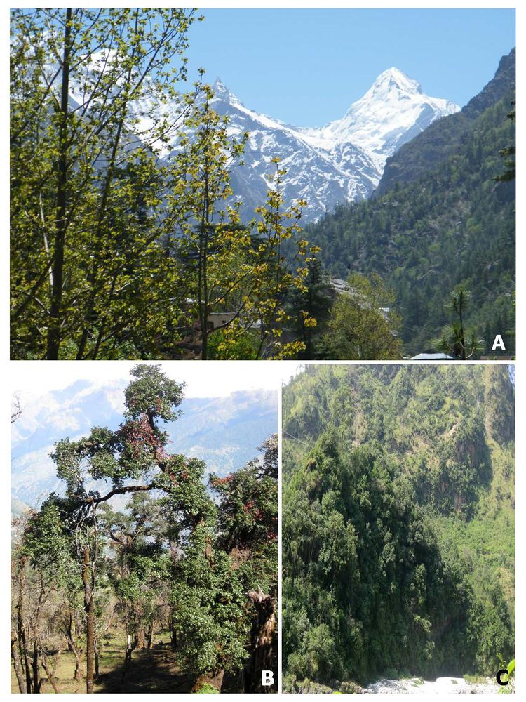
 Spectacular glimpses of Western Himalayan alpine meadows. Source: Saikat Basu, own work
Additional information on this ecoregion
- For a shorter summary of this entry, see the WWF WildWorld profile of this ecoregion
- To see the species that live in this ecoregion, including images and threat levels, see the WWF Wildfinder description of this ecoregion.
- World Wildlife Fund Homepage
| Disclaimer: This article is taken wholly from, or contains information that was originally published by, the World Wildlife Fund. Topic editors and authors for the Encyclopedia of Earth may have edited its content or added new information. The use of information from the World Wildlife Fund should not be construed as support for or endorsement by that organization for any new information added by EoE personnel, or for any editing of the original content. |


2 Comments
Glen Godfrey wrote: 02-10-2011 23:16:55
Brahma Kamal found in Kedarnath, is going to vanish soon due to climatic changes. http://www.travelindia360.net/kedarnath-the-abode-of-lord-shiva.html
Vinay Tandon wrote: 09-22-2010 04:13:49
The ecoregion's longitudinal limits need to be more accurately drawn as this will include several PAs not shown right now in the write up. Road building and hydro electric projects now pose a major threat to the ecology and biodiversity of the region. Many, many species including those listed in the write up are under various degrees of threat. It would help to indicate IUCN Red Listing for those species where threat assessment has been done, like for many medicinal herbs. Migratory grazing routes criss-crossing habitats of wildlife and the generally escalating human wildlife conflict in the ecoregion are other factors that threaten the wildlife of the area.