Water profile of St. Lucia
Contents
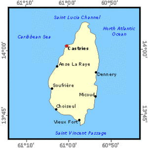
Geography and Population
St. Lucia, located at latitude 13° 50? N and longitude 60° 59? W, is the second largest of the Windward Islands with an area of 616 square kilometers (km2). The island is 42 kilometers (km) long and 22 km wide with a very irregular, steep terrain especially in its interior, which rises to a height of 950 meters (m). The island boasts very fertile volcanic soils but, due mainly to topographic constraints, only 28% (17,360 ha) of the total land area has been classified as suitable for agriculture. According to the 1996 Agricultural Census, 15,784 hectares (ha) are under cultivation, of which approximately 12% are under temporary and fallow cropping, and the remainder, some 13,945 ha, is under permanent crops.
The island's population was estimated at 146,000 inhabitants in 1997 (a density of 235 inhabitants/km2), of which 62.3% was rural population. The population has experienced a growth rate of 1.3% in the 1990-97 period. As agricultural land availability continues to decline, so too has the number of permanent agricultural workers decreased from 16% of the employed population in 1986 to 13% in 1996. Notwithstanding this reduction, agricultural production continues to be one of the most important economic activities in the country, accounting for 13% of the export, and more than 13% of the Gross Domestic Product (GDP) over the period 1985 to 1995. The banana industry is the most important contributor to agricultural GDP, accounting for more than 30% of export earnings in 1995.
Climate and Water Resources
Climate
St. Lucia has a tropical climate strongly influenced by its broken, rugged topography. Rainfall increases and temperature decreases with altitude, and the western side of the island experiences higher rainfall. Annual rainfall averages about 1,600 millimeters (mm) in the northern and southern extremities of the island to about 3,500 mm in the higher altitudes. The island experiences distinct rainy and dry seasons; the rainy season extends from June to December while February, March and April are the driest months.
Water Resources
The island is subdivided into 37 water catchments or river basins from which a number of perennial streams emanate. Though a hydrological network was installed in the mid-1980s, the water resources available from these surface sources have not been quantified.
Water Withdrawal
A rapidly increasing population and growing tourism sector have resulted in significant increases in water consumption. This increased consumption has led to the commissioning in 1995 of a new water supply system to serve the northern half of the island. The main component of the system includes a 3.41 million cubic meters (m3) storage facility, designed to satisfy the demands for domestic, industrial, commercial, hotel, and institutional supply. Total rainy season production is approximately 41,000 m3 per day. It falls to 24,500 m3 per day in the dry season, when the Water and Sewerage Authority (WASA) has to resort to water rationing.
WASA operates approximately 32 small to medium water sources and 30 treatment plants. WASA reports indicate that the amount of water supplied annually is about 12.53 million m3, with 100% of the urban and 90% of the rural population having access to potable water. Attempts to develop groundwater for public supply have had very limited success on the island. A 1998 study on improved water supplies for the south of the island concluded that this source is unlikely to make a significant contribution except in small isolated rural communities through the use of hand pumps.
Irrigation and Drainage Development
Agriculture in St. Lucia is in a transitional state after tropical storm Debbie hit the island in 1994. Development of the agricultural sector, propelled by preferential arrangements for the export of bananas, brought with it the development of more marginal lands in the upper catchment areas. This development has resulted in extensive denudation of these catchment areas and an attendant loss of vegetative cover on the steep slopes, an increase in the incidence of landslides, soil erosion, and siltation of drainage systems in the valley bottoms and ultimately, increased incidence of flash flooding. Banana is the primary crop grown in these valleys and because this crop does not tolerate waterlogging, farmers in the valley bottoms have over the years come to appreciate the need for proper in-field surface drainage. Contour drainage is also widely practiced on hillside farms. In all cases, drainage is designed for the discharge of stormwater runoff and not for excess irrigation application. While farmers are generally able to manage their in-field drainage systems, problems arise because the bed levels of streams and rivers, which serve as outlets to these systems, are getting increasingly silted.
During the period of the island's colonization, a number of aqueducts were built to serve the water needs of large estates in the important agricultural areas on the island. With the evolution of the banana industry, the larger estates were again quick to adopt the technology of the time and supplementary irrigation was applied utilizing large gun sprinklers. Very little attention was paid at the time to application and other irrigation efficiencies.
Currently, a fairly large and well managed irrigation system exists in Fond State, and is used to support the production of a wide range of crops, including bananas, pineapples, and vegetables. In addition, there is a centrally organized scheme in the Mabouya Valley and there are a few individual small farm systems. In total, about 297 ha are irrigated. Of that figure, 65% apply to five large holdings of more than 15 ha each. Methods of application include drip and sprinklers as well as flooding of field drains. Irrigated crops include bananas, vegetables, limited amounts of tree crops and some 65 ha of pasture. Details on actual amounts abstracted and other data on irrigated agriculture are not currently recorded and no further analysis is therefore possible.
A recent FAO (Food and Agriculture Organization (FAO)) "Prefeasibility Study on Small-Scale Irrigation" estimated that the investment cost for irrigation schemes ranges from 6,400 to 16,000 US$/ha (the higher cost refers to a gravity-fed system). Annual operating costs were estimated at 475 US$/ha for a typical sprinkler pumping scheme, with maintenance costs estimated at 125 US$/ha for the same scheme and 90 US$/ha for a gravity-fed scheme.
The island has had no experience to date of any of the adverse environmental effects of irrigation, as irrigation has never been a very widespread or intensive practice.
Institutional Environment
The Water and Sewerage Authority (WASA), a parastatal entity, is vested with the responsibility for water supply and sewerage on the entire island. While it is generally assumed otherwise, WASA has no legal rights to water over persons in possession of land riparian to a stream or above a groundwater source. Although the Water and Sewerage Authority Act requires WASA to "establish a hydrological network and carry out periodic water surveys", the Agricultural Engineering Services Division (AESD) of the Ministry of Agriculture has, over time, assumed this responsibility. The importance of hydrological data collection to the AESD grew out of its mandate within that Ministry to develop irrigation water supplies for farmers. Currently this Division is the only one providing support services to farmers in the area of irrigation system design and operation. It is, however, very poorly equipped with respect to the availability of trained personnel and is unable to provide the level of services required.
There are three main legal instruments of direct relevance to the island's water resources. They are the Land Conservation and Improvement Act No. 10 of 1992, the Forest, Soil and Water Ordinance No. 25 of 1945 and the Water and Sewerage Act (1984). A FAO (Food and Agriculture Organization (FAO)) study on small-scale irrigation, in reviewing these instruments, recommended that the Land Conservation and Improvement Act be reviewed and amended to accommodate changes undergone since its first enactment, and to accommodate provisions for "Rights on Water" and "Water Resources Planning". The study also recommended that land-use regulatory provisions of the Act be implemented to minimize the possibility of pollution due to drainage from irrigated fields.
More recently, the Government of Saint Lucia has taken the policy decision and action to transform WASA into a private corporate entity called WASCO. In this regard, new legislation has been enacted in the form of the Water and Sewerage Act (No. 13 of 1999). This Act has led to the appointment of the National Water and Sewerage Commission, which is to function primarily as the economic regulator.
Trends in Water Resources Management
The Watershed and Environmental Management Project completed in 1997 undertook a detailed examination of the issues involved in the management of the island's water resources. The report recommends a number of institutional and other essential changes for a more comprehensive and cohesive approach toward watershed management. Although to date none of these institutional changes has been made, there is growing recognition of the need for water resources planning and management at the national level. Within the agricultural sector, it is now understood that irrigation must be regarded as equal in importance to fertilizers and other such inputs. As competition increases among water users, it is important that farmers adopt methods which will increase irrigation efficiencies.
In order that the water resources of the country could be better managed, the Ministry of Agriculture, Forestry, Fisheries and the Environment is about to establish a Water Resources Unit to specifically address the issue of water for agriculture.
Further Reading
- FAO. 1998. Prefeasibility study for small-scale irrigation. Report /98/082 TCP-STL. Rome.
- The Caribbean Conservation Association. 1991. Country Environmental Profile. Saint Michael. Barbados.
- Ministry of Agriculture, Lands, Fisheries & Forestry. 1999. Portrait of the main findings: summary of censal results. Government of St. Lucia. Castries.
- Harvey, W. 1997. Water resources management and water use in the agriculture sector of the windward islands. Main Report. Bridgetown. Barbados
| Disclaimer: This article is taken wholly from, or contains information that was originally published by, the Food and Agriculture Organization. Topic editors and authors for the Encyclopedia of Earth may have edited its content or added new information. The use of information from the Food and Agriculture Organization should not be construed as support for or endorsement by that organization for any new information added by EoE personnel, or for any editing of the original content. |