Water profile of Afghanistan
Contents
Geography and Population
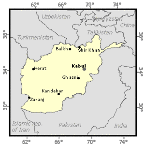
Afghanistan (33°00' North, 65°00' East) is a landlocked country in central Asia with a total area of about 652,000 square kilometers (km2). It is bordered by Turkmenistan, Uzbekistan, and Tajikistan to the north, China to the northeast, Pakistan to the east and south, and Iran to the west. It is characterized by its rugged terrain and an average elevation of 1,100 meters (m) above sea level, ranging from 150 to 8,000 meters. About three-quarters of the territory consist of mountains and hills, while lowlands include river valleys in the northern part, and desert regions in the southern and southeastern part.
The political instability prevailing in Afghanistan makes it extremely difficult to obtain reliable information on basic agricultural indicators. Most of the information presented below dates back to years prior to 1978.
The cultivable area has been estimated at 8 million hectares (ha), which is 12% of the total area.
In 1991, the area cultivated with annual crops was estimated at 3.2 million ha, which is only 82% of the area cultivated in 1978. In addition, about 144,000 ha were estimated to consist of permanent crops in 1990.
The total population is 20.1 million (1995), of which 80% is rural. Up to 6 million Afghans, perhaps one-third of Afghanistan's 1978 population, are estimated to have fled the country because of the war. Another 800,000 to 1 million people are thought to have been displaced by the warfare to the more remote, mountainous regions of the country or to the relative security of the country's few towns and cities. In 1991, 67% of the labor force was employed in the agricultural sector and agriculture accounted for almost 46% of the nation's gross domestic product (GDP).
Climate and Water Resources
Climate
Afghanistan is characterized by a continental climate, though the presence of mountains causes many local variations. Temperatures vary from - 10°C in winter to 34°C in summer. The annual distribution of rainfall shows a picture of an essentially arid country, with more than 50% of the territory receiving less than 300 millimeters (mm) of rain. With the exception of the eastern border regions, which are at the far edges of monsoon influence, about 50% of the precipitation occurs in winter (January to March), much of which falls in the form of snow in the central mountainous regions. A further 30% falls in spring (April to June). The runoff from snow melt, in the spring and summer months when daytime temperatures are high, is the lifeblood of Afghan agriculture.
Water Resources
Based on the hydrographic systems, the country can be divided into four zones:
- the northern basin (24% of the territory) with the Amu Darya and its tributaries (14%), which drain towards the Aral sea, and the rivers of northern Afghanistan (10%), which disappear within the country before joining the Amu Darya;
- the western region (12%) consisting of the Hari Rud river basin (6%) and the Murgab river basin (6%), both rivers disappearing in Turkmenistan;
- the southwestern basin (52%) with the Helmand river flowing towards the Sistan swamps, located on the border of Iran and Afghanistan. In 1972, a document was signed between Afghanistan and Iran to allocate a discharge of 26 meters per second (m/s) of Helmand river water to Iran all year round;
- the eastern Kabul basin (12%), which is the only river system having an outlet to the sea, joining the Indus at Attock in Pakistan.
Internal renewable water resources are estimated at 55 cubic kilometers per year (km3/year). The Kunar river, which originates in Pakistan, crosses the border with an average annual flow of 10 km3 and joins the Kabul river at Jalalabad about 180 km further downstream. The Kabul river flows again into Pakistan 80 km further downstream.
Total water withdrawal was estimated at 26.11 km3 in 1987, of which 99% was consumed for agricultural purposes. Recently, there has been a large development of groundwater use in some provinces.
In 1986, there were two dams higher than 15 m. The installed capacity of the hydroelectric plants was 281 megawatts (MW) in 1992, which is about 70% of total installed capacity. There is considerable potential for the generation of hydropower, both by large dams and micro-hydropower stations.
Irrigation and Drainage Development
By 1978, the surface water potential was more or less fully exploited by existing irrigation systems if no further regulation works were going to be constructed, although the efficiency of exploitation left room for considerable improvement. Irrigated areas could have been expanded by building major dams and other water regulation structures, all of which required large capital investment. There is no estimate, even rough, of irrigation potential.
An estimated 27 to 36% of all irrigation systems were directly affected by war and these figures do not take into account the indirect effects of neglect and abandonment.
Agriculture was said to be almost entirely dependent on irrigation, although this view tended to ignore the large areas of rainfed wheat grown on the steep rolling hills and steppes in the north. The most reliable figures for irrigated areas date back to 1967, giving a total of 2,385 740 ha. Irrigated land can be divided into 4 classes, according to the origin of the irrigation water. They are:
In 1963, some 114,000 ha were reported to be equipped for sprinkler irrigation. From 1967 up to the present, many different figures have been given for irrigated, rainfed and total cultivated areas. Unfortunately, most of them are unreliable. Some pre-war publications suggest that 2.8 million ha were cultivated, of which 1.4 million had sufficient water to support double-cropping. Figures for rainfed areas are generally cited as 1.4 million ha, but recent satellite data (1992) indicate that the area might be much larger - a figure of 3.1 million ha has been suggested.
Irrigation systems can be divided into four main categories:
- Kareze systems. A kareze (qanat) is an unlined tunnel in the hillside, bringing water by free flow from underground aquifers to be used for surface irrigation. Dug by local craftsmen from shafts at close intervals, they are small in size but may be many kilometers in length. It is estimated that 6,470 kareze still supply water to 167,750 ha, as in 1967, the date of the last inventory. It should be noted that kareze are often used for domestic water supply.
- Small-scale informal surface water systems. These are the traditional irrigation systems, many of which have been established for centuries. In the past, maintenance and reconstruction were generally arranged on a traditional informal or communal village basis, and water rights were determined and recognized in a similar manner. Technical knowledge and operational systems were thus dependent on traditional community structures, and were largely retained in the memory of individuals.
- Large-scale informal surface water systems. These are located mainly in the plains and along the main valleys. Although they are called informal, their operation and maintenance was highly structured. Repair and maintenance works can mobilize very large quantities of labor for a long period and farmers in the command area have to contribute in labor, cash, or kind. Large parts of these schemes have been abandoned because of the sterilization of the land (waterlogging and salinization), particularly in the Hari Rud, Farah, Rud and Helmand valleys.
- Formal irrigation schemes. Formally organized large-scale irrigation systems are a relatively recent innovation. However, by the late 1970s three large-scale modern irrigation systems had been built and were in operation: the Helmand-Arghandab system in the south-west, the Ghaziabad farms near Jalalabad in the east, and the Kunduz-Khanabad system in the northern part of the country. By 1993, only a very small part of these schemes was still operational. Land tenure was different from most traditional systems in that ownership of land was registered. Some schemes were operated under private land ownership agreements, while others were operated as state farms where land ownership was deeded to the State.
In 1993, the average cost of irrigation scheme rehabilitation was estimated at $US 200/ha for small schemes. Rehabilitation costs for large, modern schemes, including main structures, are considerably higher.
Cropping intensity varies widely from system to system according to the relative scarcity of water in relation to land. It might reach 200% in large formal systems with water control (upstream of the river systems, when climatic conditions allow an early wheat crop), while in other systems up to two-thirds of the equipped area are kept fallow each year on a rotation basis.
Per capita wheat consumption in Afghanistan is one of the highest in the world. Pre-war, irrigated land produced 77% of all wheat and 85% of all food and agricultural crops. About 1 million ha of wheat was irrigated in 1990, although the 1978 figure may be as high as 1.3 million ha, and irrigated yields are estimated to be 3 times rainfed yields. Global cereal yields are estimated to have decreased by 30% between 1978 and 1987.
Floods are generally violent and can cause serious damage to agricultural land or inhabited areas. About 50 gabion river protection works and 50 flood protection masonry walls were constructed before the war, mostly in the Nangarhar and Parwan provinces, in the eastern part of the country.
Institutional Environment
The Central Authority for Water and Sewerage is responsible for the urban water supply and sanitation, under the aegis of the Central Authority for Housing and Town Planning, while the Ministry of Rural Development and Rehabilitation is responsible for the rural water supply.
The Ministry of Water and Power was formed in 1988 as the merger of the former separate Ministry of Irrigation and Water Resources and the Ministry of Power. It is in charge of the hydrological network, the development of water resources and of large-scale and modern irrigation systems, especially of diversion structures on the rivers and main canals. The Ministry's Department of Water Management is operational in most provinces.
The Department of Irrigation of the Ministry of Rural Rehabilitation and Development is in charge of small-scale irrigation systems and of irrigation systems downstream of the diversion structures on the main canal.
The Ministry of Agriculture is in charge of production and, therefore, of on-farm infrastructure and water management.
An Irrigation Secretariat within the Ministry of Planning is coordinating irrigation development planning.
In some cases, the Irrigation Development Authorities are still operational. They are in charge of the development, operation, and maintenance of large-scale irrigation systems. Government construction and consulting companies involved in irrigation are:
- The Helmand Construction Company (HCC)
- The Spinghar Construction Unit
- The Water & Power Engineering Company of Afghanistan (WAPECA)
A water law was passed in 1981.
Trends in Water Resources Management
In 1993, the Ministry of Agriculture's most pessimistic estimates were that only 750,000 ha were still under satisfactory irrigation. A number of programs have been proposed and some launched in order to rehabilitate the infrastructures, the human and other resources and the institutions and social infrastructure as related to irrigated agriculture.
At the same time, rehabilitation works have to be carried out in a context of scarce human resources and funds, because the people must also address several other urgent needs and repair other basic infrastructures. Therefore, apart from improving water management and reducing water losses to increase irrigated areas, rehabilitation works have to aim at reducing future maintenance requirements through proper design.
Under the last five-year plan, 76% of the budget for the agricultural sector was earmarked for irrigation works.
Due to the increasing use of groundwater in recent years, there is a risk of over-exploitation and depletion in the absence of regulating and licensing authorities, which in some places might lead to the drying out of kareze or qanats, springs, and wells, depending on the same water sources.
Further Reading
- World Factbook: Afghanistan, Central Intelligence Agency.
- Water profile of Afghanistan, Food and Agriculture Organization.
- FAO. 1965. Survey on land and water resources. Afghanistan. Six volumes. Kabul.
- UNDP. 1993. Afghanistan rehabilitation strategy: Action plan for immediate rehabilitation. Six volumes. Kabul.
- UNORSA. 1993. Afghanistan irrigation subsector profile: Elements for a two-year agriculture rehabilitation action plan. Report prepared by T. Facon, FAO. Islamabad, Pakistan.
| Disclaimer: This article is taken wholly from, or contains information that was originally published by, the Food and Agriculture Organization. Topic editors and authors for the Encyclopedia of Earth may have edited its content or added new information. The use of information from the Food and Agriculture Organization should not be construed as support for or endorsement by that organization for any new information added by EoE personnel, or for any editing of the original content. |