United States Virgin Islands
| Topics: |
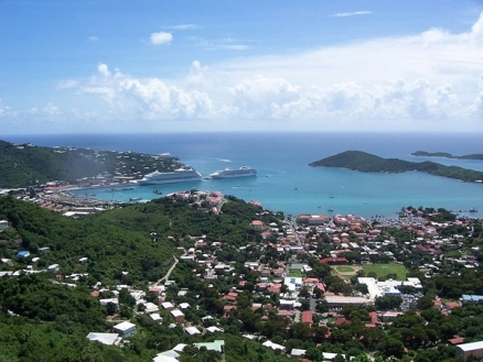
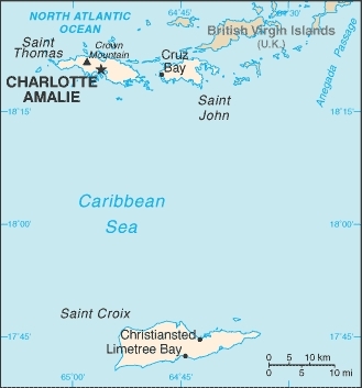
Countries and Regions of the World Collection  The United States Virgin Islands are a group of three major islands (Saint Croix, Saint John, and Saint Thomas) and several smaller islands located in the Caribbean Sea, 90 miles east of Puerto Rico.
The islands are a territory of the United States. The islands arepart of the island group referred to as the Leeward Islands which are part of the Lesser Antillies and the region known as the Caribbean or the West Indies.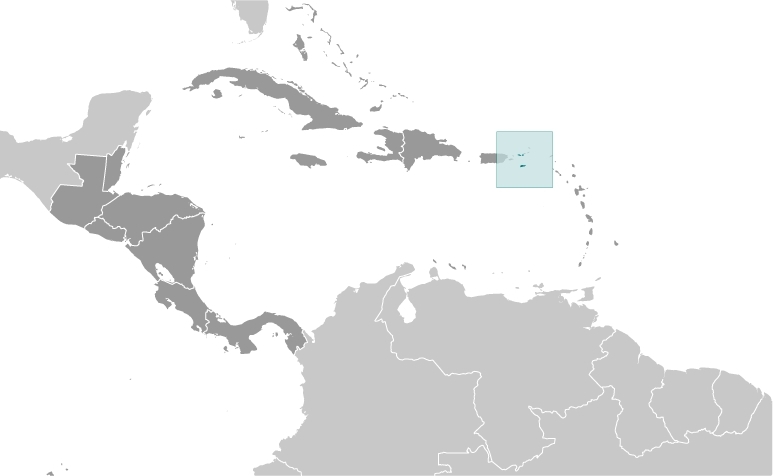
Its major environmental issue is a lack of natural freshwater resources.
During the 17th century, the archipelago was divided into two territorial units, one English and the other Danish.
Sugarcane, produced by slave labor, drove the islands' economy during the 18th and early 19th centuries.
In 1917, the US purchased the Danish portion, which had been in economic decline since the abolition of slavery in 1848.
Contents
Geography
Geographic Coordinates: 18 20 N, 64 50 W
Area: 1,910 square km (346 sq km of land and 1,564 sq km of water)
arable land: 5.71%
permanent crops: 2.86%
other: 91.43% (2005)
Coastline: 188 km
Maritime Claims: Territorial sea to 12 nautical miles and an exclusive economic zone to 200 nautical miles.
Natural Hazards: Several hurricanes in recent years; frequent and severe droughts and floods; occasional earthquakes.
Terrain: Mostly hilly to rugged and mountainous with little level land. The highest point is Crown Mountain (475 meters)
Climate: Subtropical, tempered by easterly trade winds, relatively low humidity, little seasonal temperature variation; rainy season September to November. The main hurricane track passes through these islands.
Capitol: Charlotte Amalie
Ecology and Biodiversity
See Leeward Islands moist forests
Large western portions of each of the US Virgin Islands are encompassed by a forest ecoregion known as the Leeward Islands moist forests ecoregion. This ecoregion is found in various proportions on the Caribbean’s Leeward Islands and is characterized by rugged, volcanic mountains covered in moist tropical forest. Specifically, this ecoregion covers approximately 85% of Basse Terre of Guadeloupe, the central, mountainous portions of Montserrat, St. Kitts and Nevis, small southern portions of Antigua, and western portions of the U.S. and British Virgin Islands.
Nineteen percent (6,623 ha) of the total land area of the US Virgin Islands is considered a protected area. The protected areas include the Virgin Islands Biosphere Reserve which has produced a significant number of scientific studies regarding the local flora and fauna.
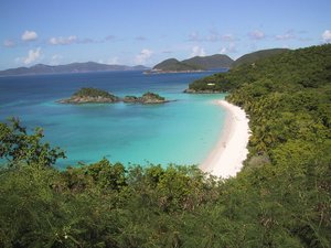
The Virgin Islands National Park includes much of St. John. The National Park Service reports that there are 140 species of birds, 302 species of fish, 7 species of amphibians, 22 species of mammals and 740 species of plants inhabiting St. John. In addition there are about 50 corals species and numerous gorgonians, and sponges. The only mammal native to St. John is the bat. Three of the six native species of bats are protected under the V.I. Endangered and Indigenous Species Act of 1990. Some bat species are important pollinators of many floral species on the island as well as important seed dispersal agents for many species of fruit bearing trees and shrubs. Other species of bats consume vast quantities of insects, including mosquitoes. Present day St. John does have many other species of animals that are not native to the island or even the tropics. These include: deer, goats, sheep, donkeys, cats, dogs, mongoose and pigs.
Coral Reef Fisheries
See Managing coral reef fisheries.
Fishing is historically important to the culture and livelihoods of US Virgin Islands’ communities but, as in many Caribbean islands, social and economic developments over the last half century has altered local residents’ traditional relationships with marine resources and threatened the integrity of the marine environment. As a result, fisheries (Fisheries and aquaculture) policy makers struggle to promote tourism and address mounting environmental threats, while still protecting the livelihoods of artisanal fishers.
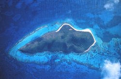
The distinct biophysical seascape and social structure of each of three main US Virgin Islands – St. Croix, St. Thomas, and St. John – add to the controversy and complexity of fisheries management issues. In the early 1960s Buck Island National Monument and the marine component of Virgin Islands National Park were established as marine protected areas, but had little direct impact on artisanal fishers of nearby St. Croix and St. John as they only imposed restrictions on non-traditional fishing methods. In 2001, however, President Bill Clinton expanded the size of Buck Island National Monument by 18,000 acres (7,284.34 hectares) and designated the entire area a no-take zone and established the Virgin Islands Coral Reef National Monument, a 12,000 acre (4,856.23 hectare) no-take zone adjacent to Virgin Islands National Park. The majority of the local population opposed the marine protected areas due to their unilateral manner of establishment and new area closures which placed considerable limitations on St. John’s and St. Croix’s fishers’ livelihoods.
The Caribbean Fisheries Management Council, which includes federal scientists, fisheries managers, and some local fishing stakeholders, has established three marine protected areas at spawning aggregation sites. The first was Red Hind Marine Conservation District established in 1989 as a seasonal closure for a small spawning aggregation of red hind, an important species to the relatively large artisanal fishing community of St. Thomas. The closure was supported by the fishing community who recognized its overexploitation and provided scientists with the traditional knowledge necessary for its establishment. The closure is credited with increasing the average length of red hind adults from 29.5 centimeters (cm) in 1988 to 38.8 cm in 2000 and their abundance from 5 fish to 25 fish per 100 meters squared. In 1999, just prior to documenting this achievement, the Caribbean Fisheries Management Council designated the marine protected area as a permanent no-take zone and expanded its size by 16 square miles (41.44 square kilometers) to include reef areas not proven to be aggregating sites. This decision was a surprise to St. Thomas fishermen who viewed the Caribbean Fisheries Management Council as having abused their trust by using their traditional knowledge against them. Similarly, in 2005, the Council deemed St. Croix’s marine protected areas, Mutton Snapper Spawning Aggregation and Lang Bank Red Hind Spawning Aggregation, as permanent no-take zones. The Council has also implemented seasonal bans on St. Croix’s conch fishery.
There has been great pressure from the local population and conservation organizations for the territorial government of the US Virgin Islands to establish its own system of marine protected areas using more bottom:up management approaches. These efforts have yielded numerous, relatively ineffective marine protected areas. The most recent and notable case is St. Croix’s East End Marine Park which, due to compromises made during the establishment process, includes few restrictions against fishing and thus has little potential for aiding the recovery of local fisheries. Even the territorial government’s efforts to curtail overfishing by placing a moratorium on commercial fishing licenses has had a negligible effect as they lack any significant means of enforcement.
People and Society
Population: 109,574 (July 2012 est.)
Ethnic groups: black 76.2%, white 13.1%, Asian 1.1%, other 6.1%, mixed 3.5% (2000 census)
Age Structure:
0-14 years: 19.5% (male 10,886/female 10,470)
15-64 years: 65.2% (male 33,280/female 38,210)
65 years and over: 15.3% (male 7,626/female 9,194) (2011 est.)
Population Growth Rate: -0.088% (2012 est.)
Birthrate: 11.32 births/1,000 population (2012 est.)
Death Rate: 7.39 deaths/1,000 population (July 2012 est.)
Net Migration Rate: -4.8 migrant(s)/1,000 population (2012 est.)
Life Expectancy at Birth: 79.47 years
male: 76.43 years
female: 82.69 years (2012 est.)
Total Fertility Rate: 1.78 children born/woman (2012 est.)
Languages: English 74.7%, Spanish or Spanish Creole 16.8%, French or French Creole 6.6%, other 1.9% (2000 census)
Literacy: 90-95% est.
Economy
Tourism is the primary economic activity, accounting for 80% of GDP and employment. The islands hosted 2.4 million visitors in 2008.
The manufacturing sector consists of petroleum refining, rum distilling, textiles, electronics, pharmaceuticals, and watch assembly. One of the world's largest petroleum refineries is at Saint Croix.
The agricultural sector is small, with most food being imported. International business and financial services are small but growing components of the economy.
The islands are vulnerable to substantial damage from storms. The government is working to improve fiscal discipline, to support construction projects in the private sector, to expand tourist facilities, to reduce crime, and to protect the environment.
GDP: (Purchasing Power Parity): $1.577 billion (2004 est.)
GDP- per capita (PPP): $14,500 (2004 est.)
GDP- composition by sector:
agriculture: 1%
industry: 19%
services: 80% (2003 est.)
Industries: Tourism, petroleum refining, watch assembly, rum distilling, construction, pharmaceuticals, textiles, and electronics.
Currency: United States Dollar
