Northern Indochina subtropical forests
The Northern Indochina Subtropical Forests are globally outstanding for their biological diversity; this ecoregion has the highest species richness for birds among all ecoregions in the Indo-Pacific region and ranks third for mammal richness. The ecoregion sits astride a major zoogeographic ecotone, where the northern Palearctic and the southern Indo-Malayan faunas mix, allowing langurs to mix with red pandas and muntjac and musk deer to mingle. It is also a crossroads for the south Asian and east Asian floras as well as some ancient relicts that have found refuge here during the turbulent and variable geological past.
Location and General Description
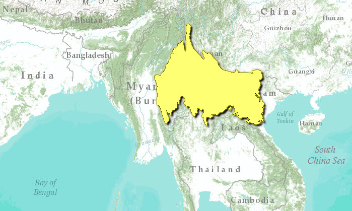
This large ecoregion extends across the highlands of northern Myanmar, Laos, and Vietnam and also includes most of southern Yunnan Province, China. A complex network of hills and river valleys extends south of the Yunnan Plateau into northern Indochina to include the middle catchments of the Red, Mekong, and Salween rivers. Mountains in this area are composed of intrusive igneous rocks or Paleozoic limestone and approach but seldom exceed 2,000 meters (m), and major river valleys lie at 200-400 m elevation.
The climate throughout northern Indochina is summer monsoonal. Precipitation averages 1,200 to 2,500 millimeters (mm) per year, depending on location, and almost all of this consists of summer rain fetched from the Bay of Bengal and the South China Sea during April to October. From November to March, westerly subtropical winds drawn from continental Asia create dry conditions. These are moderated by easterly rain in southern Vietnam. Mean temperatures vary with elevation, but the spring pre-monsoon period is the hottest time of the year, and January is the coldest. Frost is known from the higher elevations, but it is infrequent.
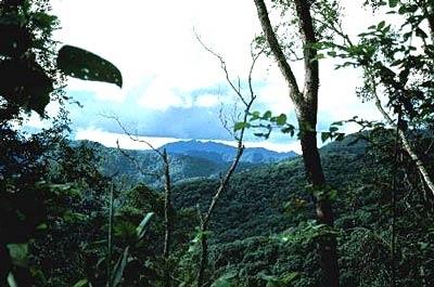
The cool winter temperatures and high elevation here at the edge of the tropics promote a montane flora with a distinct Himalayan component. Some of the important tree taxa belong to families such as Theaceae (Schima spp.), Magnoliaceae (Michelia spp., Magnolia spp.), and Fagaceae (Quercus spp., Castanopsis spp., Lithocarpus spp.). Open-canopy pine forests occur in the higher elevations, and patches of tropical forests grow in the moist valleys. Montane deciduous forests are especially well developed in the Shan Plateau area of northern Myanmar.
Tropical forests of Xishuangbanna in the southern part of Yunnan Province, China are typical of this ecoregion. They have been classified according to five different categories. Three of these (tropical seasonal rain forest, tropical montane rain forest, and evergreen broad-leaved forest) form a replacement sequence driven by declining drought stress with increased elevation. The other two are associated with anomalous moisture conditions: monsoon forest over limestone is determined by the fact that limestone loses water quickly, and the fifth, monsoon forest on river banks, is determined by perennial high water availability.
Subtropical broadleaf evergreen forest once covered much of the area of this ecoregion. The lower-elevation broadleaf forests up to 600-800 m appear to represent a transition from wet evergreen lowland forest to montane forests. The forest canopy is three-layered, with upper crowns reaching about 30 m in height. This transition zone contains clear elements of wet evergreen forests to the south but also subtropical Chinese elements from the north. Several distinctive forest communities can be distinguished in this region, although quantitative data on forest structure and floristics are highly limited. Above this zone, at elevations of 800-2,000 m, a clear montane evergreen forest takes over, with low-temperature conditions eliminating most of the tropical lowland forest elements. These forest communities are poorly studied in Laos and Myanmar but are better described for southern Yunnan Province in China. Little of these broadleaf evergreen forests remains intact today. Much of the former area of broadleaf evergreen forest has been converted to grasslands or savannas under the heavy impact of human overexploitation and swidden agriculture.
The characteristic families for the dominant forest trees at lower elevations are the Betulaceae, Fagaceae, Hamamelidaceae, Lauraceae, Magnoliaceae, Sapotaceae, Elaeocarpaceae, and Theaceae. These are all families characteristic of montane evergreen forests to the north in China. The montane broadleaf evergreen forests show a number of floristic elements, indicating that this is a relictual Tertiary flora. The family Rhoipteleaceae, with a single species, is endemic to this ecoregion.
Elevations above about 2,000 m in the Fan Si Pan massif of northern Vietnam support a distinct Tsuga dumosa-Abies delavayi var. nukiangensis forest unlike that present anywhere else in southeast Asia. Associated with the hemlock and fir are a moderate diversity of broadleaf trees, with the most species belonging to the Aceraceae, Hippocastanaceae, Fagaceae, Magnoliaceae, Lauraceae, Cupressaceae, Podocarpaceae, and Taxaceae.
Forests growing on patches of limestone are distinctive and are dominated by Tetrameles nudiflora, Antiaris toxicaria, Celtis cinnamomifolia, C. wightii, Cleistanthus sumatranus, Garuga floribunda, Pterospermum menglunense, Ulmus lanceaefolia, and Xantolis stenopetala.
Many basic questions about plant biodiversity remain unresolved for this ecoregion. For example, tropical montane forest in Xishuangbanna is species-poor, whereas studies in Doi Suthep National Park, Thailand, near the southern limit of this ecoregion, show that this forest type is the most species-rich. Another source of controversy is the role of fire in this ecosystem. Some evidence suggests that species in the seasonal forests at low elevation are adapted to a regime of frequent fire. Phoenix palms, for example, are well adapted to survive a ground fire. Yet most of the fires that occur now are lit by people, and it is thought that in the absence of fire, the composition of the forest would change.
Biodiversity Features
More than 183 mammal species are known from this ecoregion, of which 4 are endemic and 5 near endemic (table 1). Several other species are threatened, including the critically endangered Tonkin snub-nosed monkey (Rhinopithecus avunculus) and the tiger (Panthera tigris). Other mammals of conservation significance include Asian elephant (Elephas maximus), gaur (Bos gaurus), southern serow (Capricornis sumatraensis), banteng (Bos javanicus), red panda (Ailurus fulgens), particoloured flying squirrel (Hylopetes alboniger), pygmy loris (Nycticebus pygmaeus), three macaque species (Macaca nemestrina, Macaca assamensis, and Macaca arctoides), wild dog (Cuon alpinus), Asian black bear (Ursus thibetanus), back-striped weasel (Mustela strigidorsa), inornate squirrel (Callosciurus inornatus), smooth-coated otter (Lutrogale perspicillata), Lowe's otter civet (Cynogale lowei), and clouded leopard (Pardofelis nebulosa).
|
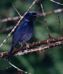
Table 1. Endemic and Near-Endemic Mammal Species. Family Species Loridae* Nycticebus intermedius* Cercopithecidae Rhinopithecus avunculus Hylobatidae* Hylobates leucogenys* Viverridiae* Hemigalus owstoni* Cervidae Muntiacus feae Cervidae* Muntiacus rooseveltorum* Sciuridae Callosciurus quinquestriatus Muridae Dremomys gularis Muridae* Eothenomys olitor* An asterisk signifies that the species' range is limited to this ecoregion. The bird fauna here is very rich (Northern Indochina subtropical forests) , 707 species, and includes species such as Ward's trogon (Harpactes wardi) (table 2). Among these is one near endemic, the short-tailed scimitar babbler Jabouilleia danjoui. This ecoregion also supports several pheasant and hornbill species that need intact, mature forests and are intolerant of human disturbance. Moreover, hornbills, as large frugivores, play an important role in dispersing the large seeds of some late-successional forest species, including trees and large lianas. The pheasants are Blyth's tragopan (Tragopan blythii), Temminck's tragopan (Tragopan temminckii), ring-necked pheasant (Phasianus colchicus), Lady Amherst's pheasant (Chrysolophus amherstiae), blood pheasant (Ithaginis cruentus), silver pheasant (Lophura nycthemera), and Siamese fireback (Lophura diardi). The hornbills are the plain-pouched hornbill (Aceros subruficollis), rufous-necked hornbill (Aceros nipalensis), great hornbill (Buceros bicornis), and brown hornbill (Anorrhinus tickelli). Because of their status as vulnerable indicator species and because of the important role they play in the dynamics of this ecosystem, these birds should receive special conservation attention. {| border="1" cellpadding="3" align="center" ! colspan="3" align="center" | Table 2. Endemic and Near-Endemic Bird Species. Family Common Name Species Timaliidae Short-tailed scimitar-babbler Jabouilleia danjoui (Northern Indochina subtropical forests) ==Current Status== {| width="35%" border="1" cellpadding="3" align="right" ! colspan="3" align="center" | Table 3. WCMC Protected Areas That Overlap with the Ecoregion. Protected Area Area (km2) IUCN Category Shwe u Daung 240 UA Maymyo 110 UA Taunggyi 20 UA Nam Ha 790 VIII Inle Lake 180 UA Mong Pai Lake 170 PRO Tay Con Linh 70 PRO Muong Nhe 3,720 IV Nui Hoang Lien 400 IV Phou Dene Dinh 950 VIII Nam Don 200 IV Muong Phang 30 UA Xuan Son 40 IV Nam Et 2,700 VIII Dao Ho Song Da 10 UA Xuan Nha 580 IV Sop Cop 60 IV Den Hung 30 UA Ba Vi 100 II Thuong Tien 20 IV Phou Loeuy 1,700 VIII Nam Xam 850 VIII Bu Huong 230 IV Cuc Phuong 110 II Ngoc Trao 10 UA Xishuangbanna 2,418 UA Doi Pha Chang 210 IV Total 15,948 Almost all forests in Vietnam have been cleared (Northern Indochina subtropical forests) , and only very small fragments remain in this heavily populated area. Large areas of forest in the eastern Shan State of Myanmar, along the border with Laos and China, also have been cleared, although a few large blocks of habitat still remain in this part of the ecoregion. Forests in the hills of southern Yunnan are similarly degraded, although large tracts of monsoon forest remain in the Xishuangbanna Nature Reserve (2,418 square kilometers (km2)), a complex of several smaller reserves that supports small populations of Asian elephant and tiger. There are twenty-seven protected areas that cover 15,948 km2 (5 percent) of this vast ecoregion (Table 3). But many of these are small (less than 100 km2) reserves that lie in northern Vietnam and do not contribute significantly to conservation of the many space-sensitive, larger mammals and birds. The average size of protected areas is 590 km2, but nineteen reserves (73 percent) are less than 500 km2, and nine (35 percent) are less than 100 km2. The large average is driven by the few large protected areas, many in Laos. ==Types and Severity of Threats== The threats to biodiversity in this ecoregion stem from two main sources: land clearing for shifting cultivation, poppy cultivation, and logging; and hunting for food and income. Even though human population density is low in these northern highlands, shifting cultivation in steep and unproductive land accounts for large-scale forest clearing. Fallow lands take more than thirty years to regenerate into forest, although some ecosystem function as wildlife habitat is restored in a much shorter time. If degradation is extensive, then forest regeneration will not occur at all, and the vegetation consists of a subclimax of Imperata grasslands or the exotic weed Eupatorium adenophorum. Hunting at unsustainable levels to supply a thriving market in China is a severe threat. And hunting is indiscriminate, targeting all species, from the large mammals to small birds, reptiles, amphibians, and invertebrates. ==Justification of Ecoregion Delineation== A previous analysis included this region in three subunits: Indochina Biounit 10a, b, and c. The subtropical forests across the northern areas of Thailand, Laos, and Vietnam and in southern China extend across all three subunits. In keeping with our rules for defining [[ecoregion]s], we used the distribution of these subtropical broadleaf forests as depicted in MacKinnon's (1997) map of the original extent of vegetation within the Northern Indochina Subtropical Forests. ==Additional Information on this Ecoregion== * For a shorter summary of this entry, see the WWF WildWorld profile of this ecoregion. * To see the species that live in this ecoregion, including images and threat levels, see the WWF Wildfinder description of this ecoregion. * World Wildlife Fund Homepage All text by World Wildlife Fund © 2001 |
|---|


