Meteorology (Weather & Climate)
Contents
Meteorology
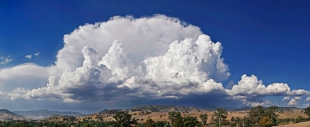
Meteorology is the scientific study of the atmosphere (Atmosphere layers) and physical processes of interaction with the Earth's crust, oceans and outer space. Meteorological phenomena are observable weather events which are investigated by the science of meteorology. The chief parameters comprised by the science of meteorology are: temperature, barometric pressure (Pressure), humidity, sunlight and the gradients and interactions of each variable, as well as their temporal variability. The majority of Earth's observed weather is located in the troposphere. Different spatial scales are studied to determine how systems on local, regional, and global levels impact meteorological phenomena. Meteorology, climatology, atmospheric physics and atmospheric chemistry are sub-disciplines of the atmospheric sciences. Meteorology and hydrology compose the interdisciplinary field of hydrometeorology. Interactions between Earth's atmosphere (Atmosphere layers) and the oceans are part of coupled ocean-atmosphere studies, and within the domain of meteorology.
History
Aristotle is generally considered the first scientist to systematically address meteorology, although several millennia before Indian writings alluded to meteorological phenomena. Aristotle's tour de force was a treatise that first explained the hydrologic cycle under influence of meteorlogical variables. Fellow Greek Theophrastus produced a work on weather forecasting, that continued to be a significant presence in weather forecasting for almost two millennia. In 25 AD, the Roman Pomponius Mela, developed the first climatic zone formulation.
King Sejong the Great of Korea is generally credited with invention of the first rain gauge in the fifteenth century. In 1607, Galileo invented his thermometer based upon the differential densities of two distinct fluid substances. By 1643, the first mercury barometer was developed by Evangelista Torricelli. In the 1700s, James Burnett Lord Monboddo of Scotland was an important figure who explored meteorology, especially from the standpoint of agricultural productivity and an early observer of climate change, particularly in his letters with Lord Ellis.
A series of technology improvements were made to meteorological sensors and to telemetry for data collection during the period 1940s to present. Modern contributions to meteorological history include NASA's TIROS-1, the first successful weather satellite placed into orbit in 1960.
Meteorological variables and measurement
The principal meteorological variables can be viewed as follows:
- Precipitation is the cumulative rain or snowfall measured by a tipping bucket or rain gauge.
- Wind velocity is the speed and direction of air flow, measured by an anemometer.
- Barometric pressure (Pressure) is the vertical force of an air mass above a given reference point, measured by a barometer.
- Humidity is the amount of water vapor in the atmosphere as measured with a psychrometer or hygrometer.
- Sunlight is the incident solar radiation measured over the entire electromagnetic spectrum.
- Temperature is a measure of mean kinetic energy of atmospheric gases, measured historically by a mercury thermometer, and more recently by a thermocouple.
There are numerous derivatives of the basic meteorological parameters, including the rate of change of these variables with space and time. For example the thermocline is the rate of change of temperature with altitude, and wind shear is the vertical change in wind speed; both of these are important factors in aviation, air pollution and noise pollution technology.
Scales of analysis
Meteorolgy encompasses four scales of analysis referred to as microscale, mesoscale, synoptic scale and global scale, with microscale being the smallest and global scale being the largest.
Microscale
See main article: MicroclimateA number of natural environment and man-made circumstances affect microscale meteorology. Natural environment factors include: topography, sun angle exposure, latitude, soil type, vegetative cover as well as the host of factors that comprise the wider area meteorology: cloud cover, regional precipitation, high altitude wind characteristics. Topography is often critical since it can lead to localized ponding of water and hence localized anomalies in relative humidity; moreover, the topography greatly influences air flow patterns and localized wind shear, providing areas of relative shelter or exposure to winds. Topography also influences surface runoff, thereby altering upper soil water retention and hence local temperature and humidity.Vegetative cover is an important influence on microclimate, altering air flow patterns, local temperature and humidity; in extreme cases of dense forest, a quiescent zone can be created beneath a forest or chaparral canopy; in other cases the structure of vegetation simply modifies the airflow with surface friction effects, altering directionality, speed and vertical profile of wind speed. The type and density of vegetation will alter the efflux rate of water vapor from stomata on leaf surfaces, and also affect the soil surface evaporation rate, both processes affecting local humidity and temperature.
Man made influences on microclimate include built structures and roads; conversion of natural habitat to agriculture; replacing native forests with plantations; introduction of exotic species as landscaping elements; mass grading to alter topography; and installation of power generation schemes such as windfarms, solar arrays, hydroelectric dams or other power plants that alter albedo and generate thermal pollution or air pollution plumes.
Mesoscale
Mesoscale meteorology involves air flow regimes smaller than synoptic scale, but larger than microclimate scale. Area sizes may range from about 25 kilometers to tens of thousands of square kilometers. Large metropolitan area air flows, squall lines, thunderstorms, extratropical cyclones, ocean breezes and mountain waves are all examples of mesoscale meteorology.
Vertical wind velocity sometimes exceeds horizontal velocity in mesoscale regimes, since non-hydrostatic processes such as buoyant acceleration of a rising thermal or air flow acceleration through a narrow mountain pass may force vertical flow to extreme limits.
Mesoscale regimes possess a vertical scale with limits of the Earth's surface and extending through the atmospheric boundary layer, troposphere, tropopause and lower stratosphere. The time scale associated with mesoscale phenomena range from tens of hours to tens of days.
Synoptic scale
Synoptic meteorology is in common parlance the scale of continental weather forecasting, describing air flow over hundreds to thousands of kilometers. Phenomena typically depicted by the synoptic scale include baroclinic troughs and ridges, weather fronts, hurricanes and jet streams. All of these are generally illustrated in a format akin to conventional weather maps. The minimum longitudinal scale of synoptic phenomena is normally defined by the spacing between weather observation stations.
The majority of weather maps displaying high and low pressure zones are synoptic scale systems, driven by Rossby waves. Low-pressure areas and their related frontal zones occur on the leading edge of a trough within the Rossby wave pattern, while surface highs form on the back edge of the trough. Most precipitation areas occur near frontal zones.
Global scale
See main article: Global-scale circulation of the atmosphere
Global scale atmospheric circulation is driven by large scale ocean/earth/atmosphere/solar radiation forces. This scale meteorology addresses transport of heat from the equator to the North and South polear regions. Large scale oscillations also play a role, having time periods typically on the order of months, such as the Madden-Julian Oscillation; moreover, some of these oscillations have characteristic times of years, such as the El Niño-Southern Oscillation and the Pacific decadal oscillation. Global scale meteorology enters into climatology.
Complex numerical mathematical models are required for many investigations of the global scale, including treatment of air-sea interactions, tropical meteorology, atmospheric predictability, and tropospheric/stratospheric processes. The U.S.Naval Research Laboratory in Monterey developed an atmospheric model named "NOGAPS", a global scale atmospheric model, which is run operationally at the Fleet Numerical Meteorology and Oceanography Center. A variety of other global atmospheric models are run by numerous public and private agencies, although the predictive accuracy of this technology would have to be considered in its infancy.
Global circulation can be understood in a simplified form by the following simplifying assumptions:(a) the Earth is not rotating in space; (b) the Earth's surface is composed of similar materials; and (c) the global reception of solar insolation and loss of longwave radiation cause a temperature gradient of warmer air at the equator and colder air at the poles.
Surface air flow in this simplifed model is from the poles to the equator. When air parcels reach the equator, it is lifted vertically by the processes of convection and convergence. When it reaches the top of the troposphere, it begins to flow once again horizontally. However, the direction of flow is now from the equator to the poles. At the poles, the air in the upper atmosphere then descends to the Earth's surface to complete the flow cycle.
Hydrologic cycle
See main article: Hydrologic cycle
For non-vegetated systems, interception processes usually do not occur, however, within vegetated systems, precipitation can be intercepted and lost to evaporation. In vegetated systems, some precipitation may reach the ground by stemflow, but most often reaches the soil by a process called throughfall. Precipitation that reaches the soil surface can then infiltrate and recharge soil waters. From there it can percolate through soil to deeper soil layers or groundwater supplies. The rate of evaporation from soils or surface waters (including oceans) can be influenced by several factors including radiation, temperature, relative humidity, and wind.
Warmer air can hold more water vapor, thereby generating increased evaporation rates. Drier air can accept much more water vapor than air that is nearly saturated, and windy conditions generally accelerate evaporation. Transpiration from plants takes place via water loss from the stomates, the gas exchange organs found on the leaves of plants. The stomates also act as an important cooling mechanism for plants by means of latent heat absorbed and transferred from the plants through evaporation/transpiration processes. This process is also that which supplies the tensional forces necessary to help draw water into roots from the surrounding soil. Transpiration is often lumped with evaporation and is then called evapotranspiration. With enough energy added, water can be converted directly from a solid (ice) to water vapor. This process is called sublimation. Sublimation is the result of ice going directly from a solid to water vapor without passing through a liquid state.
Air can only hold a certain amount of water vapor. The amount depends largely upon temperature; thus, as mentioned, hotter air can hold more water vapor than colder air. When air is saturated with water vapor, the water vapor condenses into droplets of water, forming clouds. When the droplets gain enough mass, they fall to the ground as rain or snow.
Influence on ecosystems
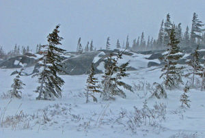
See main article: Abiotic factorMeteorologcal factors can strongly influence the functioning of an ecosystem. Even though large scale processes of the atmosphere (Atmosphere layers) involve interactions with the Earth's crust, oceans and outer space, microscale meteorology is an inherent part of any terrestrial or aquatic ecosystem. The chief meteorological parameters that comprise abiotic factors of ecosystems are temperature, sunlight, wind velocity, barometric pressure (Pressure), humidity and the gradients and interactions of each variable, as well as their temporal variability.Meteorology and hydrology compose the interdisciplinary field of hydrometeorology, which is also a significant set of abiotic factors. Meteorological abiotic factors may be simply the prevailing climatic features that define an ecosystem's atmospheric abiotic features. Meteorological factors are critical in plant respiration, in that stomatal openings and corresponding gas exhange are typically regulated by sunlight, humidity, temperature and even wind conditions. Overt signs of meteorological influence may be present in temperature stress to plant leaves, or in the phenomenon known as wind pruning, where strong prevailing winds (especially if laden with salt or ice crystals) selectively kill off or prune trees on their windward edge.
In the case of terrestrial fauna, optimum metabolism and growth are typically confined to a window of optimum meteorological conditions, outside of which those organisms fail to thrive or propagate. Seasonal factors are often element in faunal influences, including meteorological optima for reproduction and birthing; in other cases there is meteorolgical signaling for migration or mating seasons; examples of this are seasonal signals for large scale bird migration, or onset of a rainy season to signal mating times for many amphibian species.
in some cases, the meteorogical factors may be episodic or even catastropic events that define major transformations of an ecosystem. Examples of such abiotic upheavals are windthrow from hurricanes and tornadoes; torrential floods that scour and uproot large amounts of vegetative cover; and prolonged drought which may alter the plant association and animal ecology.
Relationship to energy generation
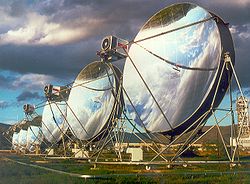
Cited by the periods of useful solar flux, both with respect to seasonal and diurnal variations as well as intermittent cloud cover. Wind power is dominated by the availability of suitable wind velocities (which can be neither to low or too high for the system to perform). Hydroelectric power is governed by the flow rate of rivers, which in turn is driven by precipitation patterns. Even nuclear power has an important association with hydro-meterology in that the impact of thermal pollution is regulated by the flow rate of any river body that receives heated water efflux from the nuclear plant. Furthermore, tidal power is subject to certain meteorological variables that affect tides. Correspondingly, fossil fuel power plants are significantly impacted by atmospheric turbulence and wind velocity, which are the key vairables in the ability of the atmosphere (Atmosphere layers) to disperse air pollutants from the stack emissions.
Transportation applications
Understanding of meteorology and ability to apply meteorological theory in a predictive manner are vital functions in many forms of transportation: notably in aviation, marine transport and surface transportation. The accuracy of forecasting has improved markedly in the previous half century, and have significantly improved public safety as well as efficiency of goods transport.Aviation safety depends upon understanding the occurrence of clear air turbulence as well the turbulence encountered in mpountainous areas. Foreknowledge of the location of high turbulence areas reduces risk of aircraft fatalities, in addition to providing more efficient and comfortable air travel. The very selection of runways is often dependent upon an accurate understanding of current wind velocity conditions; optimum runway utilization reduces mortality on aircraft takeoff and landing, and also allows efficient management of aircraft operations at busy airports. Probably the most hazardous condition in aviation is the tendency of wing icing in low temperatures and high moisture settings; knowledge of these conditions and ultimately the predictive ability serves to reduce takeoff mortality.
In the marine environment, application of meteorological modeling is pivotal to vessel navigation in terms of fog and rough sea avoidance, as well as protection of vessels in cataclysmic events such as hurricanes. In a commercial sense, advance understanding of development of meteorological events is important in making decisions on fishing expeditions, off-shore oil rig access and even routing cruise ships.
Surface transportation is probably the activity most widely addressed by meteorology, in that millions of motorists daily avail themselves of traffic weather data. Although the technology may not be as sophisticated as some of the aviation and marine counterparts, the sheer numbers of people demanding surface traffic weather data merits note.
Environmental applications
Applied meteorology is important in understanding air pollution dispersion, noise propagation, thermal pollution of surface waters and other environmental phenomena. These fields have been given great attention in the last four decades because of the public interest in environmental quality and the corresponding development of associated regulatory standards.
Air pollution dispersion modeling, following the protocols of Turner, Beychok and others, first addressed point source phenomena such as industrial stacks. These models have been used extensively in industrial siting decisions and even determination of appropriate industrial emission controls. Later line source modeling was applied to roadway design as well as certain aircraft flight pattern managment.
Noise pollution has gained increasing attention beginning in the 1960s, with legislative mandates requiring pridiction of sound levels for major transportation decisions, particularly in heavily populated areas. Meteorological considerations have been an important component of noise propagation modeling since the early 1970s, when the first comprehensive transportation models were developed by Bot, Beranek and Newman and by ESL Inc. Particularly critical in such treatment of noise propagation are near surface wind shear effects and thermoclines.
References
- Aristotle. 350 B.C. Meteorology. The University of Adelaide Library, University of Adelaide, South Australia ebooks.adelaide.edu. Translated by E. W. Webster (2004)
- Key Young & Renaud Kim. 1992. King Sejong the Great: the light of fifteenth century Korea books.google.com, 119 pages.
- James Knight. 1993. Lord Monboddo and some of his contemporaries. Thoemmes Press, Bristol, England ISBN 1-85506-207-0 (a reprint of the 1900 edition).
- Byers and Horace.1994. General Meteorology. McGraw-Hill, New York.
- Michael Hogan, Leda C. Patmore and Harry Seidman. 1973. Statistical Prediction of Dynamic Thermal Equilibrium Temperatures using Standard Meteorological Data Bases, United States Environmental Protection Agency Office of Research and Development EPA-660/2-73-003, U.S. Government Printing Office, Washington. DC.
- H. Bluestein. 1992. Synoptic-Dynamic Meteorology in Midlatitudes: Principles of Kinematics and Dynamics, Vol. 1, Oxford University Press ISBN 0-19-506267-1.
- M.R. Beychok. 2005. Fundamentals Of Stack Gas Dispersion, 4th Edition, ISBN 0-9644588-0-2.
