Northern Dry Pacific Coast mangroves
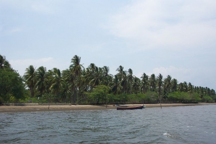
Isla Madre Sal, Bahía de Jiquilisco, El Salvador, by Metztli via Wikimedia Commons
The mangrove ecosystems of the Northern dry Pacific Coast mangroves ecoregion are a truly unique assemblage and serve as the basis for most life in the surrounding environment. When the areas outside of this ecoregion begin to dry up and resources are scarce,the animals move into the mangrove ecosystem for refuge. This ecoregion supplies food from the most primary source up the food chain to complex carnivores. Shelter is also a very important resource and is provided by the mangrove trees. Birds many different species living the mangroves year round and during the winter. Many bird species also nest in this ecoregion making it easier to raise their brood with so many available resource like invertebrate larvae, mussels, snails, fish fry, and other living things which help give the mangrove areas the representation of being nurseries to marine organisms.
Location and General Description
The Northern dry Pacific Coast ecoregion extends in patches along the coastline of Guatemala and El Salvador. The mangrove ecosystems are concentrated on lagoons and estuaries, with brackish waters. For example there are patches of this ecoregion in the Bahia de Jiquilisco, Estero de Jaltepeque, Punta San Juan, Rio Paz, Rio Acome, and Rio Lempa estuaries and behind Barra de Santiago and Monterrico Lagoons. This ecoregion is a good example of how the combination of lagoon, bay, and river delta make the appropriate areas for mangrove growth. Many call this area Punta San Juan although the most notable river is said to be the Rio Lempa.
This Pacific coast ecoregion much like others along the western coast is considered semi-arid with annual rainfall between 1,400-1,600 millimeters (mm) most of which falls from May to October. An apparent dry season runs from November to April. Temperature ranges are fairly stable between 27-29° C but can be higher in some localized areas. There are however a wide range of salinity in the estuaries throughout the ecoregion due to their small size and seasonal fluctuations in freshwater flow.
Mangroves and tidal flats dominate estuarine shorelines, with salt marsh occurring inland in sediments that are often hypersaline and less often flooded; these estuarine habitats are associated with coastal plain while rocky shorelines are associated with mountain ranges. These landscape features, associated with river deltas and lagoon areas, increase diversity of species by allowing and encouraging development. In the mucky swales surrounding these delta areas mixed mangrove forests species of Rhizophora mangle, R. harrisonii, R. racemosa grow, while stands of Laguncularia racemosa, Conocarpus erectus and Avicennis germinans, A. nitida and A. bicolor grow on slightly elevated clay and sand surface deposits. These coastal habitats also include salt marshes, sand and gravel beaches, tidal flats, rocky platforms, reefs, rock cliffs and islands with various vegetation types present on each.
Biodiversity Features
200 species of wildlife occur in near-shore marine and coastal areas of which 70 are threatened or endangered; are particularly concentrated around the estuaries. Mangroves provide protection, roosting and nesting sites to many waterbirds, while inlets and tidal flats are used as feeding grounds. Mangroves also provide critical habitat for the highly endangered white-fronted (Amazona albifrons) and yellow-naped parrots (A. auropalliata). This unique ecoregion also holds the single most important bird nesting area, "Colegio de las Aves", a complex of mangroves, tidal creeks and flats, and small coastal streams associated with the Barra de Santiago estuary. Some other representative birds for this ecoregion include reddish egret (Egretta rufescens), little blue heron (Egretta caerulea), great blue heron (Ardea herodias), sanderling (Calidris alba), sandpiper (C. mauri) and Wilson's plover (Charadrius wilsonia).
Mammals and reptiles also add to the diversity of this ecoregion but mainly as visitors. These mangrove patches serve as sanctuaries for species that need to escape the constraints of the dry season. Resources are typically more available in these mangrove patches as freshwater is drawn up by the mangroves and mists from the ocean help provide moisture for plants. Two mammals, which most likely do live in this ecoregion, are the raccoon (Procyon lotor) and lesser bulldog bat (Noctilio albiventris) a fish eating bat that can find plenty of food in this ecoregion. Many species of sea turtles, freshwater turtles, crocodiles, iguanas, snakes, caimans and alligators can also be found utilizing the mangrove ecosystems.
Many important fisheries are estuarine dependent, using mangroves as nursery habitat. Mangroves are also important to some primarily freshwater fish and shrimp that migrate down to the mangroves in early larval stages, such as the mountain mullet (Agonostomus monticola) and the shrimp Macobrachium spp. and Atya spp. These are of interest from a conservation perspective as they provide an indicator of watershed health and are the basis for a diverse and complex food chain that arises around mangrove ecosystems. Marine fauna such as Bottlenose dolphins (Tursips truncates), Spotted dolphin (Stenella attenuata), Spinner dolphin (S. longirostris), five distinct species of whales, Pacific green turtle (Chelonia mydas agassizi), Leatherback (Dermochelys coriacea), Hawksbill (Eretmocchelys imbricata), and Olive Ridley (Lepidochelys olivacea) are just a sampling that take advantage of the wealth of resources provided by the mangrove ecosystem.
Current Status
In Guatemala, total mangrove area has been reduced from 23,334 square kilometers (km2) to 165 km2 between 1965 and 1984. In El Salvador, total remaining mangrove area is 268 km2 but includes G. Fonseca. The total 35,235 hectares (ha) remaining in the ecoregion breaks down as: Bahía de Jiquilisco 19,847 ha, Estero de Jaltepeque 5,385 ha, Fonseca 4,657 ha and other 5346 indicating a 22% decline from 1974 to 1989. At least 13,000 ha in El Salvador is used for shrimp farming; although it leaves the habitat semi-intact it degrades and alters natural processes. Other stresses on the ecoregion from the current numbers of resident humans include heavy dependence on fish and agriculture.
A significant number of coastal protected areas contain mangroves, for example: Rio Paz, Los Cobanos, La Libertad, Estero de Jaltlepeque, Rio Llempa, Bahia Jiquilisco.
Type and Severity of Threats
Destruction and alteration of mangrove areas are the biggest threat to this ecoregion. The trees and other portions of the habitat are being destroyed and altered for tourism development, expansion of population centers, clearing for agriculture, over-grazing, and construction of salt production ponds. Resulting effects from deforestation and further degradation of the areas including the uncontrolled run-off of sediments resulting in soil erosion and pollution from fertilizers, pesticides, industrial discharges, and animal wastes. Not to mention the effects of poor water resources management including building of dams and diverting water for irrigation which would have supplied the flora and fauna dependents of this ecoregion. Of great concern, especially with the concentration of avifauna, is the detection of DDT in sediment samples taken at river mouths. The impacts of small settlement use of mangrove areas have not been fully studied for cumulative impacts of small-scale cutting and removal of mangroves for use as fuel, building material and agricultural expansion.
Justification of Ecoregion Delineation
Classification and linework for all mangrove [[ecoregion]s] in Latin America and the Caribbean follow the results of a mangrove ecoregion workshop and subsequent report.
Additional Information on this ecoregion
- For a shorter summary of this entry, see the WWF WildWorld profile of this ecoregion.
Further Reading
- Chapman, V. J. editor. 1992. Ecosystems of the World; Wet Coastal Ecosystems. Elsevier Science Publishers B. V., Amsterdam, Netherlands. ISBN: 0444415602
- Cotsapas, L., S.A. Zengel and E.J. Barraza, E.J. 2000. El Salvador. C. Sheppard, editor. Seas at the Millenium: An Environmental Evaluation. Elsevier Science, New York. ISBN: 0080432077
- Ecoregional Workshop: A Conservation Assessment of Mangrove Ecoregions of Latin America and the Caribbean. 1994. Washington D.C., World Wildlife Fund.
- Junio, C.A. 1982. Mapa de cobertura y uso actual de la tierra Republica de Guatemala. Instituto Geografico Nacional Guatemala, Guatemala City, Guatemala.
- Olson, David M., Eric Dinerstein, Gilberto Cintrón and Pia Iolster. 1996. A Conservation Assessment of Latin America and the Caribbean: Report from WWF's Conservation Assessment of Mangrove Ecorsystems of Latin America and the Caribbean Workshop. WWF, Washington D.C.
- Yáñez-Arancibia, A. and Lara-Domínguez, A. L. 1999. Ecosistemas de Mangular en América Tropical; Mangrove Ecosystems in Tropical America. Instituto de Ecología, Mexico, Veracruz.
| Disclaimer: This article contains information that was originally published by the World Wildlife Fund. Topic editors and authors for the Encyclopedia of Earth have edited its content and added new information. The use of information from the World Wildlife Fund should not be construed as support for or endorsement by that organization for any new information added by EoE personnel, or for any editing of the original content. |