Hierapolis-Pamukkale, Turkey (About the EoE)
Contents
- 1 Hierapolis-Pamukkale, Turkey
- 1.1 Geographical Location
- 1.2 Date and History of Establishment
- 1.3 Area
- 1.4 Land Tenure
- 1.5 Altitude
- 1.6 Physical Features
- 1.7 Climate
- 1.8 Vegetation
- 1.9 Fauna
- 1.10 Cultural Heritage
- 1.11 Local Human Population
- 1.12 Visitors and Visitor Facilities
- 1.13 Scientific Research and Facilities
- 1.14 Conservation Value
- 1.15 Conservation Management
- 1.16 IUCN Management Category
- 1.17 Further Reading
Hierapolis-Pamukkale, Turkey
| Topics: |
Geographical Location
Hierapolis-Pamukkale (37°57'N, 28°50'E), is a World Heritage Site situated in south-east Turkey, in the province of Denizli, 22 kilometers (km) north-north-east of the town on the northern side of the Curuksu River valley which at this point is some 6 km wide. The Curuksu is a ]]tributary\ of the Menderes River which, passing through the western extension of the Taurus Mountains, creates a deep V-shaped canyon to the immediate north of the region.
Date and History of Establishment
Although a management plan for the area was prepared in 1969 and the area proposed as a national park, it has yet to be officially approved. Inscribed on the World Heritage List in 1988.
Area
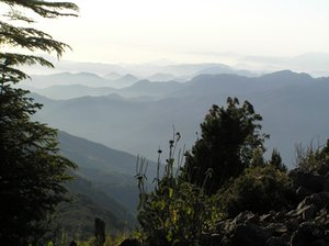
 Taurus Mountains, Turkey. (Source: Cornell University)
 None given, but the management plan suggests it be of sufficient size to include all the significant natural and historical features associated with the site.
Land Tenure
State ownership.
Altitude
Around 500 meters (m), rising to 1,840 m in the Cokelez mountains, to the immediate north of the park. Peaks further out but surrounding the park rise to 2,308 m (Babadag) and 2,571 m (Honaz).
Physical Features
The chief features of the site are its 20 m high travertine cliffs and waterfalls. The travertine terraces lie along the foothills of the Cokelez mountains, the highest being about 200 m above the Curuksu plain and extending some 6 km between the villages of Pamukkale and Karahayit. The famous thermal springs and travertine pools are located on the site of the Roman town of Hierapolis, at the south-eastern tip of the terraces and occupy an area 2,500 m in length and 500 m in width. Semi-circular pools occur in a step-like arrangement down the upper one-third of the slope; the steps range from 1-6 m. Fresh deposits of calcium carbonate give the pools a dazzling white coating. The travertine deposits, Quaternary in age, are thought to originate from a fault in the contact zone between the Mesozoic crystalline rocks and the layers of the Neogen series. The water temperature averages 35°C with a flow of 25 liters per second (from four springs). The springs form part of a complex hydraulic system extending 70 km to the north-west to Alasehir and west along the valley of the Menderes River. These canals take thermal water to nearby villages and agricultural areas, some over the years having accumulated travertine deposits up to 10 m in height. The oldest rocks in the area are crystalline marbles, quartzites and schists and are located in the northern parts of the proposed park. Most of the rocks are, however, of the Pliocene period.
Climate
The climate is quite mild, in summer being cooler than the nearby plains. Temperatures are high in July and August, average maximum of 34°C, with January temperatures dropping to an average of 1°C. Humidity is high in summer and precipitation highest in December, January and February, mostly in the form of snow, up to 35 centimeters (cm). Winds are most frequently from the north-west.
Vegetation
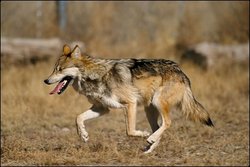
 Canis Lupus. (Source: University of Texas El Paso)
 In 1969 the vegetation map of the proposed park, showed land use cover, in descending order of area - to be, cultivated land, bare land subject to erosion, bare land, urban areas and maquis. The extended area around the site is largely agricultural, accounting for 33% of land cover but with 41% classified as forest, meadow and pasture. Agricultural crops produced under irrigation include wheat, barley, corn, chick peas, lentils, cotton, tobacco, sugar beet and opium poppies. Fruit and vegetables are also grown. There are records of some 45 species of flowering plants, not all necessarily from the proposed park area.
Fauna
Within the Denizli province there are records of ten mammals (including grey wolf Canis lupus (V), jackal Canis ureus, bear Ursus arctos, chamois Capra hircus and boar Sus scrofa) and ten species of bird including great bustard Otis arda.
Cultural Heritage
Near to the site are the ruins of the Roman town of Hierapolis which include the theater (with the best preserved 'scaena' in Asia Minor), many tombs and the old 'thermae'. The town was founded at the end of the 2nd century BC, reaching the peak of its development under the Romans at the end of the 2nd and 3rd centuries. In structure, it follows the hellenistic tradition with the main buildings lining the main street which is 1 km long, with side streets arranged at right angles. The buildings of major importance include the theater, octagonus, monumental gate, nymphaeum and the necropolis. A major activity was the wool industry which benefited from the cleansing properties of the hot springs. The town became a bishopric in the 4th and 5th centuries.
Local Human Population
The town of Denizli (population 61,000 in 1965, estimate 231,000 in 1985) is the nearest urban center, with villages in the surrounding area adding a further 56,000 to the total population. Some 70% of the population is engaged in agricultural activities.
Visitors and Visitor Facilities
Tourist infrastructure has been built by both the municipality of Denizli and by private enterprise and includes hotels, motels and swimming pools. The area is frequented by local people (24% of total visitors in late 1960s) and is a popular picnic spot. Other nearby resorts include Karahayit, 5 km from Pamukkale, which also has thermal springs. At present, there is only one access road into the site with branches, one to the north to the village of Karahayit, the other to Kurtluca. The number of visitors rose from 1,720 in 1962 to 24,670 in 1968.
Scientific Research and Facilities
The archaeological site of the town of Hierapolis has been extensively investigated and partially restored by teams provided by the Italian government (funded by the Ministry of Foreign Affairs and Ministry of Culture and Ambiente, as well as the National Research Council). From 1957 to 1977 these were under the direction of P. Verzone and from 1979 under D. de Bernardi Ferrero. The investigations elucidated the plans of the town and the main town buildings. The Italian mission included archaeologists, engineers and architects. The Hierapolis Museum is presently an official institution funded and supported by the Turkish government.
Conservation Value
Calcite-laden waters have created this unique landscape comprising mineral [[forest]s], petrified waterfalls and a series of terraced basins.
At the end of the 2nd century B.C., the dynasty of the Attalides, the kings of Pergame, had set up the thermal station of Hieroplis. The site also includes the ruins of the baths, temples and other monuments.
Conservation Management
Tourist facilities are restricted to the edge of the archaeological area, and the site is largely free from intrusion by modern constructions, although parts of the lower town have been embedded by travertine deposits. A certain amount of reuse of old monuments is taking place, such as the road to the necropolis being covered with macadam and the use of some buildings as a museum and bureau by the Ministry of Culture and Tourism. All major buildings have undergone restoration work with emphasis now being placed on the theater.
A management plan was prepared in 1969 with assistance from the US Agency for International Development, but has yet to receive official approval. It defines three management zones, from a zone of maximum protection to an urban development control zone.
Management Constraints
The archaeological area has several thousand visitors each year, a problem aggravated by the lack of supervision. Over the centuries, earthquake damage has occurred, but interestingly enough this aspect has contributed to the architectural development of the town.
Staff
The management plan proposed a staff consisting of a superintendent, administrative officer, chief of visitor services and chief of maintenance.
Budget
No information .
IUCN Management Category
- Proposed National Park
- Natural/Cultural World Heritage Site - Natural Criteria iii/Cultural Criteria iii, iv
Further Reading
There are 15 main references listed in the submission document to the World Heritage Committee. Others include:
- Anon. (1969). Master plan for protection and use. Pamukkale National Park.
- Anon. (1987). Pamukkale (Hierapolis). NET. Turistik Yayinlar sonayi ve Ticaret A.S.
| Disclaimer: This article is taken wholly from, or contains information that was originally published by, the United Nations Environment Programme-World Conservation Monitoring Centre (UNEP-WCMC). Topic editors and authors for the Encyclopedia of Earth may have edited its content or added new information. The use of information from the United Nations Environment Programme-World Conservation Monitoring Centre (UNEP-WCMC) should not be construed as support for or endorsement by that organization for any new information added by EoE personnel, or for any editing of the original content. |
1 Comment
Jehnavi pat wrote: 02-08-2011 15:40:18
As you go toward Hierapolis you can see the “cotton castle” of the Pamukkale, which is simply a feast for the eyes. The mountain is like a lacework with pools of water. Pamukkale was created by dripping calcareous waters, which carved the mountain. http://www.historicaltravelguide.com/hierapolis-pamukkale-turkey.html