Gulf of Panama mangroves
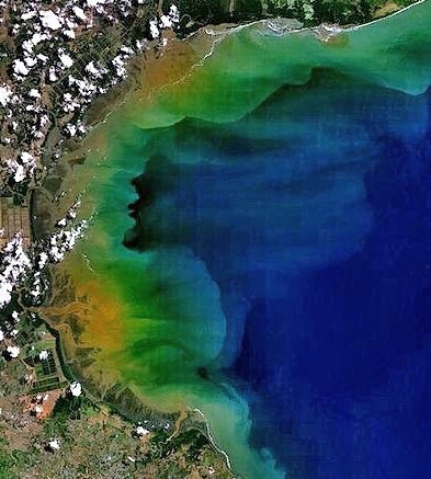
Gulf of Parita, western part of Gulf of Panama. Source: NASA
The Gulf of Panama mangroves ecoregion lies along the Pacific Coast of central Panama, and exhibits exceptional biological diversity for a mangrove ecosystem, due to high microclimate variation in climatic conditions within relatively small areas; this biodiversity is further enhanced by periodic hurricane and El Nino disturbances that bring both high and low extremes in rainfall in a ecoregion where dry and rainy seasons are already extreme. Climatic conditions range from dry to humid and rainy tropical, and humid subtropical. The types of mangroves found within this ecoregion depend heavily on localised salinity levels, which depend in turn on the supply of freshwater, levels of evapotranspiration associated with the microclimate, and distance from tidal channels, which affects levels of marine inundation. The wetlands associated with this ecoregion play an important role in storing freshwater for release during the dry seasons.
Location and General Description
The Gulf of Panama mangroves include those on the eastern versant along the Pacific coast of the country, from the Parita Bay to the San Miguel Gulf, and include the Chame Bay and the Panama Bay in between. There is considerable climatic variability found within this region. Annual rainfall varies from an average of 1070 millimeters (mm) in the western part of the ecoregion to 3000 mm in the eastern part, where mangrove habitats are better developed. Tidal amplitude ranges from two to six metres. Rainfall covers the region between May and December, which is the rainy season. The dry season occurs from January to April. The low pressure systems strengthen winds coming from the east, which bring stronger storms, and winds that are capable of damaging mangroves, paired with higher freshwater inputs that allow the mangroves to remain inundated for prolonged periods. Another regular disturbance arises from El Ninós, which severely reduces rainfall, disturbing mangrove reproductive cycles by limiting available freshwater.
Because of high evapotranspiration rates and the severity of the dry seasons, there is a water deficit in this ecoregion most of the year. Thus, extreme values are more important than the mean values of river discharge, as one attains an understanding of the effects of seasonal rainfall on river load and its influence on mangroves. In general, the river basins are of high topographic relief and therefore prone to erosion caused by agricultural practices, livestock overgrazing and deforestation, together with steep slopes, seasonally intense rainfall, highly erodible soils, and high concentrations of people and livestock; the direct result of which is high sedimentation and nutrient loading. Therefore, sand and mud are abundant within these mangrove forests. Coral reefs are not associated with the mangroves in this ecoregion because of the heavy sediment load, though some are found further offshore near islands. Mangroves are better developed where there is a greater supply of freshwater reducing salt accumulation in the mangroves. Evapotranspiration, marine water, availability of freshwater, rainfall, river discharge and surface runoff regulate salinity variations in the soil. Small wetlands in the ecoregion function as reservoirs, slowly releasing water during the dry season. In areas of seasonal climate, salinity concentrations increase towards the internal side of the forest. With greater distance from the tidal channels, diminishing intensity of inundation, salt accumulated in the soil through evapotranspiration as freshwater creates salt pans. In the rainier climates, freshwater input is so high that it is virtually impossible for high salt concentrations to accumulate. In this case, a transition zone can be found in which mangrove vegetation mixes with that typical of freshwater wetlands such as palms and swamp forests.
Biodiversity Features
The mangrove forests also have high variation, corresponding with the tremendous variation in climatic conditions. Two principal zones can be distinguished: external and internal. The external areas are directly exposed to estuarine waters; the internal are isolated from them but are seasonal inundated by the tides. Red Mangroves (Rhizopora mangle and R. brevistyla), which reach up to 40 meters in height dominate brackish areas of the Pacific Coast. Other species found along the salinity gradient are: Black Mangrove (Avicennia germinans), White Mangrove (Laguncularia racemosa), Mora (Mora oleifera) and Yautia Madera (Montrichardia arborescens). Also found in this ecoregion are Mangle Piñuelo (Pelliciera rhizophorae) and Avicennia bicolor, another Black Mangrove species that is only found along the coasts of Costa Rica, Panama and slightly into northeastern Colombia.
Birds most specific to these mangroves include Roseate Spoonbill (Platalea ajaja), Grey-necked Wood Rail (Aramides cajanea), Rufous-necked Wood Rail (A. axillaris), Common Black-hawk (Buteogallus subtilis), Yellow-billed Cotinga (Carpodectes antoniae) (now rare), Green Kingfisher (Chloroceryle americana), Amazon Kingfisher (Chloroceryle amazona), Lesser Nighthawk (Chordeiles acutipennis), Rufous-browed Peppershrike (Cyclarhis gujanensis) and many other avian species.
Also contributing to the immense biodiversity are the many types of mammals which both live within and in lowlands adjacent to this ecoregion. Included in the mammalian associates are arboreal taxa such as the Mexican Anteater (Tamandua mexicana), pygmy anteater (Cyclopes didactylus), Mantled Howler Monkey (Allouatta palliata), white-throated capuchin (Cebus capucinus), raccoon (Procyoon lotor) and Crab-eating Raccoon (P. cancrivorus). In A. bicolor and L. racemosa mangrove forests, White-tailed Deer (Odocoileus virginianus) can be seen feeding on the rich foliage. Reptiles found in the branches of the canopy include (Boa constrictor), Iguanas (Iguana iguana), and the Black Iguana (Ctenosaura similis).
The role of mangrove ecosystems as nurseries for fish, invertebrates and crustaceans leads to higher levels of diversity especially in water associated species of birds. These immature species, including the thirty fish species reported to be found in their juvenile stages, are part of the basis for this [[ecoregion]’s] foodchain. Fish and crustacean species dominant for the ecoregion are those traditionally found in estuarine and arid environments such as Serranidae (sea basses), Gerreidae (ray-finned fishes) and Mugilidae (mullets). Crabs play an important role in the pathways of leaf decomposition and also, through selective predation on propagules, the mangrove species that are found in this ecoregion. Three species of shrimp are particularly abundant; they spawn offshore but live in the mangroves as juveniles for four to five months, when they grow from twelve millimetres up 80 millimetres, prior to migrating back into the open ocean.
Current Status
Mangroves of the Gulf of Panama ecoregion cover approximately 892.78 square kilometers (km2) of this [[region]’s] total 2424 km2. 21.45 km2 have been converted to salt flats, shrimp ponds, crops, cattle farming, [[tidal]ly] flooded land, non-vegetated land and agriculture. Most of this decrease has occurred on the Pacific Coast in the Chiriqui area – the greatest losses to shrimp farming have occurred in the more saline areas.
Management is complicated by the tremendous variation found within this region and within small areas. There is heavy economic dependence on the mangroves. Many families exist solely on mangrove resources, and 70% of the population relies on fuelwood for energy. Most of the country’s income from fishing is from mangrove related fish species, and shrimp is, economically, the most important fishery. Also important are anchovies (Centengraulis mysticetus), for which the largest catches are in the areas with the greatest mangrove cover (particularly in Gulf of Panama), because they feed on detritus or organic debris from the mangroves. Artisanal fisheries are also associated with mangroves include snappers (Lutjanus spp.), corvinas (Micropogon altipinnis), and robalos (Centropopmus spp.).
Types and Severity of Threats
The fundamental threat to this ecoregion is due to the burgeoning human population in the Panama City area. Mangrove ecosystems are threatened by conversion to agricultural areas that are used for low productivity crop and part of these areas often remains unvegetated because of periodic inundation. Pressures from urbanization occur in an ongoing fashion around Panama City. A special concern is with the potential for oil and chemical spills because of the quantity of oil and other chemical freight that is transported through the Panama Canal and also through pipelines. The destruction, conversion and utilization of mangrove ecosystems for use as fuelwood, salt flats, shrimp ponds and cattle grazing are a continual threat, since the surrounding human population largely relies on these resources and this ecoregion to supply them.
Further Reading
- D’Croz L. 1993. Status and uses of mangroves in the Republic of Panamá. L.D. Lacerda, editor. Conservation and sustainable utilization of Mangrove Forests in Latin America and Africa Regions. Part 1; Volume 2.
- Ecoregional Workshop: A Conservation Assessment of Mangrove Ecoregions of Latin America and the Caribbean. 1994. Washington D.C., World Wildlife Fund.
- Jimenez, Jorge A. 1999. Ambiente, distribucíon y características estructurales en los manglares del Pacífico de Centro América: contrastes climáticos. Yáñez-Arancibia, Alejandro and Ana Laura Lara-Domínguez, editors. Ecosistemas de Manglar en América Tropical. Instituto de Ecologia, A.C. Xalapa, México; UICN/ORMA Costa Rica; NOAA/NMFS Silver Spring MD USA.
- Reid F. A. 1997. A field guide to the mammals of Central America and Southeast Mexico. Oxford University Press, New York. ISBN: 0195064011.
| Disclaimer: This article contains information that was originally published by the World Wildlife Fund. Topic editors and authors for the Encyclopedia of Earth have edited its content and added new information. The use of information from the World Wildlife Fund should not be construed as support for or endorsement by that organization for any new information added by EoE personnel, or for any editing of the original content. |