Gros Morne National Park
Contents
- 1 Gros Morne National Park, Canada
- 1.1 Geographical Location
- 1.2 Date and History of Establishment
- 1.3 Area
- 1.4 Altitude
- 1.5 Land tenure
- 1.6 Physical Features
- 1.7 Climate
- 1.8 Vegetation
- 1.9 Fauna
- 1.10 Cultural Heritage
- 1.11 Local Human Population
- 1.12 Visitors and Visitor Facilities
- 1.13 Scientific Research and Facilities
- 1.14 Conservation Value
- 1.15 Conservation Management
- 1.16 IUCN Management Category
- 1.17 Further Reading
Gros Morne National Park, Canada
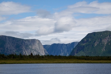
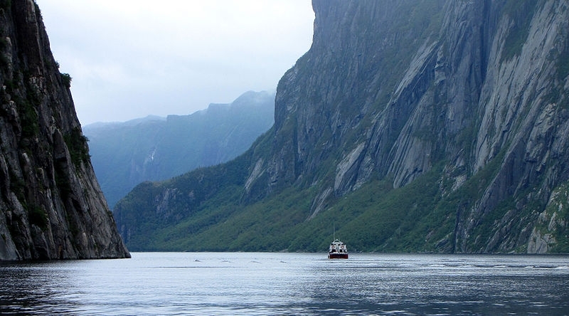
A view of the fjords in Gros Morne National Park in Newfoundland ,Canada. Source: Natalie Lucier/Flickr
Gros Morne National Park (49°18'-49°59'N, 57°25'-58°10'W) is a World Heritage Site located in Canada.
Geographical Location
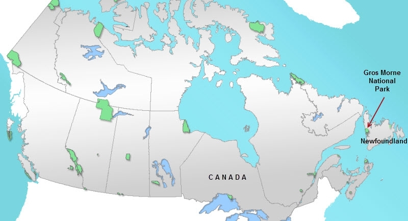
Location of Gros Morne National Park. Source: Wikimedia Commons.
Located on the western shore of the Great Northern Peninsula of Newfoundland, in the province of Newfoundland and Labrador. The park comprises part of the Long Range Mountains and faces the Gulf of St Lawrence. The mainland is some 150 kilometers (km) to the west, and the nearest large towns are Deer Lake and Corner Brook 76 km south-east and 120 km south by road, respectively. The boundary, detailed in Parks Canada, comprises a series of Canada Lands Surveys posts and the Ordinary Low Water Mark of the Gulf of St Lawrence. 49°18'-49°59'N, 57°25'-58°10'W 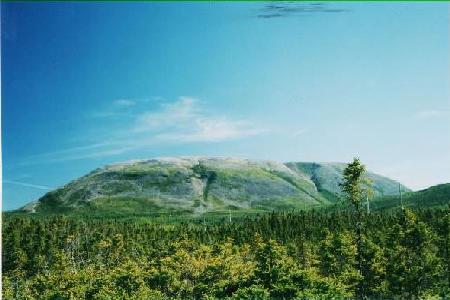 View of Gros Morne Mountain from the start of the Gros Morne Mountain trail. Source: University of Utah
Date and History of Establishment
Established under a Federal/Provincial Agreement signed by the Governments of Canada and Newfoundland and Labrador on 13 August 1973. The same authorities amended this agreement on 18 May 1983, whereby approximately 9,300 hectares (ha) were returned to the province. The park is currently being formally established under the National Parks Act. Inscribed on the World Heritage List in 1987.
Area
180,500 ha.
Altitude
Sea level to 806 meters (m) (Gros Morne Mountain).
Land tenure
Clear title to all lands was acquired on 27 December 1984 by the Provincial government, and has subsequently been transferred to the Federal government, under the administrative responsibility of Parks Canada,
Physical Features

Gros Morne National Park map. Source: Parks Canada.
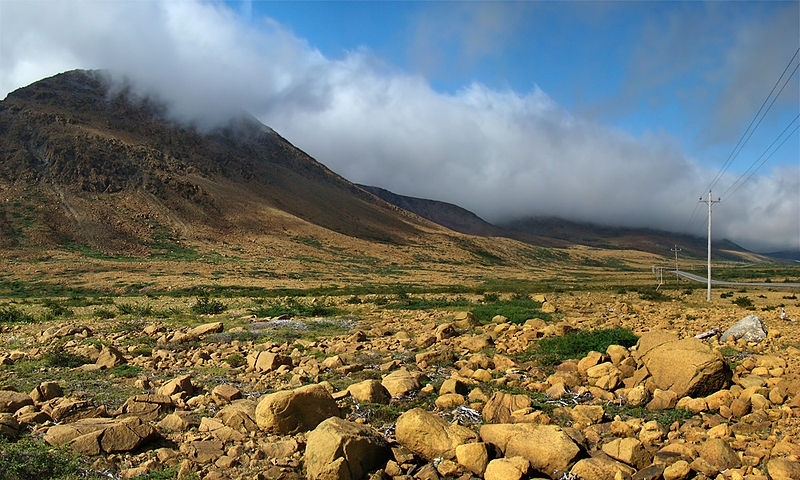
The park comprises two distinct physiographic components: coastal lowland and alpine plateau. The major ecological units include coastal plain, piedmont moraines, the frontal slopes and upland areas of the Long Range mountains, the southern hills, and the Klippe Complex. 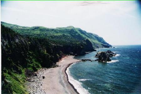 View of the western coat of Newfoundland from the Green Gardens trail in Gros Morne National Park. (View is from the southern part of the trail with the Gulf of St. Lawrence to the right) . Source: University of Utah
The marine areas included in the park comprise the inner portion of St Paul's Inlet, inter-tidal zones and estuaries. The shoreline features beaches, steep cliffs of unconsolidated deposits, and dune formations up to 30 m in height which extend inland for some 1.6 km in a number of places.
The gently sloping coastal plain, which is bordered to the east by the Long Range fault scarp, extends inland for 4-13 km and along the coast for about 55 km. It is composed largely of limestone, and slopes gently seaward in a series of steps, defined by faulting in the underlying Ordovician rock. Meandering creeks, eutrophic bog lakes, dead ice moraine deposits, erratics and small patches of isostatically raised beach deposits are found on the plain.
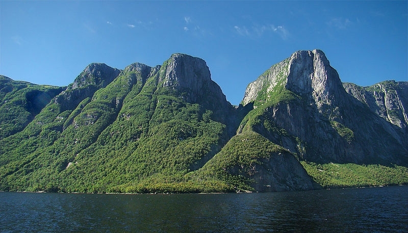
A number of steep sided, glacial valleys cut through the Long Range scarp face, forming deep, oligotrophic lakes, with vertical cliffs up to 685 m high. An upland alpine plateau with perched lakes, bare rock and valleys, covers a large proportion of the eastern central park. The serpentine hills in the south-west comprise ultra-basic igneous rocks, which, due to a high heavy metal content, inhibit most plant life. There are eight major drainage systems which, due to local topography, are all less than 34 km long and tend to flow east or west. 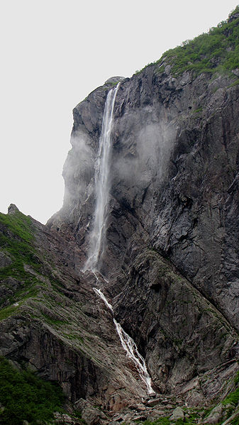 Pissing Mare Falls, , Western Brook Pond, Gros Morne National Park, Newfoundland and Labrador. Source: D. Gordon E. Robertson
A number of waterfalls are fed in the summer by snow melt at higher altitudes. The park is geologically diverse with areas of Ordovician sedimentary rocks, Precambrian granite and gneiss, Palaeozoic serpentinized ultra-basic rocks, gabbros, volcanic and lower Palaeozoic sedimentary rocks. Exposed oceanic crust, mantle, a section of ancient Mohorovicic discontinuity, and other distinctive geological features are also found. The evolution of the North Atlantic Basin and much more recent glacial activities can be determined from these relics. There is also an unusually complete palaeotological sequence which has been proposed as the world stratotype for the Cambrian-Ordovician boundary.
Climate
The climate is cool, wet maritime at sea level and sub-arctic at higher altitudes, and is influenced by the adjacent ocean, strong prevailing south-westerly winds from the Gulf of St. Lawrence and a continual moisture excess. Mean annual air temperature is 3°C with a mean maximum 15.5°C in July and minimum of -8.4°C in February; the highlands are usually some 3°C cooler. Mean annual precipitation for the area includes 1397 millimeters (mm) of rain and 3,281 mm of snow, with 10-30 days of fog. Sea ice forms in winter and the onset of both spring and autumn is delayed by the oceanic influence.
Vegetation
There are up to 36 distinct vegetation types and communities, with some 711 vascular species and 401 bryophytes, representing about 60% of Newfoundland's insular flora. The coast includes typical shoreline communities, namely active dunes with white spruce Picea glauca, and cliffs with prostrate spruce and balsam fir Abies balsamea. The coastal plain further inland has a number of plant communities described by Bouchard and Hay including a mosaic of sedges Carex spp. in meadows with American larch Larix laricina scrub. Black spruce P. mariana dominates wet, oligotrophic sites and balsam fir is found in more protected and mesic areas. Black spruce and dwarf larch Larix larieina scrub colonises exposed moraines, giving way to an ericaceous shrub formation in the more exposed and unstable areas with alpine bearberry Anctostaphylos alpina, alpine azalea Loiseleuria procumbens and diapensia. The scarp cliffs support a mixed deciduous and spruce-fir forest which becomes stunted in higher areas. Tundra vegetation has developed on the plateau above this and varies from small areas of coniferous forest and stunted forest to bare rock. Wet meadows between rock outcrops include grasses, sedges, mosses, pitcher plant Saracenia purpurea, sundew Drosera sp. and purple fringed orchid Habenaria psycodes. Serpentiaicolous plant communities have developed on the Serpentine tablelands in the south, and alpine communities are found on the Bonne Bay Highlands. Close to 100 vascular plant taxa have been identified as significantly rare. The distribution of phytogeographical groups and life-form categories of the vascular flora have been studied, establishing relationships between plant distributions, life-forms and vegetation types.
Gros Morne National Park, Western Newfoundland, Canada. The Tablelands seen from Route 431 in the southern part of the park. Source: Wikimedia Commons.
Fauna
Faunal diversity resembles an oceanic rather than continental shelf island and is markedly reduced compared to the mainland. However a number of species scarce in Canada are found, including lynx Lynx lynx ssp., caribou Rangifer tarandus ssp. and arctic hare Lepus arcticus. The more common marine mammals that can be observed from the park, albeit with a diminishing frequency in recent years include pilot whale Globicephala melaena, minke whale Balaenoptera autorostrata, finback whale B. physalus (V) and harbour seals Phoca vitulina. The avifauna comprises 235 arctic, boreal and pelagic species, with strays from mainland, the north-west Atlantic and Europe. The park is a significant breeding site for harlequin duck Histrionicus histrionicus, blackpoll warbler Dendroica striata, common tern Sterna hirundo, and arctic tern S. paridisaea, a nesting site for bald eagle Haliaeetus leucocephala, rock ptarmigan Lagopus mutus and American tree sparrow Spizella arborea, and a stopover for migrating shore birds. Anadromous Atlantic salmon Salmo salar and arctic char Salvelinus alpinus are found in park waters and also in permanent freshwater form in certain landlocked lakes on the Long Range Mountains.
Cultural Heritage
There are a number of archaeological sites in the park and human habitation can be traced back to the Maritime Archaic Indians (4,500-3,000 years ago) and the Dorset Eskimos (1,800-1,200 years ago). Europeans settled the area from the late 18th century and initially relied upon fishing, and from the 1900 upon commercial logging. Despite developments and modernization, the coastal enclaves retain a distinctive language and cultural tradition.
Local Human Population
The park boundary excludes eight coastal settlements with a population of about 6,000; there are no residents in the park. Principal occupations are seasonal inshore fishing, subsistence agriculture, logging and hunting. In recent years the local employment base has diversified to include tourism.
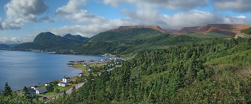
Gros Morne National Park, Western Newfoundland, Canada. Panorama seen on Route 431, overlooking Bonne Bay. Source: Wikimedia Commons.
Visitors and Visitor Facilities
An estimated 125,000 people visited the park in 1994, although revenue figures are not available. In addition to 120km of paved roads, a system of hiking trails allows access to more remote areas. A number of campsites, with a total of 282 site emplacements, are located in the park, and hotels and other services are available in the adjacent communities. Information is available at a number of sites, including the administrative and visitor reception center in Rocky Harbour. Facilities are also available for outdoor activities. Two concession-run boat tours operate. A popular account of the park is given by Nicol and Mace. An interpretive program is offered and educational materials and extension services are provided.
Scientific Research and Facilities
Bouchard and Hay provide a historical account of floristic studies on the western coast of Newfoundland; the Memorial University of Newfoundland, St John's has been prominent in much of the research undertaken in the park. A bibliography of recent research is provided in the World Heritage Site nomination, and published material is available from the Park Superintendent, Rocky Harbour. A research description was completed in 1990, with updates specific to vegetation, freshwater (Freshwater biomes) fish resources, and limnology.
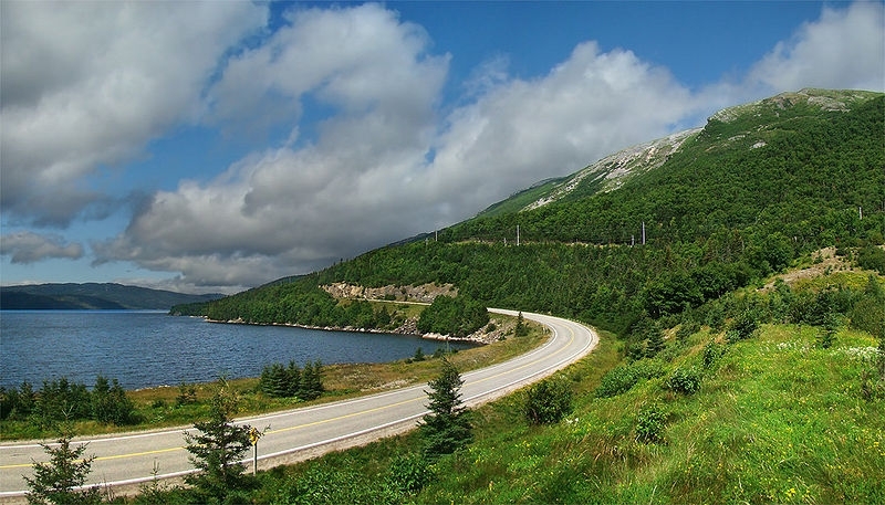
Gros Morne National Park, Western Newfoundland, Canada. Along Route 430 near Rocky Cove. Source: Wikimedia Commons.
Conservation Value
The primary value of the park is its biotic, visual, anthropological, recreational and geological assets. The park is internationally acclaimed for its complete portrayal of the geological events that took place when the ancient continental margin of North America was destroyed by plate movement, and represents an outstanding demonstration of glaciation in an island setting.
Conservation Management
Although the park is not at present formally established under the National Parks Act, legal protection is given by a number of Federal and Provincial statutes including the federal Forestry Development and Research Act, the Fisheries Act, the Migratory Birds Convention Act and the provincial Newfoundland Wildlife Act. Under these acts, felling, rabbit snaring and aggregate extraction are permitted in controlled areas for domestic consumption by a limited number of local communities. Long term management objectives are to: preserve and protect natural resources, geological features, ecosystems and processes; protect and preserve archaeological, historical and cultural resources and landscapes; provide interpretive and extension material and recreational facilities; ensure public safety, convenience and enjoyment; and to integrate the park with activities in its environments. Management has focused on the development of roads, trails and basic facilities. The park is zoned into: zone I Special Preservation Areas (12,645 ha), in which visitor use is restricted; zone II Wilderness Areas (110,105 ha), where limited extensive visitor use is allowed; zone III Natural Environment Areas (55,955 ha), which are designated for domestic resource harvesting and in which visitor use is discouraged; and zone IV General Outdoor Recreation Areas and Park Roads (1,805 ha), designated for intensive use. In addition, a number of small Environmentally Sensitive Sites, with natural or cultural interest have been identified.
Western Brook Pond, Gros Morne National Park, Newfoundland and Labrador. Source: D. Gordon E. Robertson
Management Constraints
The park landscape and natural resources have been disturbed by previous land uses and hunting has reduced wildlife [[population]s]. Furthermore, a number of exotic species (Alien species) have been introduced to the detriment of the indigenous fauna. Nevertheless protection since 1973, has seen populations increase, with the exception of American marten which has disappeared from the park. The continued activities of the local communities will disturb specific areas for the foreseeable future, and the designation of zone III areas is an attempt to reduce land-use conflicts. Whilst extensive recreation poses only a slight threat to the park, intensively used areas are likely to incur some environmental impacts. However, several management activities, such as Parks Canada's environmental assessment and review process aim to minimize impacts.
Western Brook Pond, Gros Morne National Park, Newfoundland and Labrador. Source: Wikimedia Commons.
Staff
A superintendent is assisted by both full time and seasonal staff, with a total of 50 man-years available. A regional office in Halifax, Nova Scotia and district office in St. John's provide management services and assistance. It is proposed that a number of recreational facilities be operated on a commercial basis by private concessionaires.
Budget
Canadian $2.5 million per annum for operations and maintenance. This does not include capital development funding. The bulk of these funds come from federal sources and the capital budget is likely to decline when the cost-intensive initial development is complete.
IUCN Management Category
- II (National Park)
- Natural World Heritage Site - Criteria i, iii
Further Reading
- Bouchard, A. and Hay, S. (1976) The vascular flora of the Gros Morne National Park coastal plain in Newfoundland. Rhodora 78 (814): 207-260.
- Bouchard, A., Hay, S., Gauvin, C. and Bergeron, Y. (1986). Rare vascular plants of Gros Morne National Park, Newfoundland, Canada. Rhodora 88(856): 481-502.
- Bouchard, A., Hay, S., Bergeron, Y. and Leduc, A. (1987). Phytogeographical and life-form analysis of the vascular flora of Gros Morne National Park, Newfoundland, Canada. Journal of Biogeography 14: 343-358.
- Bouchard, A., Hay, S., Bergeron, Y. and Leduc, A. (1991). The vascular flora of Gros Morne National Park, Newfoundland: A habitat classification approach based on floristic, biogeographical and life-form data. In: Nimis, P.L. and Crovello (Eds). Quantitative Approaches to Phytogeography. Kluwer Academic Publishers, Netherlands. Pp 123-157. ISBN: 079230795X.
- Moorhead, S. et al. (1971). Gros Morne National Park study. Report No. 1. Analysis of existing factors and constraints. Strong Moorhead Sigsby Limited, Toronto, Ontario. 120 pp.
- Nicol, K. and Mace, L. (1989). Gros Morne. Canadian Geographic, April/May: 40-49.
- Parks Canada (1990). Rocks Adrift: The geology of Gros Morne National Park. Robinson-Blackmore, Canada. 57 pp. ISBN: 096995090X.
- Parks Canada (1986). Gros Morne National Park. World Heritage Site Nomination No. 419. 63 pp. (Contains a bibliography)
- Parks Canada (1981). Protecting Canada's natural heritage- Canada's national park system. Sixteenth international seminar on national parks and equivalent reserves. 8 pp.
- Parks Canada (not dated). Gros Morne National Park: management plan summary. 22 pp
| Disclaimer: This article is taken wholly from, or contains information that was originally published by, the United Nations Environment Programme-World Conservation Monitoring Centre (UNEP-WCMC). Topic editors and authors for the Encyclopedia of Earth may have edited its content or added new information. The use of information from the United Nations Environment Programme-World Conservation Monitoring Centre (UNEP-WCMC) should not be construed as support for or endorsement by that organization for any new information added by EoE personnel, or for any editing of the original content. |