Canterbury-Otago tussock grasslands
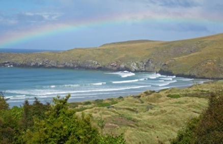
Tussock grassland, breeding habitat of Yellow-eyed penguin, Otago Peninsula. @ C.Michael Hogan
The Canterbury-Otago tussock grasslands ecoregion has unique and unusual landforms and habitats supporting plant and animal communities, rare or absent elsewhere in New Zealand. For example, in addition to tussock habitat, the ecoregion contains expansive coastal marshes and varied coastal terrace landforms. The inland climate is more continental than other parts of the country with extreme seasonal temperature variations. The low rainfall and tendency towards drought conditions had made the original forest cover vulnerable to fire, and by the time European settlers arrived it had long been replaced by tussock grasslands due to alteration by the Maori people who arrived approximately 1100 AD.
Location and General Description
The ecoregion is situated on the eastern side of South Island, New Zealand. Canterbury and Otago lie on the eastern side of the Southern Alps in the South Island of New Zealand; Canterbury to the north, and Otago to the south, the ecoregion is divided by the Hawkdun Range and the Mackenzie Basin. This region lies in the rainshadow of the Southern Alps, so the intermontane basins that lie between the Southern Alps and the eastern foothills tend to be dry and subject to severe frosts in winter. The largest of the basins, the Mackenzie and Maniatoto, in Central Otago, are some of the driest places in New Zealand with annual precipitaion rarely exceeding 500 millimeters (mm).
 Source: WWF
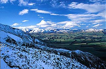
While there are some climatic similarities between Canterbury and Otago there are significant differences that differentiate the two. Canterbury's smaller intermontane basins and frontal ranges (e.g., the Craigieburn and Grampian Ranges) are higher and wetter than the ranges in Otago. They are characterized by typical greywacke landscape features like extensive scree slopes and large alluvial fans. This area was extensively glaciated and remnant features include broad, deeply incised river valleys and moraines. Festuca tussock grasslands and Matagouri (Discaria toumatou) form the main vegetation cover. East of the foothills, the Canterbury Plains stretch 180 kilometers (km) along the coast, with a maximum width of about 70 km. They are a series of giant alluvial fans made up of coarse greywacke-derived gravel, up to 500 metres (m) deep in places, and overlaid with loess. The rivers that formed these fans, the Rangitata, Rakaia, Ashburton and Waimakariri, arise in the Southern Alps and are generally wide with multiple braided channels threading between semi-permanent gravel islands. A millenium ago, there was a zone of swamps at the river mouths, but most have now been drained, with coastal lagoons remaining.
In contrast, the distinctive block mountains of central Otago were generally too low lying, and possibly too dry, to have been glaciated. Their broad tops, decorated with distinctive rocky tors and dotted with boggy wetlands, are thought to be the remains of an eroded peneplain formed during the Cretaceous period. The parent rock is predominantly schist, with only incidental intrusions of greywacke. A large proportion of the area is semi-arid, and the winters can be extreme. Records from the Old Man Range (1590 m) show an average of only 73 frost-free days per annum. In the most arid areas, salt pans occur that support rare [[plant]s] and animals specifically adapted to saline soils. The mountains and low hill country of Otago are linked to the coastal zone by deep rivers often surrounded by rocky gorges, such as New Zealand's largest river (by flow volume), the Clutha.
Prior to the Maori people's arrival, the drier central regions of Otago exhibited a cover of low conifer-broadleaf forest comprised buy species like Mountain Toatoa (Phyllocladus trichomanoides var. alpinus), Montane totara (Podocarpus cunninghamii), New Zealand Broadleaf (Griselinia littoralis), and White Teatree (Kunzea ericoides). The foothills from north to south were originally covered in beech forest (Nothofagus spp.), while the plains were carpeted with mixed beech-podocarp forest dominated by the tree taxa Matai (Prumnopitys taxifolia) and Totara (Podocarpus totara). Coastal broadleaf forest was extensive, and kahikatea swamp forest (dominated byDacrycarpus dacrydioides) grew discontinuously from the Banks Peninsula southward. However, the Maori people destroyed many of these forests, likely to flush out Moa, large flightless ratites (Order Struthionformes) that are now extinct; morever, Europeans later continued the process of land clearance.
The burnt forests were eventually supplanted by tussock grassland communities. Cushion plants such as Veronica thomsonii, tall tussock grasses (Chionochloa spp.), and large herbs such as the speargrass Aciphylla subflabellata are found at high elevations above the natural treeline. These communities are generally stable with few alien plant invaders, although they are often colonized by woody shrubs such as Matagouri. These grasslands can, however, be depleted by burning and grazing animals that selectively take out the more palatable species, leading to a dominance of shorter, less preferred plants.
ort, drought-resistant tussock communities, mainly Hard Tussock (Festuca novae-zelandiae) and Blue Tussock (Poa cita), once dominated the region's lowland zones. The majority of these low- and mid-elevation grasslands are now highly modified as a result of human-caused fires in the Maori period, weed invasion, overgrazing commencing in the European settlement era, irrigation, fertilization, and European Rabbit (Oryctolagus cuniculus) plagues. Introduced pastoral grasses now predominate on the fertile, intensively farmed lowlands and many short tussock species such as Carex inopinata are now severely restricted. Nationally only 10 percent of the tussock areas that were present in 1840 remain today.
Original beech forests (and areas of regeneration) occur in northern and southwestern parts of the region. Coastal and swamp forest remnants are rare.
Biodiversity Features
 The Canterbury Plains, South Island, New Zealand. @ Peter Sundstrom Extensive braided river systems are not common worldwide (only North America, the Danube Delta and the Himalayas have similarly extensive systems), and in New Zealand they are limited to Canterbury and parts of Marlborough. During spring and summer, at least 26 species of water birds feed or breed along these dynamic rivers. However, some of these birds are now threatened or critically endangered. The critically endangered Black Stilt (Himantopus novaezelandiae) is one of the rarest wading birds on Earth: in 2000 only 48 adults remained in the wild. The braided riverbeds, swamps and tarns of the upper Waitaki Basin are now its sole breeding habitat. In addition to birds, braided rivers provide important habitat for numerous [[plant]s] and other native fauna. These include McCann's Skink (Oligosoma maccanni), various encrusting lichens, small cushion plants (Raoulia spp.), willowherbs (Epilobium spp.), and prostrate shrubs such as Sprawling Wirevine (Muehlenbeckia axillaris}. There is a poor vertebrate species richness in the ecoregion with a scant 58 specie of vertebrates recorded, with no native mammals or amphibians.
The small salt pans found in Central Otago's dry montane basins are also noteworthy. There are now few such areas still retaining their native flora, which include very specialized species such as Atriplex buchananii, which plant is normally found in coastal saltmarsh or aerosol spray zones. Also of note are the very rare, minute Lepidium spp. each specimen of which covers only a few square centimetres.
Fish
The endemic Canterbury Mudfish (Neochanna burrowsius) dwells in lentic streams, but can burrow into damp mud even in dry conditions. Its numbers are small, and this fish is presently restricted to habitats that are at risk from modification and drainage. Other native fish found in the region include a variety of Galaxid species such as Whitebait (Galaxias brevipinnis) and the Banded Kokopu (G. fasciatua). In recent years a number of new Galaxids have been described in this region. These, and most other native fish, are migratory and their breeding success is dependent upon maintaining open fish passages to the sea. The large rivers of Otago and Canterbury are now also populated by introduced sport-fish such as Brown Trout (Salmo trutta), Rainbow Trout (Oncorhynchus mykiss), Quinnat Salmon (O. tshawytscha), and Sockeye Salmon (O. nerka).
Reptiles
The dry inland climate and rocky mountain outcrops of Otago are known for their high number of endemic reptiles and invertebrates. Of particular note are two of New Zealand's rarest lizards, both listed as vulnerable on the IUCN 2000 Red List: the Otago Skink (Oligosoma otagense) and the Grand Skink (Oligosoma grande). The range of both these skinks has decreased by approximately 90 percent as a result of habitat destruction and predation. Also found here are the Eyespot Ground Skink (Oligosoma lineoocellatum); Gray's Sticky-toed Gecko (Hoplodactylus granulatus), a new Zealand endemic found on both South and North Island as well as some of the smaller islands in Cook Strait; Whitacker's Sticky-toed Gecko (Hoplodactylus kahutarae); Natural Tree Gecko (Naultinus rudis); Spotted Sticky-toed Gecko (Hoplodactylus maculatus) and the Near Threatened South Island Tree Gecko (Naultinus gemmeus)
Sixty percent of New Zealand's known invertebrate fauna are also found in Otago and an estimated ten percent of these are endemic to the region. They occupy all available habitats from high elevation peaks to coastal habitat and are found in mixed native/exotic communities as well as less modified habitats.
Arthropods
Beetles are a dominant arthropod order, and Otago has a number of distinctive species, particularly the flightless chafers of the genus Prodontria. P. lewisi is restricted to a 0.8 square-kilometer (km2) reserve of sand-dune habitat in the Cromwell area. Moths are also well represented: Otago has 120 endemic species - about 10 percent of its total moth fauna. Some moths have unusual distribution patterns in the region, with normally alpine species such as Chloroclystis nereis found along the coastal zone.
Marine taxa
The Otago Peninsula is a major breeding center for New Zealand Fur Seals (Arctocephalus forsteri), and is also the northernmost place where vulnerable New Zealand Sea Lion (Phocarctos hookeri) breeds on the mainland. About 20 pairs of southern royal Albatross (Diomedea epomophora VU) nest at a protected area on the northern end of the Otago Peninsula: the only mainland colony of this species worldwide. New Zealand's rarest penguin, the endangered Yellow-eyed Penguin (Megadyptus antipodes) is also found on the Otago Peninsula and southward along the coast. It has made a comeback in recent years after a population crash in 1990.
Current Status
The need to preserve intact indigenous communities is a management priority, but because of the discontinuity of land tenure, it requires a high degree of interagency and community cooperation. For example, the Department of Conservation is currently working with pastoral leaseholders on a tenure review to protect the natural values of the region's tussock grasslands. As a result of the review significant blocks of high altitude areas will come under conservation management over the next few years. Forty-two covenants have already been created on private land in Otago, protecting a combined area of nearly 50 km2 and conservation parks are proposed for the Rock and Pillar, Lammermoor, Old Man, Old Woman, Pisa, and Remarkable Ranges. However, the restoration of lowlands is more problematic, given the degree of degradation already present.
Project River Recovery was set up to create and enhance rivers and wetlands in the region and to maintain populations of native plants and animals. River protection will directly benefit the intensively managed black stilt. Other landforms and ecosystems in protected areas include beech and podocarp forests, braided rivers, lakes, coastal wetlands, inland salt pans, geothermal areas, and enclosed bay shorelines. However, the fragmented nature of this region's protected areas (particularly in Otago and on the Canterbury Plains) result in low boundary to area ratios meaning protected areas vulnerable to edge effects such as weed invasion and fires.
There is also a lack of protection for some specific ecosystems (high country wetlands, short tussock grasslands, some forest remnants) and insect species. Threatened plant species currently being protected or monitored include the endemic saltpan cresses (Lepidium kirkii and L. 'sisymbrioides subsp. matau), the upland shrub Veronica cupressoides, the endangered Hector's tree daisy (Olearia hectorii), native Peraxilla mistletoes, and the epiphytic forest shrub Tupeia antarctica.
Types and Severity of Threats
Many of Canterbury and Otago's low stature plant communities are threatened by the invasion of weed species and browsing. Browsing in tussock grasslands and unfenced forest remnants causes habitat damage, erosion, and gives greater scope for weed invasion. Control programs target possums (Trichosurus vulpecula), goats (Capra hircus), Bennett's wallaby (Macropus rufogriseus rufogriseus), and red deer (Cervus elaphus). Efforts are also being made to exclude farm stock from high value tussock grasslands through the tenure review program.
Tussock grasslands are threatened by exotic conifers, such as the lodgepole pine (Pinus contorta), while dryland environments are invaded by broom (Cytisus scoparius) and sweet briar (Rosa rubiginosa). Along with loss of conservation values, weed species such as conifers can reduced stream water yield, reduced profitability of pastoral farming, restrict access for recreation, and generally transform the landscape.
If weed species caused a transformation to taller, denser cover, all the open country and tussock-dependent species would be disadvantaged. Dense mats of hawkweeds (e.g. Hieracium pilosella) tend to take over in heavily grazed short-tussock grasslands, preventing any regeneration of native species. Braided river habitat and surrounding wetlands are at risk from weeds like willows (Salix cinerea and S. fragilis) and Russell lupins (Lupinus polyphyllus) which can colonize and stabilize the dynamic gravels. This makes it difficult for wading birds such as the endemic wrybill (Anarhynchus frontalis) and the black stilt to feed. These birds also need open habitat and good visibility to avoid predators.
Predation from alien species is the greatest threat to native species within conservation areas with feral cats (Felis cattus), rats (Rattus rattus and R. norvegicus), stoats (Mustela erminea), and ferrets (M. putorius) causing the most concern. The region's reptiles, black stilts, and the yellow eyed penguin, are especially at risk from introduced predators although all have benefited from targeted management programs in recent years.
Wetlands and river systems are exploited for water extraction, flood protection works, drainage, and dams. Some once common aquatic species are declining due to obstructed migratory routes, commercial and recreational fishing pressure, especially on some Galaxid species and on freshwater eels (Anguilla spp.), competition from alien species of fish, and habitat degradation.
Fire has played a significant part in the origin of the region's biota and is still used as an agricultural tool in some places. However, repeated and frequent firing of grasslands leads to nutrient depletion, and human-caused fires can destroy established grasslands, shrublands and forest communities.
Justification of Ecoregion Delineation
The Canterbury-Otago tussock grasslands extend from the foothills of the Southern Alps to the east coast of the South Island, incorporating ecological regions and districts as defined by the New Zealand Department of Conservation. The ecoregion largely falls within Wardle's Canterbury and Otago Botanical Provinces, but extends further north, and does not reach as far west, but instead is bounded by the Alps.
Further Reading
- J. Dawson. 1988. Forest vines to snow tussock: the story of New Zealand's plants. Victoria University Press. Wellington, New Zealand. ISBN: 0864730470
- Department of Conservation. 1987. New Zealand topographical map: Ecological regions and districts of New Zealand. Map (1:500,000). Departments of Lands and Survey, Wellington, New Zealand.
- Department of Conservation. 1998. Otago Conservation Management Strategy. Otago Conservation Management Planning Series: 7. Otago Conservancy. Dunedin, New Zealand.
- Department of Conservation. website. http://doc.govt.nz. viewed September 2001.
- C. Hilton-Taylor. 2000. The IUCN 2000 Red List of Threatened Species. IUCN, Gland, Switzerland and Cambridge, United Kingdom. ISBN: 2831705657
- M.S. McGlone. 1989. The Polynesian settlement of New Zealand in relation to environmental and biotic changes. New Zealand Journal of Ecology 12: 115-219.
- L. Molloy. 1988. Soils in the New Zealand landscape: the living mantle. Mallinson Rendel. Wellington. ISBN: 0908606559
- L. Molloy. 1994. Wild New Zealand. New Holland Publishers. London. ISBN: 0262133040
- Patterson, G. 2000. Skinks on the edge. New Zealand Geographic 47: 60-81.
- Soons, J. and M. Selby, editors. 1982. Landforms of New Zealand. Longman Paul, Auckland, New Zealand. ISBN: 0582717868
- Wardle, P. 1991. Vegetation of New Zealand. Cambridge University Press, Cambridge, United Kingdom. ISBN: 193066558X
| Disclaimer: This Article (Canterbury-Otago tussock grasslands) contains some information that was originally published by the World Wildlife Fund. Topic editors and authors for the Encyclopedia of Earth have edited its content and added new information. The use of information from the World Wildlife Fund should not be construed as support for or endorsement by that organization for any new information added by EoE personnel, or for any editing of the original content. |