Water profile of Barbados
Contents
Geography and population
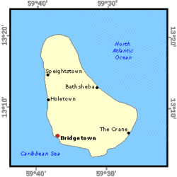
Barbados (13°10' North, 59°32' West) is an independent island nation. It is the most easterly of the Eastern Caribbean islands. It has a land area of 430 kilometers2 with the highest point rising to 323 meters near the center of the island. About five-sixths of the island are coraline in nature, with the remaining one-sixth of shales, sands and clays known as the Scotland District. The Scotland District though quite rugged is known for its land slips and erosion problems. The coraline area is characterized by a number of terraces rising towards the interior of the island, and deep gullies from the higher elevations (bordering the Scotland District) radiating to the coast. Cultivable land is estimated at 22,472 hectares (ha), of which the cultivated area in 1997 was 17,000 ha, 16,000 for annual and 1,000 ha for permanent crops. The major crops grown are sugar cane, cotton, root crops and vegetables. For administrative purposes, the country is divided into 15 provinces or parishes.
The population census of 1990 recorded 260,491 residents, mainly concentrated in the urban corridor along the west coast, south coast and Bridgetown, the capital (located in the southwest). Population growth rate averaged about 0.27% from 1990 to 1997. There are well established and accessible health and education institutions, potable water to the entire population, well developed local and international transport links and telecommunications infrastructure. The main foreign currency earners are tourism and agriculture. Agriculture (non-sugar, sugar and fisheries) contributed 6.3% and 4.9% to gross domestic product (GDP) in 1996 and 1997 respectively, and employed 5.1% of the labor force in 1997.
Climate and water resources
Climate
Barbados has a tropical oceanic climate with a cooling influence from the northeast trade winds. Average daytime temperature is about 29°C ranging from 20 to 32°C. The average annual rainfall is 1,422 mm with the wet (hurricane) season from June to December. In the dry season, rainfall may be less than 25 milimeters/month.
Water resources
Annual internal renewable water resources (IRWR) were estimated in a 1997 Water Resources Study to total about 82 million m3. Groundwater derived from infiltrated rainfall accounts for 73.9 million m3; surface water amounts to 5.8 million m3; springs 2.0 million m3 and direct runoff to the sea 0.5 million m3.
Water withdrawal
Exact quantities of water withdrawal are unknown since irrigation applications are rarely ever calculated, as total metering is only now being implemented for all abstractions and connections to the potable supply. Annual water withdrawal in the agriculture sector in 1996 was estimated at 19.01 million m3 (not including golf course irrigation at 0.9 million m3) whereas the domestic, municipal and industrial sector accounted for 25.85 million m3. Unaccounted water was about 35 million m3.
Almost all of the island's potable water is pumped from 21 groundwater wells in the karstic coraline area of the island, and small quantities obtained from two springs in the Scotland District. Water is treated with chlorine to meet World Health Organization (WHO) and U.S. Environmental Protection Agency (EPA) guidelines and standards, prior to distribution. In the east of the island, there are a few relatively small rivers fed by spring sources, and ephemeral streams that flow during rain events. During the dry season (January to June) there can be water shortages in the potable supply to some areas. The use of water for other non-essential purposes is then prohibited island-wide. There is a sewerage system in place servicing the Bridgetown area.
Irrigation and drainage development
Irrigation potential was estimated in 1998 at 3,587 ha. In estimating this figure, consideration was given to land capability and maintaining safe yields from the groundwater supplies. The 1989 agricultural census indicated an irrigated area of about 1,000 ha. The island's potable water supply is used extensively by small farmers as their irrigation water supply. There are about 120 private hand-dug wells which are mainly used for irrigation. In the past many of the shallower wells were equipped with windmills but today the electric submersible pump is the norm. There is some relatively limited use of dams, springs, streams, roof catchments and road-catchments.
There is extensive use of conventional sprinkler systems and drip micro-irrigation systems for vegetable, fruit and horticultural crops. Drip irrigation has been widely used especially in the past ten years both by farmers and for landscaping. There is no surface irrigation (basin, furrow, flood recession) in the conventional sense, but the term is used to include the use of garden-hose flooding and hand-watering. The Government offers rebate incentives for the use of sprinkler and drip irrigation systems.
There are two Government-financed and operated irrigation schemes providing a piped, on-demand, pressurized water supply. In the north of the island, there is the Spring Hall Land Lease Project (land settlement project) with 22 farmer/family leased plots of land averaging about 10 ha each. The second scheme is the Rural Development Programme in the south, made up of nine individual irrigation systems servicing over 250 farmer-owned plots averaging under one hectare each. The systems are now quite dependable and small farmers rely upon them heavily during the dry season. Water charges are respectively US$16 cents and 22 cents per cubic meter of water used (compared to US$1.06 commercial rate for the potable supply). Regularly produced crops include tomatoes, cucumbers, hot peppers, sweet peppers, onion, carrot and beet. Other irrigated crops include citrus, bananas, plantains and cut-flowers. Irrigated vegetable farmers can get three crops in a season.
There is relatively little wastewater reuse at present for irrigation. A few hotels treat their wastewater and re-use it for irrigating lawns and gardens. Also a number of private homes run part of their wastewater to fruit trees or small banana patches in the backyard.
There is little drainage work carried out by private farmers. In some areas, beds are raised in the wet season to facilitate better drainage in the root zone. Generally, none of the drainage work is traditionally linked to surface irrigation or a high water table. The Soil Conservation Unit of the Ministry of Agriculture has carried out substantial land stabilization works in the Scotland District. The drainage of surface and subsurface flows is essential for this land stabilization. The flows are channeled safely via gabion structures to storage reservoirs or to stream courses which flow into the sea. Little of this water is now used for irrigation, and little quantification is made of the stream flow and irrigation potential in the area. Plans are being put in place to utilize some of this water for irrigation.
Institutional environment
The Barbados Water Authority (BWA) is the institution with overall responsibility for the development, management (Water governance) and assessment of the island's water resources. BWA supplies all potable water and also operates the Bridgetown Sewerage System. All abstractions from wells, streams and rivers must be approved and licensed by the BWA. There is currently no abstraction fee but there are plans to implement this in the near future.
Generally, development of irrigation rests with the Land and Water Use Unit of the Ministry of Agriculture and the Irrigation Unit of the Barbados Agricultural Development and Management Corporation (a Government corporation), which operates and maintains the two public irrigation schemes. They have no regulatory mandate. The Soil Conservation Unit of the Ministry of Agriculture must be consulted on all development in the Scotland District.
Water quality and environmental pollution matters fall within the mandate of the Environmental Engineering Division while public health water-related matters fall to the Public Health Inspectorate. Both are sections within the Ministry of Health. In 1963, the Government instituted a policy (revised in 1973) which created a system of five Groundwater Protection Zones implemented across the island to guard against bacteriological contamination of the public water supply wells. The most stringent regulations are enforced in the Zone I area which is located immediately around all existing and potential public water supply sites. Zones 2 to 5 provide progressively less stringent controls. The policy, however, does not address chemical contamination and still needs specific legislative authority.
Relevant water resources conservation legislation includes the Barbados Water Authority Act (1980), the Underground Water Control Act (1953), the Three Houses Act (1713) and the Porey Spring Act.
Trends in water resources management
The 1997 Water Resources Study suggests that unaccounted-for water in the BWA's potable water supply approaches 60%. There are ongoing efforts to reduce this level by at least 30% with several measures including the implementation of tariff increases to control demand. Contracts have been signed for the construction of a 6 million m3/y brackish water desalination plant to augment the potable water supply. A Draft Policy Framework for Water Resources Development and Management for Barbados is in preparation.
Construction is well advanced on a sewerage system to service the south coast and plans are approved for a system for the west coast by 2005. Wastewater from these systems together with the Bridgetown system will amount to about 11 million m3/y, and is now being considered as a water resource for golf course irrigation, as a buffer to seawater intrusion along the west coast and other uses.
Licensing and a usage fee will be implemented for all agricultural (and other) abstractions in an attempt to control and monitor water use.
Sprinkler and drip irrigation systems are now well accepted by the farming community. The focus will now be to optimize irrigation water use efficiencies. Further development of farming districts similar to the Rural Development Programme with dedicated (public or private financed) irrigation systems, will encourage farmers to reduce their dependence on the potable (chlorinate) water supply, and allow them access to lower rates for irrigation water.
There are recommendations for the implementation of a Code of Agricultural Practice to address potential pollution problems attributed to pesticides, herbicides, and fertilizers in agriculture.
Further reading
- Water profile of Barbados, Food and agriculture Organization.
- World Factbook: Barbados, Central Intelligence Agency.
- Town and Country Planning Department. 1998. Area Development Plan (Final Draft). Bridgetown.
- Barbados Water Authority. 1997. Draft Policy Framework for Water Resources Development and Management. Bridgetown.
- Barbados Water Authority. 1997. Barbados Water Resources Development and Management. Statistical Services Department. Statistical Services Labor Force Survey. Bridgetown.
- Statistical Services Department. 1994. Barbados 1990 Population and Housing Census, Vol I. Bridgetown.
- Ministry of Agriculture. 1992. Barbados 1989 Agricultural Census. Bridgetown.
| Disclaimer: This article is taken wholly from, or contains information that was originally published by, the Food and Agriculture Organization. Topic editors and authors for the Encyclopedia of Earth may have edited its content or added new information. The use of information from the Food and Agriculture Organization should not be construed as support for or endorsement by that organization for any new information added by EoE personnel, or for any editing of the original content. |