Northern Zanzibar-Inhambane coastal forest mosaic
Introduction The Northern Zanzibar-Inhambane Coastal Forest Mosaic ecoregion (Northern Zanzibar-Inhambane coastal forest mosaic) , together with the Eastern Arc montane forests, together harbor densities of plant species that are among the highest in the world. The great diversity of habitats contributes to the species richness of the area, although the levels of species endemism, most notably among the plants, is also high in this ecoregion. Natural habitats, especially small forest patches, are highly threatened along the Kenyan coast, and only slightly less threatened in coastal Tanzania. This has resulted primarily from conversion to agricultural land, although various forms of extraction also pose significant threats.
Location and General Description
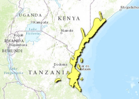
This is the northernmost ecoregion of the eastern and southern African coastal forest belt, and is found in Somalia, Kenya and Tanzania. The northern margin is an isolated forest outlier along the Jubba Valley in central [[coast]al] Somalia. The ecoregion then resumes in southern Somalia, extends into northern Kenya, inland along the Tana River, and then follows the narrow coastal strip in central and southern Kenya to the border with Tanzania. In northern Tanzania the ecoregion extends around the base of the East Usambara Mountains where the habitat intergrades with that of the Eastern Arc Mountains. It then continues along the coast of northern Tanzania to Dar es Salaam where outliers of the ecoregion extend inland at the base of the Uluguru, Nguru and Udzungwa Eastern Arc Mountains. It again narrows around the Rufiji River, continuing along the coast until it meets the border of the next ecoregion around the Tanzanian town of Lindi. The ecoregion includes the large offshore islands of Pemba, Zanzibar and Mafia and other smaller islets in the Indian Ocean close to the coast.
The climate of this ecoregion is tropical, with average temperatures above 25°C, little variation in day length, and generally high humidity. Most rainfall comes in distinctive rainy seasons, although showers can also occur at other times. In the northern portion of the ecoregion there are two rainy seasons, with a longer season from April to June and a shorter season from November to December. In the south, the rain falls over the one long season between April and June. One of the main characteristics of the region is the extreme variability in rainfall from year to year, with dry seasons that sometimes extend into droughts and rainy seasons that can cause severe flooding. However, it is the dry season that is the most characteristic ecological feature of the forests of the area; during these times even the forest floor can become quite dry. Despite the high annual variability in the rainfall, the long-term climate of the ecoregion has remained relatively stable over millions of years, and potentially as long as 30 million years, even during the colder and drier periods of the last Ice Age.
The ecoregion contains a large number of rock types dating from the Pre-Cambrian basement rocks through recent unconsolidated sediments at the mouths of rivers and along the coast. The majority of the area is, however, formed from marine sediments deposited since the break-up of Pangea, with younger sediments closer to the coast. Over the past 30 million years, the Northern Zanzibar-Inhambane Coastal Forest Mosaic has been subject to considerable tectonic activity, which has formed low ridges and swells (generally 100-300 meters [m] high). This activity has also caused the shoreline to move in and out from its present position, with the subsequent deposition and erosion of sediments. Faulting associated with the development of the Rift Valley also affected the eastern African coastal region. One such fault has isolated Pemba Island through the formation of a deep-water Pemba Trench.
The soils in the ecoregion are complex with at least six major FAO (Food and Agriculture Organization (FAO)) soil units. There is also considerable variation at the local scale. There are approximately 12 major soil types supporting coastal forests in this ecoregion. These range from soils that are sandy with imperfect drainage, sandy loams with excessive drainage, loams with moderately good drainage, loams with imperfect drainage, and clays with imperfect drainage. The regular and predictable change in soils down available slopes gave rise to the theory of catenary succession in soils.
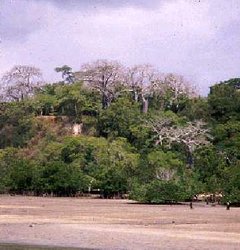
 Arabuko-sokoke forest, Kenya. (Photograph by Judy Oglethorpe) The human population of the area is relatively high in the central part of the ecoregion from southern Kenya to northern Tanzania (around 100 persons per km2 in the rural areas). There are also a number of large towns in the ecoregion (Mombasa, Tanga and especially Dar es Salaam) that already have dense populations, and continue to attract people from the rural areas. Because they require a large input of raw materials, such as charcoal for cooking fuel, their impact is considerable on the surrounding areas. Population density falls rapidly to the north and south of the ecoregion (to 1-10 persons per km2), in line with declining rainfall and increasing seasonality.
This ecoregion forms a part of White's Zanzibar-Inhambane regional mosaic. Due to the exceptional level of plant endemism in the northern part of this regional mosaic, the Zanzibar-Inhambane regional mosaic has recently been reclassified as the Swahilian regional center of endemism and the Swahilian-Maputaland regional transition zone. The Northern Zanzibar Inhambane coastal forest mosaic falls entirely within the Swahilian regional center of endemism. In the phytogeographical schemes of White and Clarke the complex integration of moist (at the base of the Eastern Arc Mountains) and drier forests with [[coast]al] thicket, fire-climax savanna woodlands, seasonal and permanent swamps, and littoral habitats is emphasized.
Approximately 2500 km2 of forest is found in the ecoregion. It is believed that over thousands of years the forests in this ecoregion have been reduced dramatically. Evidence that supports this is diverse, but most of the convincing evidence is from the previous mining of sub-fossil resin (Gum Copal) of the forest species, Hymenea verrucosa, from many coastal areas that currently support fire-maintained savanna-woodland vegetation. Starting approximately 100,000 years ago, it is believed that the forest was lost due to fires set by early humans. Over the past 2000 years, this loss has intensified because of farming, cutting trees for firewood, and building materials in order to supply the empires of Arabia, Portugal, Germany, and Britain. Currently only remnant areas of forest remain, and these are highly threatened.
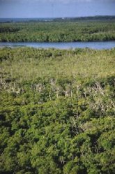
Part of the complexity of vegetation types is natural, but the influence of anthropogenic activities over thousands of years is also believed to have been vital in shaping the natural vegetation now found in the area. There are over 4,500 plant species and 1,050 genera that occur in this mosaic. Of these, 3,000 species in 750 genera are confined to forest habitats. Trees account for the greatest proportion (48%) of the coastal forest flora. There are many tree species in these forests, with the dominant species changing markedly between forest patches. Some of the more abundant trees are Afzelia quanzensis, Scorodophloeus fischeri, Dialium holtzii, Hymenaea verrucosa, Millettia struhlmanni, Berlinia orientalis, Cynometra spp., and Xylia africana. Lianas are also common, as are shrubs, herbs, grasses, sedges, ferns, and epiphytes.
Biodiversity Features
The ecoregion supports a large number of endemic species, at a density among the highest in the world. These endemics are concentrated in the forest areas, but are also found in drier bushland and grassland habitats. Biologically, the drier forest types within this ecoregion are the most distinctive, with monospecific genera and numerous endemic species, especially within the plants. Species richness is low in the strict forest taxa, but is greatly boosted by savanna, woodland and wetland species that also occur in the ecoregion.
In all biological groups there are distinctive localized peaks of endemism, which seem to be related more to relictualization of ancient species in certain areas, rather than rapid evolution of new species, or undue collection biases. One of the more remarkable features of the flora is the close relationship at the genera level with certain forests in West Africa. This implies an ancient forest connection and the persistence of genera that have gone extinct in between, even though relationships at the species level are not as strong. A further feature of the endemism is the high degree of local turnover in the species between adjacent forest fragments within the landscape mosaic, and the high incidence of rare species exhibiting disjunct distributional patterns. All these features indicate an ancient history of the forests within this ecoregion, and also indicate that the species may naturally be declining in an area that has been slowly drying for millions of years.
Distributional patterns for many species are fragmented, and among the numerous endemics, most are forest specialists and are confined to the remaining forested patches within the mosaic of habitats. Of the ten strictly endemic bird species, four are restricted to the island of Pemba (Treron pembaensis, Nectarinia pembae, Zosterops vaughani and Otus pembaensis), one in the lower Tana River (Cisticola restrictus, DD), and the rest mainly in the mainland coastal forest remnants (Erythrocercus holochlorus, Anthus sokokensis (EN), Ploceus golandi (EN), and Campethera mombassica). The remaining strict endemic is found in [[coast]al] grasslands in Kenya, Anthus melindae. The most restricted species on the mainland is Clarke's weaver (Ploceus golandi), which is known only from Arabuko-Sokoke and one adjacent forest in coastal Kenya. Somewhat more wide-ranging species found in these forests include the Sokoke Scops Owl (Otus ireneae, EN), Fischer's turaco (Tauraco fischeri), plain-backed sunbird (Anthreptus pallidigaster, EN), spotted ground-thrush (Zoothera guttata, EN), east coast akalat (Sheppardia gunningi, VU) and the southern-banded snake eagle (Circaetus fasciolatus).
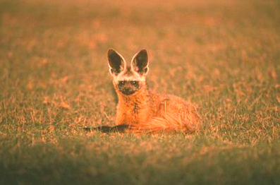
At least 158 species of mammal use this ecoregion, approximately 17% of the total species in the Afrotropical realm. The most diverse mammal groups are bats (58 species), rodents (27+ species), carnivores (19 species), primates (14 species), and shrews (14 species). This high rate of species richness is due to the mixing of habitats in the ecoregion, and hence the large number of savanna, wetland and forest species which can be found in close proximity. Among the mammals, endemism is also pronounced. Strict endemics include Ader's duiker (Cephalophus adersi, EN), Pemba flying fox (Pteropus voeltzkowi, CR), two other poorly known bat species (Chalinolobus kenyacola, DD) and (Pipistrellus permixtus, DD), golden-rumped elephant shrew (Rhynchocyon chrysopygus, EN), Tana River Red colobus (Procolobus rufomitratus, CR), the agile mangabey (Cercocebus galeritus galeritus, CR) and the rodent Grammomys caniceps. There are also a number of near-endemic threatened species, including the eastern tree hyrax (Dendrohyrax validus, VU) and the black and rufous elephant shrew (Rhynchocyon petersi, EN). Larger mammals in the ecoregion are generally habitat specialists that take advantage of the forest patches, but cross to open savanna and grasslands. These include bushpig (Potamochoerus porcus), bushbuck (Tragelaphus scriptus), yellow baboon (Papio cynocephalus), elephant (Loxodonta africana), leopard (Panthera pardus), lion (Pantera leo), and caracal (Caracal caracal).
Of the 94 reptile species occuring in the ecoregion, 47 are forest-dependent and 34 are strictly endemic. Key endemic reptile groups include geckos (Gekkonidae), chameleons (Chameleonidae), skinks (Scincidae), lacertid lizards (Lacertidae), worm-snakes (Typhlopidae), and true snakes (Atractaspididae, Elapidae, and Colubridae). The amphibians in this ecoregion are also diverse and exhibit a moderate rate of endemism. Poynton list 14 species as largely confined to [[coast]al] forests, with 2 species being strictly endemic to this ecoregion (Afrixalus sylvaticus and Stephopaedes sp. nov).
Millipedes, mollusks, and butterflies also exhibit high diversity and moderate levels of endemism. There are 1,200 species of mollusks in the region, 125 of which are confined to forests. Of the regional total, 207 species are endemic, of which 86 species confined to forests. Butterflies are represented by 400 forest species, of which 75 are endemic.
Current Status
The forest habitat in this ecoregion is highly fragmented, with over 200 separate patches. The remaining natural habitats are becoming more fragmented as agriculture and other human activities spread with increasing populations. The habitat between the forests in Kenya is mainly comprised of farmland, urban areas, and in some places, quarries. In Tanzania, habitat between the forests is generally savanna woodland or thicket, with increasing agricultural areas. The largest remaining block of habitat is the 370 km2 Arabuko-Sokoke Forest near Malindi in Kenya. This site falls mainly within a forest reserve although part of the forest is protected as a national park (6 km2). The only other protected forest of more than 50 km2 is in the Shimba Hills National Reserve in southern Kenya. In Tanzania forested areas are not larger than 40 km2, and typically are much smaller. There are also numerous small forest patches through the ecoregion, some protected as forest reserves, some as traditionally protected reserves and burial groves, and others that are unprotected (or inaccessible).
There are few protected areas in this 111,829 km2 ecoregion. These are Tana River Primate Reserve, Shimba Hills National Reserve, Arabuko-Sokoke National Park, Sadaani Game Reserve (now including Mkwaja Ranch) and the Mafia Island Marine Park. In total these areas cover less than 1,200 km2 of land, of which much is savanna woodland. Most of the larger forest patches remaining in this ecoregion are found within government controlled forest reserves, which were originally established for controlled resource exploitation. However, many of the forest reserves are poorly managed through lack of resources in the Forestry Department. Some important sites are protected as sacred forests of local peoples, but many of these are threatened due to westernization, increased influence of Islam and Christianity, and agricultural expansion.
There are a number of conservation projects operating in different [[coast]al] forests, all generally pursuing an integrated conservation and development (ICDP) model. Current donor supported projects in the coastal forests include BirdLife International (with EU funding), Coast Forest Conservation Unit (with various funding sources), WWF-Tanzania (with DiFiD of UK funding), Wildlife Conservation Society of Tanzania (through IUCN Netherlands, Forum Sud with Sweden and EU funding), Tanga Catchment Forestry (with FINNIDA funding), Tanzania Forest Conservation Group (with various funding from USA and UK), and Care-Tanzania (with EU Funding). There is also a Global Environmental Facility (GEF)-funded project in the Tana River, and the GEF is also preparing a project in the coastal forests of Tanzania.
Types and Severity of Threats
A recent analysis found that the most severe threat to the [[coast]al] forest patches in this ecoregion was from agricultural expansion. Other common threats include extraction of woody materials (poles, timber, firewood, charcoal, ropes, etc). These occur in almost every forest that is not in a national park, with the level of intensity linked to the population density near the forest. In the past, extensive areas of forest were converted for plantations of trees and sisal. Such losses are no longer occurring, but the current activities threaten the remaining forests. Threats to other habitats in the ecoregion are also typically due to agricultural use of the land from an expanding population, and extractive use of woody materials for firewood, charcoal, building materials, etc.
The non-forest habitats of the ecoregion are also threatened. The extensive areas of bushland and savanna that are found along the coast are utilized extensively to provide wood for charcoal burning. This activity is most intense close to the large urban centers, especially Dar es Salaam in Tanzania. The bushland and wetland areas are also converted to farmlands and plantations of species such as sisal and various tree crops. Most of this conversion is presently small in scale, but in the past large areas of natural habitats have been converted to such uses. Some habitat has also been lost to mining of limestone for the production of concrete, especially near Mombasa and Dar es Salaam.
Justification of Ecoregion Delineation
This ecoregion largely follows the northern section of the Zanzibar-Inhambane regional mosaic and the Swahilian Regional Centre of Endemism. The northern boundary includes the Jubba riverine forests in Somalia and the Tana riverine forests in northern Kenya. The western boundary largely follows that of White, although some small patches of habitat are merged in with this ecoregion, and the offshore islands are also included. The southern boundary was shifted north from Clarke's boundary to the vicinity of the Lukuledi River in southern Tanzania, as this area represents a possible transition among biotas. Further investigation of this pattern is needed to better understand the biogeographic relationships.
Additional information on this ecoregion
- For a shorter summary of this entry, see the WWF WildWorld profile of this ecoregion.
- To see the species that live in this ecoregion, including images and threat levels, see the WWF Wildfinder description of this ecoregion.
- World Wildlife Fund Homepage
Further Reading
- Axelrod, D.I. and P.H. Raven. 1978. Late Cretaceous and Tertiary vegetation history of Africa. M.J.A. Werger, editor. with assistance from A.C.Van Bruggen, (1978). Biogeography and Ecology of Southern Africa. Dr. W. Junk Publishers, The Hague.
- Bennun, L.A., R.A. Aman, and S.A. Crafter, editors. 1995. Conservation of biodiversity in Africa: local initiatives and institutional roles. Center for Biodiversity, National Museums of Kenya.
- Brenan, J. P. M. 1978. Some aspects of the phytogeography of tropical Africa. Ann. Miss. Bot. Gard. 65: 437-478.
- Bullock, S.H., H.A. Mooney, and E. Medina, editors. 1996. Seasonally dry tropical forests. Cambridge University Press, Cambridge UK. 450 pp.
- Burgess, N.D., C. FitzGibbon, and G.P. Clarke. 1996. Coastal Forests of East Africa. Pages 329-359. T. McClanaghan, and T.P. Young. Ecosystems and their conservation in East Africa. Oxford University Press, New York.
- Burgess, N.D. and G.P. Clarke, editors. 2000. The Coastal Forests of Eastern Africa. IUCN: Cambridge and Gland.
- Burgess, N.D., G.P. Clarke, and W.A. Rodgers. 1998. Coastal Forests of eastern Africa: status, species endemism and its possible causes. Biological Journal of the Linnean Society 64: 337-367
- Clarke, G.P. 1998. A new regional centre of endemism in Africa. D.F. Cutler, C.R. Huxley, J.M. Lock, editors. Aspects of the ecology, taxonomy and chorology of the floras of Africa and Madagascar. Kew Bulletin Additional Series. Royal Botanic Gardens, Kew.
- Hamilton, A.C. 1982. Environmental History of East Africa. Academic Press, London.
- Hawthorne, W.D. 1993. East African Coastal Forest botany. Pages 57-99 in J.C. Lovett, and S.K. Wasser, editors. Biogeography and Ecology of the Rain Forests of Eastern Africa. Cambridge: Cambridge University Press.
- Kingdon, J. 1989. Island Africa, the evolution of Africa's rare animals and plants. Princeton University Press, Princeton, NJ, USA. 287 pp.
- Lovett, J.C. and S.K. Wasser, editors. 1993. Biogeography and Ecology of the Rain Forests of Eastern Africa. Cambridge University Press, Cambridge.
- Madgwick, F.J. 1988. Riverine forest in the Jubba Valley: vegetation analysis and comments on forest conservation. The Biogeography of Somalia, Biogeographia 14: 67-88.
- Milne, G. 1935. Some suggested units of classification and mapping, particularly for East African soil. Soils Research 4: 183-198.
- Mittermeier, R.A., N. Myers, and C.G. Mittermeier. 1999. Hotspots: earth's biologically richest and most endangered terrestrial ecoregions. CEMEX, Mexico, D.F.
- Moll, E. and F. White. 1978. The Indian Ocean Coastal Belt. M.J.A. Werger, editor, with assistance from A.C. Van Bruggen. Biogeography and Ecology of Southern Africa. The Hague: Dr. W. Junk Publishers.
- Myers, N., R.A., C.G. Mittermeier, G.A.B. Mittermeier da Fonseca, and J. Kent. 2000. Biodiversity hotspots for conservation priorities. Nature 403(6772): 853-858.
- Nicholson, S.E. 1994. Recent rainfall fluctuations in Africa and their relationships to past conditions over the continent. The Holocene 4: 121-131.
- Prell, W.L., W.H. Hutson, D.F. Williams, A.W.H. Be, H. Geitzenauer, and B. Molfino. 1980. Surface Circulation of the Indian Ocean during the Last Glacial Maximum, Approximately 18,000 yr. B.P. Quaternary Research 14: 309-336.
- Stattersfield, A.J., M.J. Crosby, A.J. Long, and D.C. Wege. 1998. Endemic Bird Areas of the World. Priorities for Biodiversity Conservation. BirdLife Conservation Series No. 7. BirdLife International, Cambridge, UK.
- Wass, P., editor. 1995. Kenya's Indigenous Forests: status, management and conservation. IUCN Forest Conservation Programme, Gland and Cambridge.
- White, F. 1983. The vegetation of Africa, a descriptive memoir to accompany the UNESCO/AETFAT/UNSO Vegetation Map of Africa (3 Plates, Northwestern Africa, Northeastern Africa, and Southern Africa, 1:5,000,000). UNESCO, Paris.
| Disclaimer: This article is taken wholly from, or contains information that was originally published by, the World Wildlife Fund. Topic editors and authors for the Encyclopedia of Earth may have edited its content or added new information. The use of information from the World Wildlife Fund should not be construed as support for or endorsement by that organization for any new information added by EoE personnel, or for any editing of the original content. |


