Nauru
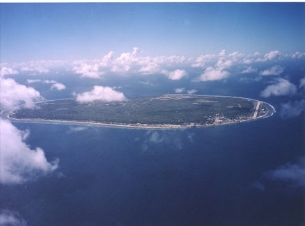
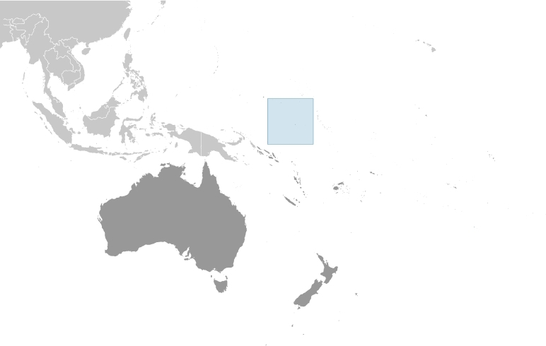
Countries and Regions of the World Collection  Nauru is an island nation of under 10,000 people in the South Pacific Ocean, only 53 km south of Equator, south of the Marshall Islands.
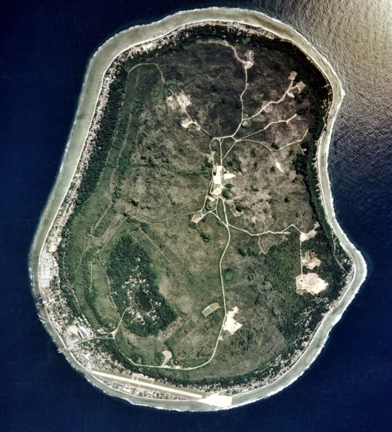
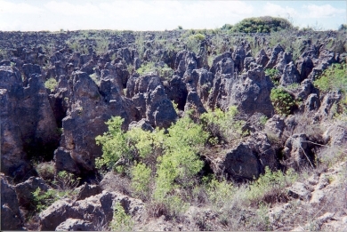
Nauru is one of the three great phosphate rock islands in the Pacific Ocean - the others are Banaba (Ocean Island) in Kiribati and Makatea in French Polynesia. Intensive phosphate mining during the past 90 years - mainly by a UK, Australia, and NZ consortium - has left the central 90% of Nauru a wasteland and threatens limited remaining land resources.
Its other major environmental issues include limited natural freshwater resources, roof storage tanks collect rainwater but mostly dependent on a single, aging desalination plant.
Nauru is susceptible to periodic droughts.
The exact origins of the Nauruans are unclear since their language does not resemble any other in the Pacific.
Germany annexed the island in 1888. A German-British consortium began mining the island's phosphate deposits early in the 20th century.
Australian forces occupied Nauru in World War I; it subsequently became a League of Nations mandate.
After the Second World War - and a brutal occupation by Japan - Nauru became a UN trust territory.
It achieved independence in 1968 and joined the UN in 1999 as the world's smallest independent republic.
Source: Wikimedia Commons.
Contents
Geography
Location: Oceania, island in the South Pacific Ocean, south of the Marshall Islands
Geographic Coordinates: 0 32 S, 166 55 E
Area: 21 sq km
Coastline: 30 km
Maritime Claims:
Natural Hazards: periodic droughts
Terrain: sandy beach rises to fertile ring around raised coral reefs with phosphate plateau in center. The highest point is an unnamed elevation along plateau rim (61 m).
Climate: tropical with a monsoonal pattern; rainy season (November to February)
Source: U.S. Department of Energy's Atmospheric Radiation Measurement Program.
Government
Government Type: Republic
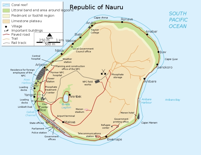
Capital: no official capital; government offices in Yaren District
Administrative divisions: 14 districts; Aiwo, Anabar, Anetan, Anibare, Baiti, Boe, Buada, Denigomodu, Ewa, Ijuw, Meneng, Nibok, Uaboe, Yaren
Independence Date: 31 January 1968 (from the Australia-, NZ-, and UK-administered UN trusteeship)
Legal System: mixed legal system of common law based on the English model and customary law. Nauru has not submitted an International Court of Justice (ICJ) jurisdiction declaration; and accepts International criminal court (ICCt) jurisdiction.
| A limestone karst on Nauru Island as a result of the over-mining of phosphate. Source: U.S. Department of Energy's Atmospheric Radiation Measurement Program. |
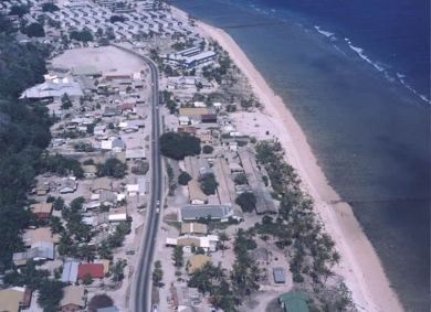
| Nauruan districts of Denigomodu and Nibok. Source: U.S. Department of Energy's Atmospheric Radiation Measurement Program. |
International Environmental Agreements
Nauru is party to international agreements on: Biodiversity, Climate Change, Climate Change-Kyoto Protocol, Desertification, Hazardous Wastes, Law of the Sea, Marine Dumping, Ozone Layer Protection, and Whaling.
People and Society
Population: 9,378 (July 2012 est.)
Ethnic Groups: Nauruan 58%, other Pacific Islander 26%, Chinese 8%, European 8%
Age Structure:
0-14 years: 33% (male 1,398/female 1,682)
15-64 years: 65.3% (male 2,996/female 3,093)
65 years and over: 1.6% (male 68/female 85) (2011 est.)
Population Growth Rate: 0.608% (2012 est.)
Birthrate: 27.08 births/1,000 population (2012 est.)
Death Rate: 5.97 deaths/1,000 population (July 2012 est.)
Net Migration Rate: -15.04 migrant(s)/1,000 population (2012 est.)
Life Expectancy at Birth: 65.7 years
male: 61.62 years
female: 69.11 years (2012 est.)
Total Fertility Rate: 3.03 children born/woman (2012 est.)
Languages: Nauruan (official, a distinct Pacific Island language), English (widely understood, spoken, and used for most government and commercial purposes)
Urbanization: 100% of total population (2010)
Access to Improved Drinking Water Sources: 90% of population
Access to Improved Sanitation Facilities: 50% of population
Resources
Natural Resources: phosphates, fish
Land Use:
arable land: 0%
permanent crops: 0%
other: 100% (2005)
Economy
Revenues of this tiny island traditionally have come from exports of phosphates. Few other resources exist, with most necessities being imported, mainly from Australia, its former occupier and later major source of support.
In 2005 an Australian company entered into an agreement to exploit remaining supplies. Primary reserves of phosphates were exhausted and mining ceased in 2006, but mining of a deeper layer of "secondary phosphate" in the interior of the island began the following year. The secondary phosphate deposits may last another 30 years.
The rehabilitation of mined land and the replacement of income from phosphates are serious long-term problems.
In anticipation of the exhaustion of Nauru's phosphate deposits, substantial amounts of phosphate income were invested in trust funds to help cushion the transition and provide for Nauru's economic future. As a result of heavy spending from the trust funds, the government faced virtual bankruptcy.
To cut costs the government has frozen wages and reduced overstaffed public service departments.
Nauru lost further revenue in 2008 with the closure of Australia's refugee processing center, making it almost totally dependent on food imports and foreign aid. Housing, hospitals, and other capital plant are deteriorating.
The cost to Australia of keeping the government and economy afloat continues to climb.
Few comprehensive statistics on the Nauru economy exist with estimates of Nauru's GDP varying widely.
GDP: (Purchasing Power Parity): $60 million (2005 est.)
GDP- per capita (PPP): $5,000 (2005 est.)
Agricultural products: coconuts
Industries: phosphate mining, offshore banking, coconut products
Currency: Australian dollars (AUD)
