French Polynesia
| Topics: |
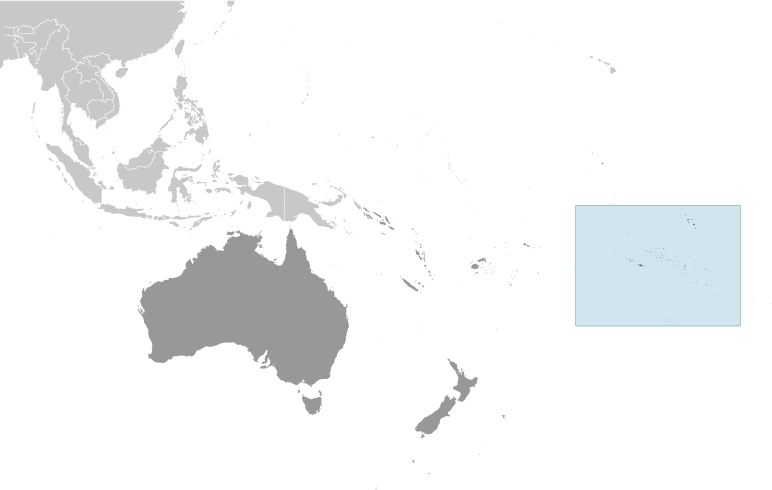
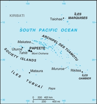
Countries and Regions of the World Collection  French Polynesia includes five archipelagoes (Archipel Des Tuamotu, Iles Gambier, Iles Marquises, Iles Tubuai, Society Islands) in the South Pacific Ocean about half way between South America and Australia. They include 118 islands and atolls with just under 300,000 people.
Four of the four archipelagoes are volcanic in origin and one coral. Makatea in French Polynesia is one of the three great phosphate rock islands in the Pacific Ocean - the others are Banaba (Ocean Island) in Kiribati and Nauru.
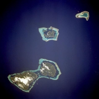
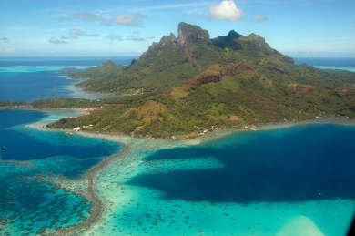
| Considered by many as one of the natural wonders of the world, the island of Bora-Bora is a single island surrounded by an extensive coral reef and a beautiful blue lagoon captured in the center of this low-oblique photograph. The coral reef north of Bora-Bora is Tupai Atoll. The two islands southeast of Bora-Bora - Tahaa (northern island) and Raiatea (larger southern island) - are encircled by a single coral reef system. Image courtesy of NASA. |
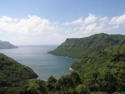
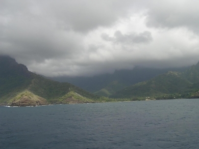
| Hiva Oa Island in the Marquesas archipelago. |
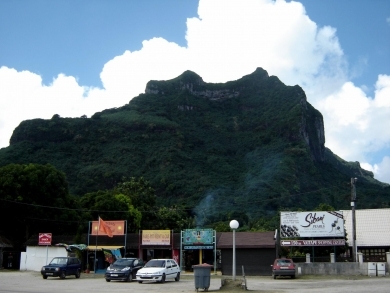
| Another view of "paradise." This is Bora Bora's "downtown," a tiny grocery store, a car rental place, and not much else. |
| Bora Bora from the air |
|
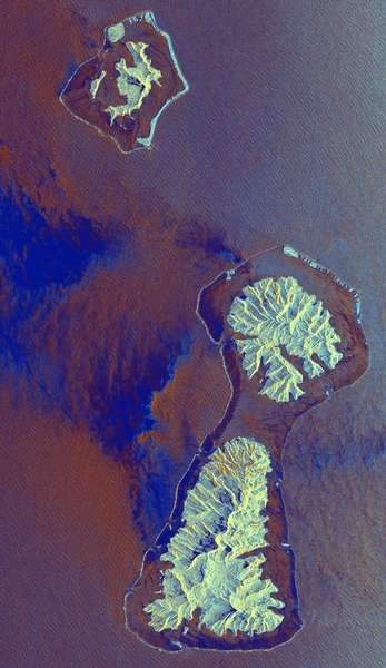
This radar image shows three of the Society Islands located 220 kilometers (136 miles) northwest of Tahiti in French Polynesia in the south Pacific ocean. The twin islands in the center of the image, Raiatea (south, lower island) and Tahaa (north, the upper island) share a common lagoon fringed by a coral reef, which appears as the thin bright line surrounding both islands. Bora Bora, the island to the northwest (top of image) is also fringed by a coral reef. The deep bay on the eastern side of Raiatea (right side of image) is fed by the Faaroa River, the only navigable river in French Polynesia. The volcanoes which created these islands were active 3 to 4 million years ago. The two "motus" (islands) southwest of Bora Bora, within the fringing coral reef, are remnants of the volcanic caldera rim that remain above sea level. Ocean swell caused by trade winds are seen as the small ripples on the ocean surface around all of the islands. The local winds were blowing from east to west (right to left) when these data were collected; large dark areas are areas of low wind while the dark narrow bands just inside much of the reef likely indicate very shallow reef zones. In addition to geological studies, scientists can use such images to study the extent and condition of coral reefs. The area shown is 39 by 67 kilometers (24 by 41 miles); north is towards the upper right. The image was acquired on October 4, 1994. Source: NASA |
The French annexed various Polynesian island groups during the 19th century.
In September 1995, France stirred up widespread protests by resuming nuclear testing on the Mururoa atoll after a three-year moratorium. The tests were suspended in January 1996.
In recent years, French Polynesia's autonomy has been considerably expanded.
Contents
Geography
Location: Oceania, five archipelagoes (Archipel Des Tuamotu, Iles Gambier, Iles Marquises, Iles Tubuai, Society Islands) in the South Pacific Ocean about half way between South America and Australia
Geographic Coordinates: 15 00 S, 140 00 W
Area: 4,167 sq km (118 islands and atolls) (land: 3,827 sq km; water: 340 sq km)
Coastline: 2,525 km
Maritime Claims:
Natural Hazards:
Terrain: mixture of rugged high islands and low islands with reefs. The highest point is Mont Orohena (2,241 m)
Climate: tropical, but moderate
Major Islands:
Archipel Des Tuamotu
- Disappointment Islands
- Duke of Gloucester Islands
- Far East Tuamotu Group
- Hao Group
- Hikueru Group
- King George Islands
- Palliser Islands
- Raeffsky Islands
Iles Gambier
- Gambier Group:
- Acteon Group:
Iles Marquises - 12 islands located at 8º to 11ºS latitude and 139º to 141ºW longitude. All islands in the group are volcanic high islands with the northwest islands being approximately 6 million years old, and the southeast are the youngest at 1.3 million years old. The topography is very steep with knife-edged ridges, deeply dissected gorges and cliffs extending from mountaintops straight to sea level.
- Northern Marquesas
- Southern Marquesas includes Hiva Oa
Iles Tubuai (sometimes combined with Bass islands to form the Austral Islands)
Society Islands - a chain of high volcanic islands extending from 16º to 18º S latitude and 148º to 154º W longitude. Of the 14 islands in the group, 9 are high dormant volcanoes while the remainder are atolls with volcanic substrata deep beneath.
- Windward Islands (Îles du Vent) includesTahiti and Moorea
- Leeward Islands (Îles Sous-le-Vent) includes Bora Bora
Ecology and Biodiversity
The Society Islands tropical moist forests occur in three general forms: lowland rain forest, montane rain forest, and cloud forest. The isolation and great age of the high islands has contributed to marked radiations in some plant and invertebrate taxa. This biodiversity has been seriously impacted by land clearing, fire, introduced mammals, and most recently by an introduced plant that threatens to engulf all remaining forest areas.
The Marquesas tropical moist forests are extremely isolated and all flora and fauna present are the result of long-distance colonization and in situ evolution for thousands to millions of years. Forty-two percent of the 320 native vascular plants are endemic. The terrestrial snail community is quite diverse, with at least 78 species represented. Ten endemic birds occur here. Unfortunately, this biodiversity has been exposed to almost two millennia of human disturbance. Several species have gone extinct in known history and much of the flora and fauna is critically endangered.
The Tuamotu tropical moist forests ecoregion is spread over 3,000 km2 of the Pacific Ocean, and encompasses the 76 atolls and islands of Tuamotu, which stretch 1,800 kilometers (km) to the Gambier Islands and the Pitcairn Islands 1,000 km to the east. The biodiversity present here highlights the effects of extreme isolation and challenging conditions of atolls on flora and fauna. The Tuamotus and Gambier Islands are largely atolls, while the Pitcairn group consists of raised limestone islands and high islands. The Tuamotus contain some of the most intact and damaged atolls in the Pacific. Natural communities are highly threatened by land clearing, introduced predators, and nuclear testing.
See also: Biological diversity in Polynesia-Micronesia
People and Society
Population: 274,512 (July 2012 est.)
Ethnic groups: Polynesian 78%, Chinese 12%, local French 6%, metropolitan French 4%
Age Structure:
0-14 years: 23.5% (male 35,376/female 33,840)
15-64 years: 69.3% (male 105,823/female 98,597)
65 years and over: 7.2% (male 10,742/female 10,557) (2011 est.)
Population Growth Rate: 1.021% (2012 est.)
Birthrate: 15.92 births/1,000 population (2012 est.)
Death Rate: 4.76 deaths/1,000 population (July 2012 est.)
Net Migration Rate: -0.94 migrant(s)/1,000 population (2012 est.)
Life Expectancy at Birth: 76.39 years
male: 74.18 years
female: 78.71 years (2012 est.)
Total Fertility Rate: 2 children born/woman (2012 est.)
Languages: French (official) 61.1%, Polynesian (official) 31.4%, Asian languages 1.2%, other 0.3%, unspecified 6% (2002 census)
Literacy: (age 14 and over can read and write): 98% (1977 est.)
Urbanization: 51% of total population (2010) growing at an annual rate of 1.3% (2010-15 est.)
Government
Dependancy Status: overseas lands of France; overseas territory of France from 1946-2003; overseas collectivity of France since 2003, though it is often referred to as an overseas country due to its degree of autonomy.
Capital: Papeete (located on Tahiti) (population: 133,000 est. 2009)
Water
Total Renewable Water Resources:
Freshwater Withdrawal (domestic, industrial, agricultural):
Agriculture
Agricultural products: fish; coconuts, vanilla, vegetables, fruits, coffee; poultry, beef, dairy products
Irrigated Land: 10 sq km (2008)
Resources
Natural Resources: timber, fish, cobalt, hydropower
Land Use:
Economy
Since 1962, when France stationed military personnel in the region, French Polynesia has changed from a subsistence agricultural economy to one in which a high proportion of the work force is either employed by the military or supports the tourist industry. With the halt of French nuclear testing in 1996, the military contribution to the economy fell sharply.
Tourism accounts for about one-fourth of GDP and is a primary source of hard currency earnings.
Other sources of income are pearl farming and deep-sea commercial fishing.
The small manufacturing sector primarily processes agricultural products.
The territory benefits substantially from development agreements with France aimed principally at creating new businesses and strengthening social services.
GDP: (Purchasing Power Parity): $4.718 billion (2004 est.)
GDP: (Official Exchange Rate): $6.1 billion (2004)
GDP- per capita (PPP): $18,000 (2004 est.)
GDP- composition by sector:
agriculture: 3.5%
industry: 20.4%
services: 76.1% (2005)
Industries: tourism, pearls, agricultural processing, handicrafts, phosphates
Currency: Comptoirs Francais du Pacifique francs (XPF)
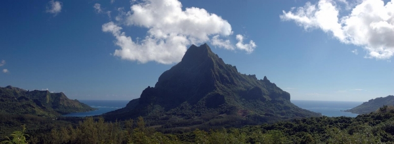
Panoramic view of Moorea.
