Great Plains ecoregion (CEC)
| Topics: |
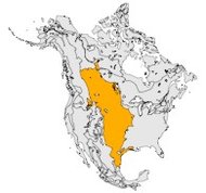
The Great Plains ecological region is found in the central part of the continent and extends over the widest latitudinal range of any single North American ecological region. It is a relatively continuous and roughly triangular area covering about 3.5 million square kilometers. The North American prairies extend for about 1,500 kilometers (km) from Alberta, Saskatchewan and Manitoba in Canada, south through the Great Plains of the United States to southern Texas and adjacent Mexico, and approximately 600 km from western Indiana to the foothills of the Rockies and into northeastern Mexico. This ecological region is distinguished particularly by the following characteristics: relatively little topographic relief; grasslands and a paucity of forests; and subhumid to semiarid climate.
Physical Setting
The Prairies range from smooth to irregular plains. In Canada they are generally flat to slightly rolling plains. Sizable portions in the United States are hilly or classified as tablelands with moderate relief (100-175 meters (m)). The Mexican landscape alternates flat areas and low hills. The landscape of the Canadian Prairies (as well as the northern prairies of the United States) has been shaped by a variety of glacial deposits consisting mostly of undulating and kettled glacial till, and level to gently-rolling lacustrine deposits. These landforms are associated with intermittent sloughs and ponds. Surficial geology in the remainder of the Great Plains ecological region is varied. Major portions are eolian, others are stream deposits, and much of the region is comprised of thin residual sediments. The Mexican portion is underlain by Cenozoic sedimentary rocks with recent continental deposits, mainly in the coast. In the northern and central Great Plains, most of the rivers have their origins in the Rockies, where rainfall, snowmelt and glacial runoff in the north contribute to their formation. The soils are commonly deep and throughout most of the region were originally highly fertile. Today, soils of agricultural potential throughout the Great Plains face problems of reduced nutrient potential, increasing salinity and susceptibility to wind and water erosion. The climate is dry and continental, characterized in the north by short, hot summers and long, cold winters. High winds are an important climatic factor in this ecological region. It is also subject to periodic, intense droughts and frosts.
Biological Setting
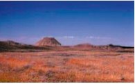
The Great Plains ecological region was once covered with natural grasslands that supported rich and highly specialized plant and animal communities. The interaction of climate, fire and grazing influenced the development and maintenance of the Great Plains. Rainfall increases from west to east, defining different types of native prairies. Short-grass prairie occurs in the west, in the rain shadow of the Rocky Mountains, with mixed-grass prairie in the central Great Plains and tall-grass prairie in the wetter eastern region. In the Mexican Great Plains, prickly scrub vegetation dominates the landscape, in transition between the desert conditions and the warmer and wetter conditions of the Prickly Tropical Forest (warm-dry jungles). Because of the suitability of the Great Plains for agricultural production, many native prairie vegetation types have been radically transformed. The short-, mixed- and tall-grass prairies now correspond to the western rangelands, the wheat belt and the corn/soybean regions, respectively, to the central and eastern Great Plains. In the northern Canadian Prairies, the remaining natural vegetation is dominated by spear grass, wheat grass and blue grama grass, where local saline areas feature alkali grass, wild barley, greasewood, red samphire and sea blite. Drier northern sites are home to yellow cactus and prickly pear, with sagebrush also abundant.
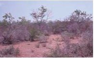
The Aspen Parkland, the northern transition zone to the boreal forest, has expanded south into former grasslands since settlement effectively stopped prairie fires. In the United States, native prairie vegetation ranges from grama grass, wheatgrass and bluestem prairie in the north to different shrub and grassland combinations (e.g., mesquite-acacia savanna and mesquite-live oak savanna) and grassland and forest combinations (e.g., juniper-oak savanna and mesquite-buffalo grass) in the south. There are also patches of blackland prairie, bluestem-scachuista and southern cordgrass prairie in the southern United States. The eastern border of the region, stretching from central Iowa to Texas, shows patterns of grassland and forest combinations mixed with oak-hickory forest. Throughout the remainder of the Great Plains there are few native deciduous trees that occur, except in the eastern regions or in very sheltered locations along waterways or at upper elevations. In Mexico, the characteristic natural vegetation consists of prickly scrubs, with dominant species including mesquite, acacia, paloverde, silverleaf, hackberry, Texas olive, barreta, corbagallina, and ocotillo. Salt-tolerant communities are common in the lower portions of the Mexican Great Plains near the Laguna Madre.
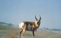
Wetland concentrations are generally greatest in the glaciated, subhumid northern grasslands and adjacent aspen parkland of the northern Great Plains, where up to half of the land is wetland. Significant wetlands are also found in the Nebraska Sandhills and a large area of playas is located in the southwestern United States. During winter, the Mexican bodies of water provide habitat for numerous migrant waterfowl from Canada and the United States. Prairie wetlands provide major breeding, staging and nesting habitat for migratory waterfowl using the central North American flyway. Prior to European settlement, the Great Plains supported millions of bison, pronghorn antelope, elk and mule deer, plains grizzly bears and plains wolves. Today, the Great Plains is home to a disproportionately high number of rare, threatened, vulnerable and endangered species (IUCN Red List Criteria for Endangered). The draining of wetlands and conversion of wildlife habitat for agriculture, industry and urban development are significant issues in this ecological region.
Human Activities
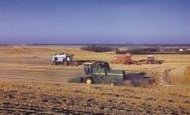
The Great Plains is currently a culturally-molded ecosystem. The first European settlers began moving westward into the northern and central Great Plains from the eastern forest regions. At first, settlers considered the prairies to be infertile, so they stayed where trees persisted. But soon, settlers realized that the prairie soil was one of the most productive soils in the world. Today, the prairie grasslands are among the largest farming and ranching areas of the Earth. Agriculture is the most important economic activity as well as the dominant land use and the main stressor for this ecological region.
Crop types vary from north to south with differences in growing seasons and temperatures. Spring wheat and other grain crops such as barley and oats are common in the north. Corn is grown along the eastern, more moist northern and central portions, whereas winter wheat and sorghum predominate in the central and southern parts. While agricultural activities dominate the rural landscape, population is centered in urban areas and rural depopulation is a continuing trend in Canada and the United States.
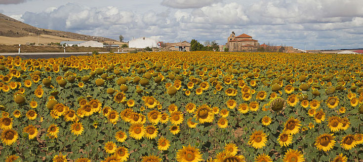
There is a general trend in Canada and the United States away from small and medium-sized farms to large agribusiness operations. The change to a more complex economic structure in this region, influenced by international market forces, is also reflected in an increasing service sector. Mining as well as gas and oil extraction are also important activities. In the southern Great Plains, irrigation agriculture along the Rio Grande is very important, as it is in the southern portion of the Mexican Great Plains. The main cultivated crops are sorghum, corn, sunflowers, canola and beans. In the undulating and drier land of open scrub vegetation in the northwest, extensive cattle and goat ranching is very important. In portions of the region, scrub vegetation has been replaced by hay meadow. The Rio Grande crosses this region, acting both as an international border for 650 km and as an area of extensive commercial activity. Overall, approximately 34 million people live within this ecological region, with some 32 million alone occupying the portion occurring within the United States.
| Disclaimer: This article is taken wholly from, or contains information that was originally published by, the Commission for Environmental Cooperation. Topic editors and authors for the Encyclopedia of Earth may have edited its content or added new information. The use of information from the Commission for Environmental Cooperation should not be construed as support for or endorsement by that organization for any new information added by EoE personnel, or for any editing of the original content. |
