Glorioso Islands
| Topics: |
Source: NASA
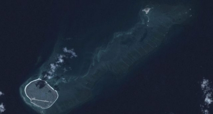
The Glorioso Islands (Îles Glorieuses) are composed of two lushly vegetated coral islands (Ile Glorieuse and Ile du Lys) and three rock islets in the northern part of the Mozambique Channel.
The islands and rocks are surrounded by an extensive reef system. A military garrison operates a weather and radio station on Ile Glorieuse.
|
|

The Glorioso Islands are part of the French Southern and Antarctic Lands. It is also considered part of the Îles Éparses (Scattered Islands or Scattered Islands in the Indian Ocean -Îles éparses de l'océan indien) which include Bassas da India, Europa Island, the Glorioso Islands, Juan de Nova Island, and Tromelin Island.
A French possession since 1892, the Islands are claimed by Madagascar.
The vegetated drying cays of Banc du Geyser, in the Mozambique Channel, which were claimed by Madagascar in 1976, also fall within the EEZ claims of the Comoros and France (Glorioso Islands).
Geographic Coodinates: 11 30 S, 47 20 E
Area: 5 sq km
Coastline: 35.2 km
Maritime claims:
territorial sea: 12 nm
exclusive economic zone: 200 nm
Climate: tropical
Terrain: low, flat, and sandy. The highest point is an unnamed location (12 m).
Natural Resources: fish, crayfish, guano, phosphates, and coconuts
Land Use: 100% lush vegetation and coconut palms
Natural Hazard: subject to periodic cyclones
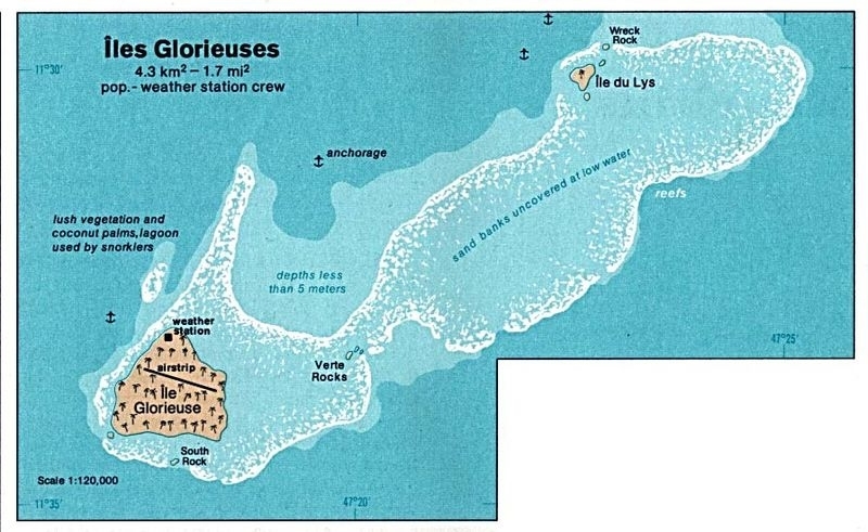
1976 Map. Source: CIA Map