Geography (Geography) 2
From The Encyclopedia of Earth
Geography
Geography is the study of natural and human constructed phenomena from a spatial perspective. Geography has two main sub disciplines:
- Human geography includes such subjects as demography, human settlements, transportation, recreation and tourism, resources, religion, social traditions, human migration, agriculture, urban systems, and economic activities
- Physical geography is concerned with the study of the Earth’s atmosphere, biosphere, hydrosphere, and lithosphere from theoretical and applied viewpoints.
Sometimes the disciplines of human and physical geography combine knowledge to create a more holistic synthesis.
========
-
 Featured Article
 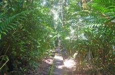 Borneo peat swamp forestsWWF Terrestrial Ecoregions Collection Although the Borneo peat swamp forests are not as biodiverse as neighbouring lowland rainforests, the... More »
- Featured Article
 Terrestrial biome (Geography)Introduction Many places on Earth share similar climatic conditions despite being found in geographically different areas. As a result of natural selection, comparable... More »
- Featured Article
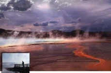 What’s in Yellowstone’s Future?Steam Explosions, Earthquakes, and Volcanic Eruptions—What’s in Yellowstone’s Future? Yellowstone, one of the world’s... More »
- Featured Article
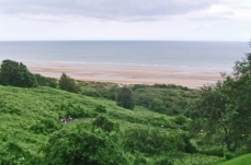 English Channel (Geography)The English Channel is that saline water body that connects the North Sea to the Celtic Sea. It is bounded on the north by England and on the south by France. This water body... More »
- Featured Article
 Northern California coastThe Northern California coast section encompasses diverse topography including mountains, hills, valleys and plains in the Northern California Coast Ranges and small parts of... More »
- Featured Article
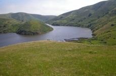
 Sea of the HebridesThe Sea of the Hebrides is an element of the North Atlantic Ocean, located off the western coast of Scotland, separating the Scottish mainland and the northern Inner Hebrides... More »
- Featured Article
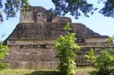 Guatemala (Geography)Guatemala is a Central American nation of fourteen million people located between Mexico, El Salvador, Honduras and Belize. Its western coast fronts to Pacific Ocean and... More »
- Featured Article
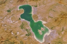 Lake Urmia (Geography)Lake Urmia is a shallow perennial inland salt water body in northwestern Iran. This lake is the second largest in the Middle East, measuring roughly 5000 square kilometers in... More »
- Featured Article
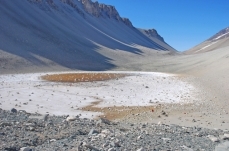 Don Juan PondThe Don Juan Pond in western Antarctica is the most saline water body on Earth, at approximately twelve to thirteen times the salinity level of other typical seas of the world.... More »
Recently Updated
 Syria (Geography) Last Updated on 2015-10-04 22:11:16 Syria is a nation of about 22,000,000 people in the Middle East, bordering the Mediterranean Sea, between Lebanon and Turkey. Its major environmental issues include: Deforestation; Environmental damage from terrorist and military activity Overgrazing; Soil erosion; Desertification; Water pollution from raw sewage and petroleum refining wastes; and, Inadequate potable water Following World War I, France acquired a mandate over the northern portion of the former Ottoman Empire province of Syria. The French administered the area as Syria until granting it independence in 1946. The new country lacked political stability, however, and experienced a series of military coups during its first decades. Syria united with Egypt in February 1958 to form the United Arab Republic. In September 1961, the two entities separated, and the Syrian Arab Republic... More »
  Croatia (Geography) Last Updated on 2015-09-29 17:08:25 Croatia is a nation of nearly four-and-a-half million people in southeastern Europe, bordering the Adriatic Sea, between Bosnia and Herzegovina and Slovenia. Its major environmental issues include: Air pollution (from metallurgical plants) and the resulting acid rain is damaging the forests; Coastal water pollution from industrial and domestic waste; and Landmine presence and reconstruction of infrastructure consequent to 1992-95 civil strife. Croatia is susceptible to destructive seismic events. Lands that today comprise Croatia were part of the Austro-Hungarian Empire until the close of World War I. In 1918, the Croats, Serbs, and Slovenes formed a kingdom known after 1929 as Yugoslavia. Following World War II, Yugoslavia became a federal independent Communist state under the strong hand of Marshal Tito. Although Croatia declared its independence... More »
 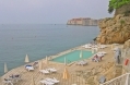 Adriatic Sea (Geography) Last Updated on 2015-09-29 15:00:08 The Adriatic Sea is a branch of the Mediterranean Sea lying between 2 (50,590 miles2). The Adriatic has a maximum depth of 1233 metres (m) and an average depth of 252 m; although north of a line from Zadar, Croatia to Pescara, Italy, it is less than 100 m deep. The northern end of the sea is the Gulf of Venice and its southern limit is the Strait of Ontranto. By European standards, the Adriatic is both warm (surface water temperature ranges from 8-13oC in winter to 22-25oC in summer) and low in turbidity; correspondingly, this sea is a popular tourist destination. Map of the Adriatic Sea basin. Source: Norman Einstein/Wikimeia Commons True-color Moderate Resolution Imaging Spectroradiometer (MODIS) image from May 18, 2002. Source: NASA The Adriatic coastline is heavily indented and includes many islands. As a result the coastline is... More »
  Lake Baikal Basin, Russian Federation Last Updated on 2015-09-15 16:56:57 Lake Baikal Basin (53°10'24.96 North, 107°39'45 East) is a World Heritage Site located in the Russian Federation. Situated in south central Siberia close to the Mongolian border, Lake Baikal is the oldest by 25 million years, and deepest, at 1637 metres (m), of the world's lakes. It is 3.15 million hectares (ha) in size and contains a fifth of the world's unfrozen surface freshwater. Its age and isolation and unusually fertile depths have given it the world's richest and most unusual lacustrine fauna which, like the Galapagos Islands, is of outstanding value to evolutionary science. The exceptional variety of endemic animals and plants make the lake one of the most biologically diverse on Earth. A pulp and cellulose mill on the southern shore, which has created water pollution of 200 square kilometres (km2) of the lake and generated some of the highest... More »
 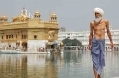 India (Geography) Last Updated on 2015-09-01 11:18:16 India is one of the major nations of the world. With 1,205 million people, it has the second largest population (after China). It is bordered by the Arabian Sea and Indian Ocean in the south, east and west. To the North, it borders Bangladesh, Bhutan, Myanmar (Burma), China, Nepal, and Pakistan. India has a long and complex history reflected in its intricate mixture of ethnic groups, languages and cultures. While, density populated, India is home to a wide range of varied ecoregions with important biodiversity. Its major environmental issues include: deforestation; soil erosion; overgrazing; desertification; air pollution from industrial effluents and vehicle emissions; water pollution from raw sewage and runoff of agricultural pesticides and herbicides; tap water is not potable throughout the country; and, its huge and growing... More »