Eritrean coastal desert
Location and General Description
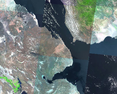
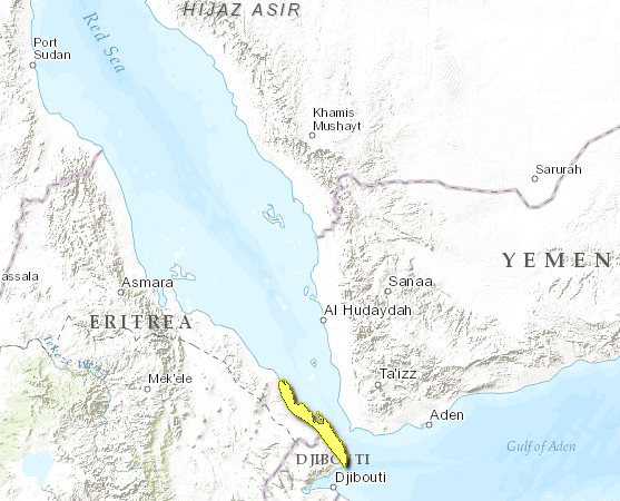
This ecoregion is located along the coast of Eritrea and Djibouti bordering the Red Sea, and includes several groups of offshore islands, such as the Sept Frères belonging to Djibouti. The climate is hot and dry with less than 100 millimeterss (mm) average annual rainfall, although rainfall is highly variable from year to year. The ecoregion experiences mean maximum temperatures of 33°C, and has the highest mean minimum temperature (27°C) of anywhere in Africa. Basement rocks consist of volcanic lavas from the Ethiopian highlands that reach the Red Sea, overlain with regosols. The landscape consists of a flat, largely featureless sand or gravel plain lying below 200 meters (m) altitude, interspersed with rocky outcrops. The shoreline is a mixture of rocky areas (e.g. around Ras Siyan in Djibouti), old coral reefs that are exposed at low tide, and sandy beaches. The human population of the area is very small with few permanent settlements, mostly fishing villages scattered along the coast near inlets.
Vegetation consists of sparse herbaceous / grassy steppe (typical species include Aerva javanica, Cymbopogon schoenanthus, Panicum turgidum, and Lasiurus scindicus) and scattered Acacia tortilis / Acacia asak steppe with some Rhigozum somalense / Caesalpinia erianthera shrubland. Along the coast, there are stretches of halophytic vegetation, and the few sheltered creeks are fringed with stands of mangroves such as Rhizophora mucronata, Ceriops tagal, and Avicennia marina. Inland, the ecoregion grades into xeric grasslands and shrublands. Phytogeographically, White (1983) regarded it as part of the Somali-Masai regional center of endemism, and mapped it as part of the Red Sea Coastal Desert, which also occurs in Egypt as the Red Sea Coastal Desert ecoregion.
Biodiversity Features
The ecoregion contains no distinctive flora, few resident fauna and few endemics. Only three near-endemic species are found here, all reptiles: the Ogaden burrowing asp (Atractaspis leucomelas), Ragazzi's cylindrical skink (Chalcides ragazzii), and Indian leaf-toed gecko (Hemidactylus flaviviridis). However, none of them are strictly endemic to this ecoregion. Dorcas gazelles (Gazella dorcas) (VU) are still relatively common, although the status of other antelopes such as Soemmerring's gazelle (Gazella soemmerringii) (VU), and Salt's dikdik (Madoqua saltiana) is not well known. Each autumn the Djiboutian section of the ecoregion is the site of one of the world's largest intercontinental raptor migrations. Hundreds of thousands of Asian and European birds of prey cross from the Arabian Peninsula to Africa via the Bab-el-Mandeb Straits at the mouth of the Red Sea. Scientists there have recorded 26 species of raptors, the two most numerous species being the steppe buzzard (Buteo buteo vulpinus) and the steppe eagle (Aquila nipalensis). In addition, the Sept Frères islands have important breeding colonies of swift terns (Sterna bergii) and lesser-crested terns (Sterna bengalensis) while green turtles (Chelonia mydas) (EN) and hawksbills (Eretmochelys imbricata) (CR) nest in sheltered sandy [[coast]al] coves.
Current Status
The habitats of the ecoregion are largely intact, but degraded by overgrazing and fuelwood collection, particularly near settlements. Although there are currently no protected areas, proposals have been made to protect the Sept Frères and the section of the coast from Kadda Guêïni to Doumêra, both in Djibouti. The inhospitable conditions of this ecoregion for human settlement offers some protection to the wildlife. In Eritrea and Djibouti a hunting ban is in place. In practice enforcement is non-existent. In 1995, researchers saw little to no evidence of its violation in areas of Eritrea; however, hunting is always a concern, both in Eritrea and Djibouti.
Types and Severity of Threats
Poaching of gazelles, marine turtles and nesting seabirds (for both meat and eggs) occurs. A potential future threat would be the upgrading of the Eritrea-Djibouti coastal road (currently an ungraded track), which could lead to unplanned and uncontrolled development. However, it could also dramatically improve the potential for sensitively managed ecotourism in the area.
Justification of Ecoregion Delineation
This ecoregion follows the boundaries of the southern portion of the Red Sea Coastal desert of White. Although communities in this region are similar to those of the Red Sea coastal desert in Egypt, this region is elevated to ecoregion status due to its isolation from the former unit (over 10° latitude) and some modest floral and faunal differences.
Additional information on this ecoregion
- For a shorter summary of this entry, see the WWF WildWorld profile of this ecoregion.
- To see the species that live in this ecoregion, including images and threat levels, see the WWF Wildfinder description of this ecoregion.
- World Wildlife Fund Homepage
Further Reading
- Audru, J., G. Cesar, G. Forgiarini, and J. Lebrun. 1987. La Végétation et les Potentialités Pastorales de la République de Djibouti. Institut d'Elevage et de Médecine Vétérinaire des Pays Tropicaux, Maisons-Alforts, France. 384 pages.
- East, R. (ed.) 1999. African Antelope Database 1998. IUCN/SSC Antelope Specialist Group. IUCN, Gland, Switzerland and Cambridge, UK.
- MacKinnon, J. and MacKinnon K. 1986. Review of the Protected Areas Systems in the Afrotropical Realm. IUCN. Gland; Switzerland.
- Magin, G. 2001. The Important Bird Areas of Djibouti. In Fishpool, L, (ed.). The Important Bird Areas of Africa. BirdLife International, Cambridge, UK.
- Magin, C., editor. 1999. Monographie Nationale de la Diversité Biologique de Djibouti. Direction de l'Environnement, Ministère de l'Habitat, de l'Urbanisme, l'Environnement et de l'Aménagement du Territoire, Djibouti et l'UICN, Nairobi, Kenya. 263 pages.
- Welch, G. and Welch, H. 1988. The autumn migration of raptors and other soaring birds across the Bab-el-Mandeb straits. Sandgrouse 10: 26-50.
- White, F. 1983. The vegetation of Africa, a descriptive memoir to accompany the UNESCO/AETFAT/UNSO Vegetation Map of Africa (3 Plates, Northwestern Africa, Northeastern Africa, and Southern Africa, 1:5,000,000). UNESCO, Paris.
| Disclaimer: This article is taken wholly from, or contains information that was originally published by, the World Wildlife Fund. Topic editors and authors for the Encyclopedia of Earth may have edited its content or added new information. The use of information from the World Wildlife Fund should not be construed as support for or endorsement by that organization for any new information added by EoE personnel, or for any editing of the original content. |

