Einasleigh upland savanna
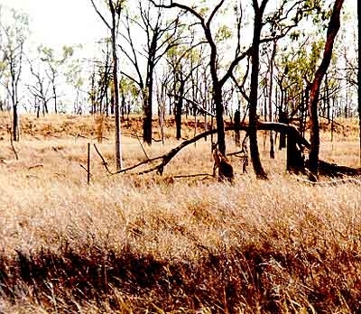
Mt. Georgetown, Queensland, Australia Photograph by John Morrison
The Einasleigh Uplands is a diverse area separated from surrounding tropical savannas by differences in climate, vegatation, and geology. The region is known for its rich basaltic soils and lava tubes. Ironbark woodlands, dry rainforests, and wetlands are all found in this ecoregion. A rich fauna is found in this ecoregion, including a number of cave-adapted insects as well as rare and localized mammals and reptiles. Due to a low intensity of human use, vegetation in this area is well-preserved and protected in conservation areas. However, cattle grazing, weeds, and mining are all threats.
Location and General Description

The Einasleigh uplands are a geologically rich area in the north of Australia’s eastern highlands. The erosional landforms of the Einasleigh Uplands are geologically distinct from surrounding areas, including the depositional plains around the Gulf of Carpentaria to the west (Carpentaria tropical savannas) and the rolling clay plains of the Mitchell grass downs to the southwest. Vegetation in this region is different from surrounding areas. Here, seasonally dry eucalypt dominated woodlands stand in sharp contrast to the Queensland tropical rain forests to the east. Acacia dominated woodlands common in the Desert Uplands region of the Mitchell Grass Downs and in the Brigalow tropical savannas to the south are largely absent from the region, accompanied by a marked transition between the basaltic southern Einasleigh Uplands to the Permian and Tertiary deposits of the Desert Uplands. The Cape York Tropical Savannas to the north occupy lower ranges and plains and are also climatically distinct.
The oldest rocks in eastern Australia are found in the Einasleigh Uplands and adjacent Cape York Peninsula in the form of Palaeoproterozoic sediments, metamorphics, and limited volcanics. However, some of the most recent basalt flows on the continent can be found in this region. Altitudes close to 1,000 meters are common and create a milder climate than coastal areas immediately to the east. Herberton in the uplands has an average July minimum of 9.5oCelsius, while Cairns, 65 kilometers to the east, has an average July minimum of 20.7oCelsius. The uplands are the northernmost part of eastern Australia to experience (infrequent) winter frosts. Summer maximums in the higher parts of the region are in the low thirties, but Croydon, in the lower, western portion of the ecoregion (124 meters elevation) reaches an average of 38.7oC during December. The majority of rainfall occurs between December and March, with ranges in the east receiving around 1,000 millimeters of annual rainfall, declining to 730 millimeters at Croydon. Landscapes are predominantly eroded hills and ranges with limited Quaternary depositional plains along major rivers. Hills typically carry shallow stony soils, with hard duplex soils in the southeast and massive earths in the east.
At the center of the Einasleigh Uplands lies the McBride volcanic sub-province. The McBride basalts form a gently raised dome on the crest of the continental divide, centered on the Undara Crater (elevation of 1,020meters). The Nulla, Chudleigh, and Sturgeon volcanic sub-provinces dominate the south of the ecoregion. The long basalt flows of these sub-provinces create gently inclined surfaces that usually cap older sediments. Due to climatic conditions, and in some cases more recent extrusion with limited weathering, the red and black clay soils of these sub-provinces are not subject to the same intensive agricultural practices seen on the basalts of the Atherton Tablelands, which lie largely to the east of the Einasleigh Uplands. Collapsed lava tubes provide important habitats for relict rainforest communities and cave faunas, and the region boasts some of the longest lava flows and tubes in the world.
Cave faunas also find refuge in the limestone Clarke River and Chillagoe caves. North of Chillagoe a limestone belt runs in a discontinuous, narrow band less than 6 kilometers in width, northwards along the Palmerville Fault between the Palmer and Mitchell Rivers. A complex geological region lies between the Nulla and McBride basalts. In the south and east it is dominated by hills of Devonian, Silurian, and Ordivician sediments in the region of the Clarke River and the middle Burdekin. A complex of Silurian and Carboniferous volcanics and intrusives with Mesoproterozoic serpententites and ultramafics border Proterozoic rocks to the northwest and the McBride basalt to the north. East of the McBride basalt is the Lucy Tableland, an eroded laterized Tertiary remnant. The upper Burdekin River turns 180° around the Lucy Tableland, changing its initial northerly course to a southward channel among the small lakes of the Valley of Lagoons. Erosion of Tertiary surfaces such as the Lucy Tableland has produced massive earths in the central-eastern part of the ecoregion.
Proterozoic rocks found to the west of the McBride basalt are some of the only parts of eastern Australia that remained above sea level during the Cretaceous period. Sediments deposited by Cretaceous seas that once inundated regions to the west of the uplands still outcrop in an eroded band to the north, west, and southwest of the Einasleigh Uplands. These sediments and associated Tertiary deposits mark the eastern edge of the Gulf Tropical Savannas and Mitchell grass downs [[ecoregion]s]. Carboniferous-Permian granites and volcanics are common in the central and northern parts of the Einasleigh Uplands, and form the hills of the Herberton-Chillagoe region north of the McBride volcanics. Rocky ridges and hills formed of folded Devonian sandstones and sediments intruded by Permian granites dominate the upper catchments of the Mitchell and Palmer Rivers, and form the northern extension of the Einasleigh Uplands.
Many of north Queensland’s major rivers have their headwaters in the uplands. In the east, the Burdekin and Herbert Rivers have channels that largely run southwards, parallel to the coast, before turning east and descending to the coastal plains and Coral Sea. The Herbert River has formed a deep gorge where it leaves the uplands. The Burdekin River’s upper catchment receives significant input from the well-watered Queensland tropical rain forests, but the majority of its catchment falls within the drier Einasleigh Uplands and Brigalow tropical savannas. The Burdekin has the highest output of any river on the eastern Australian coast. The Flinders River rises in the southwest of the Uplands and waters the Mitchell grass downs and the Carpentaria tropical savannas [[ecoregion]s] on its way to the Gulf of Carpentaria. The Lynd, Mitchell, Palmer, and Gilbert Rivers flow westwards to the Gulf from the central and northern portions of the uplands.
The widespread stony hills of the region are the favored habitat of ironbark woodlands, dominated by species of the Eucalyptus series Crebrae, of which eight species are restricted to the ecoregion and immediate surrounds, and a further two are common dominants. Ironbark woodlands are common across all habitats of the region, including clay soils derived from volcanics. Pockets of dry rainforest occur across the ecoregion and are relatively common in the east and southeast. They are particularly prevalent on basalt flows, where they cover a significant area. Lowland alluvial plains in the east commonly carry Eucalyptus persistens or E. platyphylla woodlands. Eucalyptus tetradonta open forests and woodlands and E. culleni low woodlands are common in the north of the region. The lower eroded plateaus in the west of the region carry Georgetown box (E. microneura) and ironbark woodlands.
Biodiversity Features
Several specialized geological habitats and climatic regimes within the region have promoted important centers of biological diversity. The extensive basalt flows of the region support communities reliant on the structural and climatic microhabitats they provide. Large stands of dry rainforest occur on the basaltic landforms, and those on the 13,000 year old Toomba basalt flow are the largest in Australia. Dry rainforest communities in southern parts of the ecoregion contain low to moderate numbers of specialized mammals, birds, and amphibians. There are high numbers of specialized reptiles found in dry rainforest, with approximately 35 percent of all reptiles found in dry rainforests restricted to them.
The Toomba and Undara flows of the Nulla and McBride sub-provinces harbor cave-adapted biota, similar to the cave systems of Chillagoe and Clarke River, providing refuge for specialized cave faunas and relictual rainforest faunas. Humidity and carbon dioxide levels can be high in some of the lava tubes. Species found in the Undara flows include four insect-eating bats: small cave eptesicus (Vespadelus troughtoni), eastern horseshoe (Rhinolophus megaphyllus), and two species of bent-wing bats (Miniopterus schreibersii and M. australis). Other cave fauna include Isopod spp. and Scutigerid spp.
There are a number of near-endemic and restricted-range species found in this ecoregion. Godman’s rock wallaby (Petrogale godmani) and the Mareeba rock wallaby (P. mareeba) are considered near-endemic to this ecoregion. The golden-shouldered parrot (Psephotus chyrsopterygius EN) is endemic to this region.
Ranges of the eastern parts of the uplands are in the immediate rain shadow of the Wet Tropics coast and Atherton Tablelands. They represent an important zone of mixing between eastern (wet) and western (dry) species assemblages, and are also a [[region]al] center of plant endemism. The largest wetland systems in the ecoregion are associated with the Toomba basalt and are regarded as nationally significant, representing 10 distinct wetland types. The Valley of Lagoons and Pelican Lakes are nationally significant waterbird habitat in the upper Burdekin River, while the wetlands of Innot Hot springs are the only occurrence of their kind in Australia.
Current Status
The natural vegetation of the region is largely intact. Limited land clearing has resulted in the endangered status of a single regional ecosystem, Gidgee (Acacia cambagei) which has a restricted natural occurance on basalt [[clay]s] in the south east of the region. Fifty seven percent of regional ecosystems are represented in conservation reserves. Given current patterns of low intensity landuse across the ecoregion, the reserve system is reasonably adequate and unbiased when compared to some adjacent ecoregions (eg. Brigalow Tropical Savannas ecoregion), although greater representation of wetlands and riparian habitats is needed.
Basalt landforms and their associated faunas are well represented in the current reserve system, which includes part of Lumholtz National Park, part of Bulleringa National Park, Undara Volcanic National Park, and Great Basalt Wall National Park as well as some smaller national parks and resources reserves. The caves of the Chillagoe region are protected in the Chillagoe-Mungana Caves National Park. However, the small wetlands of the region are not currently reserved except for those associated with basalt formations. Large areas of eucalypt woodlands are reserved on various substrates, however areas of floristic interest around Herberton are not represented.
Types and Severity of Threats
Cattle grazing, weeds, and mining represent the greatest threats to the natural biological value of the Einasleigh upland savannas. Shallow soils of the region are ill-suited to high cattle stocking rates and riparian habitats, particularly small wetlands like those of the upper Burdekin, are focal points for cattle. Mining still occurs throughout the region. Tailings dams and erosion that result from mining processes are of moderate concern, but could escalate to cause greater damage if not checked. Flow-on effects of land degradation in the Einasleigh Uplands could negatively impact downstream habitats in the Brigalow tropical savannas, Queensland tropical rain forests, and Carpentaria tropical savannas [[ecoregion]s].
Dry rainforests outside reserves are moderately threatened by clearing, and smaller patches within reserves are threatened by invasion of lantana (Lantana camara) and rubber vine (Crytostegia grandiflora). Pasture weeds such as Parthenium hysterophorous and introduced grasses are not yet widespread, and active management of grazing intensity and weed infestations should protect the value of native pastures and dry rainforest pockets of the region.
Justification of Ecoregion Delineation
This ecoregion contains the ‘Einasleigh Uplands’ Interim Biogeographic Region of Australia (IBRA). It is separated from surrounding tropical savannas and rainforests by vegetation, geology, and climate.
Additional Information on this Ecoregion
- For a shorter summary of this entry, see the WWF WildWorld profile of this ecoregion.
- To see the species that live in this ecoregion, including images and threat levels, see the WWF Wildfinder description of this ecoregion.
- World Wildlife Fund Homepage
Further Reading
- Atkinson, F. A. 1996. Some remarkable features of flows from Undara. Pages 4-5 in P. W. Whitehead, editor. Long Lava Flows. Department of Earth Sciences, James Cook University, Townsville, Australia. ISBN: 0864435916
- Environment Australia. 2001. A Directory of Important Wetlands in Australia, Third Edition. Environment Australia, Canberra, Australia.
- Fensham, R. J. 1994. The invasion of Lantana camara in Forty Mile Scrub National Park, north Queensland. Australian Journal of Ecology 19: 297-305.
- Fensham, R. J. 1995. Floristics and environmental relations of inland dry rainforests in north Queensland. Journal of Biogeography 22: 1047-1063.
- Fensham, R. J. 1996. Land clearance and conservation of inland dry rainforest in north Queensland. Biological Conservation 75: 289-298.
- Graetz, R. D., M. A. Wilson, S. K. Campbell. 1995. Landcover Disturbance over the Australian Continent. Biodiversity Unit, Department of the Environment Sport and Territories, Canberra. ISBN: 0642229058
- Hilton-Taylor, C. 2000. The IUCN 2000 Red List of Threatened Species. IUCN, Gland, Switzerland and Cambridge, United Kingdom. ISBN: 2831705657
- Jackes, B. in prep. Key to the Plants of the Paluma (ecotone)-Hidden Valley and Herberton-Stannery Hills area.
- Kahn, T. P. and B. C. Lawrie. 1987. Vine thickets of the inland Townsville region. The Rainforest Legacy. Australian National Rainforest Study. Volume 1. AGPS, Canberra, Australia. ISBN: 0644061634
- Morgan, G., 1999. Einasleigh Uplands. Pages 9/1-9/31 in P. Sattler and R. Williams, editors. The Conservation Status of Queensland's Bioregional Ecosystems. Environmental Protection Agency, Brisbane.
- Strahan, R. editor. 1998. The mammals of Australia. Australian Museum/Reed New Holland. Syndey, Australia. ISBN: 1560986735
- Thackway, R. and I. D. Creswell. 1995. An Interim Biogeographic Regionalisation for Australia: A framework for establishing a national system of reserves, Version 4.0. Australian Nature Conservation Agency, Canberra, Australia.
| Disclaimer: This article is taken wholly from, or contains information that was originally published by, the World Wildlife Fund. Topic editors and authors for the Encyclopedia of Earth may have edited its content or added new information. The use of information from the World Wildlife Fund should not be construed as support for or endorsement by that organization for any new information added by EoE personnel, or for any editing of the original content. |
1 Comment
alisha lopej wrote: 11-01-2010 00:52:42
The climate of this place is really awesome. The Atherton Tablelands begins 60 kilometers west of Cairns, and the ranges in altitude from 600 to 1100 meters. The area is free of coastal humidity and high temperatures, making it very comfortable. The average rainfall in the region is 1,400 mm, which means that the flora of the Atherton Tablelands is a beautiful tropical green color of the year. During the drought, crater lakes become very popular with locals and visitors, as it does not lower the water level. They feed in spring and remain at a constant level that is perfect for swimming and water activities. http://www.travelaustralia360.com/atherton-tablelands.html