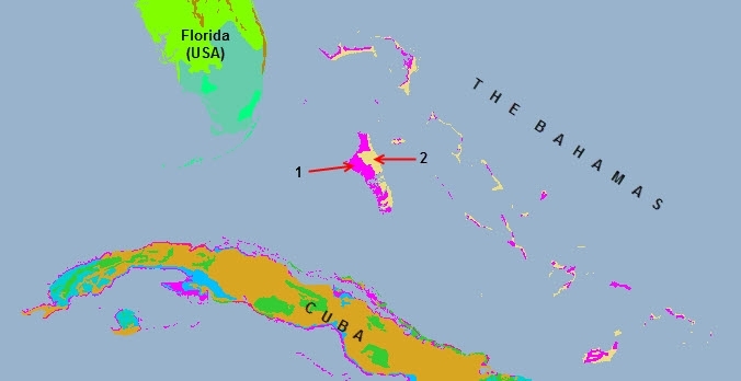
Ecoregions of The Bahamas
Contents
Ecoregions of Bahamas

Source: Christine J. Warner
Ecoregions of Countries Collection 
The Bahamas has two ecoregions
- Bahamian mangroves (part of the larger Bahamoan-Atillean mangroves ecoregion)
- Bahamian dry forests/Bahamoan pine mosaic
Source: World Wildlife Fund
Bahamian mangroves
The Bahamian mangroves (part of the larger Bahamoan-Atillean mangroves ecoregion) are found in a large area of shallow water that is of high importance for its ecological productivity. These coastal mangroves, together with coral reefs and seagrass beds, form a highly diverse and structurally complex ecosystem in which the reefs act as a barrier that shelters seagrass beds and mangroves from high wave energy and strong coastal currents typical of the Caribbean environment. Mangroves and seagrass beds in turn provide foraging and nursery habitats for many reef species and sea turtles that are found throughout the Bahamas.
There are at least four bird species endemic to the Bahamas islands which may utilize mangrove habitats at times including the Bahama woodstar , white-cheeked pintail, Bahamas swallow and Bahama yellowthroat; although none of them specifically live in mangrove habitat exclusively. Other bird species associated with mangroves include spotted sandpiper, roseate spoonbill, green heron, belted kingfisher, Mangrove cuckoo, mangrove warbler, and reddish egret.
Sea turtles found throughout Bahamas islands utilizing mangrove habitats include the green turtle, hawksbill, loggerhead, and leatherback. Important fish species found in Bahamian mangroves are snappers, grunts, parrotfishes, and mojarra, Nassau grouper, Bonefishbonefish, tarpon and barracuda a very important economically as a sport fishery.
There are 425,870 hectares (ha) of saline wetlands that contain mangroves at numerous sites throughout the Bahamas. and other Caribbean shorelines. At least two and probably half of the 12 protected areas of the Bahamas contain mangroves.
Bahamian dry forests/Bahamoan pine mosaic
Pine forests are distributed throughout the Bahamas island archipelago and Turks and Caicos Islands representing a unique habitat association in the Caribbean. The small over all geographic size of this ecoregion combined with continuing pressures from population growth and associated infrastructure development makes these pine forests particularly prone to degradation and disturbance. A history of land-use practices that include deforestation and intensive agricultural alteration of much of the original forest cover have contributed to a subsequent loss of species richness. Fortunately, logging licenses were relinquished to the Crown in 1974, which has kept tree felling localized and sporadic with allowances for natural regeneration to occur in many areas. The biodiversity includes numerous resident and migrating bird species as well as a variety of mammals and reptiles that are regionally distinct.
Agriculture among the Caribbean nations within this dry forest ecoregion has dominated land-use patterns resulting in major changes to terrestrial habitats and a reduction in biodiversity. Centuries of deforestation and land clearing have resulted in the removal or alteration of much of the original vegetation and contributed to a subsequent loss of species richness.
The Bahamas National Trust holds and manages lands, waters and places of natural beauty or historic interest for the purposes of conservation and preservation. The Wild Birds Protection Act of 1905, revised in 1972, makes provisions for the designation of areas protected from hunting through the creation of Wild Bird Protection Reserves. Between 1951 and 1965, 11 orders were passed designating 25 areas as wild bird reserves. The Turks and Caicos (Turks and Caicos Islands) National Trust was established as a statuary body in 1992 to help to preserve the biodiversity and cultural heritage of the Islands. The aim was to establish an effective managerial framework for local and international fund-raising, a public awareness and educational program, and a legal framework for conservation of sites. Much of the initiative and impetus for environmental protection and conservation in the Islands has come from non-governmental organizations. Considerable progress has been made in the designation of protected areas. Steps have been taken to implement an overall plan for national parks. Regulations have been drafted for the management of national parks with financial assistance from the UK government.
Context
Ecoregions are areas that:
[1] share a large majority of their species and ecological dynamics;
[2] share similar environmental conditions; and,
[3] interact ecologically in ways that are critical for their long-term persistence.
Scientists at the World Wildlife Fund (WWF), have established a classification system that divides the world in 867 terrestrial ecoregions, 426 freshwater ecoregions and 229 marine ecoregions that reflect the distribution of a broad range of fauna and flora across the entire planet.
WWF identifies two ecoregions the exist entirely or in part in the Bahamas.
See also: