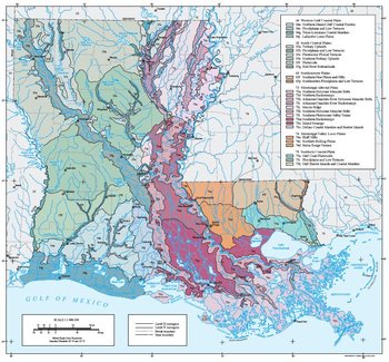
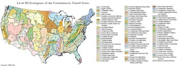
The approach used to compile this map is based on the premise that ecological regions can be identified through the analysis of the spatial patterns and the composition of biotic and abiotic phenomena that affect or reflect differences in ecosystem quality and integrity (Wiken, 1986; Omernik, 1987, 1995). These phenomena include geology, physiography, vegetation, climate, soils, land use, wildlife, and hydrology.
The relative importance of each characteristic varies from one ecological region to another regardless of the hierarchical level. A Roman numeral hierarchical scheme has been adopted for different levels of ecological regions. Level I is the coarsest level, dividing North America into 15 ecological regions. Level II divides the continent into 52 regions (Commission for Environmental Cooperation Working Group, 1997). At level III, the continental United States contains 104 ecoregions and the conterminous United States has 84 ecoregions (United States Environmental Protection Agency [USEPA], 2003). Level IV is a further subdivision of level III ecoregions. Explanations of the methods used to define the USEPA’s ecoregions are given in Omernik (1995), Omernik and others (2000), Griffith and others (1994), and Gallant and others (1989).
|
34. Western Gulf Coastal Plain
The principal distinguishing characteristics of the Western Gulf Coastal Plain are its relatively flat topography and mainly grassland potential natural vegetation. Inland from this region, the plains are older, more irregular, and have mostly forest vegetation in the Louisiana portion (Ecoregion 35) or savanna-type vegetation potentials to the west in Texas (Ecoregion 33). Largely because of this flat land and relatively fertile soils, a higher percentage of the land is in cropland than in bordering ecological regions. Rice and soybeans are the principal crops across the region, while grain sorghum and cotton are also grown mostly in the Texas portion. Urban and industrial [[land use]s] have expanded greatly in recent decades in some parts of the region, and oil and gas production is common.
|
|
34a. Quaternary-age deltaic sands, silts, clays, and gravel underlie much of the Northern Humid Gulf Coastal Prairies on this gently sloping coastal plain. The original vegetation was mostly tallgrass [[grassland]s] with gallery forests along streams. Little bluestem, big bluestem, yellow Indiangrass, brownseed paspalum, and switchgrass were dominant grasses, in a mixture with hundreds of other herbaceous species across these prairies. Almost all of the coastal prairies have been converted to cropland, pasture, crawfish aquaculture, or urban [[land use]s]. Some loblolly pines, and historically “islands” of longleaf pine, occur in the northern part of the region in the transition to Ecoregion 35. Soils in the Louisiana portion are mostly poorly or somewhat poorly drained Alfisols with silt loam or silty clay loam texture, while some Vertisols and Mollisols also occur. Pimple mounds of loamy sand were prevalent across the prairie terrace, providing micro-habitat variation.
34c. Covering the Holocene alluvial floodplain deposits of the larger and wider streams or bayous, the Floodplains and Low Terraces ecoregion is distinct from the surrounding prairie uplands of Ecoregion 34a. The region in Louisiana has some similarities to the floodplain [[forest]s] of Ecoregion 35b to the north. In most of Ecoregion 34c, however, the floodplains and low terraces have a different bottomland forest than the floodplains of Ecoregion 35. Bottomland forests of pecan, water oak, live oak, and elm are typical, with some bald cypress on larger streams. In Louisiana, the region includes the Mermentau River and its larger tributaries, as well as parts of Lacassine Bayou and tributary streams. Large portions of forest have been removed. Current land cover is a mix of wetland deciduous forest, upland mixed and deciduous forest, along with some cropland and pasture. Soils in the Louisiana portion are mostly very poorly and poorly drained Alfisols and Entisols with silt loam or very fine sandy loam surface textures.
34g. The Texas-Louisiana Coastal Marshes region is characterized by extensive freshwater and saltwater coastal marshes, few bays, and lack of barrier islands. There are many [[river]s], lakes, bayous, tidal channels, and canals. The streams and rivers that supply nutrients and sediments to this region are primarily from the humid pine belt of Ecoregion 35. Soils are very poorly drained Histosols and Entisols with muck or clay surface textures. The region, called the Chenier Plain in Louisiana, is almost treeless. The cheniers, or narrow ridges paralleling the shoreline, rise to about five feet in elevation but occupy only about three percent of the region. Live oaks and hackberries are dominant canopy species on many of the ridges, with an understory of palmetto and prickly pear cactus. Extensive cordgrass marshes occur in the more saline areas with maidencane and sawgrass on fresh marshes. The estuaries and marshes support abundant marine life, supply wintering grounds for globally significant populations of ducks and geese, and provide habitat for small mammals and alligators. Brown shrimp and white shrimp are commercially important. Sport fishery species such as red drum, black drum, southern flounder, and spotted seatrout occur in the coastal bays.
34j. The Lafayette Loess Plains had coastal prairie natural vegetation similar to Ecoregion 34a, but are capped with a loess veneer associated with the Mississippi Valley. Well to poorly drained Alfisols and Mollisols with silt loam surface textures developed on the late Pleistocene-age terraces. The historical vegetation dominated by big bluestem, little bluestem, yellow Indiangrass, switchgrass, and other herbaceous species has been replaced by crops of rice, soybeans, cotton, sugarcane, sweet potatoes, and wheat, along with crawfish aquaculture. Urban expansion in the area has been substantial. There is more pasture compared to the large extent of small grains production in Ecoregion 34a to the west. Narrow hardwood [[forest]s] occur along some streams and lowlands.
|
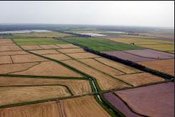 The prairies and marshes of the Western Gulf Coastal Plain (34) once supported an abundance of wildlife, including bison and red wolves, and a diversity of fish, reptile, and bird species. Almost all of the prairie has been converted to cropland, especially rice. Coastal marshes are important habitat for marine fishes and crustaceans as well as for waterfowl and migratory birds. (Photo: Greg Linscombe, LSU Agricultural Center) The prairies and marshes of the Western Gulf Coastal Plain (34) once supported an abundance of wildlife, including bison and red wolves, and a diversity of fish, reptile, and bird species. Almost all of the prairie has been converted to cropland, especially rice. Coastal marshes are important habitat for marine fishes and crustaceans as well as for waterfowl and migratory birds. (Photo: Greg Linscombe, LSU Agricultural Center)
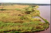 Fresh marsh near Sweet Lake. Louisiana coastal wetlands support a sport hunting industry, a growing alligator industry, and the trapping of fur-bearing animals. (Photo: Cindy Steyer, NRCS) Fresh marsh near Sweet Lake. Louisiana coastal wetlands support a sport hunting industry, a growing alligator industry, and the trapping of fur-bearing animals. (Photo: Cindy Steyer, NRCS)
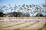 Snow geese feed in rice fields in Ecoregion 34a. Louisiana’s coastal wetlands provide winter habitat for 50% of the Mississippi flyway waterfowl population. (Photo: John Pitre, NRCS) Snow geese feed in rice fields in Ecoregion 34a. Louisiana’s coastal wetlands provide winter habitat for 50% of the Mississippi flyway waterfowl population. (Photo: John Pitre, NRCS) |
|
35. South Central Plains
Ecoregion 35 is composed of rolling plains that are broken by nearly flat fluvial terraces, bottomlands, sandy low hills, and low cuestas. Its terrain is unlike the flatter, less dissected Mississippi Alluvial Plain (73) or the Western Gulf Coastal Plain (34). Uplands are underlain mainly by poorly-consolidated Tertiary coastal plain deposits, and soils are mostly acidic sandy loams, silt loams, sands, and sandy clay loams. Bottomlands and terraces are veneered with Quaternary alluvium, terrace deposits, or loess. The lithologic mosaic is complex and distinct from the strictly Quaternary deposits of Ecoregions 34 and 73. Natural vegetation of uplands was historically dominated by longleaf pine woodlands and savannas in the south (35e and 35f), and shortleaf pine/hardwood forests in the north (35a). Southern floodplain forest of hardwoods and bald cypress typified bottomlands. Covering parts of Louisiana, Arkansas, east Texas, and Oklahoma, Ecoregion 35 is mostly in [[forest]s] or woodland, with less than 20% in cropland. Commercial pine plantations are extensive. Timber production, livestock grazing, and oil and gas production are major [[land use]s]. Cropland dominates the leveed bottomlands of the Red River.
|
|
35a. The rolling Tertiary Uplands have a great diversity of habitats and species. In Louisiana, Tertiary deposits are mostly Eocene clays, silts, and sands, with some Paleocene sediments to the west. Soils are mostly well or moderately well drained Ultisol sand Alfisols, typically with sandy and loamy surface textures. In many areas of Ecoregion 35a, commercial pine plantations have replaced the native shortleaf pine-hardwood forest. Prominent native trees include shortleaf pine, loblolly pine, southern red oak, post oak, black oak, white oak, hickories, and sweetgum. American beautyberry, sumac, greenbriar, and hawthorn are common understory species. The sandier areas often have more bluejack oak, post oak, and stunted pines. The landscape is dissected by numerous small streams. Flow is often intermittent in summer or early fall. It is one of Louisiana’s drier regions, with 51 to 55 inches annual precipitation in the northwest portion. Many state and globally rare plant and animal species are found in this region. Timber production is the dominant land use, along with livestock grazing, poultry production, and oil and gas activities.
35b. The Floodplains and Low Terraces ecoregion is nearly level, veneered by Holocene alluvium, and contains natural levees, swales, oxbow lakes, and meander scars. Many parts of Ecoregion 35b are frequently flooded, and forested wetlands are characteristic. There is a distinct vegetation change from adjacent upland ecoregions into bottomland hardwood forest, with similarities to the Mississippi Alluvial Plain (73). Water oak, willow oak, sweetgum, blackgum, American elm, red maple, and swamp chestnut oak are typical. Bald cypress and water tupelo occur in semi-permanently flooded areas. These bottomlands provide important habitat for a variety of fish and wildlife. Soils include Alfisols, Inceptisols, and Entisols and are generally somewhat poorly drained to very poorly drained, [[clay]ey] and loamy.
35c. The Pleistocene Fluvial Terraces are nearly level, poorly-drained, underlain by Pleistocene unconsolidated terrace deposits, and often covered by pine-hardwood flatwoods. The broad flats and gently sloping stream terraces are lower and less dissected than 35a, but higher than the floodplains of 35b and 35g. Soils are typically well to poorly drained Alfisols and Ultisols with loamy and sandy surfaces. Loblolly pine and a variety of lowland oaks are common and are adapted to the prevailing hydro-xeric regime. A vertical sequence of terraces occurs. The lowest terrace is nearly flat, clayey, and has extensive hardwood wetlands. Higher terraces become progressively older and more dissected with less extensive wetlands. They are dominated by pine flatwoods, or a mixed forest of pine and oak. In some parts of Ecoregion 35c to the east, the mid-level terrace is veneered with windblown silt deposits (loess). The southernmost piece of 35c, around Marksville, is a Pleistocene terrace of the Prairie Allogroup, with some similarities in soils and historical natural vegetation to that of the Lafayette Loess Plains (34j). The prairie has been converted to agriculture.
35e. The Southern Tertiary Uplands ecoregion covers the majority of Louisiana’s longleaf pine range west of the Mississippi River. The region of Tertiary geology is more hilly and dissected than the Flatwoods (35f), and soils are generally better drained over the more permeable sediments. Soils are Ultisols and Alfisols with silt loam to loamy sand textures. The Pliocene-age to Eocene-age geology contains a variety of siltstones, sandstones, and calcareous and acidic clays. Historical vegetation was dominated by longleaf pine-bluestem woodlands, but a variety of forest types were present, including shortleaf pine-hardwood forests, calcareous forests, mixed hardwood loblolly pine forests, and hardwood-dominated forests along streams. Some small, scattered prairies with many rare plants are associated with areas of calcareous clay soils. On more mesic sites, some American beech or magnolia-beech-loblolly pine forests occur. Some sandstone outcrops of the Catahoula Formation have distinctive barrens or glades that contain several rare species. Seeps in sand hills support acid bog species including southern sweetbay, gallberry, wax-myrtles, fetterbush, insectivorous plants, orchids, and wild azalea. Currently, the ecoregion in Texas and Louisiana has more pine forest than the oak-pine and pasture land cover more typical to the north in 35a. Large parts of the region are public National Forest land.
35f. The Flatwoods ecoregion occurs on mostly flat to gently sloping Pleistocene sediments. Soils are poorly to moderately well drained Alfisols and Ultisols with mostly silt loam textures. They are generally more poorly drained than many areas of Ecoregion 35e to the north, and tend to be less clayey than in 34a to the south. This ecoregion once was dominated by longleaf pine flatwoods and savannas, but also supported other mixed pine-hardwood forest types. The longleaf pine community was characterized by longleaf pine over a great diversity of herbaceous species, with the structure and composition varying from the more open forests of the wet savannas to the more closed forests of the dry flatwoods. Flatwood landscapes are characterized by pimple mounds, small hillocks that are abundant across the flats. On steep slopes, along streams and other areas where fire was less frequent, forests contained loblolly pine, sweetgum, white oak, southern red oak, willow oak, blackgum, and hollies. Although greatly reduced from its original extent, longleaf pine continues to characterize a significant portion of the area. Beech-magnolia was not extensive, occurring in narrow areas along some streams and mesic slopes. This region is warmer, wetter, flatter, less dissected, and lower in elevation than ecoregions 35a and 35e. Streams are low gradient and sluggish. In the eastern part of the region near the boundary with 35g, more loess occurs, the landscape becomes more dissected, and it supports a mixed hardwood-pine forest.
35g. The Red River Bottomlands contain the floodplain and low terraces of the Red River within Ecoregion 35. The region of broad bottomlands includes the meandering Red River channel, oxbow lakes, meander scars, ridges, and backswamps. The Holocene alluvium associated with Red River deposition developed well to somewhat poorly drained Vertisols and Entisols with [[clay]ey] and loamy, reddish-brown, neutral to calcareous surfaces. The lithology contrasts with the Pleistocene terrace deposits of Ecoregion 35c and the Tertiary sediments of Ecoregion 35a. Some major native trees of the bottomland hardwood forests on the Red River include water oak, sweetgum, willow oak, overcup oak, Nuttall oak, honey locust, water locust, river birch, red maple, green ash, and American elm. There are some plant distribution differences between the floodplains of Ecoregion 35g and 35b. Currently in Ecoregion 35g, most natural woodland has been cleared for cropland and improved pasture, although some woodland still occurs in very poorly drained and frequently flooded areas. Cotton, soybeans, corn, wheat, and rice are principal crops in 35g of Louisiana, with some sugarcane in the southern portion. The Red River historically carried high silt loads and was almost continuously turbid compared to other [[river]s] of Ecoregion 35. With the construction of the lock and dam system throughout its extent in Louisiana, silt load has lessened. Natural vegetation and other biota, hydrology, and [[land use]s] are similar to parts of Ecoregion 73.
|
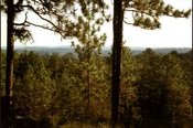 Longleaf pine forests occur on parts of the rolling Southern Tertiary Uplands (35e) in the Kisatchie National Forest. About 13.8 million acres of softwood and hardwood forests cover Louisiana, nearly half of the state. 62% of these forests are owned by private, non-industrial landowners, 29% by forest products industries, and 9% by the public. Louisiana’s mild climate and abundant rainfall give it one of the fastest tree-growing cycles in North America. (Photo: LDEQ) Longleaf pine forests occur on parts of the rolling Southern Tertiary Uplands (35e) in the Kisatchie National Forest. About 13.8 million acres of softwood and hardwood forests cover Louisiana, nearly half of the state. 62% of these forests are owned by private, non-industrial landowners, 29% by forest products industries, and 9% by the public. Louisiana’s mild climate and abundant rainfall give it one of the fastest tree-growing cycles in North America. (Photo: LDEQ)
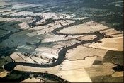 The low gradient, turbid Red River winds through Ecoregion 35g. Cropland is much more extensive than elsewhere in the South Central Plains (35). Continual efforts are made to control surface water and drain wet soils. The low gradient, turbid Red River winds through Ecoregion 35g. Cropland is much more extensive than elsewhere in the South Central Plains (35). Continual efforts are made to control surface water and drain wet soils. 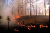 Fire historically was, and still is, an important component of longleaf pine forests of Ecoregion 35. In the absence of fire, longleaf pine and many of its associated plants and animals are replaced by other species. (Photo: Bill Platt, LSU) Fire historically was, and still is, an important component of longleaf pine forests of Ecoregion 35. In the absence of fire, longleaf pine and many of its associated plants and animals are replaced by other species. (Photo: Bill Platt, LSU) 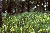 Yellow pitcher plants (Sarracenia alata) are a characteristic species of hillside bogs of Ecoregion 35. (Photo: LNHP) Yellow pitcher plants (Sarracenia alata) are a characteristic species of hillside bogs of Ecoregion 35. (Photo: LNHP) 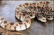 The Louisiana pine snake is considered one of the rarest snakes in North America. Its historical range included longleaf pine woodlands on deep sandy uplands of Ecoregion 35 in west-central Louisiana and eastern Texas. They depend on pocket gophers for food and burrows for shelter. (Photo: Memphis Zoo) The Louisiana pine snake is considered one of the rarest snakes in North America. Its historical range included longleaf pine woodlands on deep sandy uplands of Ecoregion 35 in west-central Louisiana and eastern Texas. They depend on pocket gophers for food and burrows for shelter. (Photo: Memphis Zoo) |
|
65. Southeastern Plains
Although mostly tree-covered, these irregular plains have a mosaic of cropland, pasture, woodland, and forest land cover. Natural vegetation in the Louisiana portion was predominantly upland longleaf pine woodlands, with smaller areas of oak-pine and mixed hardwood forest. Uplands are underlain by poorly consolidated Pleistocene and Pliocene deposits, and soils are mostly acidic sandy loams, silt loams, and sandy clay loams. Although Pleistocene-age loess deposits do influence soil characteristics in the Louisiana part of the ecoregion, mainly in the western half, the region received substantially less loess deposition than Ecoregion 74 to the west. Elevations and relief are greater than in the Southern Coastal Plain (75) and Mississippi Alluvial Plain (73). Streams are low- to moderate-gradient with mostly sandy substrates. Commercial pine plantations are extensive. Timber production and dairy and beef cattle farming are major [[land use]s], with urban and residential development increasing.
|
|
65f. The Southern Pine Plains and Hills ecoregion extends across southern Mississippi and Alabama and a portion of eastern Louisiana, covering what was once part of the longleaf pine belt. This area in Louisiana was historically rolling longleaf pine woodlands, broken by creek and river bottoms with mixed loblolly pine-hardwood [[forest]s]. Today, almost all of the longleaf pine forests are gone, replaced mostly by mixed forests of recent incidental origin and slash and loblolly pine plantations. The longleaf pine forest provided habitat for now rare or endangered species (IUCN Red List Criteria for Endangered) such as the red-cockaded woodpecker and gopher tortoise. In Louisiana, subsurface materials of the gravelly, and porous. Soils are mostly well to moderately well drained Ultisols and Alfisols with fine sandy loam or silt loam surface texture. Some cattle, horse, and hay ranches occur, as well as some poultry and dairy production.
65p. Southeastern Floodplains and Low Terraces comprise a riverine ecoregion of large rivers and backwaters with ponds, swamps, and oxbow lakes. Substrates of the low-relief region are a mix of sands, silts, and clays, resulting in well to poorly drained Entisols and Inceptisols with silt loam or fine sandy loam surfaces. River swamp forests of bald cypress and water tupelo and oak-dominated bottomland hardwood forests provide important wildlife corridors and habitat. The low terraces are mostly forested, although some small patches of pasture or cropland are found on terrace areas that are better drained. In Louisiana, the region includes only the larger, wider floodplains of Ecoregion 65, the Pearl and Bogue Chitto rivers.
|
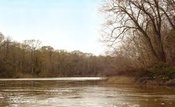 The Bogue Chitto begins near Brookhaven, Mississippi, meanders southward and flows into the West Pearl River Canal their life cycle. south of Bogalusa. It is the largest western tributary to the Pearl River system. The Bogue Chitto is valuable for its biodiversity, sports fishing, and aesthetic beauty. Increased siltation from gravel and sand mining, dairy farming, silviculture, and road construction, and high levels of fecal coliform and mercury impair its water quality. Fish species diversity and the abundance of benthic minnows and darters has declined over the past 30 years. (Photo: USFWS) The Bogue Chitto begins near Brookhaven, Mississippi, meanders southward and flows into the West Pearl River Canal their life cycle. south of Bogalusa. It is the largest western tributary to the Pearl River system. The Bogue Chitto is valuable for its biodiversity, sports fishing, and aesthetic beauty. Increased siltation from gravel and sand mining, dairy farming, silviculture, and road construction, and high levels of fecal coliform and mercury impair its water quality. Fish species diversity and the abundance of benthic minnows and darters has declined over the past 30 years. (Photo: USFWS) |
|
73. Mississippi Alluvial Plain
This riverine ecoregion extends from southern Illinois, at the confluence of the Ohio River with the Mississippi River, south to the Gulf of Mexico. The Mississippi River watershed drains all or parts of thirty-one states, two Canadian provinces, and approximately 1,243,000 square miles before the river finally reaches the Gulf. The Mississippi Alluvial Plain is mostly a broad, flat alluvial plain with river terraces, swales, and levees providing the main elements of relief. Soils are typically finer-textured and more poorly drained than the upland soils of adjacent Ecoregions 35 and 74, although there are some areas of coarser, better-drained soils. Winters are mild and summers are hot, with temperatures and precipitation increasing from north to south. Bottomland deciduous forest covered the region before much of it was cleared for cultivation. The ecoregion contained one of the largest continuous wetland systems in North America. The widespread loss of forest and wetland habitat, however, has impacted wildlife and reduced bird populations, although it is still a major bird migration corridor. Today, constructed levees restrict the river from overflowing, opening large areas for extensive agricultural use. Almost all of the region is in cropland, and it receives large inputs of pesticides. In Louisiana, cotton, corn, soybeans, pasture, and rice are major crops in the northern and central parts and sugarcane, soybeans, and pasture are dominant in the southern part. Between the levees that parallel the Mississippi River is a corridor known as the “batture lands.” The batture lands are hydrologically connected to the Mississippi River, are flood-prone, and contain remnant habitat for “big river” species (e.g., pallid sturgeon) as well as river-front plant communities. They are too narrow to map as a separate level IV ecoregion.
|
|
73a. The Northern Holocene Meander Belts ecoregion is a flat to nearly flat floodplain containing the meander belts of the present and past courses of the Mississippi River. Point bars, natural levees, swales, and abandoned channels marked by meander scars and oxbow lakes are common. Its abandoned channel network is more extensive than in the Southern Holocene Meander Belts (73k). The natural levees were the most conspicuous landform of the meander belt, and their distribution influenced human settlements, transportation routes, and agricultural and industrial activities in northeast Louisiana. Ecoregion 73a is underlain by Holocene alluvium; it lacks the Pleistocene glacial outwash deposits of Ecoregion 73j. Soils are mostly Vertisols, Inceptisols, and Alfisols with silt loam, silty clay loam, and clay textures. On natural levees, soils are more coarsetextured, better drained, and higher than those on levee back slopes and point bars. They grade to poorly-drained clays in abandoned channels and swales. Natural vegetation varies with site characteristics, mainly soil texture and hydroperiod. Coarser soils have fewer oaks and more sugarberry, elm, ash, pecan, cottonwood, and sycamore than Ecoregion 73d. Widespread draining of wetlands and removal of bottomland [[forest]s] occurred with cropland expansion. Bottomland hardwood forest restoration programs have reversed this trend since 1985. Cotton, corn, soybeans, and pasture are the main crops, and some catfish production and other aquaculture occur.
73d. The Northern Backswamps ecoregion is made up of low-lying overflow areas on floodplains, and includes poorly-drained flats and swales. Water often collects in its swamps, lakes, and low gradient streams. These were areas generally not affected by lateral river channel migrations. Soils are mostly gray to black Vertisols, developed from [[clay]ey] alluvium of overbank or slack-water deposits. These soils commonly have a high shrink-swell potential and are locally rich in organic material. Water levels are seasonally variable. Native vegetation in wettest areas is generally dominated by bald cypress–water tupelo forest; slightly higher and better drained sites have overcup oak–water hickory forest; and highest, best-drained areas support willow oak or Nuttall oak forest. Today, bottomland forest, cropland, farmed wetlands, and pasture occur. Backswamps are important areas for capturing excess nutrients from local waters and for storing water during heavy rain events.
73h. The Arkansas/Ouachita River Holocene Meander Belts ecoregion is a flat to nearly flat floodplain containing the meander belts of the present and past courses of the lower Arkansas and Ouachita [[river]s]. Point bars, natural levees, swales, and abandoned channels marked by meander scars and oxbow lakes are common and characteristic. Soils on natural levees are more coarse-textured, well-drained, and higher than those on levee back slopes and point bars. Soils grade to poorly-drained clays in abandoned channels and swales. Overall, soils have less organic matter than in the Northern Holocene Meander Belts (73a). Bayou Bartholomew inhabits the longest section of abandoned channels. It flows against the edge of the South Central Plains (35), receives drainage from it, and has sufficient habitat diversity to be one of the most species-rich streams in North America. Bayou Bartholomew supports over half of all known mussel species found in Louisiana. Within an abandoned course, bald cypress and/or water tupelo typically grow in the modern stream channel adjacent to a strip of wet bottomland hardwood forest dominated by overcup oak and water hickory. The remainder of the native forest has largely been cleared and drained for cropland and pastureland. Corn, cotton, and soybeans are the main crops.
73i. The flats, swales, and natural levees of the Arkansas/Ouachita River Backswamps ecoregion include the slackwater areas along the Arkansas and Ouachita rivers, where water often collects into swamps, oxbow lakes, ponds, and sloughs. In contrast to the Northern Backswamps (73d), this region is widely veneered with natural levee deposits. Soils derived from these deposits are Alfisols, Vertisols, and Inceptisols that are generally more loamy and better drained than the clayey soils of the Northern Backswamps (73d). As a result, willow oak and water oak are native instead of other species adapted to wetter overflow conditions. Drainage canals and ditches are common. This artificial drainage and the sandy veneer of natural levee deposits help explain why Ecoregion 73i is more easily and widely farmed than the Northern Backswamps (73d). Soybeans, corn, cotton, and rice are important crops but [[forest]s] and forested wetlands also occur.
73j. The prominent Macon Ridge is underlain almost entirely by Pleistocene glacial outwash that was transported to Arkansas and Louisiana by the Mississippi River and deposited by braided streams. It was subsequently veneered with loess, thicker on the eastern side. Its loessial Alfisols, with silt or silt loam textures, contrast with the alluvial soils of the Northern Holocene Meander Belts (73a) and Arkansas/Ouachita River Holocene Meander Belts (73h). Ecoregion 73j is higher in elevation, better drained, and supports drier plant communities than adjacent ecoregions 73a, 73d, 73h, and 73i. The eastern edge of Macon Ridge is higher than its western side, averaging 20 to 30 feet above the adjacent ecoregions 73a and 73d on the east side. On the western side, elevations of Macon Ridge are nearly the same as in the lithologically and physiographically distinct Arkansas/Ouachita River Holocene Meander Belts (73h). Native forest types range from those of better drained bottomlands dominated by willow oak, water oak, and swamp chestnut oak to upland hardwood forests dominated by white oak, southern red oak, and on drier sites, post oak. Prairies and loblolly pine-dominated areas may also have occurred. Today, Ecoregion 73j is a mosaic of cropland and pasture, with some woodland and forest. Cotton, corn, soybeans, and wheat are the major crops, and aquaculture is important in some areas.
73k. The Southern Holocene Meander Belts ecoregion stretches from just north of Natchez, Mississippi south to New Orleans, Louisiana. Similar to the Northern Holocene Meander Belts (73a), point bars, oxbows, natural levees, and abandoned channels occur. This region, however, has a longer growing season, warmer annual temperatures, some hyperthermic soils, and more precipitation than its northern counterparts of 73a and 73h. Soils are somewhat poorly and poorly drained Inceptisols, Entisols, and Vertisols. The ecoregion contains minor species such as live oak, laurel oak, and Spanish moss that are generally not found in the more northerly regions. The bottomland forests have been cleared and the region has been extensively modified for agriculture, flood control, and navigation. The levee system is extensive throughout the region. Soybeans, sugarcane, cotton, corn, and pasture are the major crops, with crawfish aquaculture common.
73l. The Southern Pleistocene Valley Trains ecoregion is a continuation of the northern valley train regions in Mississippi, Arkansas, and Tennessee. It is composed of scattered small remnants of early-Wisconsin glacial outwash deposits, similar to those of Macon Ridge (73j). This ecoregion, however, has warmer annual temperatures, a longer growing season, and higher annual [[rain]fall]. Soils are somewhat poorly and poorly drained Alfisols, Inceptisols, and Vertisols with loamy and [[clay]ey] surfaces. Some species occur here that are not present in the Macon Ridge (73j) or Western Lowlands Pleistocene Valley Trains (73g) ecoregions to the north in Arkansas. Overcup oak, Nuttall oak, honey locust, elm, water oak, sweetgum, blackgum, and hickory are the most common tree species. This region is generally higher than the adjacent Southern Backswamps (73m) ecoregion and soils are more sandy and better drained than the heavy clay soils of the backswamps. Cropland and pasture is common with corn, soybeans, and cotton as major crops.
73m. The Southern Backswamps ecoregion is generally warmer, has a longer frost free period, and has more precipitation than the Northern Backswamps (73d). Similar to 73d, soils are mostly poorly drained, clayey Vertisols, rich in organic matter. Wetlands are common and flooding occurs frequently. Bottomland hardwood [[forest]s] are more prevalent in this region than in the adjacent Southern Holocene Meander Belts (73k), where cropland is common. Channelization and flood control systems have modified this region and impacted many of the wetland habitats.
73n. The Inland Swamps ecoregion marks a transition, ranging from the fresh waters of the Southern Backswamps (73m) at the northern extent of the intratidal basins to the fresh, brackish, and saline waters of the deltaic marshes (Tidal marsh) of Ecoregion 73o. It includes a large portion of the Atchafalaya Basin. Soils are mostly poorly or very poorly drained, [[clay]ey] Entisols and Vertisols. Swamp forest communities are dominated by bald cypress and water tupelo, which are generally intolerant of brackish water except for short periods. In areas where freshwater flooding is more prolonged, the vegetative community is dominated by grasses, sedges, and rushes. This region contains one of the largest bottomland hardwood forest swamps in North America. Deposits include organic clays and peats up to 20 feet thick, and inter-bedded fresh- and brackish-water carbonaceous clays. The levees in place on either side of the Mississippi River have diverted much of the river flow from its natural tendency to flow into the Atchafalaya Basin. Large concrete structures prevent diversion into the Atchafalaya River, and flow from the Red River is also controlled. While this helps control flooding, it has also modified the region and contributed to the loss of wetland habitat.
73o. Brackish and saline marshes dominate the Deltaic Coastal Marshes and Barrier Islands ecoregion. The region supports vegetation tolerant of brackish or saline water including salt (Salt marsh) marsh cordgrass, marshhay cordgrass, black needlerush, and coastal saltgrass. Black mangrove occurs in a few areas, and some live oak is found on Grand Isle and along old natural levees. Extensive organic deposits lie mainly below sea level in permanently flooded settings resulting in the development of mucky surfaced Histosols. Sediments of silts, clays, and peats contain large amounts of methane, oil, and hydrogen sulfide gas. Inorganic sediments found within the ecoregion are soft and have high water contents. They will shrink dramatically upon draining. The wetlands and marshes act as a buffer to help moderate flooding and tidal inundation during storm events. Lack of sediment input, delta erosion, land subsidence, and rising sea levels threaten the region.
|
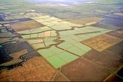 The native vegetation of the Mississippi Alluvial Plain ecoregion has been mostly converted to cropland. Only scattered small remnants remain of the original bottomland hardwood forest. (Photo: Jim Wark) The native vegetation of the Mississippi Alluvial Plain ecoregion has been mostly converted to cropland. Only scattered small remnants remain of the original bottomland hardwood forest. (Photo: Jim Wark)
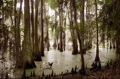 Bald cypress and tupelo are native in the wettest areas of the Northern and Southern Backswamps (Ecoregions 73d and 73m). (Photo: LNHP) Bald cypress and tupelo are native in the wettest areas of the Northern and Southern Backswamps (Ecoregions 73d and 73m). (Photo: LNHP)
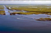 Louisiana’s coastal wetlands are an ecological, cultural, and economic treasure. Within Louisiana’s coastal wetlands, there exists more than half of the tidal marshes found in the lower 48 states, oil and gas pipelines that deliver more than a quarter of the nation’s energy supplies, one of the world’s largest port systems, and fisheries that supply more than a quarter of the seafood consumed in the lower 48 states. (Photo: Anne Marino, USACE) Louisiana’s coastal wetlands are an ecological, cultural, and economic treasure. Within Louisiana’s coastal wetlands, there exists more than half of the tidal marshes found in the lower 48 states, oil and gas pipelines that deliver more than a quarter of the nation’s energy supplies, one of the world’s largest port systems, and fisheries that supply more than a quarter of the seafood consumed in the lower 48 states. (Photo: Anne Marino, USACE)
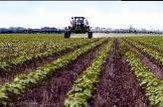 Cotton is one of the major crops in the northern part of Ecoregion 73. Although eradication programs have reduced their numbers, pesticide applications are still needed to protect the crop from the boll weevil. (Photo: NRCS) Cotton is one of the major crops in the northern part of Ecoregion 73. Although eradication programs have reduced their numbers, pesticide applications are still needed to protect the crop from the boll weevil. (Photo: NRCS)
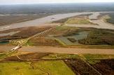 The Mississippi River system in the Southern Holocene Meander Belts (73k) has been modified and engineered for flood control and navigation. (Photo: USACE) The Mississippi River system in the Southern Holocene Meander Belts (73k) has been modified and engineered for flood control and navigation. (Photo: USACE)
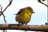 Yellow-throated vireo and other migratory songbirds depend on the bottomland hardwood forest for resting and shelter. (Photo: LNHP) Yellow-throated vireo and other migratory songbirds depend on the bottomland hardwood forest for resting and shelter. (Photo: LNHP)
 Oaks, hickory, and ash, with palmetto understory, are common plants in Ecoregion 73. Conversion to cropland has caused widespread loss of forest and wetlands. (Photo: LNHP) Oaks, hickory, and ash, with palmetto understory, are common plants in Ecoregion 73. Conversion to cropland has caused widespread loss of forest and wetlands. (Photo: LNHP)
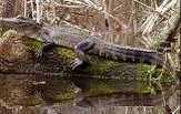 Alligators are found in aquatic habitats throughout most of Louisiana. Harvesting of wild and farmraised alligators is economically important in the state. (Photo: Jeffery Giering, LDAF) Alligators are found in aquatic habitats throughout most of Louisiana. Harvesting of wild and farmraised alligators is economically important in the state. (Photo: Jeffery Giering, LDAF) |
|
74. Mississippi Valley Loess Plains
This ecoregion stretches from the Ohio River in western Kentucky to Louisiana. It consists primarily of irregular plains, some gently rolling hills, and bluffs near the Mississippi River. The presence of thick deposits of loess is one of the distinguishing characteristics. The Bluff Hills in the western portion contain soils that are very deep, steep, silty, and erosive. Flatter topography is found to the east, and streams tend to have less gradient and more silty substrates than in the Southeastern Plains ecoregion (65). To the east, upland [[forest]s] dominated by oak, hickory, and both loblolly and shortleaf pine, and to the west, southern mesophytic forests characterized by beech, southern magnolia, and American holly, were the dominant natural vegetation. Agriculture is now the typical land cover in the Kentucky and Tennessee portion of the region, while in Mississippi and Louisiana there is a mosaic of forest, pine plantations, pasture, and cropland.
|
|
74a. The Bluff Hills ecoregion in Louisiana, locally called the Tunica Hills, has a base of sand, clay, silt, and gravel capped by thick loess. This region has deeper loess, more relief, is more dissected, and is generally more forested than neighboring 74c. The dissected loess landscape has a mosaic of microenvironments, including dry slopes and ridges, moist slopes, ravines, bottomland areas and small cypress swamps. Soils are mostly well drained loamy Alfisols. Species with more northern affinities occur far to the south in this region. This combination of northern and southern flora and fauna creates a diverse assemblage of species. A forest of southern magnolia and beech, with a mix of other mesophytes, oaks, and hickories, is the general natural vegetation type. Sweetgum, Carolina basswood, Florida sugar maple, hophornbeam, tulip poplar, and unique mesophytic herbs are also found here. Ecoregion 74a in southern Mississippi and Louisiana has more southern magnolia, water oak, and Spanish moss than in the north. The cool ravines contain some higher gradient streams and areas of gravel substrate, creating distinct aquatic habitats. Severe erosion has occurred in many parts of 74a, particularly when the soils lack adequate vegetative cover. Louisiana black bear, Webster’s salamander, and eastern chipmunk occur in this region.
74c.The Southern Rolling Plains occur on younger, Miocene- and Pliocene-age geologic formations (almost all Pliocene in Louisiana) compared to the Loess Plains (74b) to the north in Mississippi and Tennessee, and it has a warmer climate. The climatic shift from 74b includes warmer average annual air temperatures, greater annual [[rain]fall], and a transition to slightly warmer soils. Although less dissected than the Bluff Hills (74a), the region has more irregular and dissected topography than adjacent 74b to the north in Mississippi. Soils reflect this diversity with Ultisols, Alfisols, and Entisols that are thinner than in 74a and 74b, with slightly coarser surface textures. The historic [[forest]s] contained shortleaf pine, loblolly pine, and upland oaks and hickories. Pine is naturally more prevalent here than in 74a and 74b. Land cover now is mostly mixed pine-hardwood forest, pine plantations, pasture, and cropland. Some oil and gas production and cattle ranching occur here. The eastern boundary of this region is broad, with a gradual transition to Ecoregion 65.
74d. The Baton Rouge Terrace ecoregion occurs on the Pleistocene Prairie Terraces and is lower in elevation and has flatter topography than Ecoregion 74c to the north. Similar to other parts of Ecoregion 74, loess is thicker to the west. The soils are mostly Alfisols with brown or grayish-brown, silt loam surfaces that developed in the loess parent materials. High sodium soils are common. The natural vegetation was influenced by the unusual soil conditions and by different forest types occurring in adjacent regions, with some upland hardwoods to the northwest, hardwood flatwoods and spruce pine-hardwood mixed forests across extensive broad flats, and many areas of bottomland hardwoods. Large areas of the mixed pine-hardwood forest have now been cleared for pasture, cropland, and urban uses. Urban uses cover about fifty percent of the region.
|
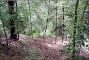 The highly dissected area of Ecoregion 74 is known as the Tunica Hills. Erosion has carved loess topography into microenvironments including dry slopes and ridges, moist slopes, ravines, and bottomlands. (Photo: LNHP) The highly dissected area of Ecoregion 74 is known as the Tunica Hills. Erosion has carved loess topography into microenvironments including dry slopes and ridges, moist slopes, ravines, and bottomlands. (Photo: LNHP)
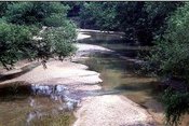 West Fork Thompson Creek in Ecoregion 74c northeast of St. Francisville. Low stream gradients and slow flows between heavy rains result in high sediment loads deposited within the stream channel. (Photo: LDEQ) West Fork Thompson Creek in Ecoregion 74c northeast of St. Francisville. Low stream gradients and slow flows between heavy rains result in high sediment loads deposited within the stream channel. (Photo: LDEQ) |
|
75. Southern Coastal Plain
The Southern Coastal Plain extends from South Carolina and Georgia through much of central Florida, and along the Gulf coast lowlands of the Florida Panhandle, Alabama, Mississippi, and eastern Louisiana. Consisting mostly of flat plains, it also includes barrier islands, coastal lagoons, marshes, and swampy lowlands along the Gulf and Atlantic coasts. In Florida, an area of discontinuous highlands contains numerous lakes. This ecoregion is lower in elevation with less relief and wetter soils than the Southeastern Plains (65). Once covered mainly by longleaf pine flatwoods and savannas, this ecoregion also had a variety of other forest communities that supported slash pine, pond pine, pond cypress, beech, sweetgum, southern magnolia, white oak, and laurel oak. Land cover in the region is now mostly slash and loblolly pine, often mixed with various hardwoods, bottomland hardwood forest in some low-lying areas, citrus groves in Florida, pasture for beef cattle, and urban land.
|
|
75a. The Gulf Coast Flatwoods is a narrow region of nearly level terraces and alluvial and deltaic deposits composed of Quaternary-age sands and clays. Soils are a mix of poorly to moderately well drained Entisols, Alfisols, and Ultisols with silty and fine sandy loam surfaces. Historically, longleaf pine dominated the broad flats and low ridges, forming more densely-stocked flatwoods and open savannas. A high natural fire frequency was typical, often sparked by lightning and fueled by grasses, and maintained the open pine flatwoods and savannas. While most of the longleaf pine savannas have been lost, remnant savannas are centers of biodiversity supporting a variety of grasses, sedges, rushes, and an array of wildflowers: red lilies, orange milkweeds, yellow pitcher plants, white, orange, and pink orchids, lavender butterworts, and purple sundews. Much of the landscape is now in mixed forest or pine plantations, while some better-drained land has been cleared for pasture or crops. Dominant [[land use]s] include woodland, wildlife habitat, and urban.
75i. Floodplains and Low Terraces are a continuation of the riverine 65p ecoregion across the Southern Coastal Plain. The broad floodplains and terraces of the Pearl River are the only portion of the region in Louisiana. Composed of stream alluvium and terrace deposits of sand, silt, clay, and gravel, along with some organic muck and swamp deposits, the region includes large sluggish [[river]s] and backwaters with ponds, swamps, and oxbow lakes. Soils are mostly loamy Entisols. River swamp [[forest]s] of bald cypress and water tupelo and oak-dominated bottomland hardwood forests provide important wildlife habitat.
75k. The Gulf Barrier Islands and Coastal Marshes ecoregion extends west from the Florida Panhandle across the Alabama and Mississippi [[coast]s] to the Pearl River area of Louisiana. In Louisiana, the sediments of this region are associated more with the Pearl River than Mississippi River deltaic deposits. The region east of Louisiana has salt (Salt marsh) and brackish marshes (Salt marsh), dunes, beaches, and barrier islands. In Louisiana, tidal freshwater marshes occur, such as those on the delta plains of the larger [[river]s]. Soils are very poorly drained Histosols and Entisols with mucky surfaces. The ecoregion provides habitat for many waterfowl, shorebird, sea turtle, and fish species, as well as for muskrat, nutria, raccoon, otter, mink, and alligator. Nearby coastal erosion of islands composed of deltaic deposits, land subsidence, and rising sea levels threaten the terrestrial habitats of the region.
|
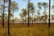 Pine savannas were once more common in Ecoregion 75a. Longleaf pine was once the predominant tree species, with a very diverse herbaceous layer. (Photo: Alice Dossett) Pine savannas were once more common in Ecoregion 75a. Longleaf pine was once the predominant tree species, with a very diverse herbaceous layer. (Photo: Alice Dossett)
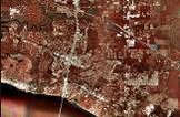 Urban and suburban development north of Lake Pontchartrain in 75a is creating a more fragmented landscape. (Photo: LA Statewide 2004 DOQQ) Urban and suburban development north of Lake Pontchartrain in 75a is creating a more fragmented landscape. (Photo: LA Statewide 2004 DOQQ) |
 The prairies and marshes of the Western Gulf Coastal Plain (34) once supported an abundance of wildlife, including bison and red wolves, and a diversity of fish, reptile, and bird species. Almost all of the prairie has been converted to cropland, especially rice. Coastal marshes are important habitat for marine fishes and crustaceans as well as for waterfowl and migratory birds. (Photo: Greg Linscombe, LSU Agricultural Center)
  Longleaf pine forests occur on parts of the rolling Southern Tertiary Uplands (35e) in the Kisatchie National Forest. About 13.8 million acres of softwood and hardwood forests cover Louisiana, nearly half of the state. 62% of these forests are owned by private, non-industrial landowners, 29% by forest products industries, and 9% by the public. Louisiana’s mild climate and abundant rainfall give it one of the fastest tree-growing cycles in North America. (Photo: LDEQ)
  The Louisiana pine snake is considered one of the rarest snakes in North America. Its historical range included longleaf pine woodlands on deep sandy uplands of Ecoregion 35 in west-central Louisiana and eastern Texas. They depend on pocket gophers for food and burrows for shelter. (Photo: Memphis Zoo)
  The Bogue Chitto begins near Brookhaven, Mississippi, meanders southward and flows into the West Pearl River Canal their life cycle. south of Bogalusa. It is the largest western tributary to the Pearl River system. The Bogue Chitto is valuable for its biodiversity, sports fishing, and aesthetic beauty. Increased siltation from gravel and sand mining, dairy farming, silviculture, and road construction, and high levels of fecal coliform and mercury impair its water quality. Fish species diversity and the abundance of benthic minnows and darters has declined over the past 30 years. (Photo: USFWS)
  Louisiana’s coastal wetlands are an ecological, cultural, and economic treasure. Within Louisiana’s coastal wetlands, there exists more than half of the tidal marshes found in the lower 48 states, oil and gas pipelines that deliver more than a quarter of the nation’s energy supplies, one of the world’s largest port systems, and fisheries that supply more than a quarter of the seafood consumed in the lower 48 states. (Photo: Anne Marino, USACE)