Ecoregions of Mississippi (EPA)
| Topics: |
Ecoregions denote areas of general similarity in ecosystems and in the type, quality, and quantity of environmental resources. They are designed to serve as a spatial framework for the research, assessment, management, and monitoring of ecosystems and ecosystem components. By recognizing the spatial differences in the capacities and potentials of ecosystems, ecoregions stratify the environment by its probable response to disturbance (Bryce and others, 1999). These general purpose regions are critical for structuring and implementing ecosystem management strategies across federal agencies, state agencies, and nongovernment organizations that are responsible for different types of resources within the same geographical areas (Omernik and others, 2000).
The approach used to compile this map is based on the premise that ecological regions are hierarchical and can be identified through the analysis of the spatial patterns and the composition of biotic and abiotic phenomena that affect or reflect differences in ecosystem quality and integrity (Wiken 1986; Omernik 1987, 1995). These phenomena include geology, physiography, vegetation, climate, soils, land use, wildlife, and hydrology. The relative importance of each characteristic varies from one ecological region to another regardless of the hierarchical level. A Roman numeral hierarchical scheme has been adopted for different levels of ecological regions. Level I is the coarsest level, dividing North America into 15 ecological regions. Level II divides the continent into 52 regions (Commission for Environmental Cooperation Working Group 1997). At level III, the continental United States contains 104 ecoregions and the conterminous United States has 84 ecoregions (United States Environmental Protection Agency (USEPA 2003). Level IV is a further subdivision of level III ecoregions. Explanations of the methods used to define the USEPA’s ecoregions are given in Omernik (1995), Omernik and others (2000), and Gallant and others (1989).
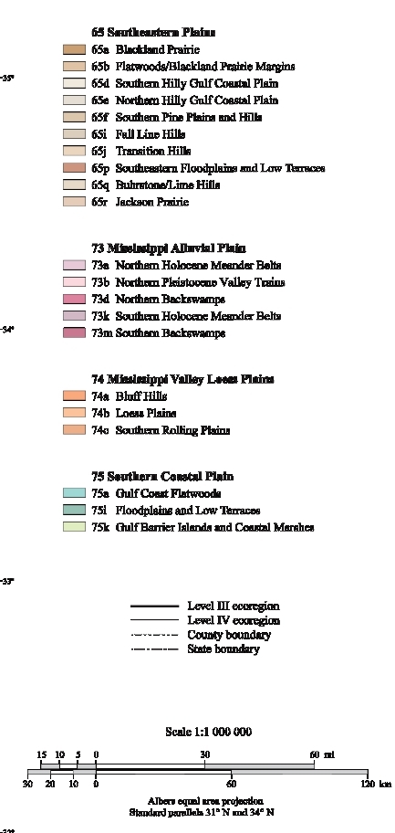
Ecological and biological diversity within Mississippi is great. The state contains barrier islands and coastal lowlands, large river floodplain forests, rolling and hilly coastal plains with evergreen and deciduous forests, and a variety of aquatic habitats. There are 4 level III ecoregions and 21 level IV ecoregions in Mississippi and most continue into ecologically similar parts of adjacent states.
The level III and IV ecoregions on this poster were compiled at a scale of 1:250,000 and depict revisions and subdivisions of earlier level III ecoregions that were originally compiled at a smaller scale (USEPA 2003; Omernik 1987). This poster is part of a collaborative project primarily between USEPA Region IV, USEPA National Health and Environmental Effects Research Laboratory (Corvallis, Oregon), Mississippi Department of Environmental Quality (MDEQ), and the United States Department of Agriculture-Natural Resources Conservation Service (NRCS). Collaboration and consultation also occurred with the United States Department of Agriculture-Forest Service (USFS), United States Department of the Interior-Geological Survey (USGS), USGS Earth Resources Observation Systems (EROS) Data Center, United States Army Corps of Engineers (USACE), and with other State of Mississippi agencies.
The project is associated with an interagency effort to develop a common framework of ecological regions (McMahon and others, 2001). Reaching that objective requires recognition of the differences in the conceptual approaches and mapping methodologies applied to develop the most common ecoregion-type frameworks, including those developed by the USFS (Bailey and others, 1994), the USEPA (Omernik 1987, 1995), and the NRCS (U.S. Department of Agriculture-Soil Conservation Service, 1981). As each of these frameworks is further refined, their differences are becoming less discernible. Regional collaborative projects such as this one in Mississippi, where some agreement has been reached among multiple resource management agencies, are a step toward attaining consensus and consistency in ecoregion frameworks for the entire nation.
65. Southeastern Plains
Although mostly tree-covered, these irregular plains have a mosaic of cropland, pasture, woodland, and forest land cover. Natural vegetation in the southern portion was predominantly longleaf pine (Pinus palustris), with smaller areas of oak-pine and southern mixed forest. In central and northern Mississippi, oak-pine and some western mixed mesophytic forests were dominant. In states to the east of Mississippi, the Cretaceous or Tertiary-age sands, silts, and clays of this region contrast geologically with the older metamorphic and igneous rocks of the Piedmont (45), and with the Paleozoic limestone, chert, and shale of the Interior Plateau (71). The region has thinner loess than Ecoregion 74 to the west, and elevations and relief are greater than in the Southern Coastal Plain (75) and Mississippi Alluvial Plain (73). Streams are low- to moderate-gradient with mostly sandy substrates.
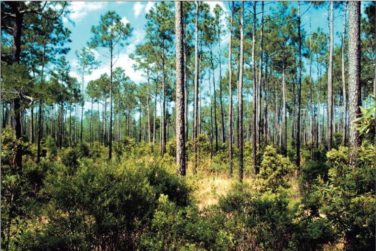
Almost all of the longleaf pine (Pinus palustris) forests in the southern parts of the Southeastern Plains (65f and 65d) have been replaced with other land cover. Some longleaf pine restoration has occurred in recent years. To the north, loblolly (P. taeda) and shortleaf (P. echinata) are the more typical pines, along with more hardwoods in the mixed oak and oak-hickory-pine forests.
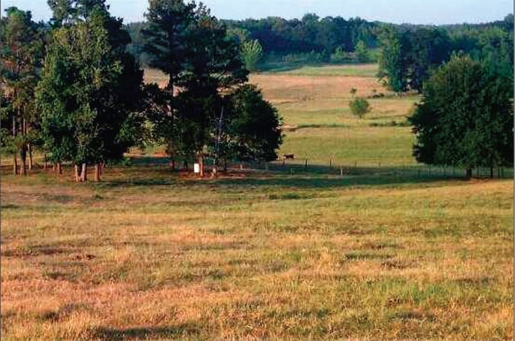
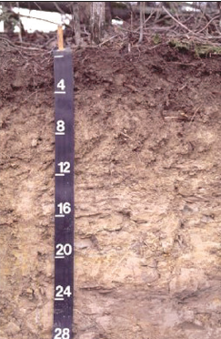 The Blackland Prairie (65a) was likely named more for its dark, calcareous soils than for any grassland vegetation. The Demopolis soils formed in thick beds of Cretaceous-age chalk. Photo: George Martin, NRCS 65a. The flat to undulating Blackland Prairie region is underlain by distinctive Cretaceous-age chalk, marl, and calcareous clays of the Selma Group. The fine-textured, clayey soils have smectitic or carbonatic mineralogy. They tend to shrink and crack when dry and swell when wet. Streams are low gradient with chalk, clay, sand, and silt substrates, and have a high variability in flow which affects some fish species distributions. The natural vegetation had dominant trees of sweetgum (Liquidamber styraciflua), post oak (Quercus stellata), blackjack oak (Q. marilandica), and red cedar (Juniperus virginiana), along with patches of bluestem prairie. Today, the area is mostly cropland and pasture, with small patches of mixed hardwoods, red cedar, and pines. Pond-raised catfish aquaculture occurs in some parts of this region.
65b. In Mississippi and Alabama, the Flatwoods/Blackland Prairie Margins ecoregion is a transitional region between the Blackland Prairie (65a) and the more forested plains and hills of 65d, 65e, and 65i. This region combines two slightly different areas. The Flatwoods are comprised of a mostly forested lowland area of little relief, formed primarily on Late Cretaceous and Paleocene-age dark, massive, marine clay. Soils are very deep, clayey, somewhat poorly or poorly drained, and acidic. The Blackland Prairie Margins are undulating, irregular plains, with slightly more relief than the Flatwoods, but also tend to have clayey soils that are sticky when wet, hard and cracked when dry, with generally poor drainage. Land cover is mostly mixed forest, pasture or hayland, and some cropland.
65d. The dissected irregular plains and gently rolling low hills of the Southern Hilly Gulf Coastal Plain developed over diverse bands of Eocene, Oligocene, and Miocene sand, clay, and marl formations. The region extends from Mississippi through Alabama and into the western edge of Georgia and has more rolling topography, higher elevations, and more relief than 65a, 65b, and 65f. Some broad cuestas with gentle south slopes and steeper north-facing slopes occur, and the heterogeneous region has a mix of clayey, loamy, and sandy soils. The region has a warmer climate and more pines than 65e to the north. The natural vegetation of mostly oak-hickory-pine forest grades into southern mixed forest (with more beech, southern magnolia and other hardwoods and pines) and longleaf pine forest to the south. Land cover is mostly forest and woodland, with pasture and some cropland. Poultry production is common in the southern portion of the region.
The landscape of the Jackson Prairie (65r) today is a mix of pine and hardwood forests and pasture/hayland, with only a few small remnants of calcareous prairie vegetation. The prairies have been affected by historical land uses, such as cultivation, grazing, haying, pine tree planting, and shell mining, along with changes due to soil erosion and fire suppression. Photo: Joe Shoemake and Tommy McGlothlin
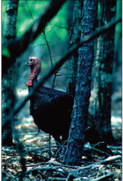 Eastern wild turkeys (Meleagris gallopavo silvestris) have important aesthetic, recreational, and economic value in Mississippi. About 350,000 wild turkeys exist in the state, with hunters taking 40,000 birds annually. 65e. The Northern Hilly Gulf Coastal Plain ecoregion contains several northsouth trending bands of sand and clay formations, and extends north to the Kentucky-Tennessee border. Eocene and Paleocene-age sand, clay, and lignite underlie the western part of the region, and Cretaceous-age fine sands and clays lie to the east. In Mississippi, the region includes the prominent Pontotoc Ridge. The ridge is formed from outcroppings of marls and sands on the Ripley Formation cuesta. The marl and sand surficial materials have weathered into a reddish surface color, contrasting with the darker soils of adjacent 65a and 65b. The boundary to the south with the Southern Hilly Gulf Coastal Plain (65d) is broad and transitional. The climate is generally cooler to the north in 65e and there is a greater density of upland hardwood forests than in 65d.
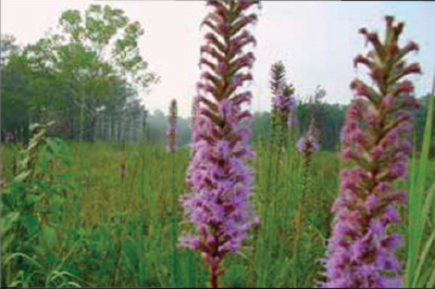
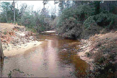
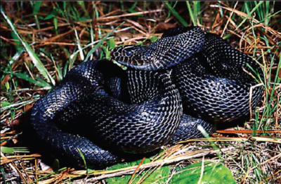
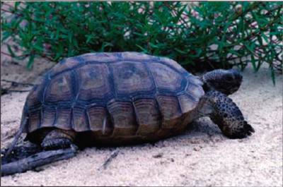
65f. Often called the Pine Hills or Piney Woods in Mississippi, the Southern Pine Plains and Hills ecoregion extends across southern Mississippi and Alabama, covering what was once part of the longleaf pine belt. Today, almost all of the southern mixed forest and longleaf pine forests are gone, replaced mostly by slash and loblolly pine plantations. The longleaf pine forest provided habitat for now rare or endangered species (IUCN Red List Criteria for Endangered) such as the red-cockaded woodpecker, gopher tortoise, eastern indigo snake, and black pine snake. Wet savannas and bogs contained an array of colorful wildflowers: red lillies, orange milkweeds, yellow pitcher plants, lavender butterworts, and purple sundews. Subsurface materials of the region are composed mostly of the clays and sands of the Miocene-age Hattiesburg and Pascagoula Formations, with some Catahoula Sandstone in the north. Hill summits and higher elevations are composed of Pleistocene and Pliocene-age deposits such as the Citronelle Formation that are generally sandy, gravelly, and porous, and more resistant to erosion than the older underlying Miocene clays and sands. Streams of this region tend to be darker tea-colored and more acidic than those of 65d. Some hay and cattle ranches occur, and poultry production has increased in recent years, as it has in the southern parts of 65d.
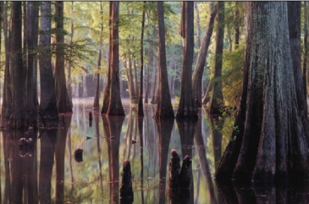
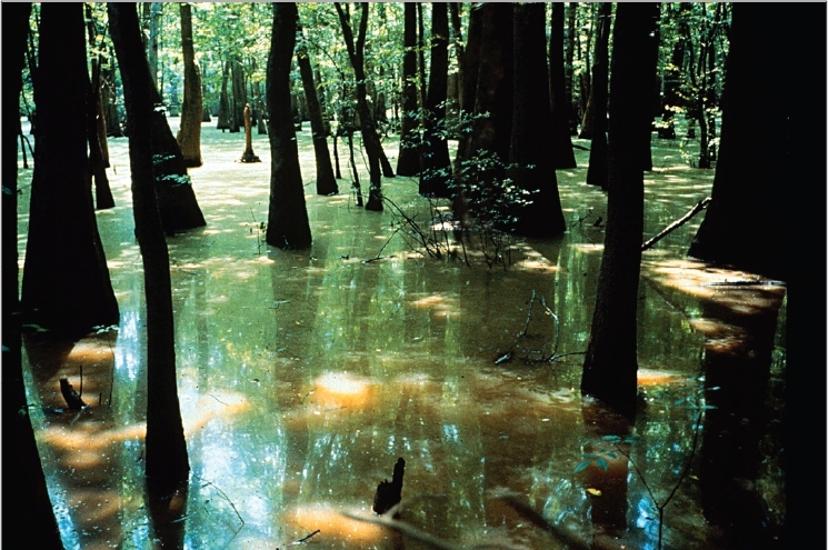
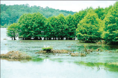
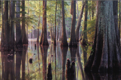
Cypress swamps and bottomland hardwood forests occur in some of the larger floodplains, such as these along the Tombigbee River in Ecoregion 65p. Many parts of the floodplain and main channel of the Tombigbee River were modified by the Tennessee-Tombigbee Waterway Project, one of the largest and most expensive earth moving projects in history. Photo: USACE.
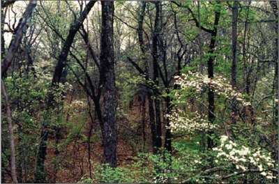
65i. The Fall Line Hills ecoregion is an area of rugged hills drained by tributaries of the Tombigbee and Tennessee [[river]s]. It is composed of Cretaceous-age sands and clays overlain by mostly loamy soils. The steep, dissected hills have narrow ridgetops and narrow valleys. The land cover is predominately oak-hickory-pine forests with only small areas used for pasture or crops. Ridgetops are often dominated by shortleaf pine (Pinus echinata), while dry-mesic hardwood forests are common on slopes. Elevations are mostly 400 to 700 feet, and the region includes Mississippi’s highest point, Woodall Mountain in Tishomingo County at 806 feet.
65j. The Transition Hills have some of the higher elevations in Ecoregion 65, and contain characteristics of both the Southeastern Plains and the Interior Plateau (71) ecoregions. Many streams in this transition area have cut down into the Mississippian and Devonian-age rocks and look similar to those of the Interior Plateau. Cretaceous-age deposits of silt, sand, clay, and gravel overlie the older limestone, shale, and chert. Although there are small areas of cropland and pasture in the valleys and on gently sloping ridges, the region is mostly forested with oakhickory- pine forests. The presence of chestnut oak (Quercus prinus) and Virginia pine (Pinus virginiana) help distinguish this region in Mississippi.
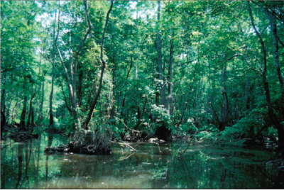
65p. Southeastern Floodplains and Low Terraces comprise a riverine ecoregion of large [[river]s] and backwaters with ponds, swamps, and oxbow lakes. Substrates of the low-relief region are a mix of sands, silts, and clays. River swamp forests of bald cypress (Taxodium distichum) and water tupelo (Nyssa aquatica) and oak-dominated bottomland hardwood forests provide important wildlife corridors and habitat. The low terraces are mostly forested, although some cropland or pasture is found on the broader level terraces that are better drained. In Mississippi, the region includes only the larger, wider floodplains of Ecoregion 65, the lower Pearl, Leaf/Pascagoula, and Tombigbee rivers.
65q. The terrain is more hilly and irregular in the Buhrstone/Lime Hills ecoregion than in most parts of surrounding ecoregion 65d. Extending from Alabama where the region includes both the Buhrstone and Lime Hills, it narrows in Mississippi to include only the most rugged portion of the Buhrstone Hills in the area just south and west of Meridian. These hills are associated primarily with the resistant claystone and sandstone of the Eocene-age Tallahatta Formation, and are part of the rugged, north-facing escarpment or cuesta that extends into the middle of Alabama. Although the Tallahatta Formation extends to the northwest, the hills lose their topographic prominence and relief. Well-drained, loamy and sandy soils are typical on the narrow ridges and steep side slopes. Some streams have higher gradients and more rocky substrates than in neighboring regions, affecting water quality, macroinvertebrates, and fish populations.
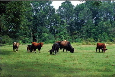
65r. The Jackson Prairie ecoregion is a narrow belt of irregular plains and low, broad hills underlain primarily by the Yazoo Clay of the Eocene-age Jackson Group. The calcareous clay, sand, and marl is commonly overlain by alkaline, clayey soils that expand when wet and shrink when dry. Fossilized bones of ancient whale-like [[mammal|mammals] (Basilosaurus cetoides and Zygorhiza kochii) are found in this formation, along with fossil oyster shells and other calcareous sediments that contributed to the formation of the alkaline soils. Although the region is only mapped in Mississippi, a few small areas that have similar soils extend into western Alabama. The historic vegetation was mostly mixed hardwood and pine forests with a scattering of prairies. The soils and gentle topography of the region attracted early settlement and agricultural development, but logging, cultivation, and land abandonment also caused extensive soil erosion. Fire suppression also allowed encroachment of woody vegetation into the prairies. Today, much of the region is forested or in pine plantations, with some rowcrop agriculture, and grazing and haying for livestock production. Some isolated calcareous prairie remnants occur, surrounded by more acidic mixed pine and hardwood forests. Efforts are being made to maintain the prairie species with controlled burning and other management programs on national forest lands.
73. Mississippi Alluvial Plain
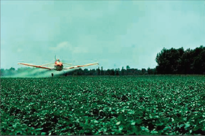
This riverine ecoregion extends from southern Illinois, at the confluence of the Ohio River with the Mississippi River, south to the Gulf of Mexico. The Mississippi River watershed drains all or parts of thirty-one states, two Canadian provinces, and 1,243,000 square miles before the river finally reaches the Gulf. The Mississippi Alluvial Plain is mostly a broad, flat alluvial plain with river terraces, swales, and levees providing the main elements of relief. Soils are typically finer-textured and more poorly drained than the upland soils of adjacent Ecoregion 74, although there are some areas of coarser, better-drained soils. Winters are mild and summers are hot, with temperatures and precipitation increasing from north to south. Bottomland deciduous forest vegetation covered the region before much of it was cleared for cultivation. The ecoregion contained one of the largest continuous wetland systems in North America and is still a major bird migration corridor. Today, levees restrict the river from overflowing, opening large areas for extensive agricultural use. Almost all of the northern and central parts of the region are in cropland, and they receive large inputs of pesticides. Soybeans, cotton, and rice are the major crops.
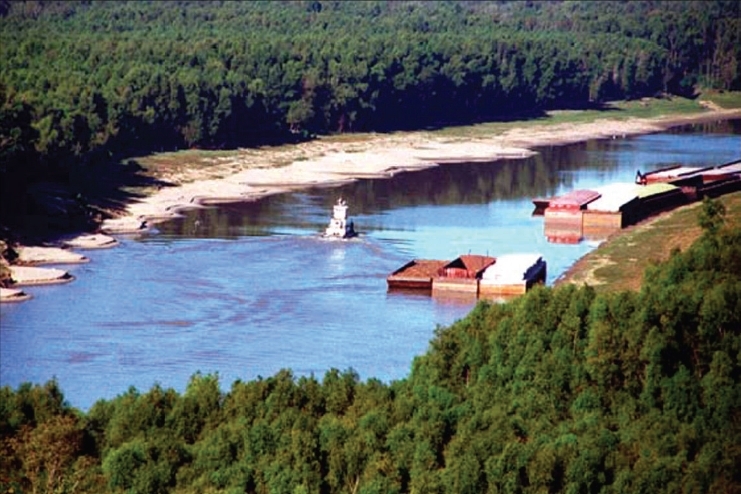
The Yazoo River near Vicksburg. The Yazoo basin drains most of northwestern Mississippi. Although greatly modified, the river still contains significant habitat for fish and wildlife, and portions still support dense populations of native freshwater mussels, such as those found in the Big Sunflower River. Many tributary streams, however, receive large amounts of sediment and agricultural contaminants resulting in high turbidity, nutrients, and toxins. Photo: Bill Strong.
73a. The Holocene floodplain of the Mississippi alluvial plain contains the meander belt of the present course of the Mississippi River and abandoned meander belts of its previous course. Point bars, oxbows, natural levees, and abandoned channels are all characteristic of the Northern Holocene Meander Belts ecoregion. The meander belt is an alluvial ridge that is often at a higher elevation than the more distant floodplain or backswamp areas. The natural levees were the most conspicuous landform of the meander belt, and their distribution influenced human settlements, transportation routes, and agricultural and industrial activities. Soils of this region tend to be silt loams and clay loams derived from alluvium, and are not as sandy as neighboring Northern Pleistocene Valley Trains (73b). The soils are often well drained to somewhat poorly drained. Widespread draining of wetlands and removal of bottomland forest has occurred in this region and agriculture is extensive. Cotton is the primary crop.
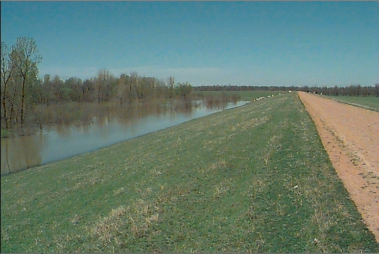
The Mississippi Alluvial Plain is one of the more heavily altered ecoregions in the United States. With construction of levees to control floods and drainage systems to drain wet soils, much of the historic landscape of dense bottomland hardwood forest has been converted to agricultural uses. Photo: USACE
73b. The Northern Pleistocene Valley Trains ecoregion is made up of Pleistocene glacial outwash deposits from the Mississippi and Ohio Rivers, with surface features that reflect braided-stream depositional regimes. Although they make up about 54% of the entire Mississippi Alluvial Plain ecoregion, the Pleistocene Valley Trains are limited in area in the Yazoo Basin of Mississippi. They have been largely eroded away by lateral channel migration or buried by thick sediments during Holocene times. The remnant valley train landscapes that occur in the northeastern and west-central part of the basin are Late Wisconsin in age, about 10,000-20,000 years before present. Relief is extremely low, with surfaces at or slightly above the adjacent Holocene floodplains, and there is slight or no incision of local drainage. Most of the original bottomland hardwood forest has been removed, replaced with cropland of soybeans and some cotton.
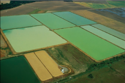
73d. The Northern Backswamps ecoregion consists of flat, poorly-drained, floodplain depressions where water often collects into small, low-gradient stream channels, lakes, swamps, and low-lying areas. These were areas generally not affected by lateral river-channel migrations. They often developed in areas of fine-grained overbank or slack-water deposits where sedimentation rates were relatively low. The soils are mostly gray to black and are clayey textured. Organic matter is locally abundant in the form of woody fragments, small particles, and peaty surface layers varying in thickness. Water levels are seasonally variable, and the clayey soils have high shrink-swell potential with the periodic wetting and drying. Although there are a few small areas of bottomland hardwood forests, with cypress and tupelo in the wettest areas, large parts of this region in Mississippi are in cropland, farmed wetlands, pasture land, or contain large catfish ponds. The backswamps can be important areas for capturing excess nutrients from local waters and for storing water during heavy rain events.
73k. The Southern Holocene Meander Belts ecoregion stretches from just north of Natchez, Mississippi south to New Orleans, Louisiana. Similar to the more northerly meander belt regions, such as 73a, point bars, oxbows, natural levees, and abandoned channels occur. This region, however, has a longer growing season, warmer temperatures, and more precipitation than its northern counterparts. The bottomland forests have been cleared and the region has been extensively modified for agriculture, flood control, and navigation. The levee system is extensive throughout the region.
73m. The Southern Backswamps ecoregion is generally warmer, has a longer frost free period, and more precipitation than the Northern Backswamps (73d). Similar to 73d, soils are [[clay]ey] with areas rich in organic matter. Wetlands are common and flooding occurs frequently. Bottomland hardwood forests are more prevalent in this region than in the adjacent Southern Holocene Meander Belts (73k), where cropland is common. Channelization and flood control systems have modified this region and impacted many of the wetland habitats.
74. Mississippi Valley Loess Plains
This ecoregion stretches from near the Ohio River in western Kentucky to Louisiana. It consists primarily of irregular plains, some gently rolling hills, and near the Mississippi River, bluffs. Thick loess is one of the distinguishing characteristics. The bluff hills in the western portion contain soils that are very deep, steep, silty, and erosive. Flatter topography is found to the east, and [[stream]s] tend to have less gradient and more silty substrates than in the Southeastern Plains ecoregion (65). Oakhickory, oak-hickory-pine, and some mixed mesophytic forests were the dominant natural vegetation. Agriculture is now the typical land cover in the Kentucky and Tennessee portion of the region, while in Mississippi there is a mosaic of forest and cropland.
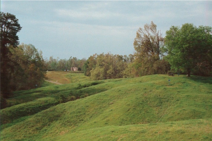
The steep slopes and deep loess of the Bluff Hills (74a) can be seen at Vicksburg National Military Park (VNMP). The loess is a wind-deposited material from the Pleistocene and is mostly silt with some fine sand and clay. Military commanders of Confederate and Union forces tried to use the high bluffs, steep ravines, and unique properties of loess soils to their best advantage in the battle for Vicksburg. Today, the forests of VNMP, younger than some of the mixed mesophytic forests of the region, are dominated by southern red oak (Quercus falcata), white oak (Q. alba), southern sugar maple (Acer barbatum), basswood (Tilia americana), black oak (Q. velutina), and northern red oak (Q. rubra). Photo: National Park Service
74a. The Bluff Hills consist of sand, clay, silt, and lignite, and are capped by loess deposits often greater than 50 feet thick. This disjunct region tends to have deeper loess and is steeper, more dissected, and generally more forested than neighboring 74b. The carved loess has a mosaic of microenvironments, including dry slopes and ridges, moist slopes, ravines, bottomland areas and small cypress swamps. Species with more northern affinities occur far to the south in this region. This combination of northern and southern flora and fauna creates a diverse assemblage of species. While oak-hickory forest is the general natural vegetation type, some of the undisturbed bluff vegetation is rich in mesophytes, such as beech (Fagus grandifolia) and maples (Acer spp.). Other common forest trees include sweetgum (Liquidamber styraciflua), basswood (Tilia americana), eastern hophornbeam (Ostrya virginiana), and tulip poplar (Liriondendron tulipifera), while forests in the southern part of the region contain more southern magnolia (Magnolia grandiflora), water oak (Quercus nigra), and Spanish moss (Tillandsia usneoides). The cool ravines contain some higher gradient streams and areas of gravel substrate, creating distinct aquatic habitats. Severe erosion has occurred in many parts of 74a, particularly when the soils lack adequate vegetative cover.
74b. The Loess Plains ecoregion was once a highly productive agricultural area in Mississippi, although many areas are now in pine plantations or have reverted to a mixed forest landscape. The gently rolling to irregular plains are a contrast to the more dissected bluffs of 74a. The loess layer tends to be thinner than neighboring 74a, and thins more to the east in the broad transition to Ecoregion 65. Streams and [[river]s] tend to be low gradient and murky with silty and sandy substrates; many have been channelized. Severe erosion in earlier years contributed heavy sediment loads to downstream reaches.
74c. The Southern Rolling Plains ecoregion occurs on younger, Miocene and Pleistocene-age geologic formations compared to 74b to the north, and it has a warmer climate. The general climatic shift from 74b includes warmer average annual air temperatures, greater annual [[rain]fall], and a transition to slightly warmer soils. The region has more irregular and dissected topography than the adjacent portion of the Loess Plains (74b) to the north that has more agriculture. Soils of this region are often more loamy or [[clay]ey] and the loess layer is thinner than in 74a and 74b. Land cover is mostly loblolly and shortleaf pine (Pinus taeda, P. echinata) forest or pine plantations, and forests have a higher concentration of pine than in 74a and 74b. Timber production occurs on the Homochitto National Forest, and oil and gas production and exploration has been widespread in the region during the past fifty years. The eastern boundary of this region is broad, with a gradual transition to Ecoregion 65.
75. Southern Coastal Plain
The Southern Coastal Plain extends from South Carolina and Georgia through much of central Florida, and along the Gulf coast lowlands of the Florida Panhandle, Alabama, and Mississippi. From a national perspective, it appears to be mostly flat plains, but it is a heterogeneous region containing barrier islands, coastal lagoons, marshes (Tidal marsh), and swampy lowlands along the Gulf and Atlantic coasts. In Florida, an area of discontinuous highlands contains numerous lakes. This ecoregion is lower in elevation with less relief and wetter soils than the Southeastern Plains (65). Once covered by a variety of forest communities that included trees of longleaf pine (Pinus palustris), slash pine (P. elliottii), pond pine (P. serotina), beech (Fagus grandifolia), sweetgum (Liquidamber styraciflua), southern magnolia (Magnolia grandiflora), white oak (Quercus alba), and laurel oak (Q. laurifolia), land cover in the region is now mostly slash and loblolly pine with oak-gum-cypress forest in some low-lying areas, citrus groves in Florida, pasture for beef cattle, and urban.
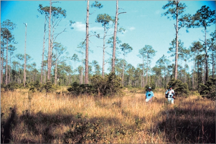
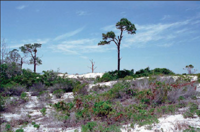
Pine savannas with slash pine (Pinus elliottii), longleaf pine (P. palustris) and wiregrass (Aristida beyrichiana) were once more common in southern Mississippi. Almost all of the pine savanna habitat was eliminated by agricultural and industrial development, fire suppression, or conversion to pine plantations. The wet prairies contained a high diversity of plant species, including many wildflowers, orchids, and carnivorous plants. Photo: NOAA
75a. In Mississippi, the Gulf Coast Flatwoods is a narrow region of nearly level terraces and delta deposits composed of Quaternary-age sands and clays. Wet, sandy flats and broad depressions that are locally swampy are now usually forested or in pine plantations, while some of the better-drained land has been cleared for pasture or crops. Dominant [[land use]s] include woodland, wildlife habitat, and urban. Historically, pine savannas with slash and longleaf pine (Pinus elliottii, P. palustris) and a variety of grasses, sedges, rushes, pitcher plants and orchids were common. A high natural fire frequency was typical, often sparked by lightning and fueled by wiregrass (Aristida spp.) that maintained the more open savannas.
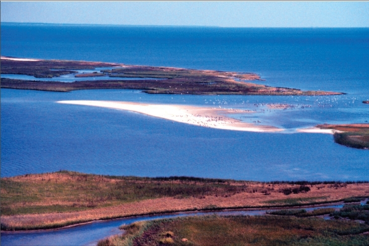
The web of coastal environments includes beaches, barrier islands, maritime forests, marshes, and estuaries. These are continually changed by wave, tide, wind, river energy, and human alterations. The Grand Bay Savanna Coastal Preserve near the Alabama state line contains a mosaic of marshes and salt flats dominated by smooth cordgrass (Spartina alterniflora), needle rush (Juncus roemerianus), and saltgrass (Distichlis spicata). Photo: NOAA
75i. Floodplains and Low Terraces are a continuation of the riverine 65p ecoregion across the Southern Coastal Plain. The broad floodplains and terraces of the Pascagoula and the Pearl rivers comprise the region in Mississippi. Composed of stream alluvium and terrace deposits of sand, silt, clay, and gravel, along with some organic muck and swamp deposits, the region includes large sluggish rivers and backwaters with ponds, swamps, and oxbow lakes. River swamp forests of bald cypress (Taxodium distichum) and water tupelo (Nyssa aquatica) and oak-dominated bottomland hardwood forests provide important wildlife habitat.
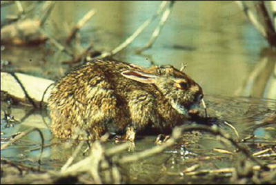
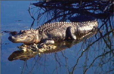
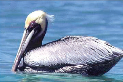
75k. The Gulf Barrier Islands and Coastal Marshes region contains salt and brackish marshes, dunes, beaches, and barrier islands that enclose the Mississippi Sound. Inland, some tidal freshwater marshes (Non-tidal marsh) occur, such as those on the alluvial delta deposits of the Pearl and Pascagoula [[river]s]. Smooth cordgrass (Spartina alterniflora), marshhay cordgrass (S. patens), and saltgrass (Distichlis spicata) tend to be dominant in the saline intertidal zone. Some xeric coastal strand and pine scrub vegetation, with live oak (Quercus virginiana), upland laurel oak (Q. hemisphaerica), and slash pine (Pinus elliottii), occurs on parts of the barrier islands. Sea oats (Uniola paniculata) are common on the dunes, spits, and beaches. In Mississippi, many of the dunes and beaches have been heavily altered by urban and industrial uses. Some of the mainland beaches, such as along Gulfport and Long Beach, have been artificially created. The outer islands include Ship, Horn, and Petit Bois Islands which are public lands managed under the Gulf Islands National Seashore. These islands and parts of the coastal fringe are used by many trans-gulf migrant bird species that can be seen in spring and fall. The ecoregion provides important habitat for many waterfowl, shorebird, sea turtle, and fish species, as well as for muskrat, nutria, raccoon, otter, mink, and alligator. Nearby island and river delta erosion, land subsidence, and rising sea levels threaten the terrestrial future of parts of the region.
Notes
- The full, original version of this entry is located here: http://www.epa.gov/wed/pages/ecoregions/ms_eco.htm. That description contains additional maps, as well as information on the physiography, geology, soil, potential natural vegetation, and the land use and land cover of the ecoregion.
- PRINCIPAL AUTHORS: Shannen S. Chapman (Dynamac Corporation), Glenn E. Griffith (Dynamac Corporation), James M. Omernik (USEPA, retired), Jeffrey A. Comstock (Indus Corporation), Michael C. Beiser (MS DEQ), and Delaney Johnson (NRCS).
- COLLABORATORS AND CONTRIBUTORS: Jim Harrison (USEPA), Mike Lilly (NRCS), Mike Bograd (MS DEQ), Larry Handley (USGS), Barb Kleiss (USACE), Alice Dossett (MS DEQ), Katherine Williams (MS DEQ), Chip Bray (MS DEQ), and Tom Loveland (USGS).
- REVIEWERS: David Beckett (University of Southern Mississippi), J. Stephen Brewer (University of Mississippi), David Dockery (MS DEQ), Jerry Griffith, (University of Southern Mississippi), George Martin (NRCS), Robert Wales (University of Southern Mississippi), and Ron Wieland (Mississippi Natural Science Museum).
- CITING THIS POSTER: Chapman, S.S, Griffith, G.E., Omernik, J.M., Comstock, J.A., Beiser, M.C., and Johnson, D., 2004, Ecoregions of Mississippi, (color poster with map, descriptive text, summary tables, and photographs): Reston, Virginia, U.S. Geological Survey (map scale 1:1,000,000).
- This project was partially supported by funds from the Mississippi Department of Natural Resources through grants provided by the U.S. Environmental Protection Agency Region IV under the provisions of Section 319(h) of the Federal Water Pollution Control Act.
Literature Cited
- Bailey, R.G., Avers, P.E., King, T., and McNab, W.H., eds., 1994, Ecoregions and subregions of the United States (map) (supplementary table of map unit descriptions compiled and edited by McNab, W.H. and Bailey, R.G.): Washington, D.C., U.S. Department of Agriculture-Forest Service, scale 1:7,500,000.
- Bryce, S.A., Omernik, J.M., and Larsen, D.P., 1999, Ecoregions - a geographic framework to guide risk characterization and ecosystem management: Environmental Practice, v. 1, no. 3, p. 141-155.
- Commission for Environmental Cooperation Working Group, 1997, Ecological regions of North America - toward a common perspective: Montreal, Quebec, Commission for Environmental Cooperation, 71 p.
- Gallant, A.L., Whittier, T.R., Larsen, D.P., Omernik, J.M., and Hughes, R.M., 1989, Regionalization as a tool for managing environmental resources: Corvallis, Oregon, U.S. Environmental Protection Agency, EPA/600/3-89/060, 152 p.
- McMahon, G., Gregonis, S.M., Waltman, S.W., Omernik, J.M., Thorson, T.D., Freeouf, J.A., Rorick, A.H., and Keys, J.E., 2001, Developing a spatial framework of common ecological regions for the conterminous United States: Environmental Management, v. 28, no. 3, p. 293-316.
- Omernik, J.M., 1987, Ecoregions of the conterminous United States (map supplement): Annals of the Association of American Geographers, v. 77, no. 1, p. 118-125, scale 1:7,500,000.
- Omernik, J.M., 1995, Ecoregions - a spatial framework for environmental management, in Davis, W.S., and Simon, T.P., eds., Biological assessment and criteria-tools for water resource planning and decision making: Boca Raton, Florida, Lewis Publishers, p. 49-62. ISBN: 0873718941.
- Omernik, J.M., Chapman, S.S., Lillie, R.A., and Dumke, R.T., 2000, Ecoregions of Wisconsin: Transactions of the Wisconsin Academy of Sciences, Arts and Letters, v. 88, no. 2000, p. 77-103.
- U.S. Department of Agriculture-Soil Conservation Service, 1981, Land resource regions and major land resource areas of the United States: Agriculture Handbook 296, 156 p.
- U.S. Environmental Protection Agency, 2003, Level III ecoregions of the continental United States] (revision of Omernik, 1987): Corvallis, Oregon, U.S. Environmental Protection Agency-National Health and Environmental Effects Research Laboratory, Map M-1, various scales.
- Wiken, E., 1986, Terrestrial ecozones of Canada: Ottawa, Environment Canada, Ecological Land Classification Series no. 19, 26 p. ISBN: 0662147618.
| Disclaimer: This article is taken wholly from, or contains information that was originally published by, the Environmental Protection Agency. Topic editors and authors for the Encyclopedia of Earth may have edited its content or added new information. The use of information from the Environmental Protection Agency should not be construed as support for or endorsement by that organization for any new information added by EoE personnel, or for any editing of the original content. |
