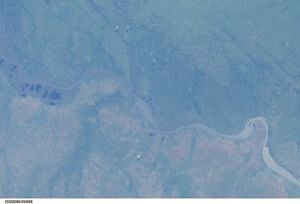
Albert Nile
The Albert Nile is a 130 mile section of the White Nile (one of the two major tributaries of the Nile River) beginning in northwest Uganda and ending at the border with Sudan, where the name of the river changes to Bahr el Jebel or River of the Mountain, or Mountain Nile.
The Albert Nile begins as the outflow of from Lake Albert on the border between Uganda and the Democratic Republic of the Congo. A few miles from the northern tip of Lake Albert where the Albert Nile begins, the lake receives the flow of the Victoria Nile which drains Lake Victoria. Lake Albert also receives the flow of the Semliki River at its southern end. Lake Albert lies at the northern end of the Albertine rift, the western branch of the Great Rift System, which runs from the Middle East south through eastern Africa to Mozambique.
The Albert Nile is navigatable over its entire length. A bridge crosses the Albert Nile just north of Lake Albert at Pakwach which carries a road between the cities of Gula, Uganda to the east and Arua to the northwest.
Several smaller rivers flow into the Albert Nile, draining the northwestern corner of Uganda, including the Ora and Zoka rivers.
The river flows through East Sudanian savanna which encompasses much of northern Uganda and encompasses much of Lake Albert. This hot, dry, wooded savanna composed mainly of Combretum and Terminalia shrub and tree species and tall elephant grass has been adversely affected by agricultural activities, fire, clearance for wood and charcoal, but large blocks of relatively intact habitat remain even outside protected areas. Populations of some of the larger mammal species have been reduced by hunting, but reasonable numbers of others remain.
See Also
References
- Sir William Willcocks, Hugh John Llewellyn Beadnell. 1904. The Nile in 1904 (Google eBook) E.& F.N. Spon, limited, 225 pages
- Julian Rzóska. 1976. The Nile: biology of an ancient river 417 pages


