Water profile of Qatar
Contents
Geography and Population
Qatar occupies a peninsula, projecting northwards from the Arabian mainland, on the west coast of the Persian Gulf. Its western [[coast]line] joins onto the shores of Saudi Arabia. The peninsula is roughly 180 kilometers (km) long and between 55 and 85 km wide and its total area is estimated at 11,000 square kilometers (km2). Qatar is stony, sandy, and barren and its surface is of low to moderate relief, with the highest elevation of 103 meters (m) above sea level being attained in the southern part, where mesa-type hills and large barchan-type sand dunes serve to break the monotony of an otherwise flat, eroded landscape.
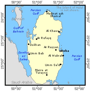 Map of Qatar. (Source: FAO)
 The cultivable land is estimated at 28,000 hectares (ha), which is 2.5% of the total area. In 1994, 8,312 ha were estimated to be cultivated as against 2,256 ha in 1980. Of this area of 8,312 ha, 5,987 ha consisted of annual crops (mainly green fodder, vegetables, and cereals) and 2,325 ha consisted of permanent crops (mainly dates). The agricultural land is government owned and most farm owners participate only indirectly in the farming process, having permanent positions in other sectors of the economy. Consequently, most farms are run by immigrants.
The total population is 551,000 (1995), of which 9% is rural. Between 1980 and 1991 the annual demographic growth rate was estimated at 4.7%. Only about one-fourth of the total population is estimated to be indigenous Qatari population. The capital Doha houses 80% of the total population and the industrial center of Umm Said, 40 km south, is being extensively developed. Agriculture represents only 1.1% of the country's Gross Domestic Product (GDP), which is dominated by oil and its by-products.
Climate and Water Resources
Climate
The climate is of the typical arid desert type with a hot, humid summer, with temperatures reaching 44°C. There is some [[[precipitation|rain]] in winter, when temperatures range between 10 and 20°C. Average annual rainfall is around 75 millimeters (mm), although there are wide variations from place to place and from year to year. It varies from 40 mm in the south to over 80 mm in the north. Most rain occus during November to April inclusive, but might be limited to two or three days of heavy rainfall per year which is more destructive than useful. Recorded falls in 24 hours have approached the total annual average.
Water Resources
There is practically no permanent surface water - annual surface runoff has been estimated at 1.35 million cubic meters (m3). Direct and indirect recharge of groundwater from rainwater forms the main natural internal water resources. Two-thirds of the land surface is made up of some 850 contiguous depressions of interior drainage with catchments varying from 0.25 km2 to 45 km2 and with a total aggregate area of 6,942 km2. While direct recharge from rainfall might take place during very rare heavy storms, the major recharge mechanism is an indirect one through runoff from surrounding catchments and the ponding of water in the depression floor. Surface runoff typically represents between 16 and 20% of rainfall. Of the amount reaching the depressions, 70% infiltrates and 30% evaporates.
There are two separate and distinct groundwater regions: the northern half, where groundwater occurs as a freshwater 'floating lens' on brackish and saline water and the southern half where no such lens exists and where water quality is generally brackish with only a thin veneer of freshwater at the top of the water table. Annual groundwater recharge has been estimated at 50.43 million m3.
The two main aquifers underlying Qatar are recharged in Saudi Arabia. Over most of Qatar the Damman formation does not contain water because of its altitude. It dips lower in southwest Qatar where it contains water, but is also overlain by impervious layers. The artesian aquifer which results from this structure is called the Alat unit of the Damman. Below this aquifer is the Umm er Radhuma, which is similarly artesian. In 1981, the Master Water Resources and Agricultural Development Plan (MWRADP) estimated that in the southern part of Qatar the safe yield of the Alat aquifer is 2 million m3/year and that of the Umm er Radhuma 10 million m3/year, based on an estimate of annual flow from Saudi Arabia. However, these safe yields would be substantially reduced if the aquifer were exploited more extensively on the Saudi Arabian side of the border. In the northern and central part the Rus aquifer overlies the Umm el Radhuma aquifer, which is partly an unconfined aquifer, recharged by percolating rainfall and return flows from irrigation but losing some water to the sea and some through abstractions. The safe yield of the aquifer system in the northern and central part of Qatar is estimated at 13 million m3/year from the upper layer and 20 million m3/year from the lower layer (the latter leading to a depletion in 50 years). In total, the estimated safe yield for the whole of Qatar is 45 million m3/year.
Another potential source of groundwater is beneath the capital Doha itself. According to the MWRADP, considerable volumes of water leak from pipelines and other sources throughout much of Doha. This leakage, estimated at about 15 million m3/year, has caused the water table to rise locally, flooding basements as well as shallow excavations.
Non-conventional Water Sources
In 1995, total desalination capacity was 98.6 million m3/year. There are two desalination plants in Qatar. The desalination plant in Ras Abu Aboud has a capacity of 52,000 m3/day or 19.0 million m3/year. The plant in Ras Abu Fontas has a capacity of 218,000 m3/day or 79.6 million m3/year. The addition of two new desalination units in Ras Abu Fontas is expected to raise the total desalination capacity of the country in 1996 to 318,000 m3/day or 116.1 million m3/year. In 1987, treated and reused municipal wastewater was almost 70,000 m3/day, or 25.2 million m3/year.
Water Withdrawal
In 1994, total water withdrawal was estimated at 292 million m3, of which 285 million m3 (74%) for agricultural purposes (23.2% is withdrawn for domestic use and 2.8% for industrial use). Desalinated water provides the vast majority of Qatar's drinking water. Of the total reused treated wastewater of 25.2 million m³, 25% is supplied to the municipality of Doha to be used in landscape irrigation on the roads and areas planted with trees. The remaining 75% is conveyed via pipelines to ponds and then re-pumped to west Doha to be used in irrigation of farms.
Total groundwater extraction is estimated at 188 million m3. Given an annual recharge of about 50 million m3, mining of [groundwater]] is 138 million m³, which is much more than the considered safe yield of 45 million m3 (which already includes fossil water).
Irrigation and Drainage Development
Agriculture is not possible without irrigation. The part of the 28,000 ha of cultivable area that can be considered to assess irrigation potential, depends on the future availability of alternative sources of water, because groundwater is already being depleted at the present rate of abstraction.
In 1993, there were 1,130 registered farms in the country, of which 889 were actually in operation. The area equipped for irrigation was estimated at 12,520 ha, while 8,312 ha was actually cultivated, which is 66% of the equipped area. Most of the water used is groundwater.
Surface irrigation (basins and furrows) is the most commonly used irrigation technique. Examples of relatively large-scale projects that use modern irrigation techniques are: the Ar Rakiyah project, where 17 center pivots cover 723 ha, and the Al Mashabiyah project, where 12,000 date palms are irrigated by bubblers and more than 30 ha of vegetables are irrigated by drippers in experimental and private farms. Some examples of the costs of irrigation development are: $US 7,400/ha for a drip irrigation system with buried PVC pipes for vegetables and $US 7,700/ha for a bubbler irrigation system with buried PVC pipes for date palms.
There are no national criteria for distinguishing between the size of the schemes. The classification of registered farms and agricultural projects according to equipped areas assumes that small schemes work areas less than 20 ha, covering 33% of the total equipped area, medium size schemes work areas between 20 and 150 ha, covering 54% of the total area, and large schemes work areas of over 150 ha, covering 13% of the total area.
The major irrigated crops are green fodder, vegetables, fruit trees, and cereals. Tomatoes are the main winter vegetable, melons the main summer vegetable. The main fruit trees are dates and citrus. Alfalfa is the main green fodder crop. Barley is the main cereal, with a small quantity of wheat and maize.
Over-extraction of groundwater results in a fast deterioration of the water quality, due to sea water intrusion and upward diffusion of deeper saline water. For this reason, a kind of shifting cultivation takes place within a farm, i.e., as soon as soil salinity has reached intolerable limits, new land is put into cultivation and the degraded land is completely abandoned.
Institutional Environment
The institutions in charge of water resources assessment, development and irrigation are:
- the [of Municipal Affairs and Agriculture] together with: the [of Agricultural and Water Research] (DAWR), the Drainage Division and the Environmental Department;
- the Ministry of Electricity and Water together with the Water Networks Department;
- the Supreme Council for Planning;
- the Ministry of Energy and Industry.
Based on the recommendation of the DAWR, Decree No. 1 of 1988 was issued to regulate drilling of wells and groundwater use. The [of Municipal Affairs and Agriculture] formed the Farms and Wells Committee to be responsible for implementing the groundwater laws. The articles of the groundwater laws which have been implemented are those connected with granting permits for drilling, alteration, and modification of wells. What remains to be done is to put into action the articles concerning water use and specifically the installation of water meters in all wells in the state, not exceeding the specified irrigated area and the allocated amount of water for each farm following the instructions issued by the DAWR regarding conveyance and irrigation systems.
Trends in Water Resources Management
The main trends in the national strategy and policy for the development of water resources and irrigation consist in fulfilling two objectives:
- the improvement of the present situation of water use. This comprises the redesign of existing farms, rehabilitation of abandoned farms, implementation of modern irrigation systems in all productive farms, strengthening of extension, and training and implementation of water laws;
- the enhancement of water resources. This could be achieved by importing fresh water, increasing the quantity of treated wastewater, irrigation with saline water, increasing the natural groundwater recharge rate, development of deep aquifers, and monitoring saline water intrusion.
The main constraint facing the implementation of the above-mentioned water resources and irrigation development plan is the high capital cost and the low return from using water in agricultural production.
Further Reading
- Civil Engineering Department, Drainage Division. 1996. Treated Sewage Effluent. MMAA Of Municipal Affairs and Agriculture.
- DAWR Of Agricultural and Water Research, Agricultural Economics and Statistics Section. 1994. Agricultural Statistics 1993. MMAA. Doha, Qatar.
- DAWR, Groundwater Unit. 1995. Groundwater Balance. MMAA.
- DAWR. 1982. Brief annual report 1981-82: irrigation and drainage section. Prepared by M.A. Hashim and N.G. Dastane. Ministry of Industry and Agriculture/FAO.
- FAO. 1978. Integrated water and land use in Qatar. Rome.
- Halcrow-Balfour Ltd. 1981. Master Water Resources and Agricultural Development Plan. Ministry of Industry and Agriculture.
| Disclaimer: This article is taken wholly from, or contains information that was originally published by, the Food and Agriculture Organization. Topic editors and authors for the Encyclopedia of Earth may have edited its content or added new information. The use of information from the Food and Agriculture Organization should not be construed as support for or endorsement by that organization for any new information added by EoE personnel, or for any editing of the original content. |