Water profile of Dominica
Contents
Geography and population
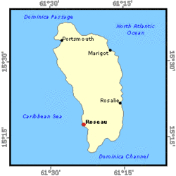
Dominica is a Caribbean island that lies between the French islands of Guadalupe and Mari-Galante to the north and Martinique to the south. It has been a member of the Commonwealth since independence in 1978. It is 47 kilometers (km) long and has a maximum width of 26 km. The total area is 750 km2. In 1997, the total cultivated area amounted to 15,000 hectares (ha), of which 12,000 ha are under permanent crops.
The island is of volcanic formation, with signs of activity including solfataras (volcanic vents) and hot springs. A range of high, forest-clad mountains runs north to south, broken in the center by a plain drained by the Layou River, which flows to the west; the highest points are Mount Diablotin (1,447 meters [m]) and Mount Trois Pitons (1,424 m).
In 1997, the population of Dominica was estimated at 71,000 inhabitants, of which 31% were rural. Demographic growth in the period 1990-97 was about zero. Population density in 1997 was about 95 persons/km2 on average over the country. The agriculture sector accounted for about 19.8% of the gross domestic product (GDP) in 1996.
Climate and water resources
Climate
Dominica has a mild climate, particularly during the cool months from December to March. Summer temperatures reach an average of 32°C; winter temperatures are not much lower, the average high being anywhere from 29 to 30°C. The dry season is from February to May, and the rainy season is from June to October, the most likely period for hurricanes. Rainfall varies, being specially heavy in the mountainous interior. Average annual coastal rainfall varies from 1,500 to 3,700 millimeters (mm), but in the mountains average rainfall can reach a maximum of 6,350 mm.
Water resources and water withdrawal
The total annual production from all currently used water sources is estimated at 16.6 million m3. Only 40% of the consumers are metered and no accurate figure for actual usage exist. It is estimated that an additional 4.1 million m3 are needed to serve the whole population adequately. There are no demand figures of commercial or industrial uses. Some sources have been identified by the Ministry of Agriculture for irrigated agricultural development.
Irrigation and drainage development
There is a considerable potential for irrigated agriculture in Dominica, but the country has practically no irrigation. In fact, there are only small systems where farmers grow vegetables (watermelons, carrots, tomatoes, cabbages, etc.). These systems are usually fed by surface water.
The Dominica Banana Growers Association (DBMC) is the central authority which manages banana production and marketing in the island and provides essential services to the farmers including export. Although there has been much talk of growing bananas under irrigation over recent years, no concrete efforts have been made to do so. Indications are that average yield could be significantly improved if irrigation were practiced. Areas like Calabishi and Marigot, which are considered prime banana areas because of the soil type, tend to suffer from drought and could benefit significantly from irrigation. Banana is the major crop in the island in terms of area and covered about 3,500 hectares (ha) in 1998.
An additional benefit of irrigation is that the national banana production target could be realized from a more reduced area. As a consequence, steep hillside areas which are currently planted to rainfed bananas could be released from arable land and put under tree crops or agroforestry, uses more consistent with good conservation practice. The DBMC is also interested in promoting crop diversification among its banana farmers.
Institutional environment
The Dominica Water and Sewerage Company (DOWASCO) is the sole organization responsible for the management (Water governance) of the water resources in the country. DOWASCO is a private company, incorporated by an Act of Parliament. It has an exclusive license, granted by the Minister of Communication and Works, to abstract and utilize the water resources of the country. It is charged with the development of the resource and for any research, data collection, projection and maintenance and development of new sources. This license was granted in 1989 for 25 years. Anyone else wishing to distribute water must therefore get a sub-license from DOWASCO. This organization has no obligation to develop or provide water for agriculture.
Trends in water resources management
The Warner Area consists of some 120 hectares (ha) and is considered to be one of the most important potential sites for the promotion of irrigated crop production. A plan for the development of the area, including an irrigation scheme, is being prepared. Water should come from the Café or Soulton Rivers.
Further Reading
- The World Factbook: Dominica, Central Intelligence Agency.
- Water profile of Dominica, Food and Agriculture Organization.
- Harvey W. 1997. Water resources management and water use in the agriculture sector of the windward islands. Main Report. Bridgetown. Barbados
| Disclaimer: This article is taken wholly from, or contains information that was originally published by, the Food and Agriculture Organization. Topic editors and authors for the Encyclopedia of Earth may have edited its content or added new information. The use of information from the Food and Agriculture Organization should not be construed as support for or endorsement by that organization for any new information added by EoE personnel, or for any editing of the original content. |