Water profile of Bahrain
Contents
Geography and population
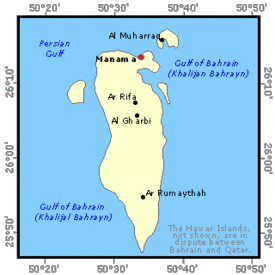
The State of Bahrain (26°00' North, 50°33' East) is an archipelago of 36 islands located in the Persian Gulf, about midway between Saudi Arabia to the west and Qatar to the east, with a total area of 695 km2. The largest island is Bahrain, where the capital is situated and which represents about 85% of the total area of the country.
The total population is 564,000 (1995), of which 10% is rural. With a population density of 812 inhabitants/km2, it is one of the world's most densely populated countries. Bahrain has experienced high rates of population growth and urbanization since the early 1960s following the sudden increase in the country's oil revenues leading to a fast increase in its economic base and an improvement in the standard of living. The average annual demographic growth rate was 4% during the period 1980 - 1991
Urban development at the expense of agricultural lands has caused significant loss of traditionally agricultural areas. Furthermore, soil salinization resulting from deterioration in the quality of the groundwater used in irrigation has led to a general reduction of the cultivated lands. At present, the total cultivable area is estimated at 4,230 hectares (ha), or 6% of the total area of the country. In 1994, the total cultivated area was about 3,165 ha, all irrigated, of which 1,483 ha consisted of annual crops (vegetables and fodder crops) and 1,682 ha consisted of permanent crops (fruit trees and dates).
Agriculture in Bahrain is generally in an unhealthy state with tenancy problems, small farm holdings, labor shortage and lack of financial incentives which restricts investment. In 1992, about 3,200 people were engaged in agricultural activities. This corresponds to about 2% of the labor force. Agriculture accounted for only 1% of gross domestic product (GDP) in 1991.
Climate and water resources
Climate
Bahrain has an arid to extremely arid environment. It is characterized by high temperatures, erratic and often scanty rainfall, high evapotranspiration rates (with peaks of over 10 mm/day in July) and high humidity levels due to the surrounding Arabian Gulf waters. Temperature averages vary from 17°C in winter (December-March) to 35°C in summer (June-September). The rainfall season extends from November to April, with an annual average of 70.6 mm, sufficient only to support the most drought resistant desert vegetation. The mean annual relative humidity is over 67%.
Water resources
Total annual surface runoff is only about 4 million m3 and there are no perennial streams. Bahrain receives groundwater by lateral under-flow from the Damman aquifer, which forms only a part of the extensive regional aquifer system, called the Eastern Arabian Aquifer. This aquifer extends from central Saudi Arabia, where its main recharge area is located at about 300 meters above sea level, to eastern Saudi Arabia and Bahrain, which are considered the discharge areas. The rate of groundwater inflow has been estimated at about 112 million m/year under steady-state conditions (before 1965) and this figure is considered to be the safe groundwater yield in Bahrain. There are no dams in Bahrain.
Desalinated water and treated wastewater
In 1991, the total quantity of desalinated water used was 44.1 million m3/year. In addition Bahrain treats about 45 million m/year of wastewater (secondary treatment). Only 8 million m3/year receive tertiary treatment and are used for irrigation purposes in government farms and some private farms, while the rest is discharged to the sea. The chemical and hygienic properties of the tertiary treated water are within international limits and are considered good for agricultural purposes. Although government plans for full utilization of the TSE (Treated Sewage Effluent) water through major agricultural projects exist, delay and lack of finances for these projects have caused limitations in the use of these waters.
Water withdrawal
| Table 1: Groundwater depletion in Bahrain, 1991/92 | |
|---|---|
| Component | Average annual rate (million m3) |
| Inflow: | |
|
Recharge by under-flow (aquifer safe yield) |
112.00 |
| Recharge by rainfall on outcrop and irrigation return flows | 0.28 |
| Total inflow | 112.28 |
| Outflow: | |
| Wells abstraction for irrigation, livestock, domestic, industrial and other purposes |
190.20 |
| Sabkha natural discharge | 12.72 |
|
Natural springs discharge |
5.40 |
| Total outflow | 208.32 |
| Total inflow - Total outflow | -96.04 |
In 1991, total water withdrawal in Bahrain was estimated at more than 239 million ma, of which 56% or more was used for irrigation and livestock watering. About 94% of the water used in agriculture, including livestock, is groundwater and 6% is treated wastewater, while for domestic and industrial purposes about 60% of the water used is groundwater and the remaining part desalinated water. Non-conventional water sources accounted for almost 22% in the total water withdrawal in 1991.
The excessive pumping of groundwater caused a sharp decrease in groundwater storage and a reduction in potentiometric levels of about 4 meters between 1965 and 1992. As a result, more than half the original groundwater reservoir has been completely degraded due to seawater intrusion and saline water up-flow from the deeper zones. Table 1 shows that annual extraction is almost twice annual recharge, leading to an ever increasing groundwater deficit. Average annual groundwater depletion over the period 1965-1992 was approximately 40 million m3, and in 1991/92 the groundwater depletion was over 96 million m3.
Irrigation and drainage development
The limited availability of good quality [[soil]s] and water has resulted in the concentration of agricultural development in a relatively narrow strip of land along the north-western coast of Bahrain Island with isolated pockets in the north central areas and along the east coast. Most soils have a sandy texture, traces of organic matter (0.05-1.5%), a deficiency in major nutrients, low water-holding capacity (available moisture 2-6%), and high infiltration rates (> 120 mm/hr). In areas along the coastal strip, calcareous impermeable layers are found at varying depths of 1 to 3 meters, causing waterlogging and impeding leaching. Electrical conductivity (EC) in irrigated soils lies within a range of 4-12 millimhos per centimeter (mmhos/cm), while in the areas of recently abandoned agriculture (1,065 ha) it could reach 60 mmhos/cm.
At present, out of the total agricultural land of 4,230 ha, drainage works are being carried out on 1,850 ha. The remaining 2,380 ha still suffer from shallow water tables resulting in waterlogging in the crop root zones and an increasing salinization of the top soil. Drainage requirements are exacerbated by the inefficient surface irrigation systems used. In 1994, drainage works had been completed on about 1,300 ha. The average cost of drainage development is estimated at $US 6,600/ha.
In the period from 1956 to 1977, agricultural lands decreased from about 6,460 ha (with 3,230 ha cultivated) to about 4,100 ha (with 1,750 ha cultivated). This decrease was attributed mainly to urban expansion, waterlogging and soil salinization due to deterioration of the quality of the groundwater used in irrigation. In an attempt to reverse the situation, the government initiated a major agricultural development program in the early 1980s represented by:
- the replacement of surface irrigation methods with micro-irrigation (more water efficient) by subsidizing more than 50% of the cost of their implementation
- the construction of major drainage systems to alleviate waterlogging and salt accumulation;
- the provision of agricultural extension services in terms of educating and advising farmers on types of crops suitable for agriculture under prevailing conditions;
- the introduction of TSE water in irrigation;
- the reclamation of new agricultural lands.
This resulted in a gradual increase and restoration of agricultural lands to about 4,230 ha, with 3,165 ha irrigated at present, all power irrigated. These 4,230 ha can also be considered as the irrigation potential, should there be an increasing future use of nonconventional water sources, in addition to groundwater. The quantity of groundwater available in the future for agriculture is difficult to estimate since groundwater quality, and hence its availability for irrigation, changes with time.
The utilization of 8 million m3/year of tertiary TSE water in the reclaimed government lands (280 ha) and on some private farms (150 ha), using modern irrigation techniques (sprinkler and micro-irrigation), had a palpable effect on the increase of agricultural lands and their productivity. While most of the program is still being carried out at present, government subsidy of the installation of modern irrigation systems ceased in the 1990s due to lack of funds. Despite efforts to introduce modern irrigation techniques, most farms still use traditional surface irrigation, which causes high water losses, estimated at between 24 and 40%. Sprinkler irrigation is used only in government projects, while micro-irrigation is used in government projects and on a limited number of private farms. Most of the land is worked either directly by the owner, often with hired labor, or by tenant farmers under a 1 to 2 year lease agreement. Such short and insecure occupation periods do not encourage tenants to invest in the installation of modern irrigation systems, which cost 40% and even up to 100% more than surface irrigation systems since the government no longer subsidizes the installation of modern irrigation systems. The small size of agricultural landholdings, ranging between 0.5 and 10 ha with an average of 2.5 ha, and in particular the fragmentation of the agricultural land of farm holdings, further restrict investment in the more expensive modern irrigation techniques.
Of the total equipped area of 3,165 ha, 2,885 ha consist of small schemes (< 50 ha). Most farms in these small-scale schemes are run under the tenancy system and at present there are about 250 households on these schemes. The remaining 280 ha of large schemes (> 50 ha) are owned and completely operated by the government and irrigated by treated wastewater, with a total of 80 government workers, of whom 11 are involved in irrigation.
The average cost of irrigation development on small schemes varies between $US 6,600/ha for surface irrigation, $US 9,300/ha for micro-irrigation and $US 13,200/ha for sprinkler irrigation. For large schemes it is $US 16,200/ha for surface irrigation, $US 13,600/ha for micro-irrigation and $US 19,800/ha for sprinkler (central pivot) irrigation. The high costs for large-scheme development are attributed to the fact that the major projects are carried out by the government on reclaimed lands. Operation and maintenance costs vary between 10 and 15% of the irrigation development costs on small schemes and between 5 and 15% on large schemes.
The major crops grown are dates and fruit trees with a yield of 7.5 tons/ha, vegetables, mainly tomatoes, with a yield of 11.7 tons/ha, and fodder crops, mainly alfalfa, with a relatively high yield of 74.5 tons/ha. In the last 10 years, there has been an increasing trend in the cultivation of alfalfa for fodder production rather than the cultivation of the traditional date and vegetable crops. Alfalfa tolerates high salinity and is a cash crop grown all year round with high local demand. However, because of the very high irrigation water requirements of alfalfa, it is expected that this trend will have negative implications for the country's groundwater resources.
The privately-owned water use rights are the only water rights that exist in Bahrain. The general principle governing these rights is that groundwater is the property of the landowners and, therefore, they have an exclusive right to extract and use this water as much as they wish and for any purpose they want without being liable for any damage caused to their neighbors or to the groundwater in general. At present, the agricultural sector's utilization of water is not subjected to any licensing system nor controlled by a pricing system. However, from the mid-1980s onwards, agricultural wells were being metered by the government and the government is in the process of passing a law that would make it compulsory for all well owners to install meters on their wells. The total number of wells metered at present is about 1,670 (86% of total). The final objective of this program is to observe irrigation water requirements, and subsequently to set up a licensing system for groundwater withdrawal and design an appropriate pricing system for excess water utilization.
The only flood protection works carried out in Bahrain are those against rainfall floods and are developed in one residential, more modern, town located in the west over an area of 1,300 ha, where no agricultural activities are going on.
Institutional development
The Bahrain High Council for Water Resources, created in 1982, is the highest authority on water resources, under the chairmanship of the Prime Minister and with the membership of the ministries concerned.
The main duties of the Council are:
- drawing up the country's water policies;
- protecting and developing the country's water resources;
- regulating and coordinating water utilization between competing sectors;
- taking necessary measures to solve any problems that might arise during the implementation of water policies.
The Ministry of Works and Agriculture acts as the advisory body for the Council, and, through its different directorates, is in charge of the country's agricultural development and planning and water resources management.
Furthermore, indicating the government's future reliance on TSE in irrigation, a TSE Utilization Committee, with representatives from the related Ministries, was set up in 1993. The Committee's main responsibilities are the management and planning of TSE utilization in irrigation.
Trends in water resources management
In the last 15 years, the government has been taking several steps and courses of action to provide solutions to the water crisis in the country and agricultural sector deterioration. These include: water conservation campaigns in all sectors, water pricing in the domestic sector and more reliance on non-conventional water sources (TSE in agriculture and desalinated water for domestic purposes).
Government policy with regard to water use is to reduce groundwater dependency for the domestic water supply, the second main water user, by constructing additional desalination plants with a total capacity of 50 million m3/year. Groundwater is planned to be exclusively used for irrigation. Additional requirements for future agricultural development would be supplemented by TSE water and the government is planning to increase the TSE utilization volume to about 49 million m3/year. The additional volume would be used to irrigate an area of about 1,810 ha using modern techniques. This will bring the total area to be irrigated by TSE water to 2,240 ha, leaving the remaining area to be irrigated from groundwater. However, these plans are still awaiting major government funds for the construction of a TSE conveyance system and farmers acceptance. Although the intentions exist, an agricultural licensing system and water pricing are still missing.
Although the government-stated policy indicates that it wishes to develop a modern farming sector on larger production units using mechanization and up-to-date techniques, these aims have not been reflected clearly in the government's capital investment and subsidy programs.
Despite its slower rate at present, the drainage development project, which was initiated in the early 1980s, continues to operate and is expected to cover the remaining 2,380 ha by 2005.
Further Reading
- Al-Noaimi, M.A. 1993. Evaluation of available water resources, present utilization, and consuming sectors' future needs, Volume I: Evaluation of available water resources and utilization patterns. Bahrain Center for Studies and Research (in Arabic).
- ACE Consulting Engineers. 1990. Irrigation master plan: draft report. Ministry of Housing, Municipalities and Environment.
- ACE. 1990. Report on treated effluent utilization. Ministry of Works and Agriculture.
- Central Statistics Organization. 1993. Statistical abstract 1992. Directorate of Statistics, Bahrain.
- GDC Development Consultants. 1980. Umm Er Radhuma study, Bahrain Assignment. Ministry of Works and Agriculture.
- Musayab, R. 1988. Water resources and development in the State of Bahrain. Directorate of Water Supply, Ministry of Electricity and Water.
- Ministry of Works and Agriculture. 1994. Annual agricultural statistical report-1994. Directorate of Agricultural Research, Agricultural Economics Section, Ministry of Works and Agriculture.
- Ministry of Works and Agriculture/Bahrain Center for Studies and Research. 1992. Country report on water and agriculture in Bahrain. Symposium on the Greening of the GCC Countries, Tokyo, Japan, October, 1992.
- UNEP and UNESCWA. 1991. The national plan of action to combat desertification in Bahrain. UNEP/ROWA (92-0725), Bahrain.
- Water profile of Bahrain, Food and Agriculture Organization.
- World Factbook: Bahrain, Central Intelligence Agency.
- Zubari, W.K., and E.J. Lori. 1991. Report on water resources studies: evaluation, utilization, and legislation in Bahrain in the period from 1924 -1991. Bahrain Centre for Studies and Research (in Arabic).
- Zubari, W.K., Mubarak, A.M, and I.M. Madany. 1993. Development Impacts on Groundwater Resources in Bahrain. Water Resources Development, Vol. 9 (3), pp. 263-279.
| Disclaimer: This article is taken wholly from, or contains information that was originally published by, the Food and Agriculture Organization. Topic editors and authors for the Encyclopedia of Earth may have edited its content or added new information. The use of information from the Food and Agriculture Organization should not be construed as support for or endorsement by that organization for any new information added by EoE personnel, or for any editing of the original content. |