Vaal River (Agricultural & Resource Economics)
Contents
Vaal River
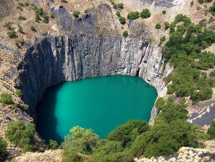
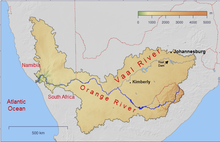
The Vaal River rises in the Drakensberg Mountains within the nation of South Africa and is the chief tributary of the Orange River. At 1105 kilometres in length, the Vaal is the world's 129th longest river and its basin is the locus of notable diamond mines.
|
|
The Vaal is critical for supplying water needs of a large fraction of the people in Johannesburg and east-central South Africa, but its over-extraction to serve the burgeoning human population has led to habitat degradation and water pollution issues.
Excessive nutrient loading from overly intensive fertilizer usage in agricultural areas in the Vaal is a major water quality issue in the basin. Headwaters areas of the catchment support high endemism in flora and reptiles, while the middle reaches of the basin boast significant endemism in small mammals.
Basin geometry and water uses
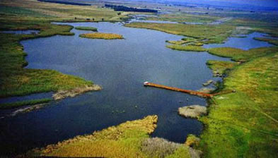 Marieville Bird Sanctuary on the Blesbokpruit. Source: Stan Madden, Univ. of Cape Town Although the Vaal rises in eastern South Africa only around 225 kilometres from the Indian Ocean, its course is westerly, meeting the Orange River which drains to the Atlantic.
The Vaal is one of the most important rivers of South Africa, with over twelve million people depending upon its waters for domestic and agricultural extraction.
Chief tributaries of the Vaal are: Bamboes Spruit, Blesbokspruit, Mooi River, Harts River, Vals River, Waterval River, Vet River, Renoster River, Riet River and Wilge River.
Precipitation in the basin varies dramatically from around 2000 millimetres per annum in the headwaters locale to merely one fourth that amount at the confluence with the Orange River.
Some cartographers consider the Orange/Vaal Basin to extend somewhat northward into the Kalahari region to the Nabbor and Molopo Basins; however, the Nabbob is [arheic] (e.g. merely a dry riverbed, whose rare flow merely disappears into the vast arid Kalahari Desert). Moreover, the Molopo has not produced discharge to the Orange in over a century, and most hydrologists consider it functionally arheic. Thus, the functional rather than the topographically theoretical basin boundary is followed here.
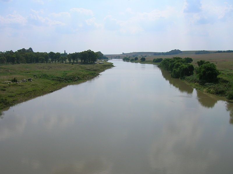 The Vaal River looking west (downstream) as taken from the N3 freeway bridge over it near Villiers, South Africa. This part of the river is upstream from the lake created by the Vaal Dam, south of Johannesburg Source: Wikimedia Commons
Water quality
The chief [[water quality] concerns] arise from the densely populated areas of Johannesburg, Pretoria and the Vaal Triangle. Exacerbating the issue are insufficiency and ageing of the wastewater treatment plants of that locale, and the fact that discharges from that high population density region is at a higher elevation than the principal dams in the Vaal/Orange River Basin; thus, inevitably polluted discharges from the densely populated area reaches these warm termperature reservoirs, which then generate elevated bacterial levels.
Agricultural runoff from the lower and middle Vaal Basin include water contamination from herbicides, pesticides, phosphate and nitrate. Industrial sources of water pollution in the Vaal basin and Johannesburg region include: coal fired power plants, gold mining, petrochemical plants and pulp mills. Cumulatively, with municipal effluent, these sources contribute to total dissolved solids concentrations, water colour and water odour issues.
Aquatic biota
A notable endemic benthopelagic fish to the Vaal and Orange Rivers is the 92 centimetre (cm) Vaal-Orange Largemouth Yellowfish (Labeobarbus kimberleyensis), which attracts anglers to the Vaal River.
Another important benthopelagic sporting fish is the the 56 cm basin endemic Smallmouth Yellowfish (Labeobarbus aeneus), which is found only in the Vaal and Orange Basins. L aeneus can be useful in algae control in the Vaal/Orange basin, since this omnivorous bottom feeder consumes considerable algae in its diet.
Basin terrestrial vegetation
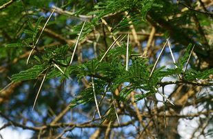 The thorny Acacia sieberiana. Source: Bart Wursten/EoL In the lower reaches of the Vaal Basin there is a Highveld grassland ecoregion, where dominant vegetation consists of grasses, admixed with geophytes and herbs. Dominant grass taxa are Thatching Grass (Hyparrhenia hirta) and Catstail Dropseed (Sporobolus pyramidalis). Larger flora are False Paperbark Thorn (Acacia sieberiana), Rhus rehmanniana, Selago densiflora, Spermacoce natalensis, Kohautia cynanchica, and Phyllanthus glaucophyllus.
Some of Africa’s oldest centres of plant endemism occur in the Vaal headwaters area of the Drakensberg Range. While the number of plant species solely restricted to the high Drakensberg is not well documented, within the KwaZulu-Natal region of the Drakensberg, over 1700 vascular plant species have been recorded. Of these, there is a high level of endemism in this portion of the Drakensberg Range, with the peak levels of endemism occurring in the highest elevations of the [catchment]. For example, Helichrysum palustre has been observed only from the summit plateau of the Drakensberg between 2300 and 3400 metres (m) above mean sea level.
Basin terrestrial fauna
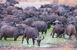 Cape Buffalo in the wild at a watering hole. @ C.Michael Hogan The uppermost reaches of the Vaal River develop within the The Drakensberg alti-montane grasslands and woodlands ecoregion which extends along the Drakensberg Mountain Range.
The highest portion of the upper reach in the Drakensberg is home to a variety of ungulates, including the Klipspringer (Oreotragus oreotragus), Mountain Reedbuck (Redunca fulvorufula), and Eland (Taurotragus oryx).
Below the higher elevations of the Drakensberg peaks the Orange Mouse (Mus orangiae) is restricted to the Highveld grassland ecoregion, which can be considered the lower reach of the basin. Large charasmatic mammals of the Vaal Basin include the Cape Buffalo (Syncerus caffer) and Black Rhino (Diceros bicornis).
 Lang's Girdled Lizard. Source: Harvard Museum of Comparative Zoology/EoL In this upper reach area, three river frogs: Sani Pass Frog (Amietia dracomontana), Large-mouthed Frog (Amietia vertebralis), and Cape River Frog (Amietia fuscigula) are endemic to rapidly-flowing streams of the alti-montane grassland.
Other anurans found here are the Dwarf African Toad (Poyntonophrynus vertebralis), a toad found only in the Drakensberg alti-montane ecoregion and the Highveld grasslands in the Vaal and Orange Basins.
Grassy banks by the alti-montane mainstem and tributaries are also home to the recently described Cream-spotted Mountain Snake (Montaspis gilvomaculata), the only member of its genus. The high alpine moors are home to three endemic lizard species: Lang's Girdled Lizard (Pseudocordylus langi), Cottrell's Mountain Lizard (Tropidosaura cottrelli) and Essex's Mountain Lizard (T. essexi).
Basin ecological conservation
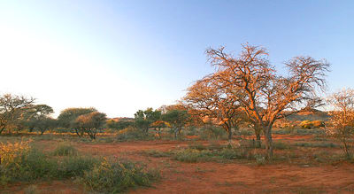 Landscape in Mokala National Park. cc-3.0 In the Vaal headwaters reach habitats are relatively intact, especially in the stony areas. However, at lower elevations of the Drakensberg, areas not explicitly protected are severely threatened.
Overgrazing pressure by domestic animals alters the ecosystem and makes the existing habitats vulnerable to encroachment by vegetation found in the lower elevation Karoo. It has been estimated that by 1986, more than 37 percent of the original extent of the Afromontane vegetation had been transformed, mostly from deforestation on lower slopes for agriculture and timber production. The stocking rates of grazing animals in portions of the upper Vaal/Orange Basin are estimated to exceed the land's grazing carrying capacity.
An important protected area near Kimberley, South Africa is the Mokala National Park.
References
- T. Coleman & van Niekerk. 2007. Water Quality of the Orange River. Orange Senqu River Commission (ORASECOM).
- W. Giess. 1971. A preliminary vegetation map of South West Africa. Dintera 4: 1-114.
- C.J. Swanevelder. 1981, Utilising South Africa's largest river: The physiographic background to the Orange River scheme, GeoJournal. vol 2 supp 2
- F. White. 1983. The vegetation of Africa, a descriptive memoir to accompany the UNESCO/AETFAT/UNSO Vegetation Map of Africa (3 Plates, Northwestern Africa, Northeastern Africa, and Southern Africa, 1:5,000,000). UNESCO, Paris.
- Gardner F. Williams. 1904. The diamond mines of South Africa. B.F. Buck & company. New York, NY
- World Wildlife Fund. 2013. Drakensberg alti-montane grasslands and woodlands. Encyclopedia of Earth. eds. Mark McGinley & C.Michael Hogan.
