South Slough National Estuarine Research Reserve, Oregon
Contents
Introduction South Slough Reserve map. (Source: NERRS (South Slough National Estuarine Research Reserve, Oregon) )
The South Slough National Estuarine Research Reserve (South Slough NERR) is a 4,771 acre natural area located in the Coos estuary on the south coast of Oregon. The Reserve was designated in 1974 at the first unit of the National Estuarine Research Reserve System (NERRS), a network of estuarine habitats protected and managed for the purposes of long-term research, education, and coastal stewardship. Established by Congress in 1972 as part of the Coastal Zone Management Act (CZMA), the NERRS is administered as a partnership between the National Oceanic and Atmospheric Administration (NOAA) and the coastal states. In particular, South Slough NERR is affiliated with both NOAA and the Oregon Department of State Lands. The Reserve's immediate governing body is the South Slough NERR Management Commission whose members are appointed by the Governor of Oregon.
Ecology of the Estuary
South Slough NERR is representative of estuaries found in the Lower Columbian biogeographic region, a distinctive section of the Pacific Northwest coast that spans the nearshore waters and estuaries from the mouth of the Columbia River to Cape Mendocino, California. The 725 km of coastline found in this region encompasses a diversity of habitat types and biotic communities distinguished by variations in geomorphology, ecological processes, and oceanographic conditions.
South Slough Watershed & Region
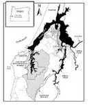 South Slough watershed map. (Source: Official Oregon State Web Site)
 South Slough National Estuarine Research Reserve (South Slough NERR) is located in a sheltered arm that forms the southern end of the Coos estuary in southwestern Oregon. The Reserve and its watershed are significant as a relatively undisturbed area representative of coastal ecosystems in the Pacific Northwest. This overview of the South Slough watershed and the surrounding Coos region illustrates the natural and cultural complexity and richness of the South Slough area.
The South Slough watershed is a 19,295 acre sub-basin of the Coos watershed drainage. Covering an area of approximately 600 square miles, the Coos estuary is the sixth largest estuary on the Pacific coast of the contiguous United States and the largest estuary completely within Oregon state lines. Like most estuaries found in Oregon, the Coos estuary is a river mouth that "drowned" as sea level began to rise 20,000 years ago. In drowned river mouth estuaries, heavy winter precipitation results in high discharge of fresh water and sediment; seawater inflows dominate during the summer when terrestrial stream flows are low.
The Coos estuary divides just inside its ocean opening. The main branch, Coos Bay, arches to the north-northeast, and the narrowly enclosed arm of South Slough drops almost due south. Coos Bay’s main tributary, the Coos River, enters at the southeastern end of the "U." At the southwestern end, the estuary opens to the sea. The ocean mouth of the estuary is defined on the north by the tip of a seven-mile-long sand spit (North Spit), and on the south by a rocky headland (Coos Head).
The shoreline of the Coos estuary is bordered by the municipalities of Charleston, Barview, North Bend, Coos Bay, Millington, Eastside, and Glasgow, with a collective population of approximately 36,000 people in 2000. The estuary is an important industrial center and shipping port, with the navigational channel routinely dredged to maintain adequate depths for commercial shipping. Extensive tidelands, primarily sand flats, mudflats, and salt marshes, constitute about 60-70% of the estuary.
The area of land that drains into South Slough is roughly shield-shaped and approximately twice as long as the Slough itself. It is generally characterized by steep slopes and sandy bluffs. The watershed boundary is defined on the east, south, and west by prominent ridges with many small streams draining into South Slough. The southern half of the watershed, beyond the Reserve boundaries, contains the springs and creeks which feed Winchester Creek, the Slough’s largest tributary stream.
Many streams enter the Slough near the narrow peninsula of Long Island Point. This north-pointing ridge separates the Slough into an eastern branch, Sengstacken Arm, and a western branch, Winchester Arm. These segments of the Slough are fringed with stream-fed marshes. Just north of Long Island Point lies 23-acre Valino Island, which like much of the surrounding land, it is essentially a consolidated dune remnant. The northern boundary of the Reserve is immediately north of the island. The shoreline of the northern end of South Slough is periodically marked with small coves and marshes. The watershed boundary extends eastward around Joe Ney Slough and its tributaries. Most of the land in this area of the watershed is more gently sloped, but with abrupt drops to the water.
Approximately 70% of the South Slough watershed is in private or county ownership with lands that are actively managed for timber production, and 5% is zoned for rural residential occupation. The remaining one-quarter of the watershed, or 4,771 acres, comprises the South Slough National Estuarine Research Reserve.
Climate
The southwestern coast of Oregon experiences two distinct climatic seasons during a typical year. The warm and relatively dry season extends from May through September, with an average rainfall of less than 4 inches (10 cm). A cooler wet season brings approximately 56 inches (142 cm) of rain to the area from October through April. Regional temperatures typically range between 40° and 75° F (4.5 – 24 °C).
Winds from the north and northwest averaging 17 mph (27 km hr) are typical of the high-pressure systems that prevail in summer. In the winter, wind blows from the south and southwest at an averages of 15 mph (24 km hr). Storms driven by the southwesterly winds move inland periodically and can deliver 7-10 cm of rainfall during a 24 hour period. Wind velocities during intense storm events can reach hurricane velocities (> 75 mph, 120 km hr). Winds are less intense between winter storm events and generally blow from the north and northwest.
Geology
The hills, flood plains, sand dunes, and headlands that characterize the vicinity of the Coos estuary are the result of a complex series of coastal geomorphic events. The shoreline, landforms, and soils of the area reflect the interactions of tectonic plates over the past 50 million years, changes in sea level, and local weakness in the Earth’s crust, along with more human recent land-use.
Geomorphology
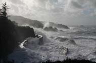 Coos estuary seacoast. (Source: Official Oregon State Web Site)
 South Slough NERR lies along a geologic fold, or syncline, which bears its name. Due to this formation, the watershed’s eastern and western sides are of distinct geologic types, with different elevations and gradients. The eastern shore formation, which rarely exceeds 250 feet, is typical of the larger Coos estuary watershed. Its highly erodable Quaternary marine terraces of unconsolidated to semi-consolidated sand, silt, and clay are gently sloping, and worn down along creek beds to sandstone and siltstone overlain by loamy sand and sandy and silty loam. The western side’s Empire Formation, with scattered Quaternary terraces, is unique to the South Slough. Its hard, impermeable marine sandstone rises 370 feet above sea level, in a long, steeply sloping north-south ridge. These western slopes are mantled with sandy and silty loam and loamy sand.
Soils
Sediments in the South Slough watershed and estuarine tidal basin are derived from several sources including terrestrial runoff, oceanic deposition, and biotic origins. The predominant soil type throughout the upland forested areas is silt loam of the Templeton-Salander group with medium to high runoff and erodability. Sandy marine terraces of the Bullards-Bandon-Blacklock group are also present on the northeastern slopes of the watershed. Soils in the tidally flooded salt marshes are classified as rich organic histosols, which typically consist of compacted clay, sand, and fine mud in alternating layers with mineral sand/silt and organic peat materials. Tidal flats in the South Slough estuary are composed of mud flats and sand flats. The organic content of the mud flats is relatively high and they occur in areas of the estuary that experience low tidal energy. Sand flats, in contrast, occur in areas of high tidal energy and have a much lower organic content.
Core sediment samples from several marsh locations in the estuary indicate a buried layer of coarse-grain sand that overlies organic material, providing evidence that South Slough was inundated by a tsunami about 300 years ago.
Mineral Resources
Due to its marine origins, the South Slough drainage area includes small deposits of black sands where ancient waves and currents concentrated heavy minerals (iron, chromium, minor amounts of gold, titanium, zirconium, platinum and garnet). Two to four thousand feet beneath the Coaledo Formation a U-shaped seam of coal encircles the Slough.
Hydrology
The Coos estuary is a drowned river mouth basin with an estimated surface water area of 12,380 acres (5,010 hectares [ha]). The estuary is relatively shallow, with an average depth of 2 meters (m) below Mean Lower Low Water (MLLW) and broad expanses of tideflats and mud are exposed at low tide. This shallow depth allows for the thorough mixing of fresh and saltwater for most of the year. Due to the seasonally high volumes of fresh water, however, the estuary becomes partially stratified in the winter, especially where deeper channels have been dredged for shipping.
Tides in the Coos estuary are mixed and follow a semi-diurnal pattern with two high and two low tides per day. Tidal currents are substantial throughout the estuary, with average flows over 1 meter per second. Mean tidal range is 2.3 meters at the mouth of the estuary; the highest tides measuring 3.3 meters above MLLW and the lowest tides occur at –0.9 m below MLLW (extreme tidal range is 3.3 m). Freshwater flow into the Coos estuary averages 5,500 cubic feet per second (cfs) during winter rains (January to April) and drops to 90 cfs from May through December. The major rivers emptying into the estuary are the Coos and the Millicoma, which supply 66% of the fresh water entering the system. Numerous smaller tributaries also enter the estuary, often through long, shallow inlets, called "sloughs." These sloughs typically receive fresh water slowly and in small amounts, usually from several streams which may have only intermittent flow.
The average water depth in the Slough is 1 meter (m), with the deepest point measuring 5.5 meters. A single narrow channel, approximately 2 m deep, meanders down the center of the South Slough. Circulation patterns within the South Slough tidal basin are strongly influenced by tidal oscillations within Coos Bay and along the outer coast, but are complex and poorly understood. The South Slough estuary is well mixed vertically (except during heavy rainfall events). Maximum tidal velocities at Valino Island are nearly 1 meter per second, with average current velocities around 0.4 meters per second. Flushing time for the estuary is estimated at 6-8 tidal cycles, or about 3 days.
Six perennial streams and over 30 intermittent creeks in the South Slough watershed provide a highly seasonal source of fresh water to the estuary. The largest drainage system, Winchester Creek, flows north through the watershed into the western (Winchester) arm of the estuary. Other significant freshwater contributions to the Slough flow from the more gently sloping eastern side of the watershed. Due to seasonal variations in freshwater flows, South Slough salinity profiles vary during the year.
Water Quality and Chemistry
The physical, chemical, and biotic characteristics of the water in South Slough vary throughout the estuary on a seasonal and tidal basis, and are influenced by conditions in the nearshore ocean, in the greater Coos estuary, and by freshwater inputs. The water column is generally well-mixed vertically, both near the mouth in the marine-dominated region and in the riverine portions of the estuary. Heavy rainfall events may cause some stratification of the water column, but the extensive exchange of tidal waters that occurs daily in the estuary result in mixing and breakdown of vertical stratification. Strong gradients exist along the marine to freshwater axis for several parameters, including salinity, density, specific conductivity, nutrients, and chlorophyll concentrations. Weaker gradients occur for temperature, dissolved oxygen, and pH.
Habitats
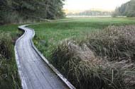 South Slough Reserve boardwalk. (Source: Official Oregon State Web Site)
 The Coos estuary and watershed contains a wide range of aquatic, terrestrial, and intertidal [[habitat]s], and a corresponding diversity of flora and fauna. The South Slough watershed presents an excellent microcosm of many habitats of the Coos estuary. However, there are three important differences between the Coos and South Slough watersheds: 1) the Coos estuary contains habitat types not found in South Slough; 2) the Coos estuary has sustained more intense development than South Slough; and 3) the Coos estuary generally experiences more tidal flushing and higher salinity than South Slough.
Uplands
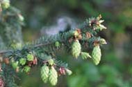 South Slough Reserve uplands. (Source: Official Oregon State Web Site)
 Upland regions of the Coos watershed are heavily forested with conifers, predominantly Sitka spruce (Picea sitchensis), Douglas fir (Pseudotsuga menziesii), western hemlock (Tsuga heterophylla), and Port Orford cedar (Chamaecyparis lawsoniana). The most prevalent broad-leaf evergreen tree is the Pacific wax myrtle (Myrica pacifica). Red alder (Alnus rubra) and willows (Salix spp.) are the predominant deciduous trees, especially in riparian areas.
The entire Coos watershed has been logged at some time in the past hundred years. Some areas contain recent clearcuts, and others have been planted exclusively with Douglas fir. Understory plants include salmonberry (Rubus parviflorus), thimbleberry (Rubus spectabilis), blackberry (both the native Rubus ursinus, and non-natives Rubus procerus and Rubus lacianata), salal (Gaultheria shallon), evergreen huckleberry (Vaccineum ovatum), red huckleberry (Vaccineum parvifolium), and Pacific sword fern (Polystichum munitum). The forests contain a rich assemblage of additional shrubs, ferns, fungi, moss, insects, amphibians, reptiles, birds, and mammals. Deer, elk, raccoons, porcupines, opossum, owls, and bats are common; black bear, cougar, coyotes, and bobcats inhabit the more remote areas.
Upland areas of the South Slough watershed are typical of the Coos estuary and include 30- to 50-year-old mixed conifer forests, recent clearcuts, and brushy slopes. The South Slough watershed also contains some small stands of trees over 80 years old, and occasional specimens estimated to be over 100 years old.
Freshwater Habitats
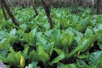 Skunk cabbage patch. (Source: Official Oregon State Web Site)
 Riparian Zones
An abundance of streams drain the uplands of the South Slough watershed. The riparian areas are typically lined with red alder and occasional small willows. Streamside herbaceous communities are typically lush with Pacific sword fern, deer fern (Blechnum spicant) and lady fern (Atherium filix-femina), and often include Oxalis (Oxalis oregona).
Beaver live in and around streams they have dammed, while river otters establish regular pathways for passage into and out of streams. Riparian areas are believed to serve raccoons, deer, and other small mammals not only as sources of food and water, but also as corridors which facilitate movement to and from the estuary. South Slough tributaries provide habitat for amphibians such as the Pacific giant salamander (Dicamptodon tenebrosus) and the red-legged frog (Rana aurora), and many contain populations of resident and anadromous fish, such coho salmon (Onchorhynchus kisutch). Other tributaries in the watershed, for reasons now under study, appear virtually unpopulated by fish. Some streams, buried by brush and sediments from [[logging[[ activities, no longer run above ground, and their biological attributes are unknown. ===Fresh Water Ponds and Marshes=== Freshwater wetlands and marshes in the South Slough watershed usually occur in direct association with streams, although some isolated wetlands exist in the uplands. Most of the larger freshwater wetlands occur in the extensive stream systems of the southern and eastern portions of the watershed. Freshwater marshes frequently form just up and downstream from leaky beaver dams, and in stream sediments which have accumulated immediately above the high tide line. Throughout the South Slough watershed, historic diking activities have artificially produced a number of freshwater marshes and wetlands.
Vegetation characteristic of freshwater wetlands includes sedges (Carex obnupta, Scirpus microcarpus), cattail (Typha latifolia), soft rush (Juncus effusus), spike rush (Eleocharis spp.), burr reed (Sparganium emersum), skunk cabbage (Lysichitum americanum), and reed canary grass (Phalaris arundinace, an introduced species). Deeper marshes and ponds may contain duckweed (Lemna minor) and spatterdock.
Tidelands
Salt Marshes
Salt marshes support large populations of larval and adult invertebrates, which are consumed by the shorebirds and waterfowl that live in or visit the estuary. The Coos estuary contains less than 10% of its original salt marsh habitat, due to fill, dredging, and other development-related disturbances. Significant portions of the salt marshes remaining in the Coos estuary are found in South Slough. Marshes occur sporadically in the northern end of the Slough, and become larger and more frequent towards its southern reaches. All South Slough salt marshes may experience less tidal influence than salt marshes in the main Coos estuary waterbody, but the biological differences between the two areas remain to be studied.
South Slough contains high and low salt marshes which have experienced varying degrees of disturbance and recovery. Plant communities of South Slough salt marshes are typical of the region, and include tufted hairgrass (Deschampsia caespitosa), saltgrass (Distichlis spicata), pickleweed (Salicornia virginica), Baltic rush (Juncus balticus), jaumea (Jaumea carnosa), and Lyngby’s sedge (Carex lyngbyei). A few small marshes in the South Slough support the less common salt marsh bird’s beak (Cordylanthus maritimus) and sea lavender (Limonium californicum).
Emergent Islands
The South Slough estuary contains several low islands of a few hundred square yards, created by deposits of dredge spoils during the past hundred years. These islands appear to provide habitat for invertebrates and feeding areas for some birds, but the biota of these islands, like the biota of the more tidally-flushed Coos estuary spoil islands, remain to be studied.
Mudflats and Channels
The sediments of the Coos estuary are primarily soft and unconsolidated. They create large mudflats which are exposed for extended periods during low tides. Most of the tidelands of the South Slough estuary are composed of mud or muddy sand. The mudflats are often partially covered by mats of Vaucheria (a green alga), and typically harbor cockles (Clinocardium nuttalli), gaper (Tresus capax), bentnose, and littleneck (Protothaca staminea) clams. Ghost shrimp (Callianassa californica), mud shrimp (Upogebia pugettensis), juvenile Dungeness crab (Cancer magister) also inhabit mudflats in the estuary. The mudflats are a rich feeding ground for a number of small shorebirds, and for great blue herons, egrets, and kingfishers.
Beds of eelgrass (both native Zostera marina, and the introduced Zostera japonica) cover an estimated 100 acres of the Coos estuary bottom. In late summer, up to 160 acres of eelgrass may be found in the Reserve, with additional beds of unknown size in the northern part of South Slough. These eelgrass beds, together with deeper tidal channels in the estuary, shelter a large number of fish and invertebrates. The blades of these plants create attachment area for algae, planktonic larvae, and snails. Eelgrass also provides cover for juvenile crab, juvenile ling cod, salmonids, starry flounder, English sole, and other fish and invertebrates. The plants’ height allows development of several vertical layers of structurally diverse and productive habitat.
Rocky Bottom
South Slough does not contain rocky or cobble-bottomed areas of significant size. The single known exception is at the northern end of the watershed, at the Coos estuary mouth, on intertidal land below a small cliff. This small rocky patch is occupied by a diverse community of hard-bottom and boring invertebrates. These include barnacles, mussels, sea anemones, snails, and clams.
Sand Flats
Sandy bottom and sand flats are very uncommon in the South Slough. Within the Reserve itself, one sand flat area occurs off the northwest corner of Valino Island, and a second narrow strip runs along part of Long Island Point’s west shore. A few coves north of the Reserve contain the only other sandy areas in the slough.
Cultural History
Native Americans
Archeological evidence indicates that the Coos estuary has supported a human population for at least 6,000 years. Along the shores of the South Slough, the Miluk people occupied small villages and seasonal camps starting around 500 AD. The Miluk villages were nearly autonomous gatherings of around 100 people. Permanent dwellings were typically pole frame lodge structures made with split cedar planks and partially set into the ground such that the floor was below ground level. The Miluk hunted, fished, and gathered all the food and fiber needed for subsistence in the South Slough estuary and the surrounding forest. Wooden fish weirs, antler hooks and nets were used to catch a variety of fish, and elk and deer were trapped in large pits. Shell middens found along the shores of South Slough provide evidence that the estuary was a productive place to collect crabs and other shellfish. Berries, seaweed, and edible plants and roots added nutrition and variety to the diet of native peoples. The remains of many villages, wooden fish weirs, and shell middens still exist along Coos estuary shorelines, but in many cases have been buried or substantially disturbed by more recent human development.
When early settlers arrived in the South Slough area during the 1850’s, the Miluk people lived in the southern part of the Coos estuary. Their area extended west to the ocean and south to the mouth of the Coquille River. The northern parts of the Coos estuary, along the Coos River, and areas as far north as Tenmile creek were inhabited by the Hanis. The languages of the Miluk and Hanis people were mutually unintelligible but are both included in the Coos family of the Penutian family of languages. South and east of the Miluk area and extending into the upper Coquille watershed lived people who spoke one of the Athabaskan languages, thereby distinguishing them from the Hanis and Miluk people. The descendents of the Coos peoples and other neighboring tribes now comprise the Confederated Tribes of the Coos, Siuslaw, and Lower Umpqua Indians.
After Euro-American settlement, the original inhabitants of the South Slough area were at first forbidden to own land and were physically deported from the region. Eventually, in the 1870s, a number of the original families were permitted to claim otherwise undesirable sites, and many made new homes along South Slough or its tributaries. These families’ names—Wasson, Talbot, Elliott, Younker, Hanson—survive in many South Slough watershed creeks, points, and coves.
Land and Resource Use
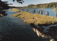 Slough pilings. (Source: Official Oregon State Web Site)
 By 1900, families who had taken up residence in South Slough had substantially altered the landscape to accommodate agricultural, transportation, and logging needs. Marshes were separated from the tides with earthen dikes and drained by ditches. Tide gates kept out salt water and provided drainage of fresh water. The dikes also served as roadways and, with culverts, as bridges across small streams or marshy areas. Almost all (90%) of the former tidelands around the edges of the Coos estuary have been diked or filled to accommodate transportation routes and to create flat land for building and agriculture.
By the 1960s, many tide gates along South Slough began to fail and have been allowed to deteriorate, while the earthen dikes are gradually eroding and have breached in some spots. As a result, former pasture lands are in various stages of reversion from uplands and freshwater wetlands to estuarine habitats. Creeks in the shallower parts of the South Slough watershed were dredged during the early to mid-1900s for logging and other transportation needs. Some creek banks are deeply scarred by splash-damming, the practice of damming and then suddenly releasing a volume of water to float logs downstream. Surplus dredge spoils were piled in the slough, and remain as small islands.
Logging and Mining
Logging and associated road building has produced the most marked changes in the uplands of the South Slough watershed. All timber in the drainage has been cut at some time, and most of the watershed continues to be managed for commercial forest purposes by public and private owners. Some of the more evident changes caused by logging include a number of clearcuts in various stages of recovery, compacted dirt roads, and remnants of trestle railroads. Parts of the shoreline and segments of Winchester Creek are lined with pilings which formerly supported docks or small donkey engine railroads for log hauling. The last large commercial cuts inside Reserve boundaries were made in the early 1970s. A small private inholding, subsequently purchased by the Reserve, was logged in 1992.
A small coal mine operated in the southern portion of the South Slough drainage during the late 1800s, but was later abandoned.
Grazing
Most of the pasturage along South Slough was abandoned in the 1930s, although cattle were grazed on one parcel within the Reserve until the late 1980s. Cattle continue to be grazed just south of the Reserve along South Slough’s main tributary, Winchester Creek.
Fishing and Aquaculture
Commercial and sport fishing (Marine fisheries), which occur just outside the estuary, are an important element of the local economy. Commercial fishing supports a number of seafood processing plants in Charleston. The Oregon Department of Agriculture leases out several acres of state-owned submerged lands in the Coos estuary and South Slough for commercial oyster cultivation. The presence of the commercial oyster industry encourages maintenance of excellent water quality, and recreational clam harvesting is also common.
Euro-American Settlement
 South Slough Reserve, Fredericksen House. (Source: Official Oregon State Web Site)
 Euro-American explorers came to the Coos estuary in the late 1700s, and permanent settlement began in the 1850s introducing homesteads and farms, logging operations, and commercial fishing to the area. Due in part to a small gold rush in the 1850s, increasing numbers of new settlers, including Chinese workers and shopkeepers, continued to move into the area, and more aggressive displacement of the original inhabitants began.
Some of the most significant changes in the Coos estuary landscape were initiated in the late 1800s to support the new settlers’ way of life. The town of Coos Bay (then Marshfield) was incorporated in 1874. At convergence of the Coos and South Slough estuaries, the small fishing village of Charleston developed in the late 1800’s. Stabilization of the bay mouth was initiated in the late 1880s, and marshes were drained, channels dredged, lowlands filled, and forests logged to support local families in agriculture and marine commerce. Coal was mined in small amounts from 1854 to 1920.
Houses, barns, windmills, a school house, and other structures were built in the coves and low hills of the South Slough watershed from the late 1800s until the 1920s, although settlement was never dense. Families supported themselves by logging and ranching cattle, sometimes on a very large scale. Transportation to and from Slough homesteads was almost entirely by boat, and dependent on favorable tides. Valino Island was the site of a speak-easy or "blind pig" during Prohibition, but no physical structures remain visible there today. Many of the early buildings and homesteads in the watershed were abandoned during the Depression and have collapsed or been razed. The sites of several older buildings, including an old schoolhouse and a shake mill, are known, but are now indicated only by small piles of decaying lumber. One of the last buildings of this period still standing in the Slough watershed is the Frederickson House.
Further Reading
| Disclaimer: This article is taken wholly from, or contains information that was originally published by, the National Oceanic and Atmospheric Administration. Topic editors and authors for the Encyclopedia of Earth may have edited its content or added new information. The use of information from the National Oceanic and Atmospheric Administration should not be construed as support for or endorsement by that organization for any new information added by EoE personnel, or for any editing of the original content. |