South Deccan Plateau dry deciduous forests
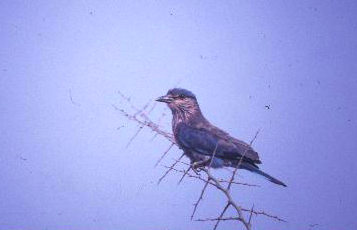
Indian roller (Coracias benghalensis), India. (Photograph by Rahula Perera)
Introduction Although not exceptionally outstanding for biological richness (South Deccan Plateau dry deciduous forests) or endemism by itself, the South Deccan Plateau Dry Deciduous Forests ecoregion is contiguous with the moist deciduous forests that lie along the foothills of the southern extent of the Western Ghats Mountains. Two of India's most important elephant conservation areas, the Nilgiris-Eastern Ghats and the Anamalais-Nelliampathis, and two of the most important TCUs extend across three ecoregions: the South Western Ghats Montane Rain Forests, South Western Ghats Moist Deciduous Forests, and South Deccan Plateau Dry Deciduous Forests. Together, these three ecoregions provide an important, contiguous habitat landscape for conservation of Asia's largest terrestrial herbivore and predator.
Location and General Description
 WWF
WWF
The ecoregion represents a large area of tall, tropical dry forests in the southern Deccan Plateau, on the leeward side of the Western Ghats Mountain Range. It extends across the southern Indian states of Karnataka and Tamil Nadu. The ecoregion's links to the ancient, southern circumpolar continent, Gondwanaland, are evident in the biotic links to Africa and Madagascar.
The ecoregion's vegetation is highly influenced by climate. The tall Western Ghats Mountain Range intercepts the moisture from the southwest monsoon; therefore, the eastern slopes and the Deccan Plateau receive very little rainfall; annual rainfall ranges from 900 to 1,500 millimeters (mm). The undulating hillsides have very shallow soils.
The dry deciduous forests of this ecoregion are flanked by the moist deciduous forests along the lower elevations and foothills of the Western Ghats to the west and by thorn scrub to the east. Therefore, this ecoregion probably represents a transition zone between the moister western vegetation and the drier vegetation to the east.
Champion and Seth classified these forests as Southern Dry Mixed Deciduous Forests, where teak (Tectona grandis) is not conspicuous. Thorny plants become more common in areas where grazing pressure is high.
Structurally, these dry forests have a three-storied forest, with an upper canopy at 15-25 meters (m), an understory at 10-15 meters, and undergrowth at 3-5 meters. Lianas drape the trees in denser, mature forests. The vegetation is characterized by Boswellia serrata, Anogeissus latifolia, Acacia catechu, Terminalia tomentosa, Terminalia paniculata, Terminalia belirica, Chloroxylon swietenia, Albizzia amara, Cassia fistula, Hardwickia binata, Dalbergia latifolia, Sterospermum personatum, Pterocarpus marsupium, Diospyros montana, and Shorea talura, among others. One of the important species of this forest, sandalwood (Santalum album), has been selectively removed from most of the forests in this ecoregion.
Biodiversity Features
Although not high in endemism or diversity, the ecoregion harbors several important populations of India's large threatened vertebrates whose populations are fast declining throughout their ranges because of habitat loss and hunting pressure. For instance, the elephant population that ranges from the Nilgiri Hills to the Eastern Ghats, estimated at more than 6,000 animals, is considered to be the largest single elephant population in India. A second important population ranges along the Anaimalai and Nelliampathi Hills.
Table 1. Endemic and Near-Endemic Mammal Species. Family Species Pteropodidae Latidens salimalii An asterisk signifies that the species' range is limited to this ecoregion. Two high-priority TCUs (Periyar-Kalakad and Dandeli-Bandipur) overlap with parts of this ecoregion. The bird fauna consists of about 260 species, of which two are near-endemic species (Table 2). The ecoregion's mammal fauna includes seventy-five species. One, the critically endangered Salim Ali fruit bat, is a near-endemic species (Table 1). Other threatened mammals include the Asian elephant (Elephas maximus), wild dog (Cuon alpinus), sloth bear (Melursus ursinus), chousingha (Tetracerus quadricornis), gaur (Bos gaurus), and grizzled giant squirrel (Ratufa macruora). Table 2. Endemic and Near-Endemic Bird Species. Family Common Name Species Timaliidae Rufous babbler Turdoides subrufus Pycnonotidae Yellow-throated bulbul Pycnonotus xantholaemus An asterisk signifies that the species' range is limited to this ecoregion. Two species in this ecoregion (South Deccan Plateau dry deciduous forests) , the Indian bustard (Ardeotis nigriceps) and lesser florican (Eupodotis indica), are globally threatened and warrant conservation attention. ==Current Status== More than 80 percent of the ecoregion's forests have been cleared, but two large blocks of contiguous habitat remain in the north. There are seven protected areas that cover about 1,100 square kilometers (km2), or a little more than 1 percent of the ecoregion. But none of these exceed 500 km2; therefore, the ecoregion's protected area system is woefully inadequate to conserve the several large vertebrates in this ecoregion. ==Types and Severity of Threats== Most of the dry deciduous forests represented by this ecoregion have already been degraded to thorn scrub. The remaining forests are highly threatened with conversion to cash crop plantations, excessive fuelwood collection, and overgrazing by large herds of cattle. The habitat contiguity with the moist deciduous forests along the foothill of the Western Ghats, in particular, has been severed in several areas by conversion to agricultural lands. Large areas of forested land are lost to development projects such as dams, mining, and resettlement of displaced people. Many of the habitat areas that will be lost to large-scale hydroelectric projects now serve as refuges for the ecoregion's biodiversity. The conservation status of the ecoregion was changed from endangered to critical because of the threats from human population to the remaining forest blocks. {| border="1" cellpadding="3" align="right" ! colspan="3" align="center" | Table 3. WCMC (1997) Protected Areas That Overlap with the Ecoregion. Protected Area Area (km2) IUCN Category Bilgiri Ranga Swamy Temple 290 PRO Bannerghatta 140 II Melkote Temple 50 IV Ranganthittu 20 IV Arabithittu 40 IV Cauvery 500 IV Vedanthangal 70 IV Total 1,110 Ecoregion numbers of protected areas that overlap with additional ecoregions are listed in brackets. Poaching (South Deccan Plateau dry deciduous forests) is a major threat in this ecoregion. The capacity to protect and manage the ecoregion's biodiversity is lacking, especially because these [[habitat]s] are perceived as being unimportant for biodiversity conservation. Where conservation efforts have been made, poor planning has resulted in the introduction of exotic species (Alien species) and conversion of grassland and open scrub habitat that are important for many focal species such as bustards and floricans. A major threat in the future will be the development of these areas for mining and industrialization. Licenses have been granted to exploit several areas in the ecoregion, and there is an urgent need to counter these initiatives by setting aside key areas for conservation of the ecoregion's representative biodiversity. ==Justification of Ecoregion Delineation==  Satellite view of southern India (Photograph by National Geographic Society) In a previous analysis of conservation units, Rodgers and Panwar (1988), and subsequently MacKinnon (1997), divided the Deccan Peninsula into five biotic provinces. This ecoregion lies within Rodgers and Panwar's Deccan Plateau South (6A) biotic province. But this biotic province contains several vegetation types. Therefore, in keeping with our definition of an ecoregion (i.e., an ecosystem of regional extent) and following our rules for ecoregion delineation (representing distinct vegetation types of regional extent in separate ecoregions), we placed the tropical dry deciduous forests in this biotic province in the South Deccan Plateau Dry Deciduous Forests. We used MacKinnon's (1997) map of original vegetation to identify the extent of the dry deciduous forests and exclude the large areas of thorn forests. ==Additional Information on this Ecoregion== * For a shorter summary of this entry, see the WWF WildWorld profile of this ecoregion. * To see the species that live in this ecoregion, including images and threat levels, see the WWF Wildfinder description of this ecoregion. * World Wildlife Fund Homepage ==Further Reading== * Sukumar, R. 1989. The Asian Elephant: Ecology and Management. Cambridge Studies in Applied Ecology and Resource Management. New York: Cambridge University Press. ISBN: 052143758X * Wikramanayake, E. D., E. Dinerstein., J. G. Robinson, K. U. Karanth, A. Rabinowitz, D. Olson, T. Mathew, P. Hedao, M. Connor, G. Hemley, and D. Bolze. 1999. Where can tigers live in the future? A framework for identifying high-priority areas for the conservation of tigers in the wild. Pages 255-272 in J. Seidensticker, S. Christie, and P. Jackson (editors), Riding the tiger: tiger conservation in human-dominated landscapes. Cambridge: Cambridge University Press. ISBN: 0521648351 * Meher-Homji, V.M. 1989. History of vegetation of Peninsular India. Man and Environment. 13:1-10 * Champion, H. G., and S. K. Seth. 1968. A revised survey of the forest types of India. Government of India Press. * Puri, G.S., Gupta, R.K., and Meher-Homji, V.M.P.S. 1989. Forest Ecology Volume 2. New Delhi, India: Oxford & IBH Publishing Company. ISBN: 812040355X * IUCN. 2000. 2000 IUCN Red list of threatened species. IUCN Red List of Threatened Species. Viewed November 2000. The IUCN Species Survival Commission and the International Union for Conservation of Nature and Natural Resources (IUCN, The World Conservation Union). * Rodgers, W. A. and H. S..Panwar. 1988. Planning a wildlife protected areas network in India. Vol 1 and 2. Dept of Environment, Forests, and Wildlife/Wildlife Institute of India report. Wildlife Institute of India. * MacKinnon, J. 1997. Protected areas systems review of the Indo-Malayan realm. Canterbury, UK: The Asian Bureau for Conservation (ABC) and The World Conservation Monitoring Center (WCMC)/ World Bank Publication. ISBN: 2880326095 Satellite view of southern India (Photograph by National Geographic Society) In a previous analysis of conservation units, Rodgers and Panwar (1988), and subsequently MacKinnon (1997), divided the Deccan Peninsula into five biotic provinces. This ecoregion lies within Rodgers and Panwar's Deccan Plateau South (6A) biotic province. But this biotic province contains several vegetation types. Therefore, in keeping with our definition of an ecoregion (i.e., an ecosystem of regional extent) and following our rules for ecoregion delineation (representing distinct vegetation types of regional extent in separate ecoregions), we placed the tropical dry deciduous forests in this biotic province in the South Deccan Plateau Dry Deciduous Forests. We used MacKinnon's (1997) map of original vegetation to identify the extent of the dry deciduous forests and exclude the large areas of thorn forests. ==Additional Information on this Ecoregion== * For a shorter summary of this entry, see the WWF WildWorld profile of this ecoregion. * To see the species that live in this ecoregion, including images and threat levels, see the WWF Wildfinder description of this ecoregion. * World Wildlife Fund Homepage ==Further Reading== * Sukumar, R. 1989. The Asian Elephant: Ecology and Management. Cambridge Studies in Applied Ecology and Resource Management. New York: Cambridge University Press. ISBN: 052143758X * Wikramanayake, E. D., E. Dinerstein., J. G. Robinson, K. U. Karanth, A. Rabinowitz, D. Olson, T. Mathew, P. Hedao, M. Connor, G. Hemley, and D. Bolze. 1999. Where can tigers live in the future? A framework for identifying high-priority areas for the conservation of tigers in the wild. Pages 255-272 in J. Seidensticker, S. Christie, and P. Jackson (editors), Riding the tiger: tiger conservation in human-dominated landscapes. Cambridge: Cambridge University Press. ISBN: 0521648351 * Meher-Homji, V.M. 1989. History of vegetation of Peninsular India. Man and Environment. 13:1-10 * Champion, H. G., and S. K. Seth. 1968. A revised survey of the forest types of India. Government of India Press. * Puri, G.S., Gupta, R.K., and Meher-Homji, V.M.P.S. 1989. Forest Ecology Volume 2. New Delhi, India: Oxford & IBH Publishing Company. ISBN: 812040355X * IUCN. 2000. 2000 IUCN Red list of threatened species. IUCN Red List of Threatened Species. Viewed November 2000. The IUCN Species Survival Commission and the International Union for Conservation of Nature and Natural Resources (IUCN, The World Conservation Union). * Rodgers, W. A. and H. S..Panwar. 1988. Planning a wildlife protected areas network in India. Vol 1 and 2. Dept of Environment, Forests, and Wildlife/Wildlife Institute of India report. Wildlife Institute of India. * MacKinnon, J. 1997. Protected areas systems review of the Indo-Malayan realm. Canterbury, UK: The Asian Bureau for Conservation (ABC) and The World Conservation Monitoring Center (WCMC)/ World Bank Publication. ISBN: 2880326095 |
|---|