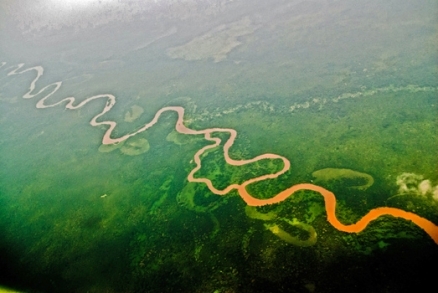
Semliki River, DRC/Uganda
| Topics: |
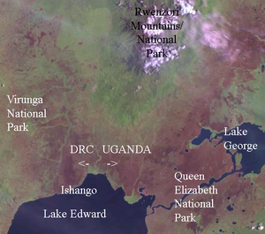
The Semliki River is a tributary of the Nile River in central Africa that flows 143 miles (230 kilometres) north across the equator from Lake Edward to Lake Albert. Alternatively known as the Semuliki River, this watercourse flows in the border region between Uganda and the Democratic Republic of the Congo in the Albertine rift (Western Rift Valley).
Contents
River sourse
The Semliki rises at Ishango on the the northwestern end of Lake Edward, within Virunga National Park in the Democratic Republic of the Congo (DRC). The River meanders north and north-northeast, flanked by the Rwenzori Mountains.
At about mid-way between the lakes, the river meanders along the border between the DRC and Uganda. On this stretch of the river it forms the western boundary of Uganda's Semuliki National Park. The Ugandan side of the river valley also encompasses the protected Semliki Wildlife Reserve.
The Semliki finally returns to the DRC side to Lake Albert. At the river's entrance into Lake Albert it forms a delta a mile or more wide on a alluvial plain that has built up from silt carried by the river.
The surface of Lake Edward is nearly 1000 feet (300 metres) higher in altitude that that of Lake Albert and, as the Semliki River, descends that height, it passes through many rapids and falls.
The area around the river in the southern and middle portion is primarily Albertine Rift montane forests, with short stretches in Northeastern Congolian lowland forests and Northern Congolian forest-savanna mosaic. The area south of Lake Albert is East Sudanian savanna.
References
- Uganda Wildlife Authority. Semuliki National Park.
- Laura Riley and William Riley (2005-01-03). Nature's Strongholds. Princeton University Press. ISBN0-691-12219-9.

