Saint John River, North America
| Topics: |
General Description
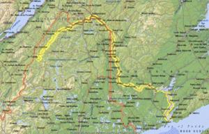
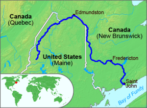
The Saint John River travels 673 kilometers (km) from its source in Somerset County, Maine to its outlet in the Bay of Fundy. Its average discharge is 35.6 cubic km per year and it drains an area of 35 500 sq. km (about half of which lies in Canada). The principal tributaries of the Saint John are the Aroostook, Madawaska, Nashwaak, Oromocto, St. Francis and Tobique rivers.
The Saint John crosses into Canada at Edmundston, New Brunswick and forms the U.S.-Canada border for approximately 120 km. It tumbles down the spectacular 23 m Grand Falls before moving south through a mining, dairy and fruit-growing region in western New Brunswick. The river continues east past Fredricton, the capital of New Brunswick and the head of navigation for small sea-going vessels, and reaches the Bay of Fundy at the city of St. John. This is the location of the famous Reversing Falls, so named because the Fundy tides (the highest in the world) produce an incoming falls when the tide rises and an outgoing falls as the tide ebbs.
History
The river was named by Pierre du Guast de Monts and Samuel de Champlain, who discovered its mouth on the day of Saint John the Baptist in 1604. It served as an important logging and transportation route prior to World War I. Today New Brunswick depends on the Saint John to drive several large hydroelectric plants and drain productive farming regions.

