Lodi Alluvium (Bailey)
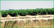 Subsection 262Ap, vineyard in the Lodi area (Scott Miles)
 Contents
Lithology and Stratigraphy
This subsection contains recent alluvium. The alluvium is mostly from granitic rock sources, but some is from volcanic, sedimentary, and metamorphic rock sources.
Geomorphology
This subsection is on a nearly level to very gently sloping plain. It consists of the floodplains and alluvial fans of the Mokelumne and Calaveras Rivers and smaller streams. The subsection elevation range is about 20 to 100 feet. Fluvial erosion and deposition are the main geomorphic processes.
Soils
The soils are mostly Typic, Pachic, and Calcic Pachic Haploxerolls and Typic Haploxeralfs. Also, there are Fluventic Haploxerolls and Aquic Xerofluvents on floodplains. The soils are mostly well drained, but some on floodplains are somewhat poorly drained. Soil temperature regimes are thermic. Soil moisture regimes are mostly xeric, with some aquic.
Vegetation
The predominant natural plant communities are Needlegrass grasslands and Valley oak series. Fremont cottonwood series occurs along streams.
Characteristic series by lifeform include:
Climate
The mean annual precipitation is about 16 to 18 inches. It is practically all rain. Mean annual temperature is about 59° to 62° F. The mean freeze-free period is about 250 to 275 days.
Surface Water
Streams in this subsection drain to the delta area of the Sacramento and San Joaquin Rivers. All but the larger streams are generally dry during the summer. There are no lakes.