Groundwater outflow
Contents
Groundwater outflow
| Topics: |
Geology (main)
|
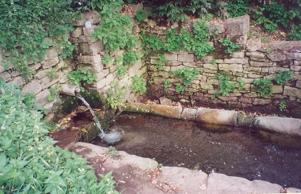
Shipot or groundwater outflow to supply drinking water, óblast de Vínnytsia, Ukraine. Image: U.Schick
Groundwater outflow is a key element of groundwater assessment methodology within the hydrological cycle. Water balance techniques have been extensively used to make quantitative estimates of water resources and the impact of man’s activities on the hydrological cycle. The study of water balance requires the systematic presentation of data on the water supply and its use within a given study area for a specific period. The estimation of groundwater balance of a region requires quantification of all individua groundwater inflows to or outflows from a groundwater system and change in groundwater storage over a given time period. The basic concept of water balance is:
- Input to the system ? outflow from the system = change in storage of the system (over a period of time)
The general methodology of computing groundwater balance consists of the following:
- Identification of significant components,
- Evaluating and quantifying individual components, and
- Presentation in the form of water balance equation.
The various outflow components of the groundwater balance equation may be estimated through field experiments or other methods, as discussed below.
Effluent Seepage (Se)
The river-aquifer interaction depends on the transmissivity of the aquifer system and the gradient of water table in respect to the river stage. Depending on the water level in the river and in the aquifer (in the vicinity of river), the river may recharge the aquifer (influent) or the aquifer may contribute to the river flow (effluent). The effluent or influent character of the river may vary from season to season and from reach to reach. The seepage from/to the river can be determined by dividing the river reach into small sub?reaches and observing the discharges at the two ends of the sub?reach along with the discharges of its tributaries and diversions, if any. The discharge at the downstream end is expressed as:
- Qd. Δt = Qu. Δt + Qg. Δt + Qt. Δt ? Qo. Δt ? E. Δt ± Srb
where,
Qd = discharge at the downstream section;
Qu = discharge at the upstream section;
Qg = groundwater contribution (unknown quantity; -ve computed value indicates influent conditions);
Qt = discharge of tributaries;
Qo = discharge diverted from the river;
E = rate of evaporation from river water surface and flood plain (for extensive bodies of surface water and for long time periods, evaporation from open water surfaces can not be neglected);
Srb = change in bank storage ( + for decrease and ? for increase); and
Δt = time period.
The change in bank storage can be determined by monitoring the water table along the cross?section normal to the river. Thus, using the above equation, seepage from/to the river over a certain period of time Δt can be computed. However, this would be the contribution from aquifers on both sides of the stream. The contribution from each side can be separated by the following method:
where, IL and TL are gradient and transmissivity respectively on the left side and IR and TR are those on the right.
Subsurface Outflow to Other Basins (Og)
For the estimation of groundwater inflow/outflow from/to other basins, regional water table contour maps are drawn based on the observed water level data from wells located within and outside the study area. The flows into and out of a region are governed mainly by the hydraulic gradient and transmissivity of the aquifer. The gradient can be determined by taking the slope of the water table normal to water table contour. The length of the section, across which groundwater inflow/outflow occurs, is determined from contour maps, the length being measured parallel to the contour. The inflow/outflow is determined as follows:
where, T is the transmissivity and I is the hydraulic gradient averaged over a length ΔL of contour line.
Evapotranspiration from Groundwater (Et)
Evapotranspiration is the combined process of transpiration from vegetation and evaporation from both soil and free water surfaces. Potential evapotranspiration is the maximum loss of water through evapotranspiration. Evapotranspiration from groundwater occurs in waterlogged areas or in forested areas with roots extending to the water table. From the land-use data, area under forests is available while the waterlogged areas may be demarcated from depth to water table maps. The potential evapotranspiration from such areas can be computed using standard methods.
Depth to water table maps may be prepared based on well inventory data to bring into focus the extensiveness of shallow water table areas. During well inventory, investigation should be specifically oriented towards accurately delineating water table depth for depths less than 2 meters. The evapotranspiration can be estimated based on the following equations:
- Et = PEt * A if h > hs
- Et = 0 if h < (hs - d)
- Ett = PEt * A (h - (hs - d))/d if (hs-d) ≤ h ≤ hs
where,
Et = evapotranspiration in volume of water per unit timeT-1;
PEt = maximum rate of evapotranspiration in volume of water per unit area per unit time L-2 T-1;
A = surface area [L2];
h = water table elevation [L];
hs = water table elevation at which the evapotranspiration loss reaches the maximum value; and
d = extinction depth. When the distance between hs and h exceeds d, evapotranspiration from groundwater ceases [L].
Draft from Groundwater (Tp)
Draft is the amount of water lifted from the aquifer by means of various lifting devices. To estimate groundwater draft, an inventory of wells and a sample survey of groundwater draft from various types of wells (state tubewells, private tubewells and open wells) are required. For state tubewells, information about their number, running hours per day, discharge, and number of days of operation in a season is generally available in the concerned departments. To compute the draft from private tubewells, pumping sets and rahats etc., sample surveys have to be conducted regarding their number, discharge and withdrawals over the season.
In areas where wells are energized, the draft may be computed using power consumption data. By conducting tests on wells, the average draft per unit of electricity consumed can be determined for different ranges in depth to water levels. By noting the depth to water level at each distribution point and multiplying the average draft value with the number of units of electricity consumed, the draft at each point can be computed for every month.
Change in Groundwater Storage (ΔS)
To estimate the change in groundwater storage, the water levels are observed through a network of observation wells spread over the area. The water levels are highest immediately after monsoon in the month of October or November and lowest just before rainfall in the month of May or June. During the monsoon season, the recharge is more than the extraction; therefore, the change in groundwater storage between the beginning and end of monsoon season indicates the total volume of water added to the groundwater reservoir. While the change in groundwater storage between the beginning and end of the non?monsoon season indicates the total quantity of water withdrawn from groundwater storage. The change in storage (ΔS) is computed as follows:
- ΔS = Σ Δh A Sy
where,
Δh = change in water table elevation during the given time period;
A = area influenced by the well; and
Sy = specific yield.
The Groundwater Resource Estimation Committee (1997) recommended that the size of the watershed as a hydrological unit could be of about 100 to 300 sq. km. area and there should be at least three spatially well-distributed observation wells in the unit, or one observation well per 100 sq. km., whichever is more. However, as per IILRI (1974), the following specification may serve as a rough guide:
| Size of the Area (ha) | Number of Observation Points | Number of Observation Points per 100 hectares |
| 100 | 20 | 20 |
| 1,000 | 40 | 4 |
| 10,000 | 100 | 1 |
| 1,00,000 | 300 | 0.3 |
The specific yield may be computed from pumping tests. The Groundwater Resource Estimation Committee (1997) recommended the following values of specific yield for different geological formations:
(a) Alluvial areas
Sandy alluvium - 16.0%
Silty alluvium - 10.0%
Clayey alluvium - 6.0%
(b) Hard rock areas
Weathered granite, gneiss and schist with low clay content - 3.0%
Weathered granite, gneiss and schist with significant clay content - 1.5%
Weathered or vesicular, jointed basalt - 2.0%
Laterite - 2.5%
Sandstone - 3.0%
Quartzites - 1.5%
Limestone - 2.0%
Karstified limestone - 8.0%
Phyllites, Shales - 1.5%
Massive poorly fractured rock - 0.3%
The values of specific yield in the zone of fluctuation of water table in different parts of the basin can also be approximately determined from the soil classification triangle showing relation between particle size and specific yield (Johnson, 1967).
Concluding Remarks
- Water balance approach, essentially a lumped model study, is a viable method of establishing the rainfall recharge coefficient and for evaluating the methods adopted for the quantification of discharge and recharge from other sources. For proper assessment of potential, present use and additional exploitability of water resources at optimal level, a water balance study is necessary. For example, it has been reported that the groundwater resource estimation methodology recommended by the Groundwater Resource Estimation Committee (1997) is being used by most of the organizations in India.
- Groundwater exploitation should be such that protection from depletion is provided, protection from pollution is provided, negative ecological effects are reduced to a minimum and economic efficiency of exploitation is attained. Determination of exploitable resources should be based upon hydrological investigations. These investigations logically necessitate use of a mathematical model of groundwater system for analyzing and solving the problems. The study of water balance is a prerequisite for groundwater modeling.
- There is a need for studying unsaturated and saturated flow through weathered and fractured rocks for finding the recharge components from rainfall and from percolation tanks in hard rock groundwater basins. The irrigation return flow under different soils, crops and irrigation practices need to be quantified. Assessment of groundwater quality in many groundwater basins is a task yet to be performed. A hydrological database for groundwater assessment should be established. Also user-friendly software should be developed for quick assessment of regional groundwater resources.
- Non-conventional methods for utilization of water such as through inter-basin transfers, artificial recharge of groundwater and desalination of brackish or sea water as well as traditional water conservation practices like rainwater harvesting, including roof-top rainwater harvesting, need to be practiced to further increase the utilizable water resources.
References
- Chandra, Satish and R. S. Saksena, 1975. "Water Balance Study for Estimation of Groundwater Resources", Journal of Irrigation and Power, India, October 1975, pp. 443?449.
- "Groundwater Resource Estimation Methodology ? 1997". Report of the Groundwater Resource Estimation Committee, Ministry of Water Resources, Government of India, New Delhi, June 1997.
- IILRI, 1974. "Drainage Principles and Applications", Survey and Investigation, Publication 16, Vol. III.
- Johnson, A. I., 1967. "Specific Yield ? Compilation of Specific Yields for Various Materials", Water Supply Paper, U.S.G.S., 1962?D, 74 p.
- Karanth, K. R., 1987. "Groundwater Assessment, Development and Management", Tata McGraw?Hill Publishing Company Limited, New Delhi, pp. 576?657.
- Kumar, C. P. and P. V. Seethapathi, 2002. "Assessment of Natural Groundwater Recharge in Upper Ganga Canal Command Area", Journal of Applied Hydrology, Association of Hydrologists of India, Vol. XV, No. 4, October 2002, pp. 13-20.
- Mishra, G. C., 1993. "Current Status of Methodology for Groundwater Assessment in the Country in Different Region", National Institute of Hydrology, Technical Report No. TR?140, 1992?93, 25 p.
- “National Water Policy”, Ministry of Water Resources, Government of India, April 2002, 18 p.
- Sokolov, A. A. and T. G. Chapman, 1974. "Methods for Water Balance Computations", The UNESCO Press, Paris.
- Sophocleous, Marios A., 1991. "Combining the Soilwater Balance and Water?Level Fluctuation Methods to Estimate Natural Groundwater Recharge: Practical Aspects". Journal of Hydrology, Vol. 124, pp. 229?241.