Gibraltar
Gibraltar is a small overseas territory of the United Kingdom with slightly under 30,000 people strategically located on Strait of Gibraltar that links the North Atlantic Ocean and Mediterranean Sea, adjoining Spain.
Strategically important, Gibraltar was reluctantly ceded to Great Britain by Spain in the 1713 Treaty of Utrecht. The British garrison was formally declared a colony in 1830.
In a referendum held in 1967, Gibraltarians voted overwhelmingly to remain a British dependency.
The subsequent granting of autonomy in 1969 by the UK led to Spain closing the border and severing all communication links.
A series of talks were held by the United Kingdom and Spain between 1997 and 2002 on establishing temporary joint sovereignty over Gibraltar. In response to these talks, the Gibraltar Government called a referendum in late 2002 in which the majority of citizens voted overwhelmingly against any sharing of sovereignty with Spain.
Since late 2004, tripartite talks among Spain, the UK, and Gibraltar have been held with the aim of cooperatively resolving problems that affect the local population, and work continues on cooperation agreements in areas such as taxation and financial services; communications and maritime security; policy, legal and customs services; environmental management; and education and visa services.
Throughout 2009, a dispute over Gibraltar's claim to territorial waters extending out three miles gave rise to periodic non-violent
maritime confrontations between Spanish and UK naval patrols.
A new noncolonial constitution came into effect in 2007, and the European Court of First Instance recognized Gibraltar's right to regulate its own tax regime in December 2008, but the UK retains responsibility for defense, foreign relations, internal security, and financial stability.
Its major environmental issues include:
- limited natural freshwater resources:
- large concrete or natural rock water catchments collect rainwater (no longer used for drinking water) and adequate desalination plant
Geography
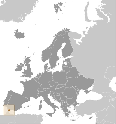
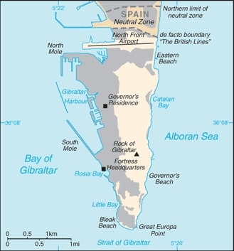
Location: Southwestern Europe, bordering the Strait of Gibraltar, which links the Mediterranean Sea and the North Atlantic Ocean, on the southern coast of Spain
Geographic Coordinates: 36 08 N, 5 21 W
Area: 6.5 sq km
Land Boundaries: 1.2 km with Spain
Coastline: 12 km
Maritime Claims: territorial sea: 3 nm
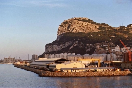
Terrain: A narrow coastal lowland borders the Rock of Gibraltar. The highest point is Rock of Gibraltar (426 m).
Climate: Mediterranean with mild winters and warm summers
Government Type: overseas territory of the UK
Legal System: the laws of the UK, where applicable, apply.
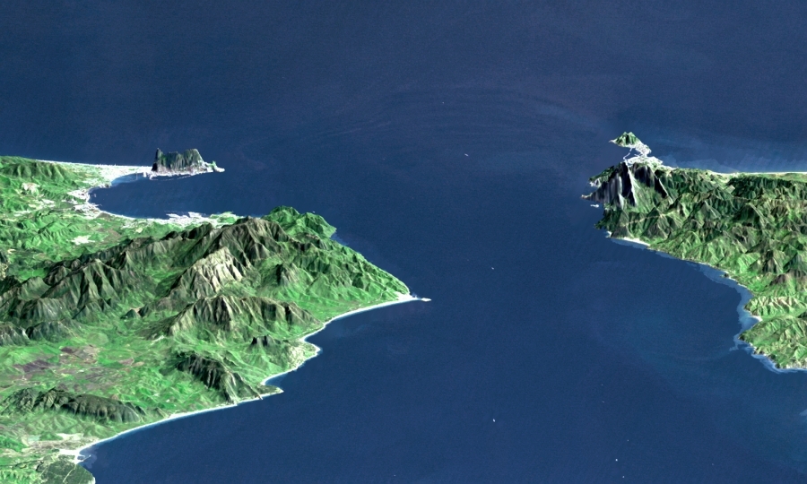
This perspective view shows the Strait of Gibraltar, which is the entrance to the Mediterranean Sea from the Atlantic Ocean. Europe (Spain) is on the left. Africa (Morocco) is on the right. The Rock of Gibraltar, administered by Great Britain, is the peninsula in the back left. Source: NASA. This image was generated from a Landsat satellite image draped over an elevation model produced by the Shuttle Radar Topography Mission (SRTM). The view looks eastward with a 3-times vertical exaggeration to enhance topographic expression. Natural colors of the scene (green vegetation, blue water, brown soil, white beaches) are enhanced by image processing. The scene includes some infrared reflectance (as green) to highlight the vegetation pattern as well as shading of the elevation model to further highlight the topographic features.
People and Society
Population: 29,034 (July 2012 est.)
Ethnic Groups: Spanish, Italian, English, Maltese, Portuguese, German, North Africans
Age Structure:
0-14 years: 20.4% (male 3,040/female 2,862)
15-64 years: 65.8% (male 9,607/female 9,451)
65 years and over: 13.8% (male 1,934/female 2,062) (2011 est.)
Population Growth Rate: 0.265% (2012 est.)
Birthrate: 14.22 births/1,000 population (2012 est.)
Death Rate: 8.27 deaths/1,000 population (July 2012 est.)
Net Migration Rate: -3.31 migrant(s)/1,000 population (2012 est.)
Life Expectancy at Birth: 78.83 years
male: 75.99 years
female: 81.87 years (2012 est.)
Total Fertility Rate: 1.94 children born/woman (2012 est.)
Languages: English (used in schools and for official purposes), Spanish, Italian, Portuguese
Urbanization: 100% of total population (2010)
Land Use:
Economy
Self-sufficient Gibraltar benefits from an extensive shipping trade, offshore banking, and its position as an international conference center. Tax rates are low to attract foreign investment.
The British military presence has been sharply reduced and now contributes about 7% to the local economy, compared with 60% in 1984.
The financial sector, tourism (almost 5 million visitors in 1998), gaming revenues, shipping services fees, and duties on consumer goods also generate revenue. The financial sector, tourism, and the shipping sector contribute 30%, 30%, and 25%, respectively, of GDP. Telecommunications, e-commerce, and e-gaming account for the remaining 15%.
In recent years, Gibraltar has seen major structural change from a public to a private sector economy, but changes in government spending still have a major impact on the level of employment.
GDP: (Purchasing Power Parity): $1.275 billion (2008)
GDP: (Official Exchange Rate): $1.106 billion (2006 est.)
GDP- per capita (PPP): $43,000 (2006 est.)
GDP- composition by sector:
Industries: tourism, banking and finance, ship repairing, tobacco
Currency: Gibraltar pounds (GIP)
Algeciras, Spain (left), the Bay of Gibraltar (Bahia de Algecira), and Gibraltar itself (right) are featured in this detailed vertical view over the European side of the Strait of Gibraltar. Ship traffic in the bay can easily be seen. Image courtesy of NASA.


